weatherwiz
-
Posts
79,817 -
Joined
-
Last visited
Content Type
Profiles
Blogs
Forums
American Weather
Media Demo
Store
Gallery
Everything posted by weatherwiz
-
Had a decent little thunderstorm like 1:30-2:00
-
Despite the wind today was pretty nice, would have watched the Bruins game outside if not for the wind. But sat outside after the game, getting chilly now because I’m losing the sun in the backyard…this is when the wind really sucks
-
Looks like we had a light frost overnight ughhh not ready for this
-

-
I am shocked Tropicana Field was used for staging when I heard that. I figured well if they are using it to stage the roof must be equip to handle winds up to a large magnitude but with those wind forecasts I was figuring that roof would blow off. Didn't hear anything of injuries (haven't checked though) but hopefully nobody was injured.
-
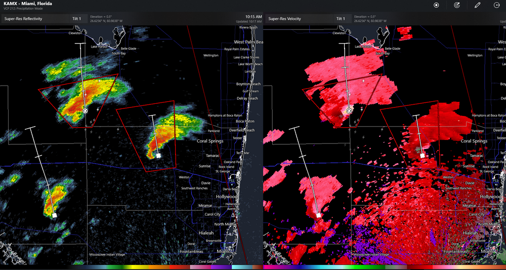
Was waiting for the flash flood emergency, looks like it came out
-
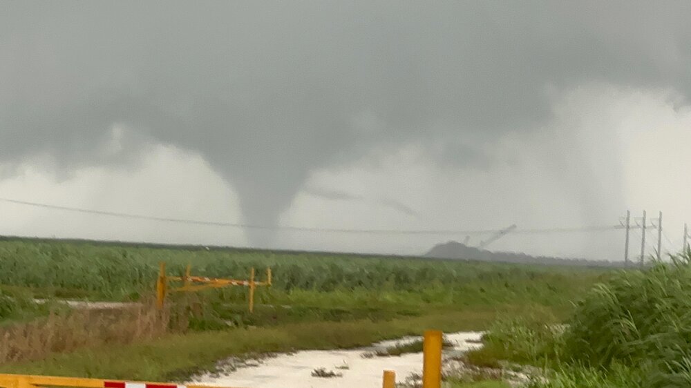
Another view of it from him
-
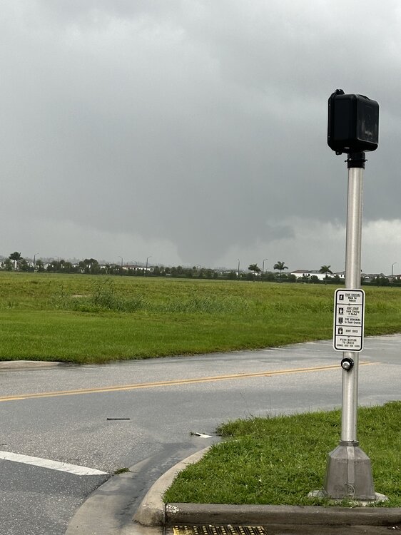
My friend is still chasing it (from the behind) he says its massive. I told him to consider backing off it.
-
Wellington
-
Holy shit from my friend. Told him to get to nws
-
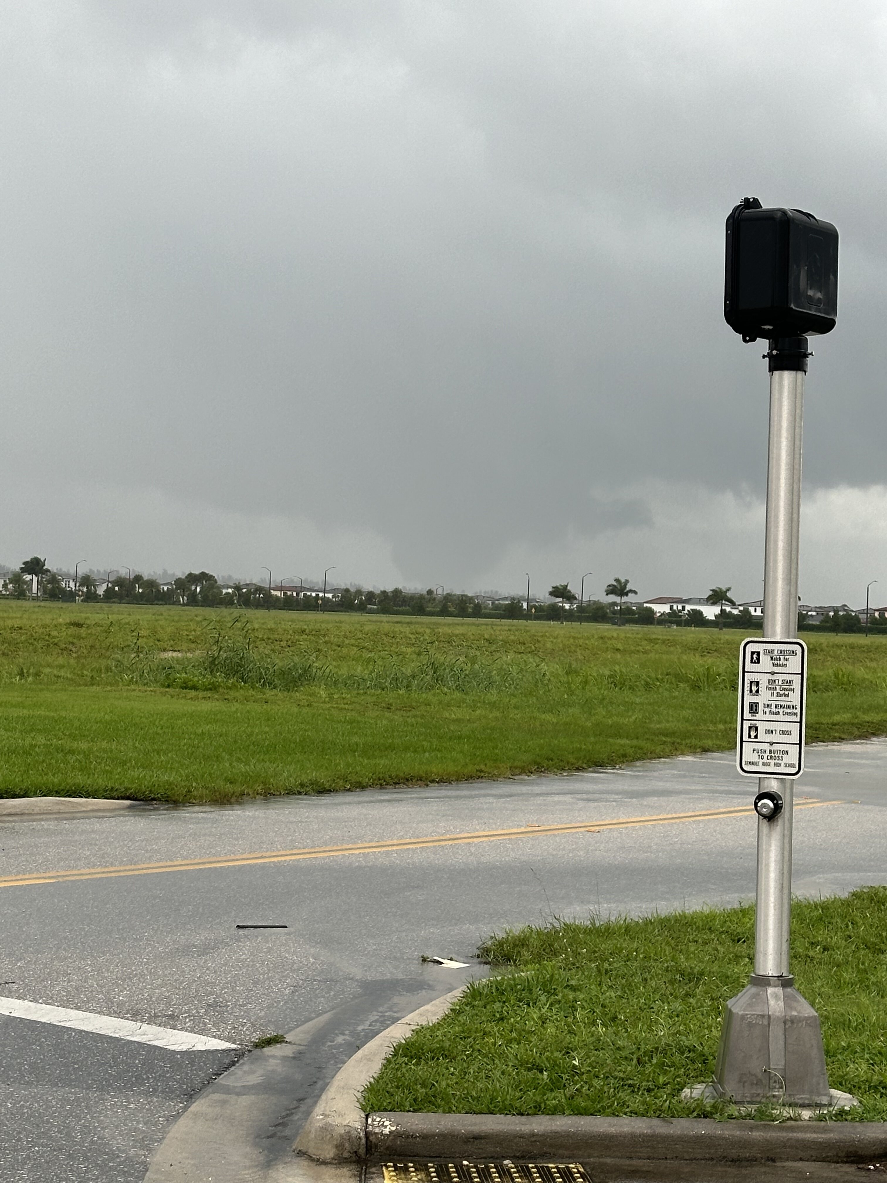
Friend down in Florida chasing the two tornado warned cells west of PBI. Just told me he sees rotation...might be one on the ground. Hoping to get some video from him.
-
I'm not so sure it's 100% fair to say its deviating or evolving differently than modeled. There are a ton of different factors to consider in these situations (this type of storm). You have to consider the fact that you're dealing with a feature (eye) which is generally small and then factor in model resolution. Not too mention this underwent two ERCs with each altering the structure, particularly the second ERC and then you also have the shear factor disrupting the structure. Much of the processes we are watching unfold today are extremely difficult, if not impossible to accurately model.
-
That cell headed towards Orlando is an absolute beast.
-
That would certainly help. Just goes to show how nail biting of a situation is for there. A few wobbles of a track and several degrees of wind could be all the difference.
-
This isn't looking good for the Bay area at all, especially with that occurring leading up to high tide. I mean maybe there are a few kinks which spare them the worst but it still looks like they could get core of eyewall plus the surge. I hope anyone who stayed is continuing to pay attention to this
-
As crazy as it is, the environment is only becoming even more primed with those higher helicity values moving in and 3km CAPE is still increasing a bit.
-
There are classic supercells too. If you didn't know there was an incoming hurricane and didn't have a geography background for reference, you would think you were looking at the southern Plains in May with a warm front having lifted north and dry line punching east.
-
yup, agreed noticed that the last few frames.
-
Was just about to post on this, a bit difficult to have a true feel but it seems like it's kind of re-formed a bit farther north and west with a northerly movement (basing on IR). I would want to think we would want to see a more easterly trajectory no later than 27N...or just a few ticks above 27N to really feel confident about lessening potential for greatest surge into the Bay
-
well here we go
-
The most important thing to probably watch over the next couple of hours is where the eye either re-emerges or becomes more clear. This is going to be critical as we near the final several hours leading up to landfall and where landfall occurs and even when talking about the angle.
-
That is one heck of a primed environment for tornadoes. 3km CAPE values going to approach 200 J/KG with MLCAPE > 1000 J/KG and 0-1km helicity > 300 m2s2.
-
I would have to think extremely uncommon. Rainfall totals could approach or exceed a foot along the landfall swath. Florida certainly isn’t a stranger to intense rainfall rates with summer thunderstorms but keep in mind the duration of those rates isn’t very long and they tend to be localized. This will be widespread and putting a ton of water into areas where there isn’t anywhere to really put it.
-
The flash flooding is going to be disastrous. That is some epic rainfall rates on the NAM over the Tampa area extending northeast towards or just south of Orlando...talking about multiple hours with rates probably exceeding 2''/hour. PWAT values in excess of 3 inches.
-
This is probably going down to the final few hours to know exactly where landfall will occur. If I lived in Tampa or around Tampa and elected to ride this one out, I would be sweating bullets. There are likely going to be numerous wobbles and re-positioning of the eye as the storm continues to go through internal structural changes. Not only this but the forward speed and the timing is adding some uncertainty to this as well because now you also need to factor in how/if trough interaction or involvement also influences the track and when any abrupt shifts more ENE occur.