

calculus1
-
Posts
5,076 -
Joined
-
Last visited
Content Type
Profiles
Blogs
Forums
American Weather
Media Demo
Store
Gallery
Posts posted by calculus1
-
-
16 minutes ago, SouthCentralWakeCo said:
3 straight runs of the GFS showing something Tuesday night
And the "jackpot zone" (if you can call 1.5 inches a "jackpot") is in the lee of the Apps in each case. I think that's good. Amirite? Or, should I concede to the conventional wisdom that you never want to be in the "jackpot zone" three or four days out?
I'm just gonna grasp at any straws thrown my way right now...
-
 1
1
-
-
Still there at 06Z. Winning!My favorite! Leeside enhancement! Let's do this!
Sent from my moto e5 supra using Tapatalk
Sent from my moto e5 supra using Tapatalk
-
My favorite! Leeside enhancement! Let's do this!0z GFS
Sent from my moto e5 supra using Tapatalk
-
52 minutes ago, mackerel_sky said:
The airport is N of 85! I have only received 1” of sleet! So those numbers are skewed
If you are south of I-85, then you should expect even less snow than what has been reported at GSP. So, again, this year isn't too different from normal. Still disappointing, but not completely aberrant.
-
 1
1
-
-
18 minutes ago, Waiting on snow said:
Good riddance to this shit box winter. Tired of seeing the Mid Atlantic weenies cry all winter how bad their winters are. They always get snow its just a matter of time. They keep getting storm after storm now while we fail miserably. Beyond done with it
You live in NW SC, man. Here are the annual (and monthly -- October to May) snowfall totals for the past 15 years or so at GSP:

Your 4.3-inch season total this year is only 0.4 inches less than normal. It's also more than 16 of the years listed here. I think it's been a pretty normal year for you as far as totals go. (I also figure you don't actually live at the airport -- Boiling Springs is more north and east of there -- so your totals will vary a bit, but this is the best I can do.)
We all want more snow, myself included. (Spring, stay away!) I think the extra bitterness and despair right now is due to the big storm that was had in December. Everyone believed that we were setting up for an epic winter with that early storm. It just hasn't materialized that way, though.
-
1 hour ago, PackGrad05 said:
This is why I almost wish we didn't have access to the models this far out... They always do this.
I really surprised WRAL even mentioned the possibility on their forecast last night. Maze said he only mentioned it because people were seeing snowflakes on their phone app, but he cautioned that models switch around frequently this far out.Wait. You're in favor of censoring which information the public has access to? I'm going to file a Freedom of Information Act request to counter your proposal. =)
It should be up to the individual to determine what information they want to give credence to and how they want to process it. I don't need/want someone else filtering my weather map access because they believe I wouldn't be able to handle whatever mood swings they think I might incur.
-
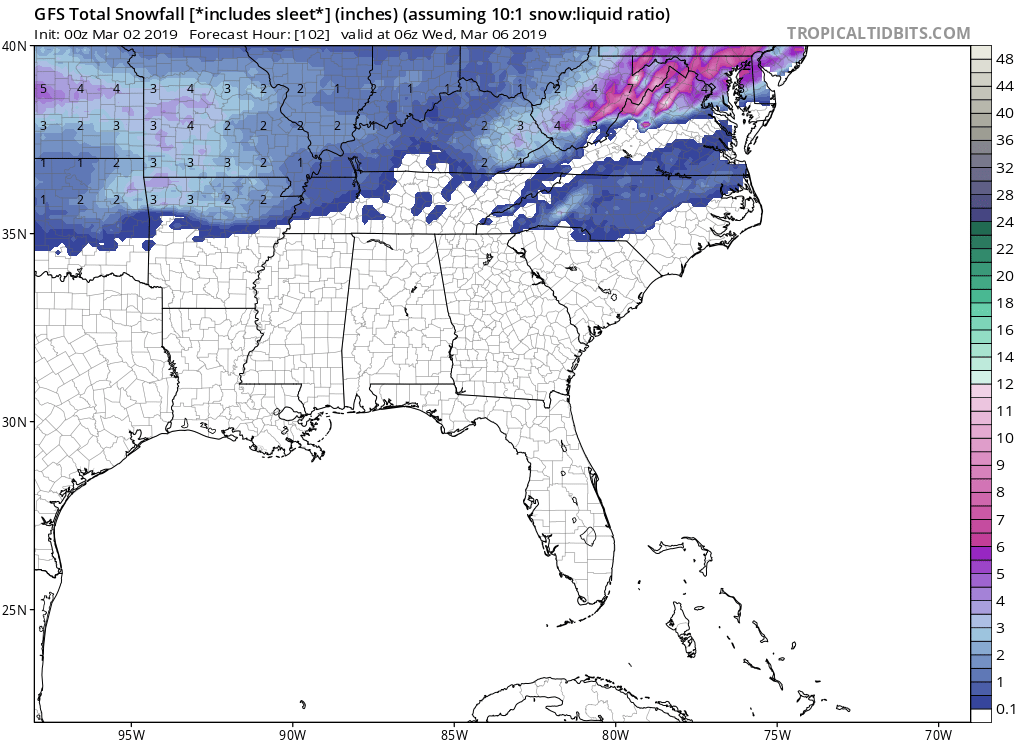
00Z GFS still looking good...

-
1
-
-
10 minutes ago, Queencitywx said:
12z has a nice little slider.
A true southern slider...

-
While it may seem that cold rain forms in eastern NC, it actually doesn't. It just happens to pass through there quite often. Perhaps something to do with a certain poster with the same name...Subfreezing 850's down to Mexico, but of course cold rain form eastern NC.
Sent from my moto e5 supra using Tapatalk
-
 1
1
-
-
Awesome! The longer it can stay cold, the better.
-
2
-
-
Well, your numbers don't lie. It would be a big jump in viewership. My personal preference for local news in Charlotte is what I gave. I still stand by my statement of interesting weather. There's a lot more snow and ice to forecast out of Charlotte north and west than there is out of Raleigh (as many posters on this site will bemoan).NBC Charlotte is way down in a distant third place for news viewership in that market. Brad sort of has a niche/cult following right now but isn't well known. In the latest Nielsen viewership numbers for 6pm newscasts, WSOC had 109k viewers, WBTV 104k, and WCNC 47k. It's a step up to go from that to the runaway #1 broadcast in the Triangle (WRAL 111k, WTVD 84k, WNCN 25k for the same sweeps period).
Charlotte is the #23 media market DMA while Raleigh is #25. It's a lateral move in terms of media market tier but to a station with orders of magnitude more cachet.
It would be a big loss for our area if he left, but if WRAL would double his salary it might be difficult to refuse. I would have to imagine Panovich has had multiple offers from other stations over the past several years due to his savvy social media interaction, and yet he still resides in Charlotte. So, I hope that will still be the case for the foreseeable future.
Sent from my moto e5 supra using Tapatalk
-
The rest of the WRAL weather bench are pretty standard fare in terms of xs and os. They show the end result/conclusions not the why behind the forecast logic. What a huge loss. Brad Panovich is too good to be at a third-place Charlotte news station - just sayin’.
Whoa-there! Why is Charlotte a bad gig? He gets to cover a variety of conditions from mountains to sandhills. It's a bigger media market than anything else in NC too. And, I definitely prefer his NBC affiliate over the ABC affiliate. CBS is about equal to NBC in Charlotte, IMO. Brad P doesn't need to go anywhere.
Sent from my moto e5 supra using Tapatalk
-
28 minutes ago, jburns said:
Personal.
You say potato, ...

I was just quoting what the station said:
“We have a difficult announcement to share with you tonight, involving a longtime member of our WRAL family. We need to let you know that chief meteorologist Greg Fishel is no longer with the company due to a personnel matter. Greg has asked that we share a written statement with you and you can find that in its entirety on wral.com.”
So, who knows what the true story is and even what the difference really is between personnel and personal matter?
-
"Personnel issues"
Hmmmm....

-
3K NAM high resolution forecast. Looks like 0.15 at the most. I'm not sure that qualifies for Winter Storm Watches, but the accretion should happen rather easily tonight due to the conditions you mentioned, Falls.

-
Both, 12Z RGEM and 3KNAM both show freezing rain breaking out around midnight and lasting through 16Z in the immediate lee of the Apps.
-
The CMC has light precipitation for the January 27-28, but then follows it with a great storm on January 30.

-
1
-
-
Wow. The 12Z RGEM shows 10 hours of freezing precipitation (freezing rain to sleet back to freezing rain) for Tuesday night and Wednesday morning, and it's still going at the end of its run:

-
2
-
-
11:41 it goes total. 12:15ish is best red.
Sent from my moto e5 supra using Tapatalk -
Yes, FV3 has back to back storms on Jan 28 and then Jan 31. Beautiful!
Sent from my moto e5 supra using Tapatalk-
 1
1
-
-
There's a whole lot of whining and complaining in the pattern thread. It would be great if you guys can take it over here to banter rather than cluttering up the actual discussion and weather talk.
This is the perfect place to talk about your winter preferences and hobbies and when you're putting out your preemergent and when you're going fishing and playing golf and whether you like dry and cold weather or warm and wet weather or any other combination and whatever short phrases you want to post as your reaction to a map and whether you identify with Lucy or Charlie Brown...
Sent from my moto e5 supra using Tapatalk-
3
-
-
3 minutes ago, Cold Rain said:
That would translate to some chilly surface temps. I doubt the magnitude of that kind of cold around here. But still, having an expansive arctic air mass in the vicinity, with a nice snow pack to the north, will definitely widen the window for some wintry weather around these parts.
Thanks for your post. I didn't read the 850 mb temp portion originally on QC's map, and was like...
 . Mind you, it's still crazy cold to have 850s that cold, but still not the same as reading -30 as my surface temp.
-
1
-
-
On the 18Z run of the FV3, the 540 line is south of VA from hour 174 to the end of the run. Wow. Lots of cold, with wintry weather chances to boot!
-
 1
1
-
1
-
-
4 hours ago, CamWX said:
Need advice. Looking to move to NC end of this year. Need to be within a couple hours of RDU (aging parents; need occasional caring for). Work in IT. Love to be in a good winter WX area. Also somewhere with relatively cheap apartment living (not like downtown Raleigh).
I would try somewhere north and/or west of RDU. Winston-Salem, Greensboro, Burlington, Roxboro, etc.
-
1
-
Banter Thread
in Southeastern States
Posted
My favorite is the COD:
https://weather.cod.edu/satrad/nexrad/index.php?type=GSP-N0Q-0-12