
Alfoman
-
Posts
252 -
Joined
-
Last visited
Content Type
Profiles
Blogs
Forums
American Weather
Media Demo
Store
Gallery
Everything posted by Alfoman
-
I guess you could say there's an F word for every situation in this forum
-
My excitement is muted because the GFS is on it's own with the moisture feed and boundary location. Need Euro/CMC support before the F word can safely be used for runs like that
-
Just watched an OP GFS run with four back to back to back to back storm potentials in the general area...are you not entertained?
-
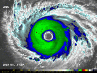
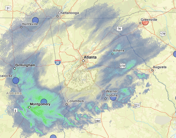
Looking at super-res reflectivity - the first thing you want to see if you are in ATL is the virga create a giant circle around the radar site (which is happening now). Next you will see that shield slowly enclose on itself as the column moistens. Likely still a few hours away from getting closer to that - the question then becomes how far north the band sets up once returns equal ground truth. Still think half an inch could be possible for inside the perimeter
-
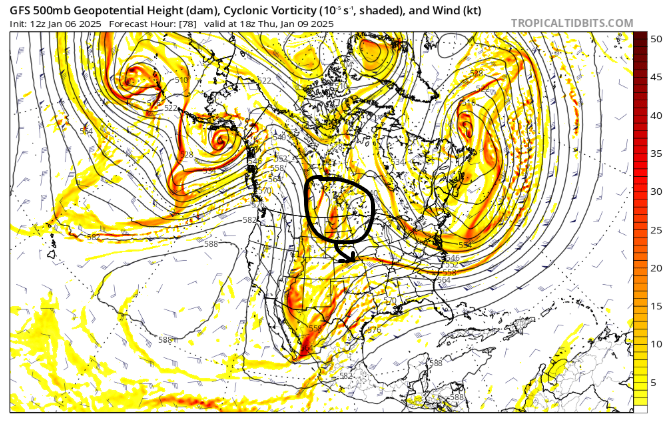
While this is true, you can't forget that both of those seasons were Ninos and we have a much more active polar jet with the current Nina regime. There is a lot more northern stream energy flying around which can muddle the long range upper level progression. While the general idea is in place here, how far back the Western shortwave is pulled back, strength of ridging, and timing of the phase would translate to a number of different outcomes. Nothing is guaranteed - but the ceiling is high with this setup.
-
Dr. No is rolling, this should be a fun one to watch!
-
I mean.... wow. At H5 the GFS, GEM, & ICON really aren't that far apart and they have had the energy being held back further out west. The only reason the GFS is not translating into a storm for someone (or a larger storm) is because of the baja bowling ball. It shears the Western shortwave and flatens the flow. Get rid of or mute it some, and I think everyone would have a smile on their face in some capacity. Ya'll wanted to go big dog hunting? This could be it.
-
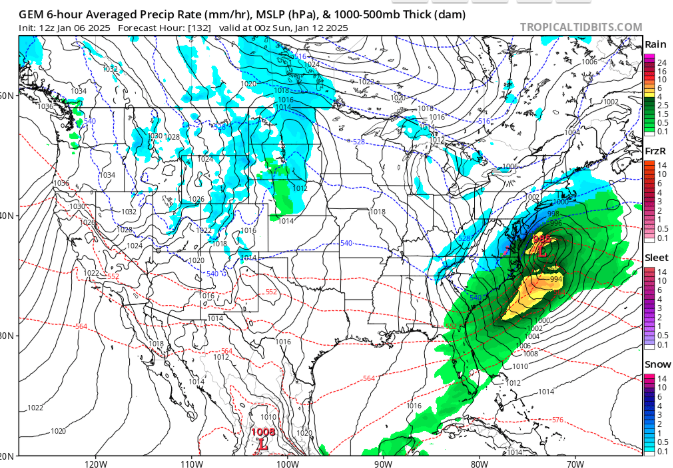
Atlanta proper made it into a heavy fronto band that came through for those 2-3 hours dropping 1-2" rates of heavy wet flakes. Reports around the city of 2-4 inches which is genuinely impressive for that short window. They're back to ZR/IP now though
-
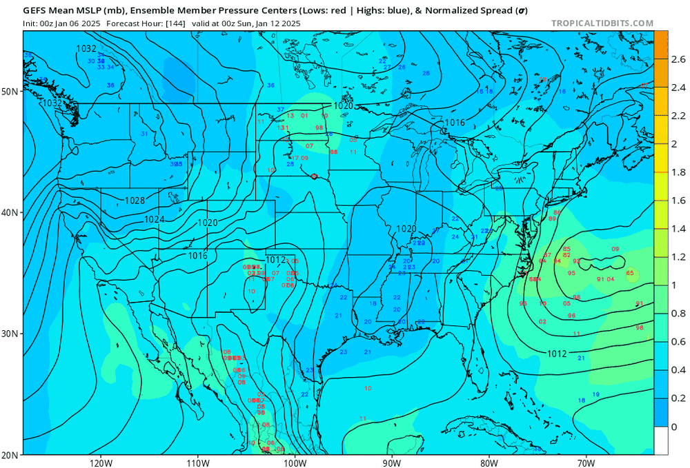
GFS had that northern stream piece come down way more aggressively the last few runs (on the later side of the storm and not early). If only our southern stream wave wasn't sheared to shit... The storm continued to trend further OTS here - we still held QPF-wise by faster strengthening of the surface low (~5 mb lower at hour 96 than 12z) off the coast. You realllllyyy need that SS SW to play nicer if we want to get something larger than a couple of inches. It hasn't trended the right way with that piece on the GFS on a single run since yesterday, need to reverse than going into 0Z.
-
I actually love this run for one reason - it's sloppier and still get's the job done with the phase and popping the sfc low in a decent spot along the coast. It shows that there is *some* room for error here with a win still possible board-wide. Regardless, 0Z will be telling on whether the GFS is making up for it's horrendous h5 forecasting for this previous storm or if it's still out to lunch.
-
Watching the area in red - like the expansion of returns behind it streaming in over the mountains. Heaviest banding south and north of the city for now, congrats on whose getting some more bang before the ULL comes thru!
-
Swear that band had the sharpest cutoff - barely saw much even in the way of pixie dust during that time. Looks like the bands are now moving ever so slightly SE around the area
-
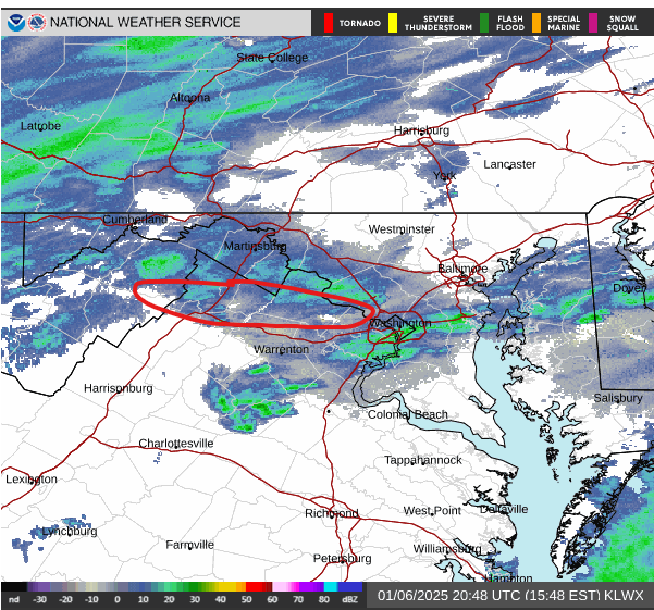
The band north of DC finally creeping down into the city with some lighter stuff back building behind it. First flakes since noon!
-
I do like the fact that the GEPS shifted towards the GEFS by a larger degree, making Euro the standout between the big three. Gives some potential credence to the GFS progression over the last 24 hours. That northern stream shortwave digging and phasing at different points/strengths really is the only crazy difference I see between the solutions. Can't say the Euro baja energy bias is really at play here when they all generally agree on placement of the phasing.
-
It's the GFS's world and we're just livin in it
-
God I don't know whether to look forward or be terrified of the model play-by-plays this week. Not gonna be for the faint hearted
-
Slightly improved evolution compared to 0Z run - bit stronger as the troff goes negative strengthens off shore. GFS is definitely more juiced with a better progression at h5 but there is support here.
-
-
100% - honestly pretty similar evolution so far compared to 18Z yesterday (not identical). Could confidently say it's a less messy solution so far though day h5...
-
Definitely had some sleet mixing into the earlier bands from DC south, so that was not wrong fully. It just never was the extent the NAM had projected it to be
-
The initial phase and transfer of energy on Friday (Hour 96-ish) is what determines our fate here - especially with that lead wave. Difference between the GFS bomb runs and 0z/6z is a stronger lead SW, allowing the baja energy to stay further back southwest for longer before completing the phase with the northern stream. This results in too positive of a tilt and would likely yield a low well off-shore by the time it reaches us. Yesterday's good run had that NS shortwave leading the phase process and ending up more neutral before it hits the EC. Such a delicate dance of energies involved here...this is going to be tough to bring home.
-
12Z ICON with a similar evolution to the previous two runs - sheared and much too positively tilted to round the bend in time.
-
Definitely hitting our stride in DC proper the past hour or two with even lighter returns showing up with pretty good rates. Very fine flakes falling but still coming down pretty hard. Eclipsing 6' at the moment.
-
Around 5.25 here in Shaw - absolutely gorgeous morning out and still coming down pretty good. I'd say it was a 70/30 split between Snow and Sleet at points during the previous heavy band. You can see the faint mixing shadows on CC radar.
-
Anyone peeping the 0Z CMC


