Sn0waddict
-
Posts
4,710 -
Joined
-
Last visited
Content Type
Profiles
Blogs
Forums
American Weather
Media Demo
Store
Gallery
Everything posted by Sn0waddict
-
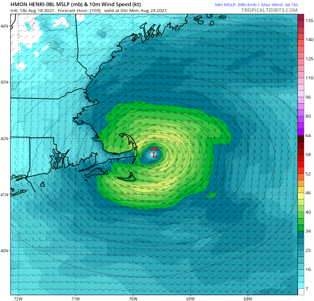
18z HMON is starting to come out. Already looks stronger so far than the 12z, which really isn’t that surprising.
-
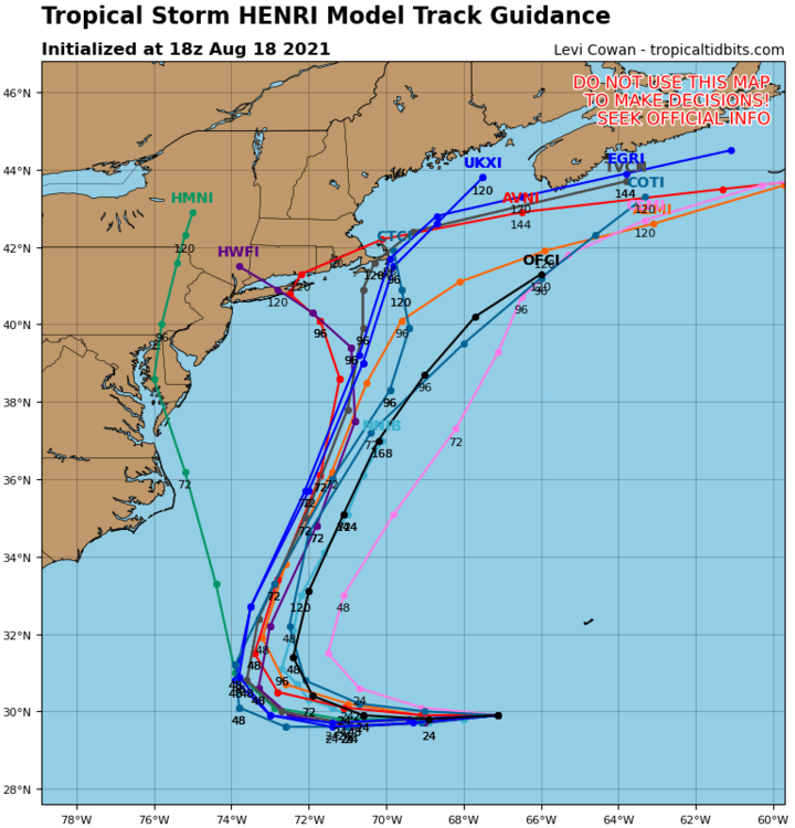
Gfs looks like it wants to stall this south of Nantucket? Might not even make landfall. This seems pretty inline with what Ray was thinking.
-
It’s has it around 995 for a while but then weakens it to around 100mb 12+ hours from now. Maybe due to shear?
-
Gfs definitely weaker so far. 995mb vs 983mb at 57hrs. Interesting
-
Very early but through hour 24 the GFS is 10mb weaker..
-
Icon identical to 12z. CC crusher. Hits and then stalls/spins around cape cod.
-
-
Good to know , no wonder why the HWRF and GFS were so similar. HMON track was similar but the intensity was wayyyy less.
-
HWRF is almost identical to the GFS.
-
HWRF on the other hand is a 949mb beast. Sheesh.
-
So the HMON looks like it may be getting pulled in, tough to say. But the huge difference is it’s a 1003mb piece of crap vs what it showed at 6z.
-
HMON pretty noticeably weaker so far vs 6z. 1003mb vs 989mb at 6z. Will have to see what impact that has. Gfs at the same time frame was already down to 969mb.
-
Yep pretty identical track to 0z.
-
CMC further offshore and weaker vs 0z.
-
Ya let’s hope that doesn’t happen.
-
Gfs kinda wants to do what the HMON did?
-
Gfs hasn’t backed off on intensity that’s for sure.
-
Icon with the last second pull back. Boston landfall? Lol
-
We still talking about weather here right?
-
HWRF looked like it was going out to sea. But then last minute it gets pulled NW.
-

August Disco 2021. Do record dews continue?
Sn0waddict replied to Damage In Tolland's topic in New England
GFS shows some snow up in Montana at hr 204 -
August Disco 2021. Do record dews continue?
Sn0waddict replied to Damage In Tolland's topic in New England
3k is east of 12z. But it looks like this is becoming a pretty good hit for SE MA. Someone has a shot at 5+ -
August Disco 2021. Do record dews continue?
Sn0waddict replied to Damage In Tolland's topic in New England
EURO is 1-3 inches most of it New London on east. A nothing burger west of HVN. As others have said thank god this isn’t a winter storm. -
August Disco 2021. Do record dews continue?
Sn0waddict replied to Damage In Tolland's topic in New England
3K NAM all on its own with how far west it brings the rain, except maybe the 0z EURO. All other models focus the rain east of HVN.