CT Rain
-
Posts
25,962 -
Joined
-
Last visited
Content Type
Profiles
Blogs
Forums
American Weather
Media Demo
Store
Gallery
Everything posted by CT Rain
-
I was joking. The meltdowns here would be pretty epic.
-
Once you start getting >+3c in that warm layer you nuke the ice nuclei pretty quickly - unless the warm layer is super shallow. Even if you're 10F in the boundary layer you're going to get ZR with an all liquid drop.
-
Watch this whole thing miss. Congrats DC?
-
How about the Euro with a -1F 2m temp at 18z Monday.
-
Still looks tough for a lot of snow here in CT. Almost looks like we’ll be straddling the PL/ZR line for a while.
-
Poor Kevin. Lost his 1.5" of ZR.
-
Juicy AF too
-
As easy it is for me to solve the equations of motion in my head.... you've gotta think that look would make it hard to get a super phase.
-
I'd pay 20 bucks for that evolution.
-
Yup. That's the way these things tend to go... unless of course we phase too early and then all bets are off.
-
I mean it's also tough to get a low to cut through the Berkshires/Albany. It can happen but you've gotta favor Jersey Shore/Long Island.
-
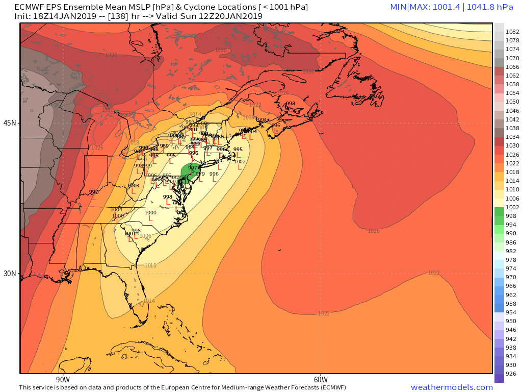
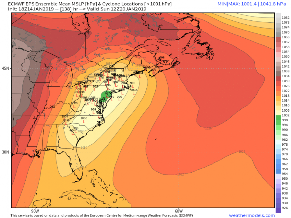
Valley may be more at risk. ECMWF has the classic valley wedge look. Not bad for a global model 5 days out!
-
It certainly has that ice look. As always the worst area is pretty narrow as sleet generally becomes predominant. Even a surface low in Long Island Sound probably keeps BDL locked in below 32.
-
I think you're right. We'll see how the upper levels shake out - if we get the earlier phase or not. Obviously with the cold to the north there's quite a risk for some big time icing.
-
GFS solution is pretty close to the best clustering of EPS surface lows (over Albany).
-
Kevin's 5:30 a.m. temper tantrum on text message was great lol
-
I thought the 00z EPS were a bit better but the 06z EPS were fairly ugly with most models inland.
-
Sure. Wouldn’t take much for the forecast to change. I also said in every weathercst that it wouldn’t take much for this to be a cutter and for us to get mainly rain.
-
You’ve been saying that. And you’re wrong.
-
Those are such garbage. GFS can't get out of its own way.
-
GFS is a crusher on Friday. Warning criteria it looks like.
-
People actually use the ICON?
-
Pretty ugly IMO
-
That was the one. I was actually home on spring break from college and it was a disaster.
-
Yeah that looks to me like mid 20s at BDL and 50s for GON lol