CT Rain
-
Posts
26,264 -
Joined
-
Last visited
Content Type
Profiles
Blogs
Forums
American Weather
Media Demo
Store
Gallery
Everything posted by CT Rain
-
Some hellacious winds on this thing. Looks like a well mixed boundary layer up to 900ish on a few of the models with 60-65 knots up there at least. Could be an unusually windy one.
-
No
-
You may be my favorite poster of all time.
-
Don't get sucked in!!
-
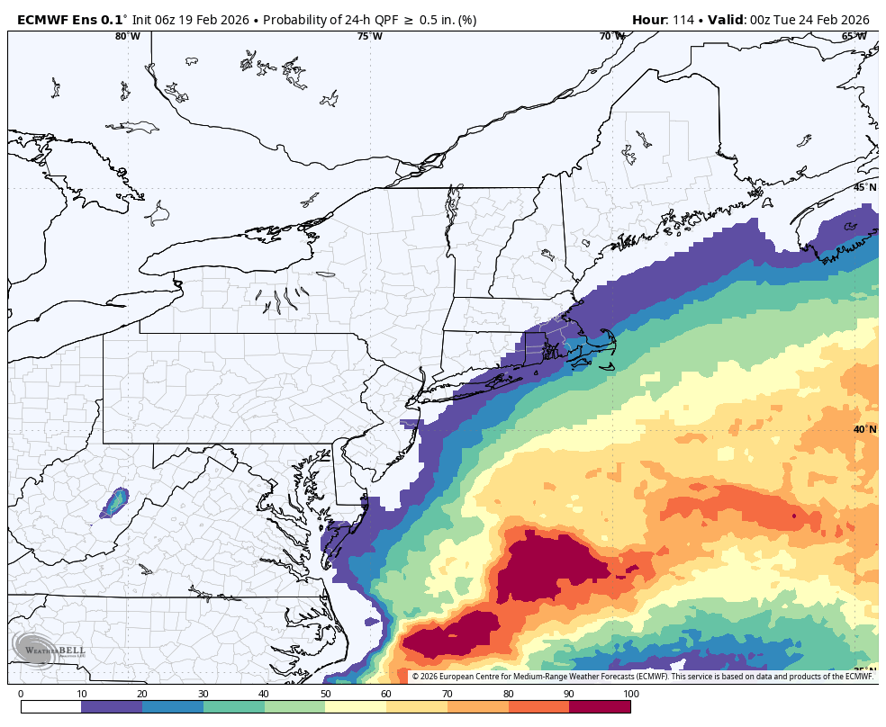
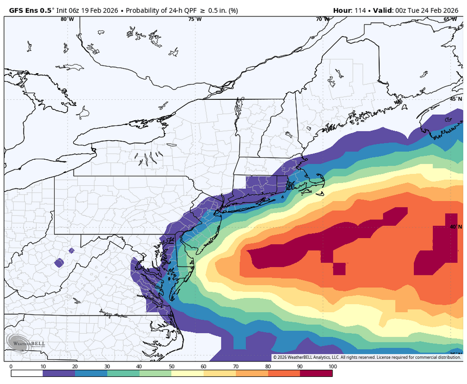
The EPS and the GEFS are still pretty similar. Pretty low odds for a significant storm >0.5" liquid for most.

-
At least with work if it misses I won't have to work all day Sunday lol
-
This hobby is truly the worst.
-
Man, what a fail.
-
Agree with this assessment. 108 hours to trend this to the Canal.
-
Yeah could be some light snow through the day Saturday? Models have had some kind of weak convergence zone/front nearby.
-
I'll take my deform band.
-
Could be a decent bit of ZR SOP
-

Wednesday Feb 18 Mixed event. NOPE …ain’t happenin’
CT Rain replied to HoarfrostHubb's topic in New England
ugh, so close!
- 468 replies
-
- 11
-

-

-
What a storm. Let's bring that about 50 miles northwest.
-
Wednesday Feb 18 Mixed event. NOPE …ain’t happenin’
CT Rain replied to HoarfrostHubb's topic in New England
....if the system trended 25 or 30 miles south. -
Wednesday Feb 18 Mixed event. NOPE …ain’t happenin’
CT Rain replied to HoarfrostHubb's topic in New England
It is? I didn't even make a snow map since I don't think we will need one with rain. -
Kevin may wind up with an inch over the next 10 days lol
-
Wednesday Feb 18 Mixed event. NOPE …ain’t happenin’
CT Rain replied to HoarfrostHubb's topic in New England
And trends have been worse today. Just doesn't look like much to me. Maybe people luck out right around the border. -
Wednesday Feb 18 Mixed event. NOPE …ain’t happenin’
CT Rain replied to HoarfrostHubb's topic in New England
Seems unlikely. MA/CT border north for this one. -
Wednesday Feb 18 Mixed event. NOPE …ain’t happenin’
CT Rain replied to HoarfrostHubb's topic in New England
Thinking rain for most of CT. Didn't even bother to make a snow map. -
lol
-
Don't hate the GFS
-
Yeah that's a cold look. Hoping next week delivers!
-
On to Morch.
-
Friday February 6 FROPA / WINDEX small event
CT Rain replied to HoarfrostHubb's topic in New England
It's weird BOX hasn't issued advisories yet for the North Shore.