msuwx
-
Posts
678 -
Joined
-
Last visited
Content Type
Profiles
Blogs
Forums
American Weather
Media Demo
Store
Gallery
Everything posted by msuwx
-
Time for my semi-annual pet peeve post. One shift does not equal a “trend.” You need multiple, subsequent movements of something in the same direction for it to be a trend. In other words, multiple model cycles in a row, not 1.
-
EPS as well as the control increase once again..... the control run was crazy.
-

The December to Remember 7th-8th blue turd winter threat thread.
msuwx replied to lilj4425's topic in Southeastern States
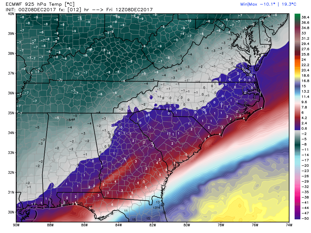
The 925mb temperatures seem to be behaving very similarly to what the European model projected. Actual vs. model: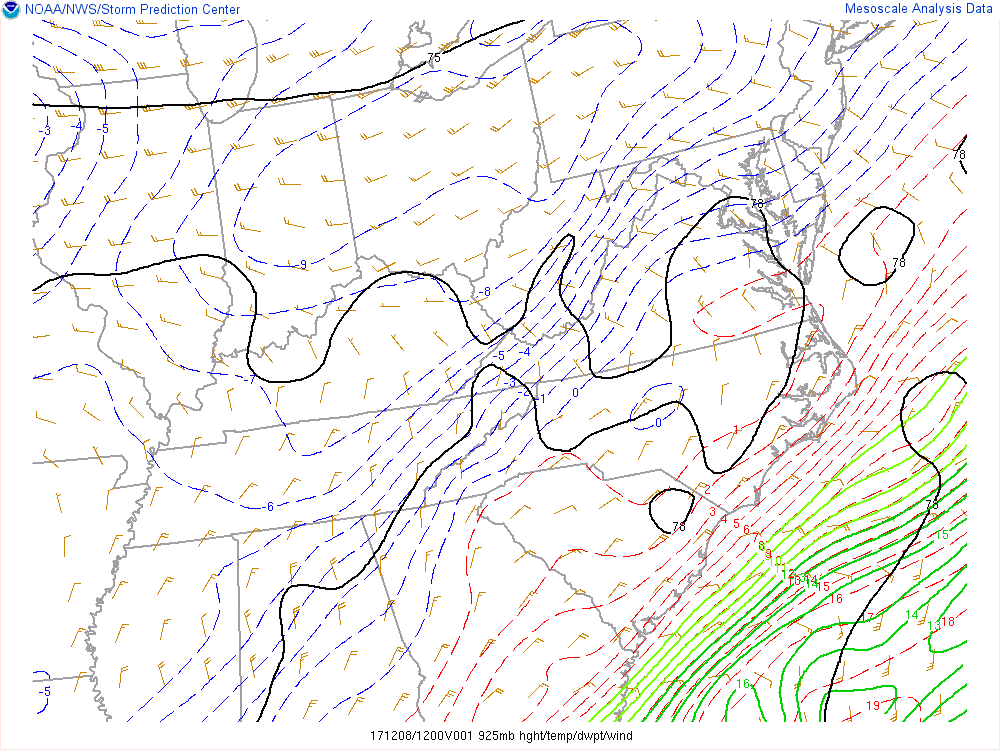

-
The December to Remember 7th-8th blue turd winter threat thread.
msuwx replied to lilj4425's topic in Southeastern States
6z GFS ensembles could very well have been the warning shot. -
The December to Remember 7th-8th blue turd winter threat thread.
msuwx replied to lilj4425's topic in Southeastern States
I think conservative is the way to go for the time being, and that's the way I continue to go in my public forecast. Way too many variables and too much uncertainty to be too whipped up into a frenzy at this juncture. -
The December to Remember 7th-8th blue turd winter threat thread.
msuwx replied to lilj4425's topic in Southeastern States
Several ensemble members now have a stronger system, similar to what a few of the others models have. -
The December to Remember 7th-8th blue turd winter threat thread.
msuwx replied to lilj4425's topic in Southeastern States
GEFS went way up on snow totals in the NW half of NC on the 6z run, compared to 0z. -
The December to Remember 7th-8th blue turd winter threat thread.
msuwx replied to lilj4425's topic in Southeastern States
Precip shield shifted NW 20-40 miles this run. Not bad. -
The December to Remember 7th-8th blue turd winter threat thread.
msuwx replied to lilj4425's topic in Southeastern States
I think some areas could get a slushy dusting or so....... but it's threading the needle. I went into it in detail in my video today. I'm just excited we have something already. -
The December to Remember 7th-8th blue turd winter threat thread.
msuwx replied to lilj4425's topic in Southeastern States
It took a step at 6z for sure.