

wncsnow
-
Posts
8,857 -
Joined
-
Last visited
Content Type
Profiles
Blogs
Forums
American Weather
Media Demo
Store
Gallery
Everything posted by wncsnow
-
This was the hottest at CAE according to the Euro
.thumb.png.9485de6914cbd33e3e9f1bb0cb326378.png)
-
Models are trending towards another heatwave starting late next week
.thumb.png.3d18bf0876b9f8273ee2d0f4e946a01f.png)
-
Looks like that upper low isnt gonna dig as far south so less rain showing up on most models over the ext 7 days.
.thumb.png.81418c60ad2bbda0d73ec9abbca73451.png)
-
We got the ol Mt Mitchell split but still had some mammatus, a shelf cloud and decent gusts
-
Tornado warning Buncombe. Looks to go just north of downtown Asheville
-
Severe Thunderstorm Watch just posted for entire area
-
I listen to this forum more than Jason
-
Yea most models are dry
-
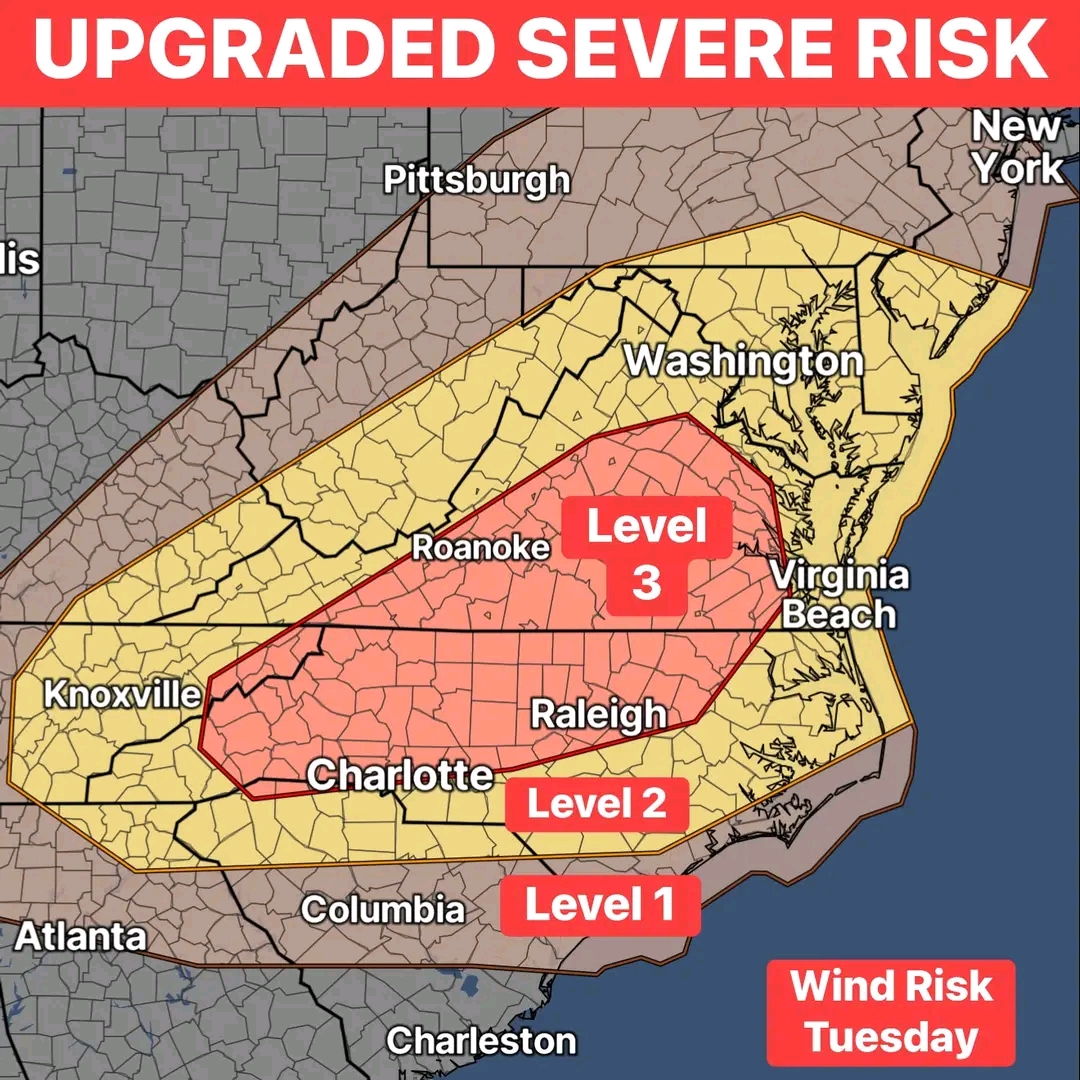
Severe outbreak in late July?
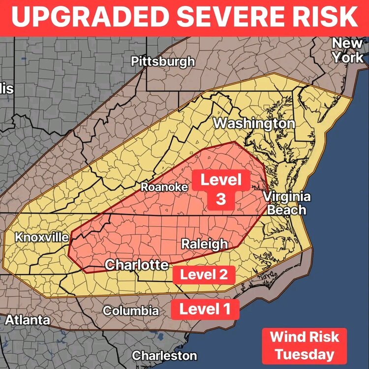
-
Rare for late July level 3 risk tomorrow
-
My grass is growing like it would in Vietnam at this point
-
1.34 overnight... This week we have had over 4 inches and over 8 on the month
-
Now at 2.75
-
2.35 storm total
-
Getting smoked now in Western McDowell. Will check the gage when I get home
-
Trying to drive home
-
Flash flooding in Asheville
-
Getting a heavy downpour with thunder in west AVL
-
Just 1.21 here
-
.47 here.
-
Drought on its way out?
.thumb.png.dabb4a00be7e1a67edc20b1dab70a672.png)
-
Its really looking cool and wet the next couple weeks. The Euro remains below average through early August after a few more days of heat.
-
We literally just got split for like the 10th time the past 5 days. We still got a decent shower but its interesting to watch these microclimate patterns
-
Mt Mitchell definitely plays a role. Central McDowell where I live can miss out in this type of flow. We rack up with NE/E or SE flow. And do well in S flow. Anything with a W component is very hit or miss.
-
Exact same here. Storms have missed to every direction the past 4 days and we have less than .2. Luckily we got hit good last week.

.png.bf271400265ae3fca65c4a7b4019c105.png)


.png.9ce195db87904ead3fbfa58cdab17e41.png)

.png.14b3d88cafdf1a82ee44978c139cd2aa.png)


.png.cd3695f2cb8310db448ffcbce8a9edc5.png)
