eaglesin2011
-
Posts
989 -
Joined
-
Last visited
Content Type
Profiles
Blogs
Forums
American Weather
Media Demo
Store
Gallery
Everything posted by eaglesin2011
-
A few nice north trends tonight on the models even the Euro 8s better.. Richmond even now right on the cusp of a decent snowfall
-
Yet the Nam says even more north.
-
Prob an increase in area of precip but still with two days to go it's a better the a decrease south
-
Well the GFS is pretty much in agreement with the Nam.. nice jump north..hmmm
-
yeah the last nam some pitty snow just about into the Richmond area... Yes, I know its its the nam.. If we can just cant a few more bumps north could pull off a little something... Still two days away but, again its now only 2 days away.. LOL
-
Getting interesting for this area.. Now to see if we get any more support...
-
Next two weekends maybe our best shot.... maybe being the key word. ha
-
Anyone ells in the area .. Here/See the real big thunder/ lightning strike last night at 4:04 am>?.. Was the loudest one I heard in awhile.. Im near Staples/295 and I know people that heard it just as loud in Chesterfield Curious to know where the lightning strike exactly was. Don't expect much but ice/sleet on Sat Morning but looks like a snow should be coming soon in the next few weeks.
-
Def gonna be close.. down to 38 in my part of Glen Allen.. maybe sum snow mixing in now.... Will be interesting to see if anything freezes up over night with all the leaves that could be an issue on back roads /neighborhoods..
-
I'll take the over unless this thing takes a quick right and really speeds up.. of course that's what is pretty much expected... I'll just hope for a good downpour with a band for the OVER .3 edit.. owell I was wrong.. dosnt look like any more bands will make it out this way.. owell. ha
-
looks like some outer bands from the hurricane are starting to come through the state... Would be interesting to see if any big storms/tornado's come up this far.. Def is felling tropical at the moment... Wilmington, NC radar https://weather.com/weather/radar/interactive/l/facf0cf6c21c3d11d04112d44542f76f1d54b2d7745168aacf4f04c4115231a5 Richmond, VA radar https://weather.com/weather/radar/interactive/l/6cd5f8297c7fc8a538e1f342171c0569f98ba22caa58df360a02096e7e677b0f
-
News/info for Hurricane Dorian
eaglesin2011 replied to eaglesin2011's topic in Tropical Headquarters
-
News/info for Hurricane Dorian
eaglesin2011 replied to eaglesin2011's topic in Tropical Headquarters
NWS Newport/Morehead NWS Newport/Morehead (@NWSMoreheadCity) / Twitter https://mobile.twitter.com/nwsmoreheadcity?ref_url=https%3a%2f%2fwww.americanwx.com%2fbb%2findex.php%3fapp%3dcore%26module%3dsystem%26controller%3dembed%26url%3dhttps%3a%2f%2ftwitter.com%2fnwsmoreheadcity%2fstatus%2f1169626122981527554 -
News/info for Hurricane Dorian
eaglesin2011 replied to eaglesin2011's topic in Tropical Headquarters
Here is a good article from miaminewtimes.com that list several public missing/found people & info sites. Just an FYI..These are public boards/list & may not be all updated/accurate. https://www.miaminewtimes.com/news/bahamas-residents-use-social-media-to-find-family-relatives-after-hurricane-dorian-11258379 http://dorianpeoplesearch.com/?fbclid=IwAR0qNxq9bkqgzXuQFnxstEbM_VtbUsdSbDoNRljS-LXnVJtCCO6lA0g9WLo Abaconians Reunite https://m.facebook.com/groups/939911119429037/ -
News/info for Hurricane Dorian
eaglesin2011 replied to eaglesin2011's topic in Tropical Headquarters
Bahamas Press (@Bahamaspress) bgg Check out Bahamas Press on Twitter. ONLINE NEWSPAPER and MEDIA WIRE. https://twitter.com/Bahamaspress?s Bahamaspress.com | The Real News in The Bahamas http://bahamaspress.com/ -
News/info for Hurricane Dorian
eaglesin2011 replied to eaglesin2011's topic in Tropical Headquarters
Wilmington, NC Weather and Radar Map - The Weather Channel | Weather.com https://weather.com/weather/radar/interactive/l/facf0cf6c21c3d11d04112d44542f76f1d54b2d7745168aacf4f04c4115231a5 Myrtle Beach, SC Weather and Radar Map - The Weather Channel | Weather.com https://weather.com/weather/radar/interactive/l/Myrtle+Beach+SC?canonicalCityId=2ba6193899a8c0c8b67388e752aae7129168bd9c13a52114b374c823ddf7f1ec Charleston, SC Weather and Radar Map - The Weather Channel | Weather.com https://weather.com/weather/radar/interactive/l/b3477bb7d4d53e5e9491d54c1468347fead05005f24b71aeb718feaa0157309a Kitty Hawk, NC Weather and Radar Map - The Weather Channel | Weather.com https://weather.com/weather/radar/interactive/l/Kitty+Hawk+NC?canonicalCityId=297bd14c54dca4f1e742ef419d37056546694cf78aabde3747f51a6b3df2a76c -
Didnt see a specific thread for news stations or live info about Hurricane Dorian...So I figured I start one.. Anyone who has Roku or a streaming service here is a kinda low quality, but very good live news station out of bahamas brodcasting info/ storm footage at times. On Roku Bahamas- ZNS Tv https://znsbahamas.com/http-original-livestream-com-houseofassembly/ Facebook. ZNS News.com (The Official Page) - Home https://m.facebook.com/znsnewsofficial/
-
Yep the clouds and mountains really are a big factor ... Will see if it clears out this afternoon to ramp up any passing energy..Still is very Humid at the moment & the severe threat is def looking more south... Still think later tonight we will see a few scattered TS
-
Think this little rain storm here in my area (Glen Alen) may of decreased the tornado chances for this specific area. The more south definitely the higher chance of tornadoes & straight line winds. .. The main storms will be out of most of the area by 9pm
-
Can't say I call it just yet the Next Weds- Monday time frame will be our best hope in awhile.. Nothing certain but Def still a chance.. ha
-
3:00amLight snow /sleet mix here now in Glen Allen 3:51am mostly & steady light snow now deck about covered 7:13am very light rain with a little light sleet at times now... prob will be all rain soon.. Never really got into any of the heavy precipitation here.. Prob some heavy rain later maybe a quick t storm Prob 1/2 inch mainy on the cars ..roads a light dusting in spots.
-
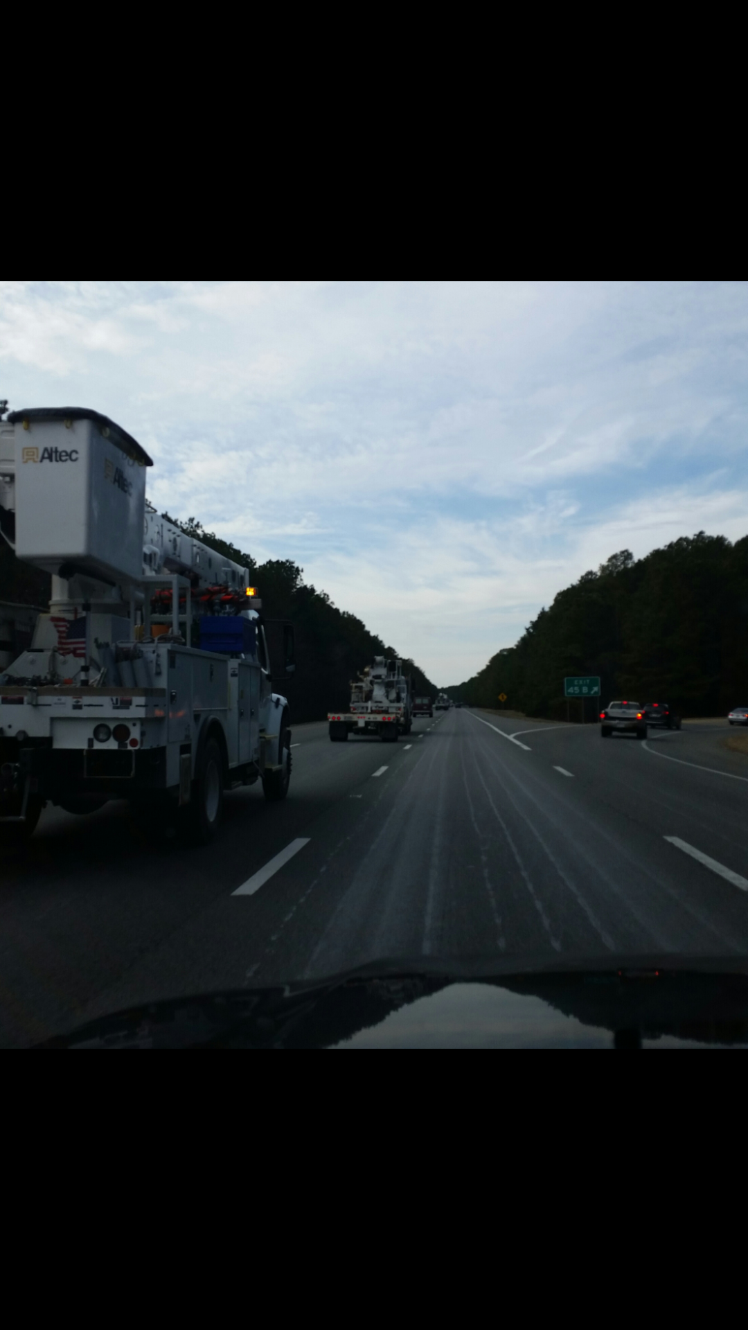
Pic from 295N Henrico ... At least 20 trucks headed north

-
https://www.wunderground.com/maps/radar/current/usa Well the T-STORMS really are bringing that warm air in quick... so any chance we prob have is if the precip moves in quicker then expected... At least its cloudy now.. TEMPS shouldnt be going up much more from here..45.4 F here in Glen Allen
-
all gonna depend on how fast it changes to sleet.. when it happens there is no changing back.. ha
-
pretty much... I doubt schools will open.. unless the snow/ice is delayed or doesnt happen at all..... rush hour in the morning prob will be the worst of the storm 5-8am .. Main roads prob will be fine after that time frame but back roads and neighborhoods prob wont be treated enough... So schools will mostly call it a day if anything icy is still on the roads..