eaglesin2011
-
Posts
989 -
Joined
-
Last visited
Content Type
Profiles
Blogs
Forums
American Weather
Media Demo
Store
Gallery
Everything posted by eaglesin2011
-
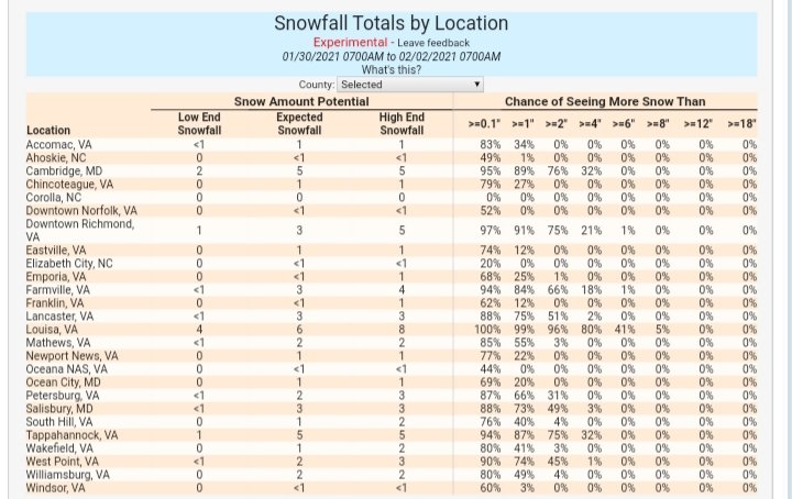
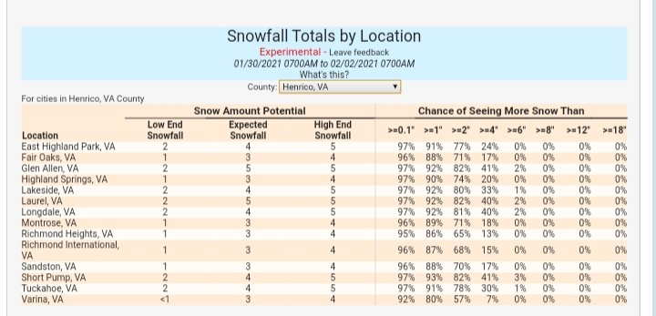
Prob about an 1/2 to a inch depending on what surfaces you measure here now.. in Glen Allen
-
I think it's at least another hour or two (IF we can stay in the heavy band )if not it will be over & gone quickly because of the marginal & slowly rising temps... Steady wet snow here at the moment in Glen Allen..
-
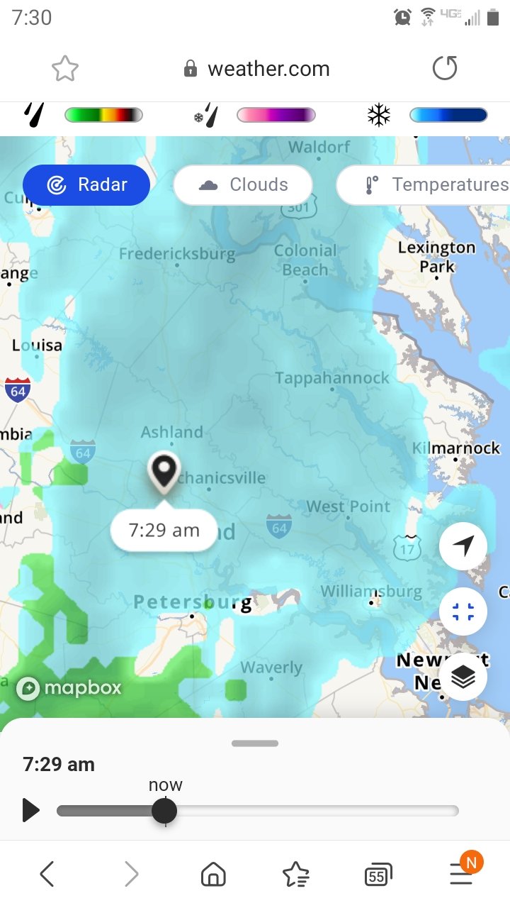
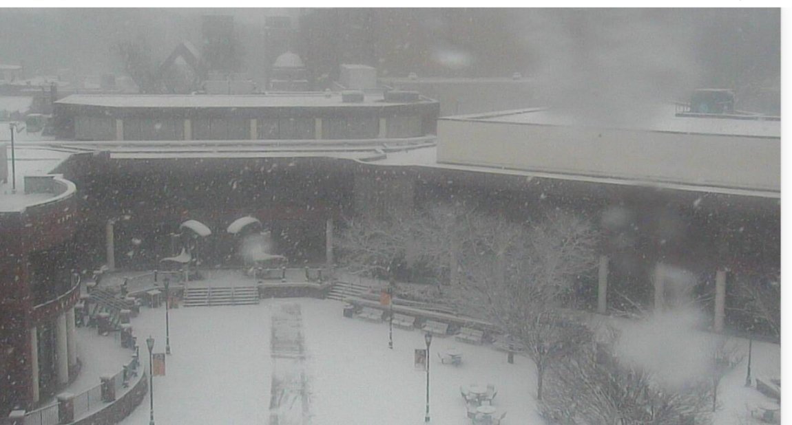
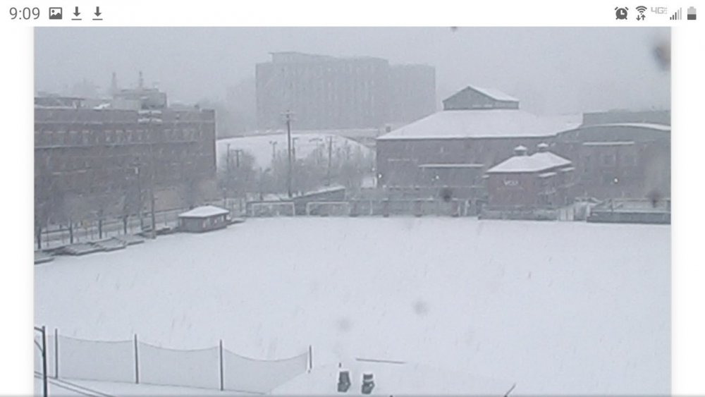
Need to stay in the heavy /precip, do to the marginal temps.. Radar Looking decent for now.. Wont stay around long once the storm passes. Here is the vcu ram cam again RamCam - Virginia Commonwealth University https://ramcam.vcu.edu/
-
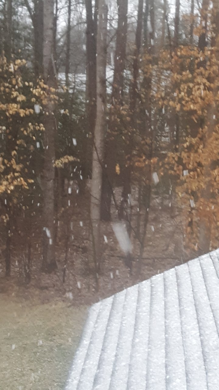
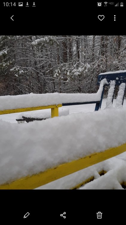
Some of the biggest wet snow flakes I have ever seen coming down now picture does no justice..lol

-
Heavy very wet snow now here
-
I wouldn't consider it a bust at all, we rarely do good in this kind of setup . I mentioned it days ago.. Never had my hopes up for this one. Its possible we still can get a dusting to a inch or two.. Mainly on grassy surfaces, if a heavy enough band moves in... Starting to mix here now in Glen Allen.. Next weekend, until the end of the month is looking very wintery....once the cold air is in place.
-
Would be nice to get something on Sunday but we rarely ever do good here with marginal temps. I'm definitely more focused on the 10th-15 time frame....definitely think we have a better shot during that time frame. Anything over this weekend is just a bonus.
-
Hanging on to the outer edge of this streaker band with the light snow here in Glen Allen. Maybe can pick up another 1/4 to 1/2.. Mainly on grassy surfaces if lucky.. A little more east may fair a tad better.

-
Of course allot of the high totals where to be form the coastal and the wrap around that has yet to happen yet.. So they could still get a few inches tonight/ tomorrow if it dosnt go too far north... Not looking like we will be able to get much of anything from that wrap around but maybe a few snow showers will make it down here who knows..
-
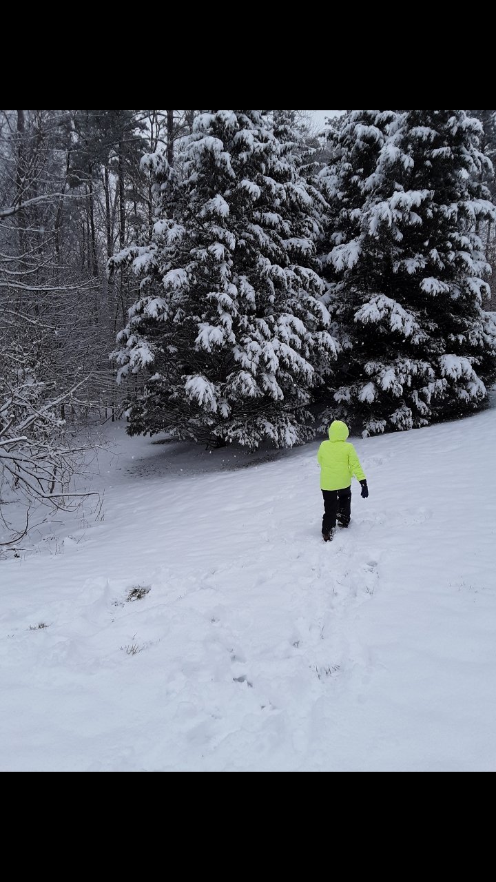
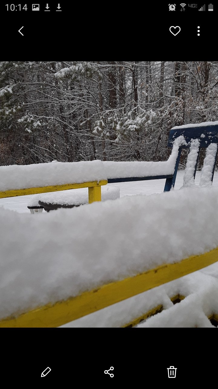
Probably ended up with about 5 inches here in my part of Glen Allen
-
A little over 3.5 here in Glen Allen
-
Looks like a good hour or two of moderate to heavy snow here in the Richmond area. Looks like if we can stay in this, it will keep the mix/rain away for a bit.. Noon looks like a key timeframe.
-
Has it turned over there?
-
Looks like its gonna start getting iffy about noon.
-
Jan 31st - 33rd Storm Obs and Disco like it's 1979
eaglesin2011 replied to Bob Chill's topic in Mid Atlantic
https://ramcam.vcu.edu/ LIVE CAM FROM VCU in Richmond VA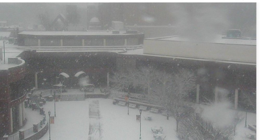
-
https://ramcam.vcu.edu/ Live Vcu cam ^

-
Well we should be in it for a few hours now so here we go!!
-
Yep, same here... going to bed now.. Next batch looks to be a few hours away, unless we stay even longer in this dry patch lol
-
First few flakes now falling in Glen Allen
-
Better hope this first band fills in .. Or Dry slots will be already getting us..
-
How much of that is virga? Any snow reports? I'm still thinking 1-2am when it will move in here but the earlier the better...
-
It's more then just that we also have to a avoid the dreaded dry slot that also seems to show up here..
-
That's been the likely outcome here for a few days now besides a few wonky model runs.. Definitely need it to come in sooner then later.. not sure if that overrunning front end that is down in NC will make it up this way it looks like its dying out a bit...
-
https://www.weather.gov/akq/winter

-
The temp probably won't make a difference since its the warm air aloft that will be pushed in that will change everything over.. If the whole storm comes in a hour or two earlier that would help. Thev more north the more problems for this area