

mreaves
-
Posts
14,322 -
Joined
-
Last visited
Content Type
Profiles
Blogs
Forums
American Weather
Media Demo
Store
Gallery
Everything posted by mreaves
-
21° but is adjustable +/- .5°. I have a G430 driver, which is the most reliable club in my bag, so I was sort of already on the Ping bandwagon. These were on sale so I decided to give it a try. Not sure how low handicap guys would like it but I did see some pros having 7 and 9 woods now. I'm a 20 index and hit it about 180-200 depending on how clean my strike is. The shaft is a "soft" regular. Ping probably makes the most forgiving woods on the market. Which is something I need.
-
Just bought a Ping G-430 Max 7 wood. I hit this thing really well. They let me try the demo for few rounds and I loved it. The pro shop had it for $269 and I had $200 in shop credit.
-
Which made these winters exceedingly awful from a winter sports perspective, aside from skiing at a resort with good snowmaking. The pack would repeatedly get wiped or severely reduced. The ground never froze and ice was sketchy on the lakes and ponds.
-
Or hiking or playing golf or biking or lawn work or attending an outdoor concert or ballgame etc.
-
Try MPV. I’m at 1250’ and recorded about 110” but could never really sustain a seven snow pack.
-
Wow. 58.8/56.8 here.
-
We had a snowmobile club meeting this evening and just sat outside the garage. It was so nice. I think I could have slept out there.
-
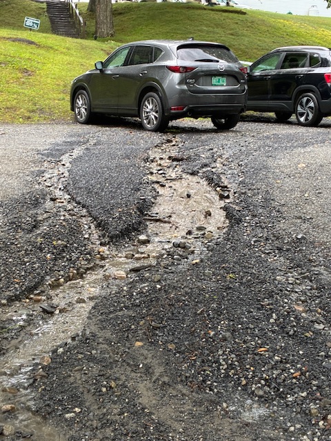
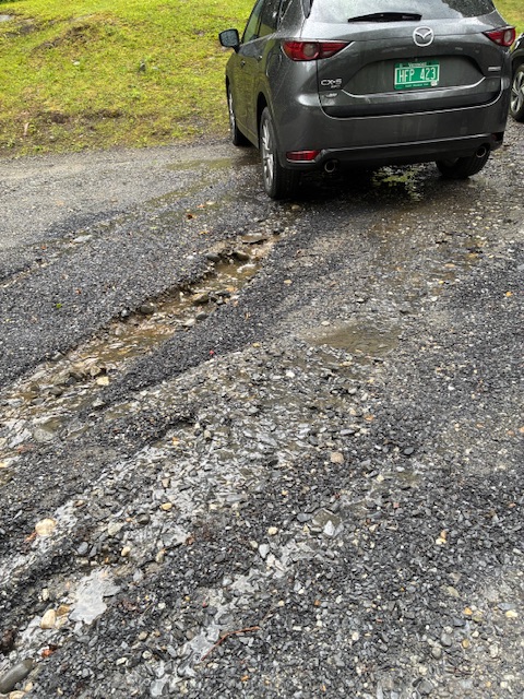
Storms blew through here 6:00-6:30. We were called off the golf course before any weather hit. By the time we got back to the clubhouse it started coming down really hard and winds were probably gusting 30+. The parking lot sustained a a little bit of damage. That’s my grey Mazda with the washout close to the tires.
-
And SLK only hits 89°.
-
I usually walk but I believe I will be taking a cart in men's league tonight. Especially snce our starting hole is at the highest point on the course.
-
It was half a degree.
-
Are you nude with your friend's father? Seems like you should reciprocate his hospitality from the hot tub days.
-
Also when you first start the car up if it's been sitting in the sun.
-
See below regarding the thermo in my last car. The new Mazda seems to be about 3° too high.
-
The thermometer in my old Ford Fusion was surprisingly accurate. It would always match KMPV or my PWS. I could be up near the airport, look at my car thermo and then see what the obs were it was spot on.
-
I'm at 1250' in central VT. My PWS is mounted about 10' off the ground on my deck railing so while not exactly in an "official" type of environment it's not sitting of mulch beds that get watered either.
-
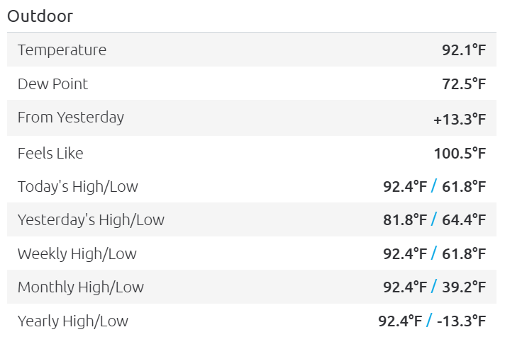
92/68 at KMPV.
-
Nice. It's fun to see the look on people's faces when you do something like that. "You're a 21 handicap?!" lol Were you called a sandbagger?
-
Our high was 82° and it was pretty breezy so it was tolerable.
-
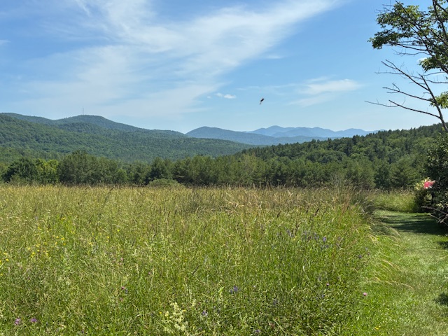
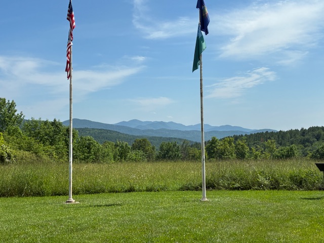
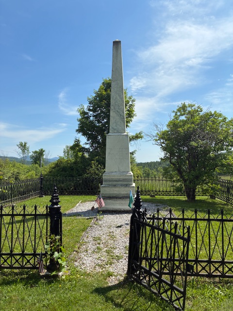
Spent the day in the Rutland area today. Attended a small bbq festival and the went over to the Hubbarton Battlefield historic site. Interesting displays and a beautiful setting. Great day to be outdoors.
-
Did any band play Green River?
-
Down there. Up here its currently 60.4°/56.5° overcast an breezy.
-
Everything split around us at the golf course tonight. Not a drop of rain.
-
If I had listened to him, my AC unit would be rusty from the snow that had accumulated on it back in March when he first started pimping the install.
-
79° for the high here today. I think we had more clouds though. Colleagues in Moretown and Cambridge said they had sun while I still had overcast.


