

Tatamy
-
Posts
2,327 -
Joined
-
Last visited
Content Type
Profiles
Blogs
Forums
American Weather
Media Demo
Store
Gallery
Posts posted by Tatamy
-
-
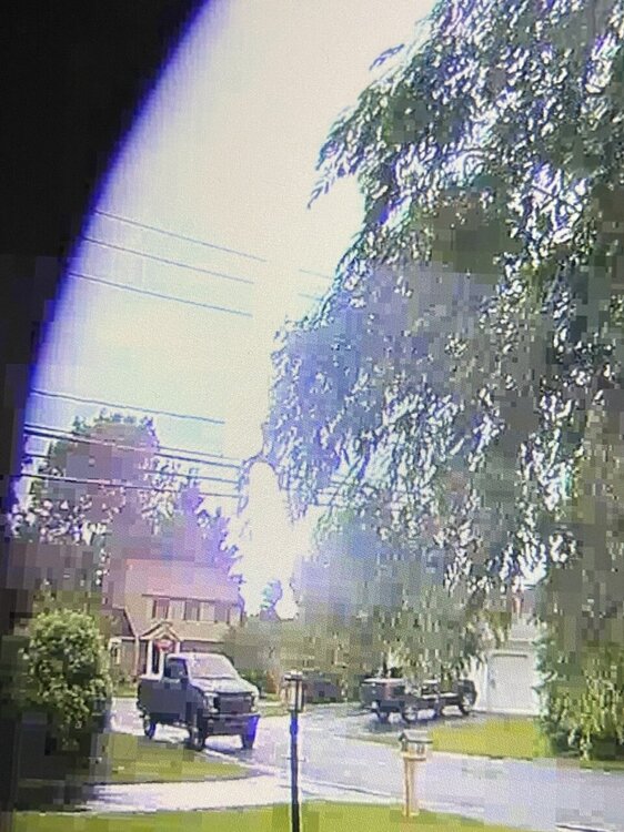
This one will be tracking very near to the Trenton airport in a few minutes.
-
 1
1
-
-
I am watching live coverage of this storm on NBC 10 Philadelphia. Tornado now reported near Washington Crossing, NJ
-
 1
1
-
-
Confirmed large tornado on the ground near New Hope, PA .
-
1
-
-
Confirmed report of a tornado near Lumberville, PA a short time ago.
-
1
-
-
New Tornado warning in the Allentown area. Heavy rain here but not too much lightning. No wind to speak of.
-
22 minutes ago, Rtd208 said:
Tornado Warning in the Allentown PA area. It looks like there are imbedded severe storms in the area of moderate/heavy rain moving in.
Seeing steady rain with lightning mainly CTC.
-
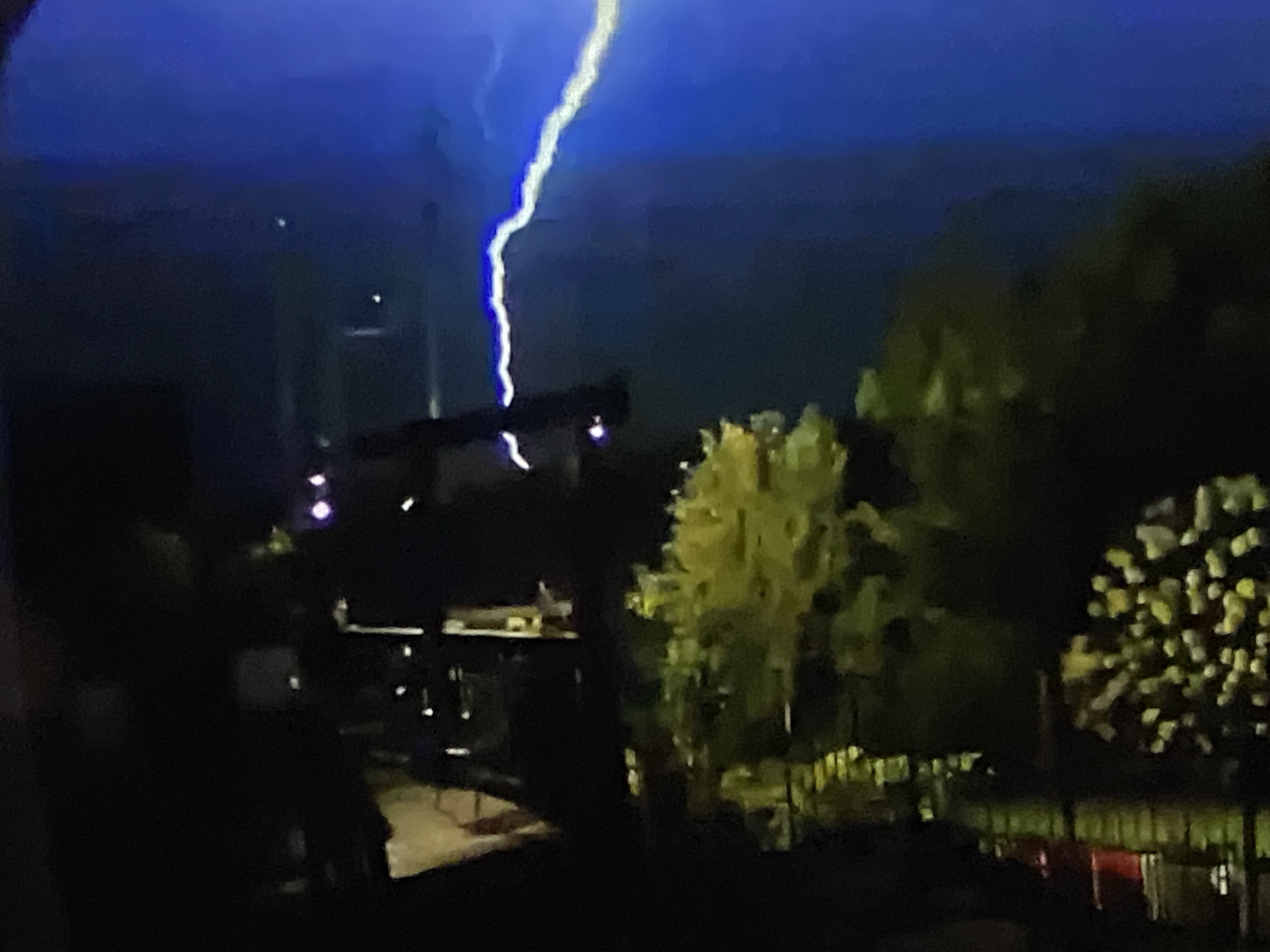
8 minutes ago, Tatamy said:
I figure it was about a mile away near a local shopping center.
This is what a quarter mile away looks like.
-
2
-
-
10 minutes ago, Will - Rutgers said:
can you estimate how far that strike is away from your house?
I figure it was about a mile away near a local shopping center.
-
3 hours ago, Will - Rutgers said:
that's badass
It was quite loud. It was actually a fairly small local cell that set out some close CTG strikes.
-
Picked up 0.27” with the overnight storms. This woke me up at 2:30am.

-
2
-
-
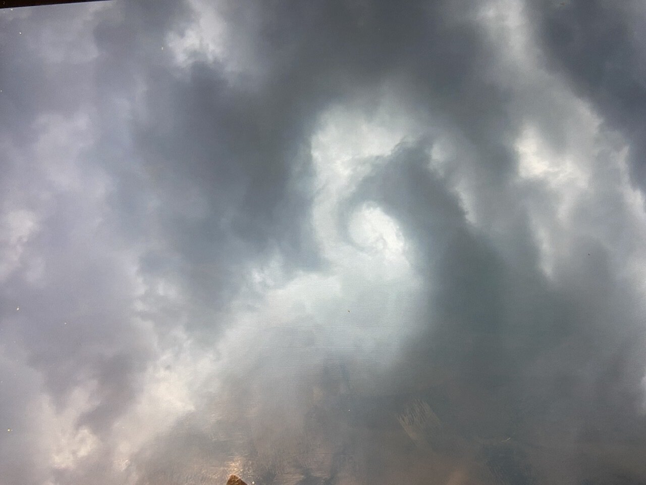
Rotation in the atmosphere over my location this afternoon.

-
11
-
1
-
-
Marble size hail with the storm that just rolled through here. 0.27” with a 28 mph wind gust.
-
1
-
-
56 minutes ago, SnoSki14 said:
Very slow moving. It'll die out once it crosses into NJ.
So far this has been a nothingburger as it passes near my location in eastern PA.
-
14 minutes ago, SRRTA22 said:
latest HRRR and NAM have more widely scattered convection developing across the metro in the next 1-3 hours from the convection to the north. See what happens. Also have an outflow boundary in the area from the storms to our south so I definitely agree that the metro will see some action in the next few hours (Nyc west)
Outflow boundaries on a local scale have been the major player in this evening’s activity out here.
-
2
-
-
Seems like you folks in the metro area are having a quiet evening convection wise. Not here. Cells have been back building over my community for the past hour. Lots of CTG with this activity. Also had a wind gust to 33 mph with one of the down bursts. Looks to be winding down now. 0.77” in the rain guage.
-
1
-
-
Precip total out here is up to 1.84” for this event.
-
The line passed through here a short while ago. 0.20” in the rain bucket and the wind did not exceed 20 mph. A few rumbles of thunder with it.
-
40 minutes ago, Snowlover11 said:
whole lot of nothing, lets see what the wind brings.
Same here - .01 on the day. I wasn’t expecting an inch of rain today however today’s precip total definitely falls into the bust column. Radar as of now does not look too promising. Let’s see how we do with the predicted winds tomorrow.
-
The severe thunderstorm at my location here in Bethlehem Twp, PA dropped marble sized hail for a few minutes about 30 minutes ago. That line which is crossing into western NJ bears watching. With the passage of the squall line our temperature dropped 20 degrees in a few minutes from 69 to 49.
-
3
-
-
Just now, Tatamy said:
I think this warning was issued due to strong winds as reported by spotters and/or radar indicated. No lightning on any of my devices either. If you you read the warning statement it does speak to high winds associated with this feature.
And just like that my Skyscan is detecting lightning. It is the nature of these features that they can start producing lightning very quickly.
-
18 minutes ago, weathermedic said:
Squall line looks to be intensifying on radar as it makes it's way through western NJ. No lightning as per the radar apps.
I think this warning was issued due to strong winds as reported by spotters and/or radar indicated. No lightning on any of my devices either. If you you read the warning statement it does speak to high winds associated with this feature.
-
1
-
-
Squall line has just passed my location. It’s a mover however no lightning or thunder here with it. Wind gust to 19 mph.
-
2 minutes ago, bluewave said:
80° at Newark and 77° in NYC
Newark Liberty MOSUNNY 80 58 46 W31G40
Central Park MOSUNNY 77 59 53 MISG
You will want to pay attention to the wind gusts today. Many gusts here from 35-40 mph. Highest gust is 49 mph so far.
-
4" new OTG. Still steady light snow. 32F

SVR FF potential 2PM-midnight Thursday July 29: especially southern part of the NYC subforum along and s of I80 PA-NJ & LI
in New York City Metro
Posted
Circulation definitely looks weaker at the moment.