Tatamy
-
Posts
2,566 -
Joined
-
Last visited
Content Type
Profiles
Blogs
Forums
American Weather
Media Demo
Store
Gallery
Everything posted by Tatamy
-
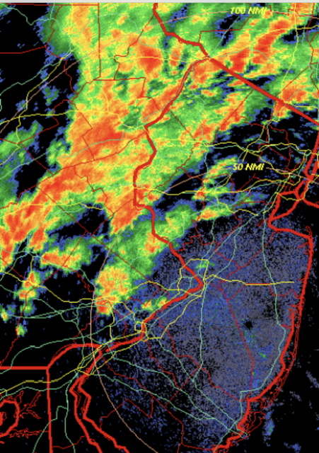
Crazy gradient as usual with these events. My station on Fire Island (Cherry Grove) has 0.17” so far today. Nearby stations to there are the same.
-
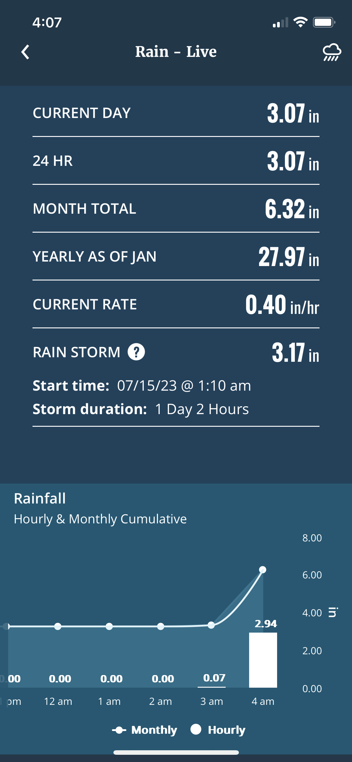
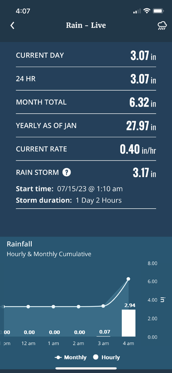
We have done the deed out here this morning. 2.94” in one hour with this crazy band.
-
74/70. Rain missed me in all directions today.
-
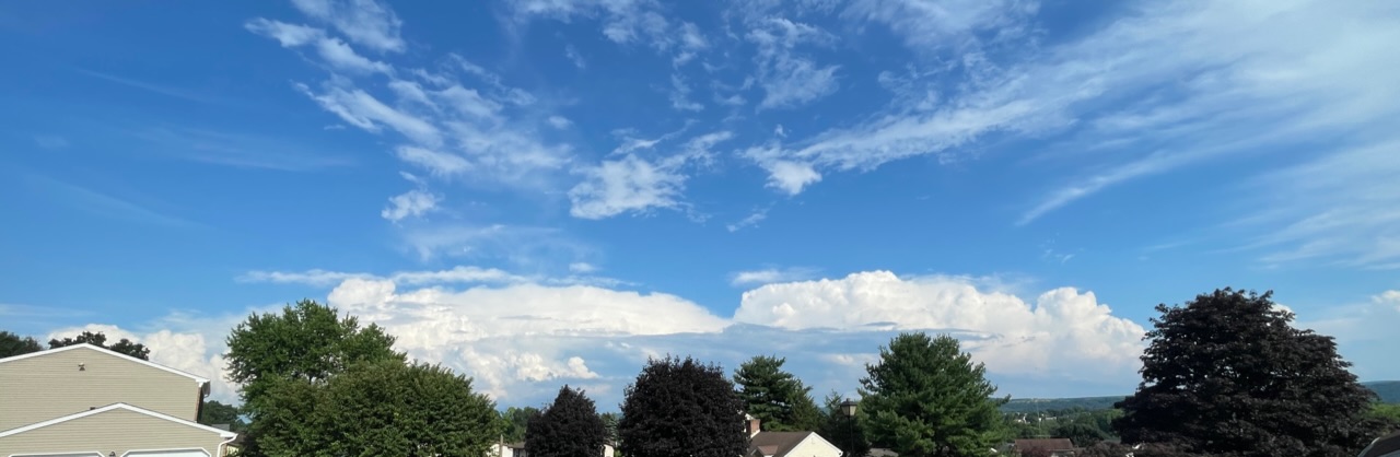
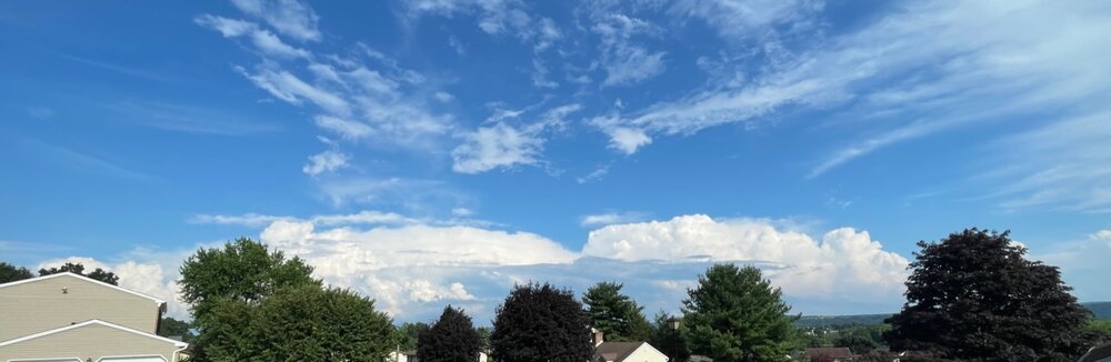
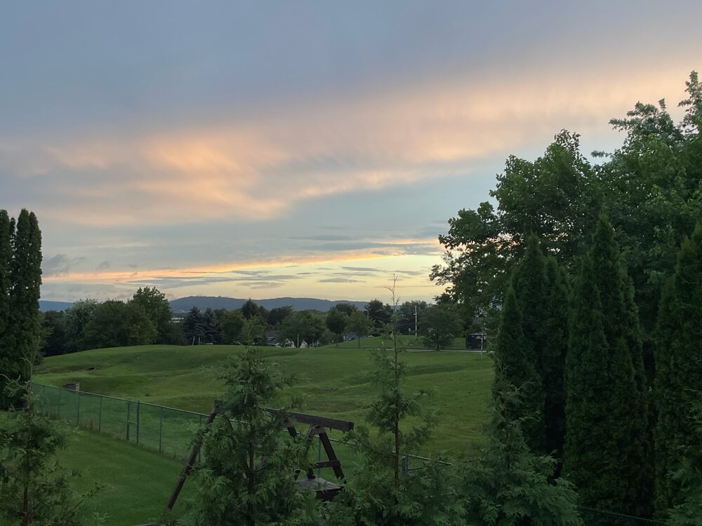
This is a view of the convection complex that has been hammering central NJ.
-
Sea breeze front has been fairly active today right along the north shore particularly in Suffolk Cty.
-
Outflow boundary from the earlier convection over the LHV has dropped south through the NYC metro area and is helping to set off new storms over the boroughs and nearby NJ.
-
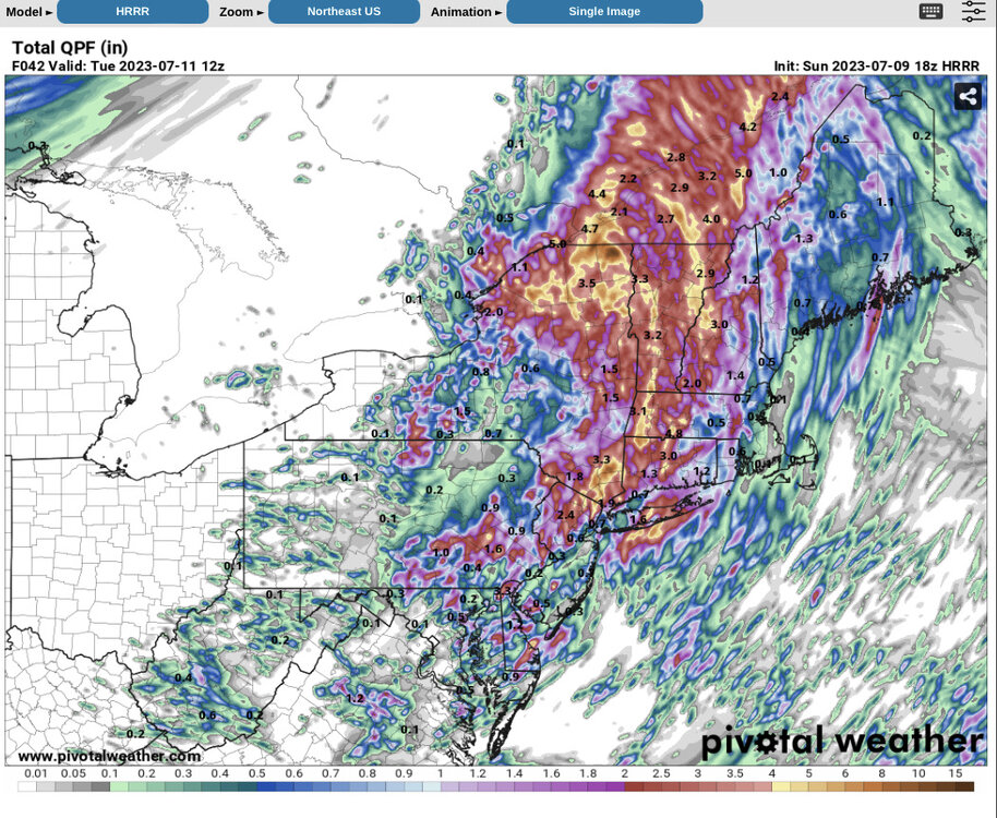
18z HRRR did still have the hole over Nassau. It was not 3-5” island wide.
-
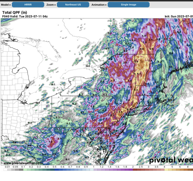
12z HRRR from yesterday. It did pick up on the lower amounts on western LI
-
There were training cells in that area. My station on Fire Island has a storm total of 1.48” so I may have caught the NW edge of that band out there.
-
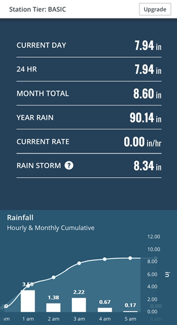
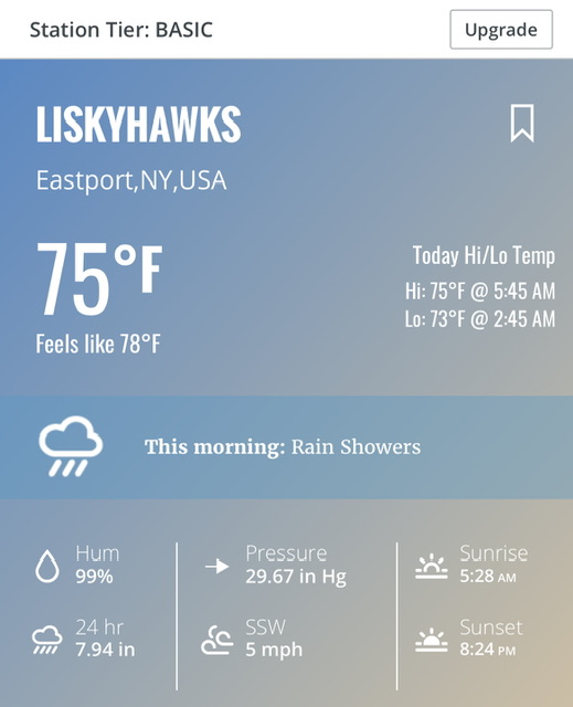
This is data from a Davis station near Eastport. Actual ground truth.
-
I saw that cell on radar earlier this morning just before 4:00 AM. It was very clearly rotating. Let’s see if there are any damage reports.
-
Radar is getting / still busy at some places around the area including LI. My station on Fire Island has recorded 1.07” since midnight.
-
All done here at 2.03”
-
My Storm total is up to 2.00”
-
My total on the day is up to 0.70”
-
As the trough axis moves east there will definitely be a pick up in the activity in NJ, SE NY, and in close to the city.
-
The best echos are located along and in proximity to Blue Mountain. That is the 1500’ ridge that runs from the Delaware Water Gap back to Harrisburg, PA. The county lines run along it so you can trace it on the radar map.
-
Much of what is going in eastern PA and NW NJ is related to orographic lift. The prevailing flow from the south is interacting with the higher elevations in those areas and resulting in the echoes that you are seeing.
-
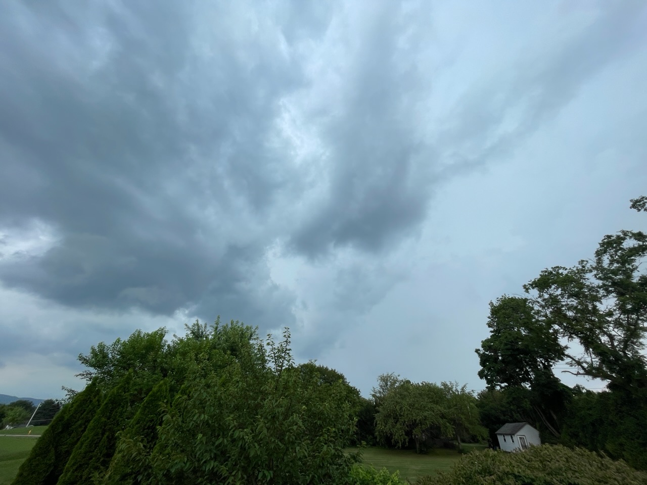
Atmosphere is really starting to pop now across eastern PA and NW NJ. Starting to see some downpours and rumbles of thunder. 78/74
-
Don’t you get any convection where you are?
-
I am under the front of it now. It’s rumbling and bumbling very slowly to the east.

-
The deed is done here. We received 0.40” with a 15 minute downpour.
-
Second Tornado Warning just issued for a storm SE of Reading, PA.
-
Tornado warning issued for the cell moving into the Lehigh Valley in eastern Pennsylvania.
-
It’s back…