Tatamy
-
Posts
2,588 -
Joined
-
Last visited
Content Type
Profiles
Blogs
Forums
American Weather
Media Demo
Store
Gallery
Everything posted by Tatamy
-
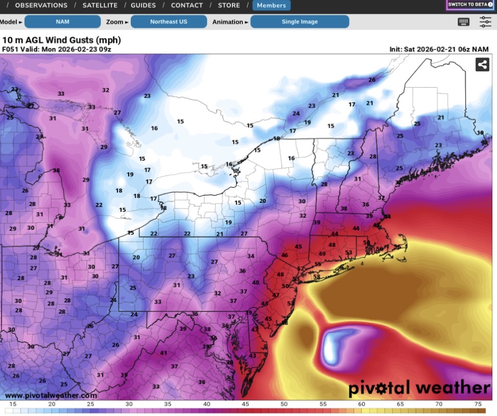
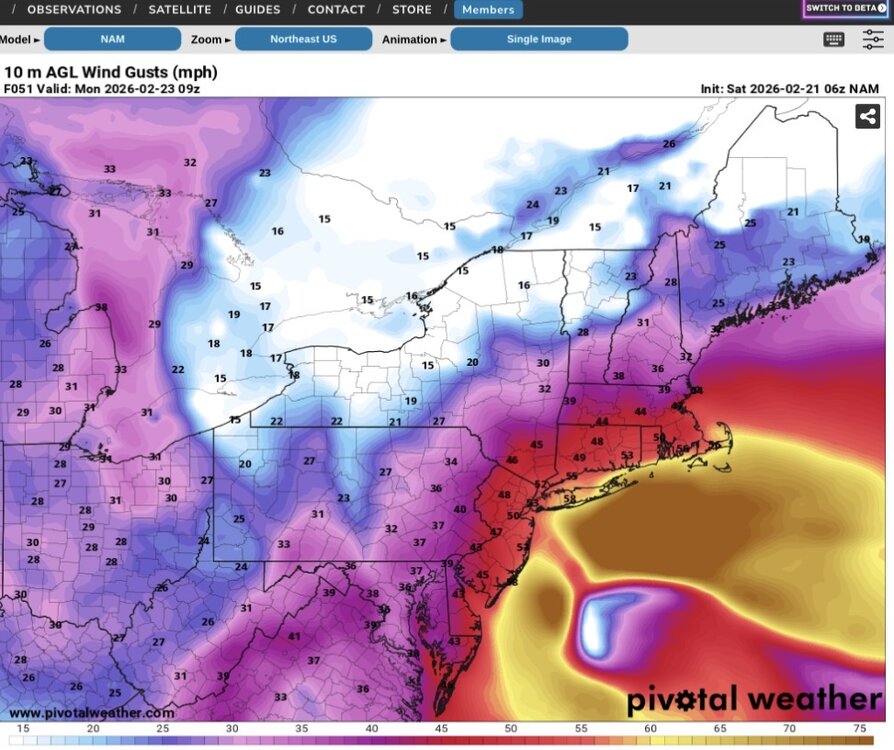
NAM Wind gusts Those are hurricane force wind gusts on eastern LI. The other visible feature is an inverted trough that helps to extend the precipitation field into western and NW NJ. This is one for the meteorology textbooks.
-
That deform band does look interesting.
-
I think we’ve had two today.
-
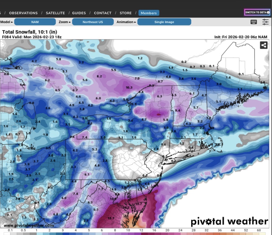
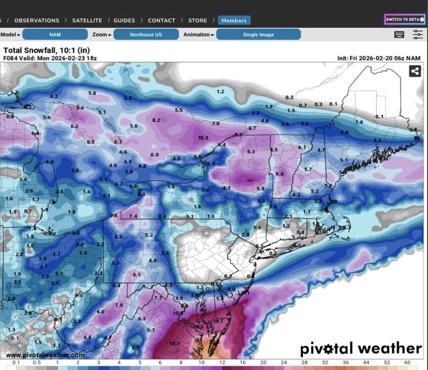
Have to love the NAM. So entertaining. We’ve gone from this at 06z to close to 30” in spots in our area in 2 runs. I think it’s outdone itself.
-
Water temps south of LI and east of NJ range from 36 - 38. This is close to the seasonal minimum and actually below normal. Coastal areas are in a different world as compared to early December (water temps then are usually still in the 50s) regarding ocean warmth being poised to flood inland.
-
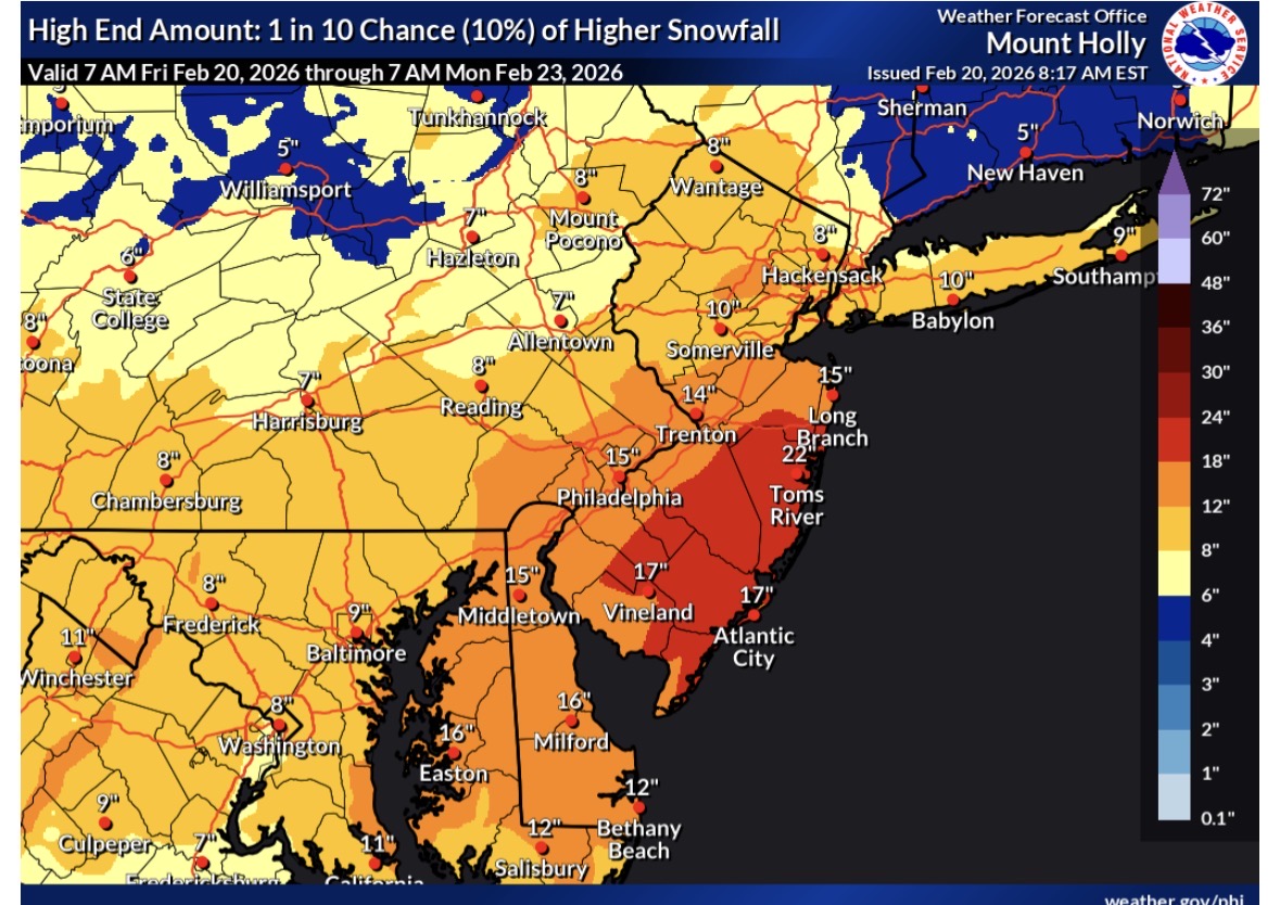
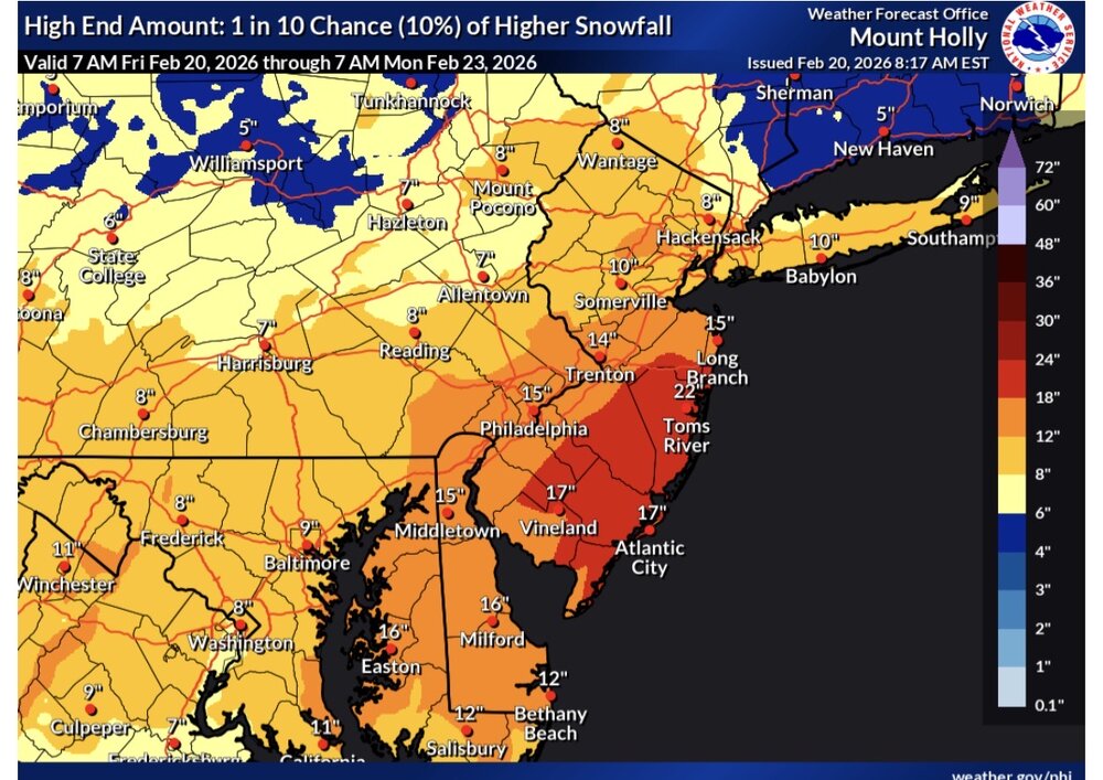
This is Mt. Holly’s high end forecast (10% chance of verification).
-
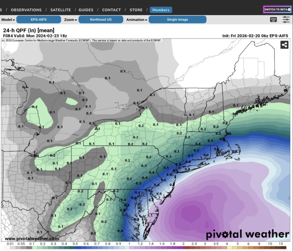
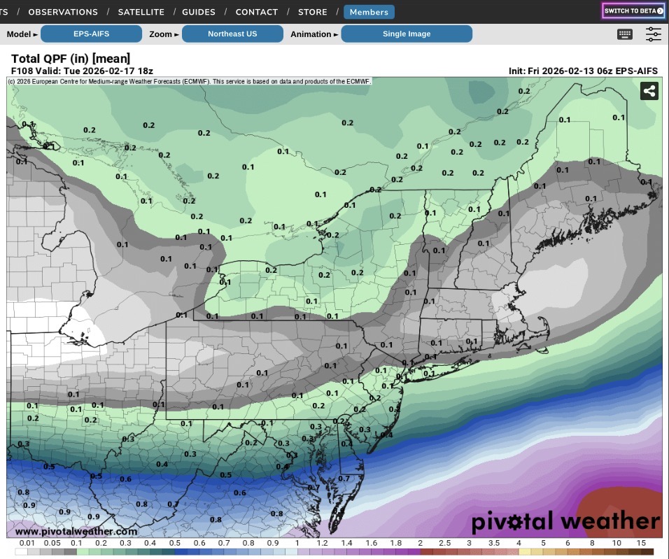
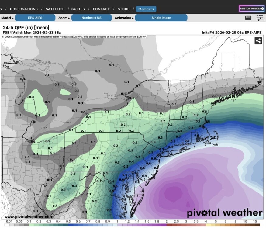
06z EPS AIFS
-
Looks just like the 06z GEFS
-
06z NAM has zip. 06z Ukie has rain from the city south at 66 hours. It’s like these models are all in separate worlds.
-
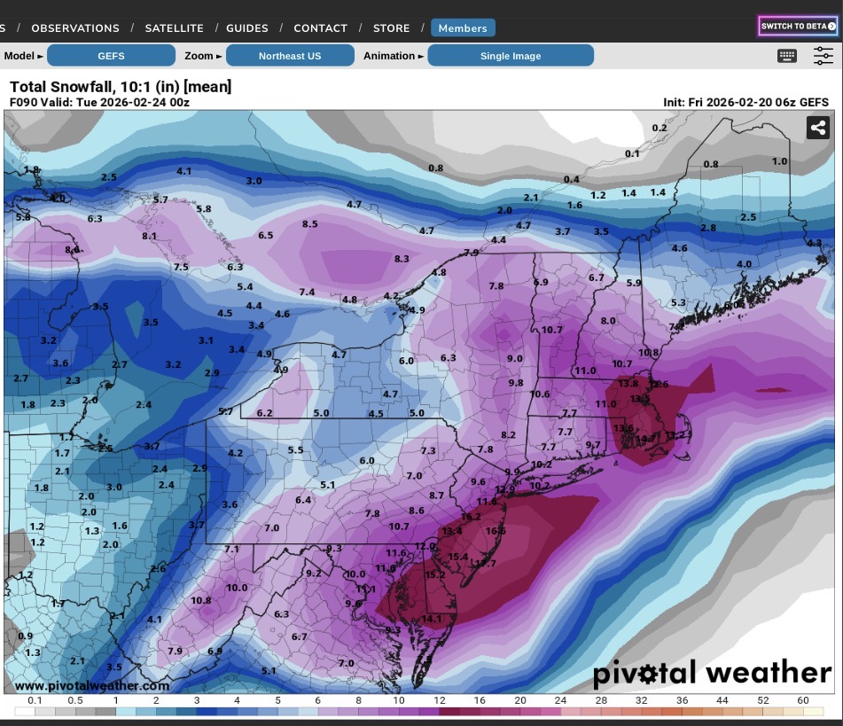
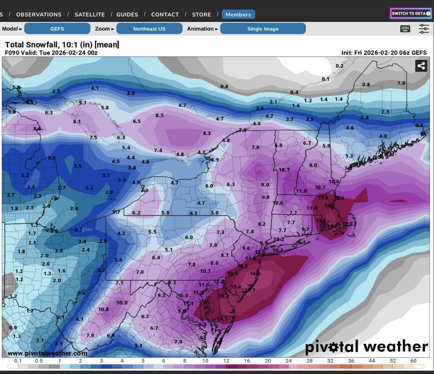
06Z GEFS
-
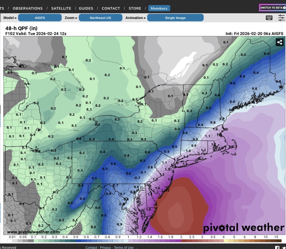
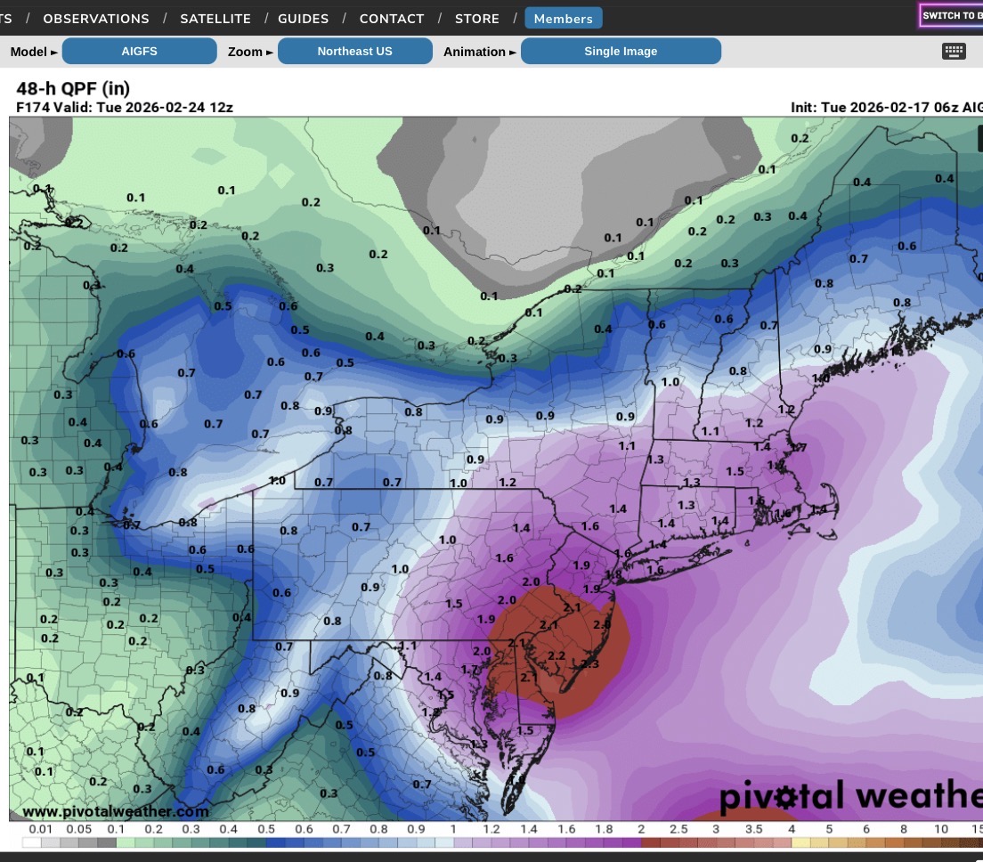
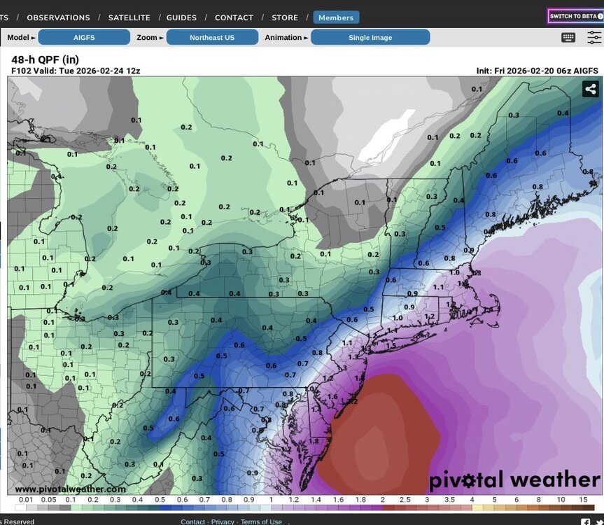
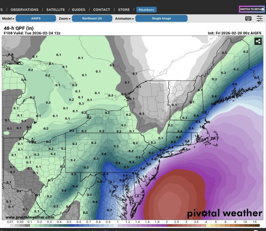
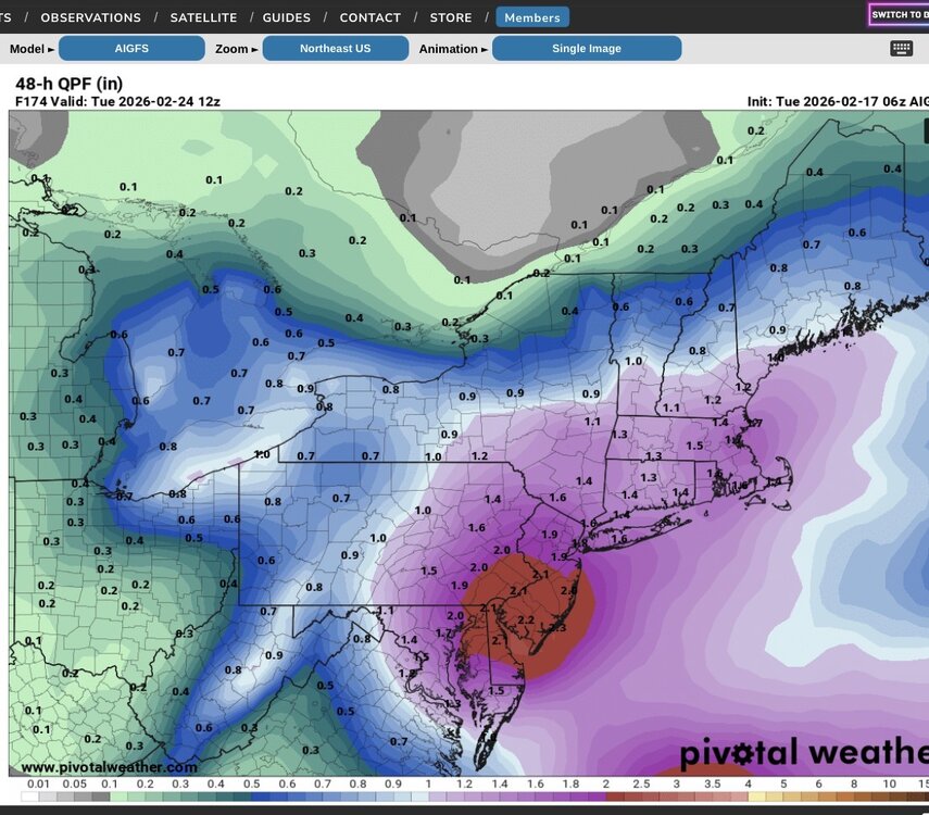
GFS AI brings 1 - 1.5” QPF across the area (less well N&W). It’s been showing a relentless push to the NW with higher precip amounts.
-
This could require hurricane force wind warnings for the coastal waters. Tidal flooding would be a big problem with this scenario.
-
06z AI GFS
-
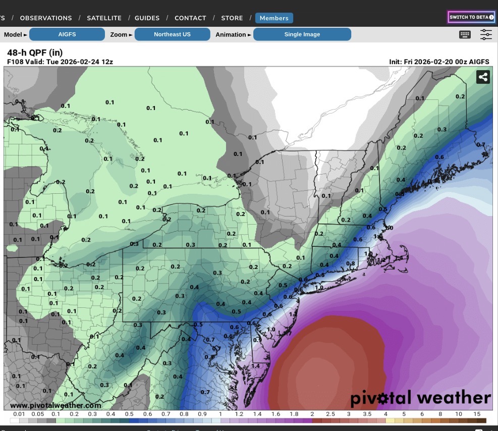
0Z AI GFS
-
No one seems interested in it…
-
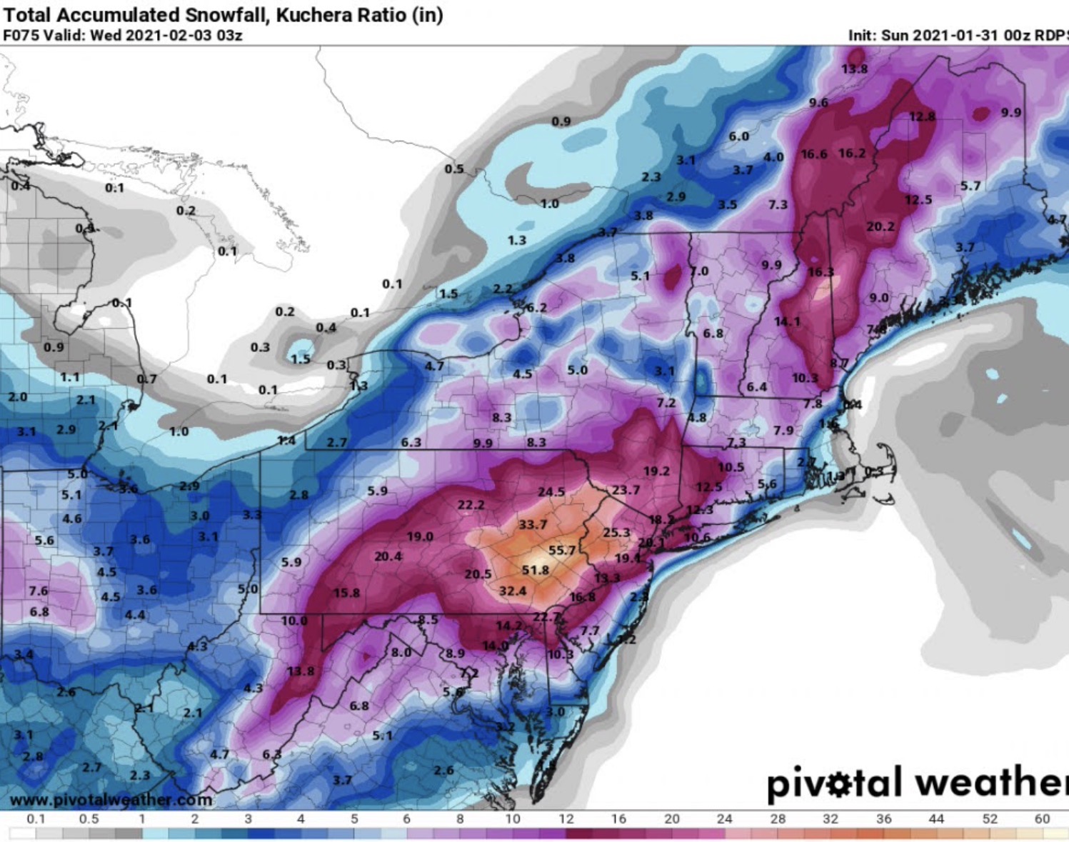
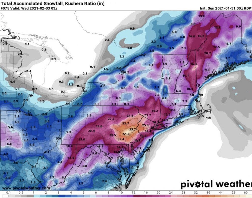
Have to careful with some of the real end outcomes coming out in the models. GDPS is calling for 30”+ for my area. In 2021 it did something similar (RDPS) only it called for 50” so there is an history with that model. Actual storm amounts ranged from 24-36” where I am.
-
-

Early Monday morning 2/16 last minute event OBS/Discussion
Tatamy replied to The Iceman's topic in Philadelphia Region
2” -
Storm total 2” on all surfaces.
-
Been getting steady light to at times moderate snow here. 1.3” new OTG. 31/30
-
Steady very light snow. 36/28. Expecting about an inch here.
-
Do you know how to read and interpret a computer model?
-
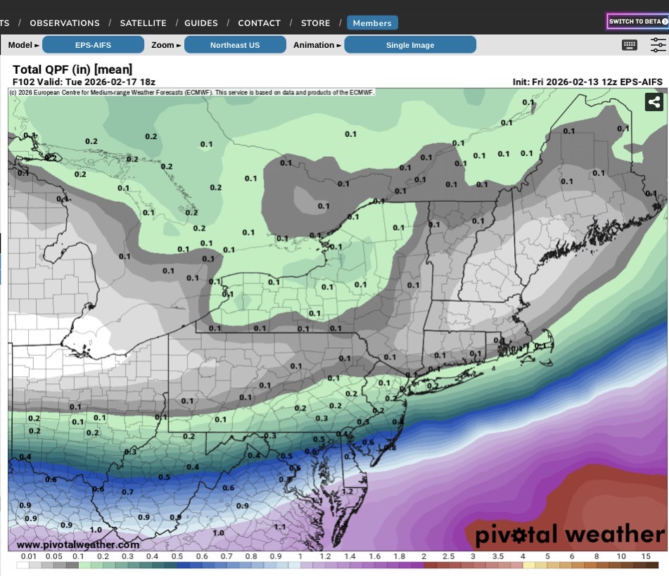
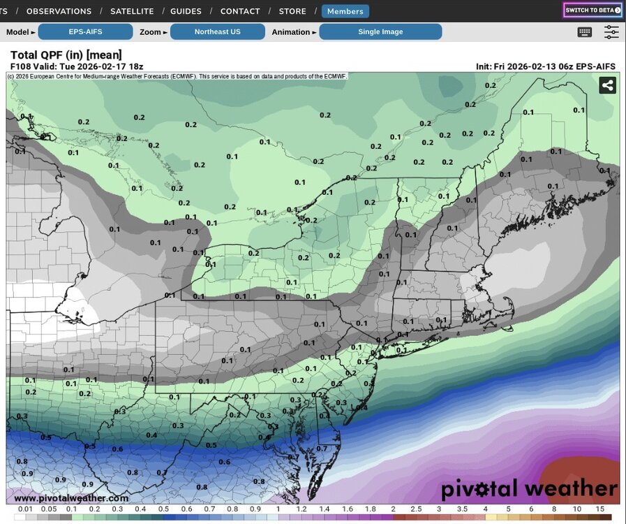
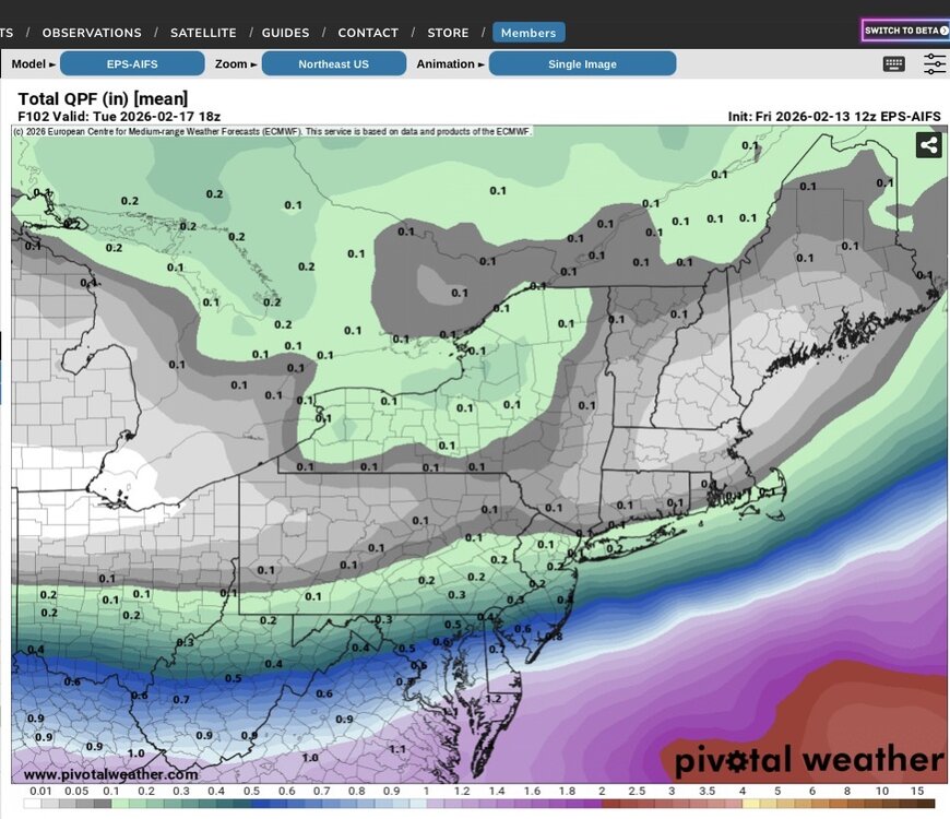
Here are the 06z and 12z runs of the EPS-AI.
-
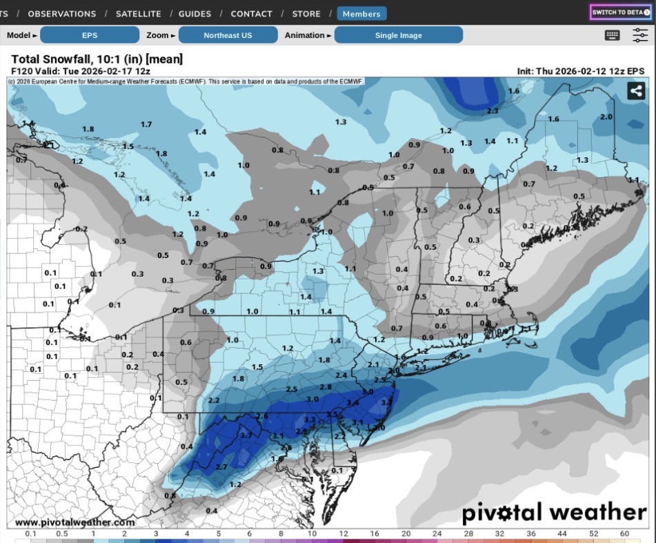
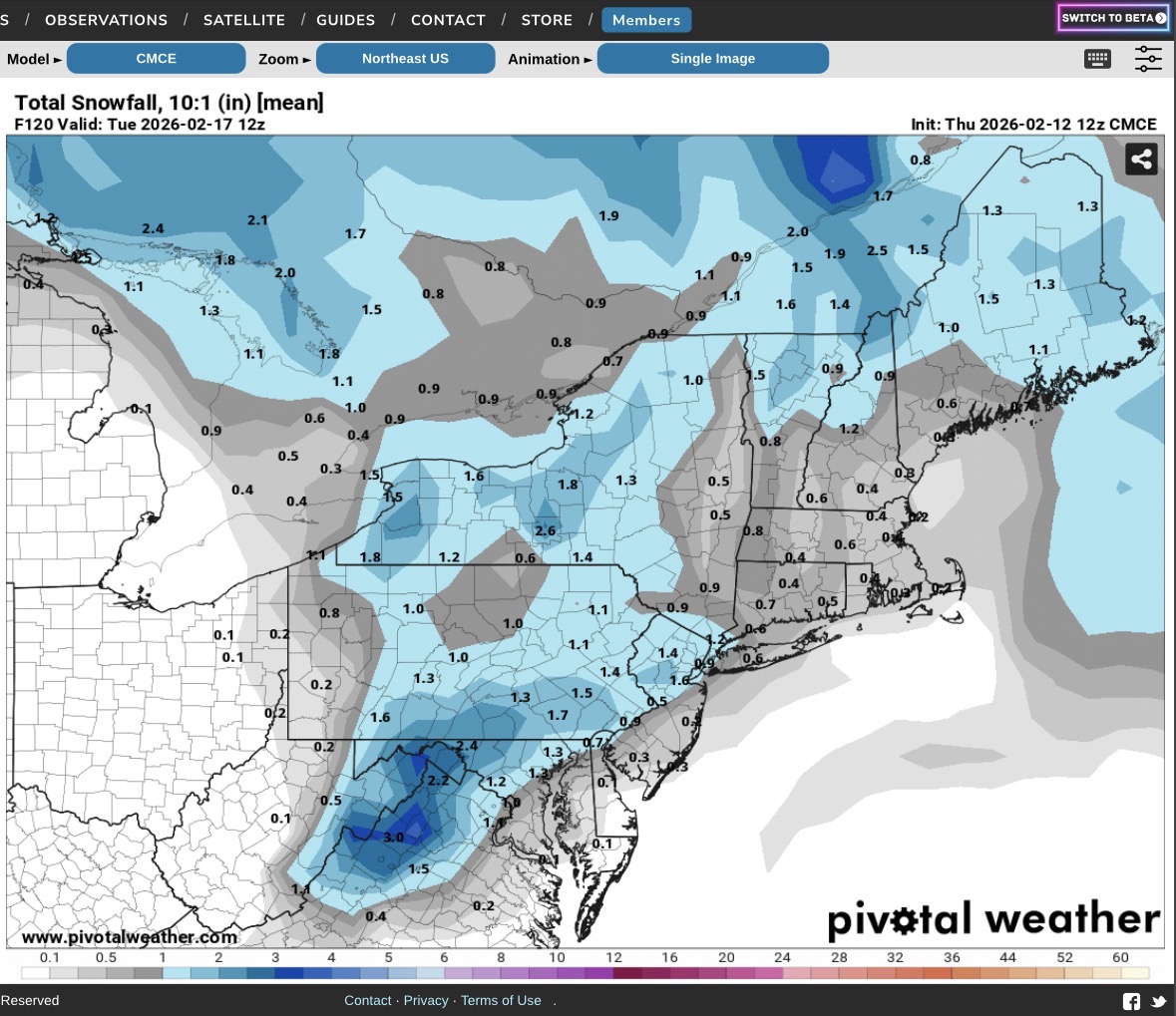
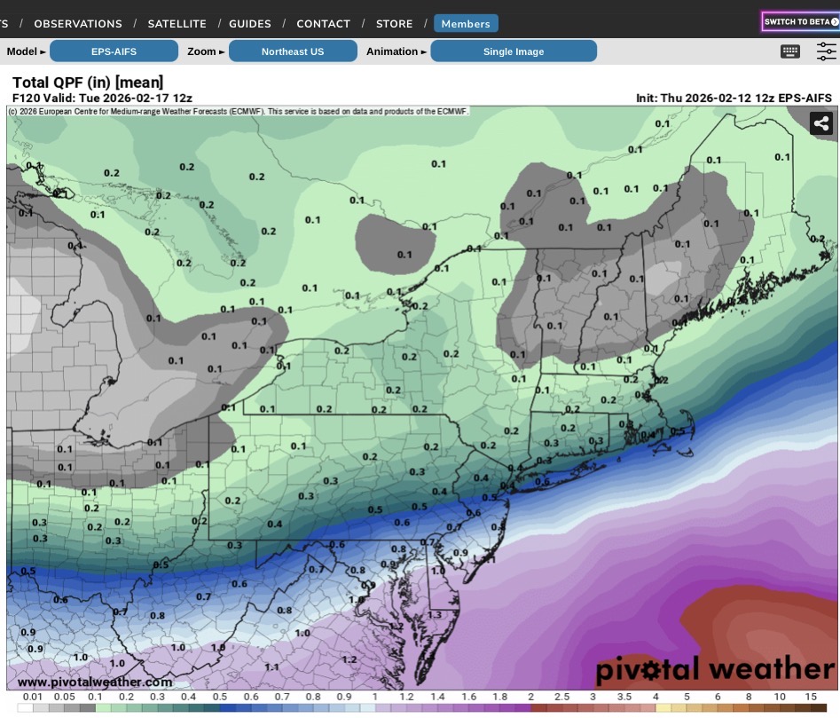
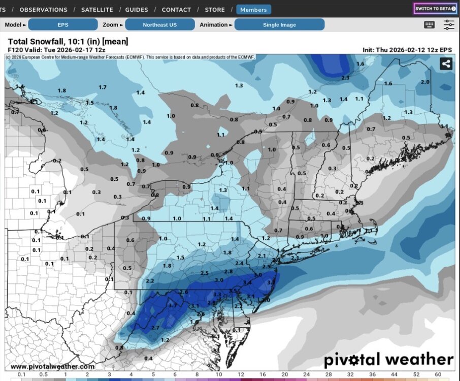
I am posting the 12z ensemble guidance below from the EPS, CMCE, and EPS AIFS. The EPS AIFS has actually been quite consistent with its precip field in recent runs.
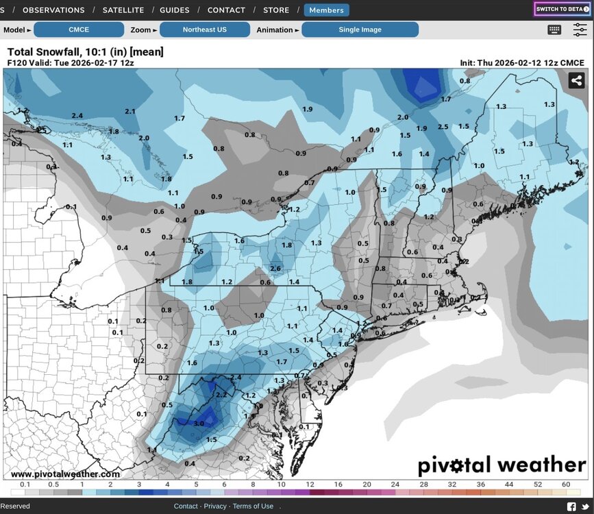
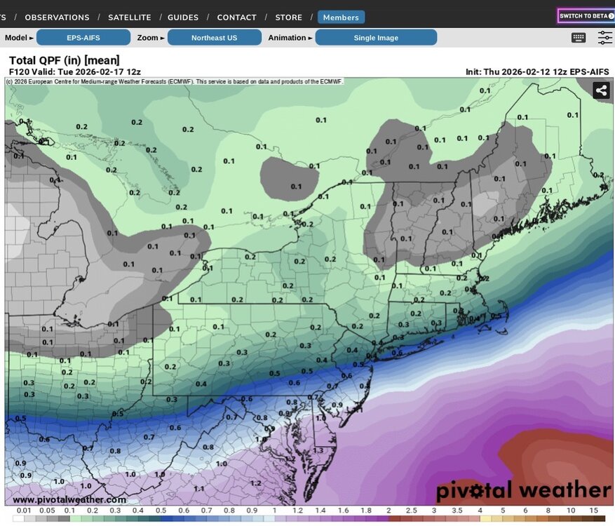
-
Places north and west could do okay however it’s borderline near the coast. Interesting run.