Tatamy
-
Posts
2,329 -
Joined
-
Last visited
Content Type
Profiles
Blogs
Forums
American Weather
Media Demo
Store
Gallery
Everything posted by Tatamy
-
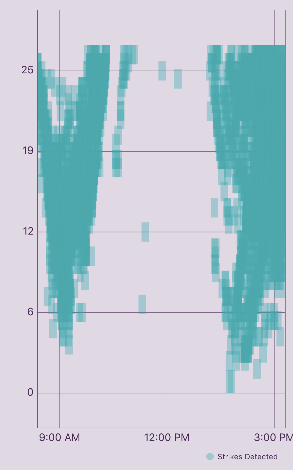
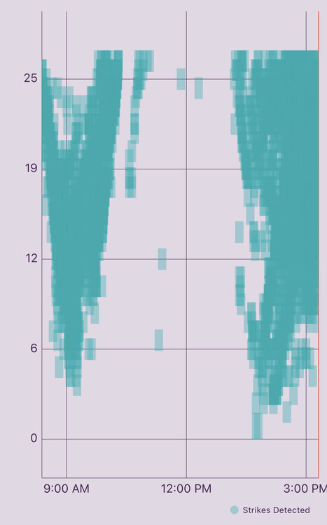
My Tempest has recorded over 5700 strikes in the past three hours here.
-
Things are really starting to pop at my location now with the storms generating overhead. Was just watching some weak rotation in the clouds above me.
-
For all this I have received 0.03” of rain… lol
-
My Tempest has recorded approximately 3600 lightning strikes in the past three hours so certainly no shortage of activity out here.
-
Mt. Holly just issued a TOR warning for that cell.
-
The frontal boundary near and along I78 is continuing to act as a focal point for convection this morning.
-
Same here. Places 5 miles from me have had over 2.5” over the weekend. My total was .30”
-
Real interesting feature on the radar a little earlier showing a north to south oriented front moving from east to west across NJ towards eastern PA. This feature was firing up storms along the way as it intersected different outflow boundaries already in place. It looks to have washed out now.
-
You guys did real well last night. Multiple reports of over 2.5” in that area. I am a little south of you and didn’t get much of anything.
-
Just about 1” here. It helps however we are still below normal.
-
Currently pouring here.
-
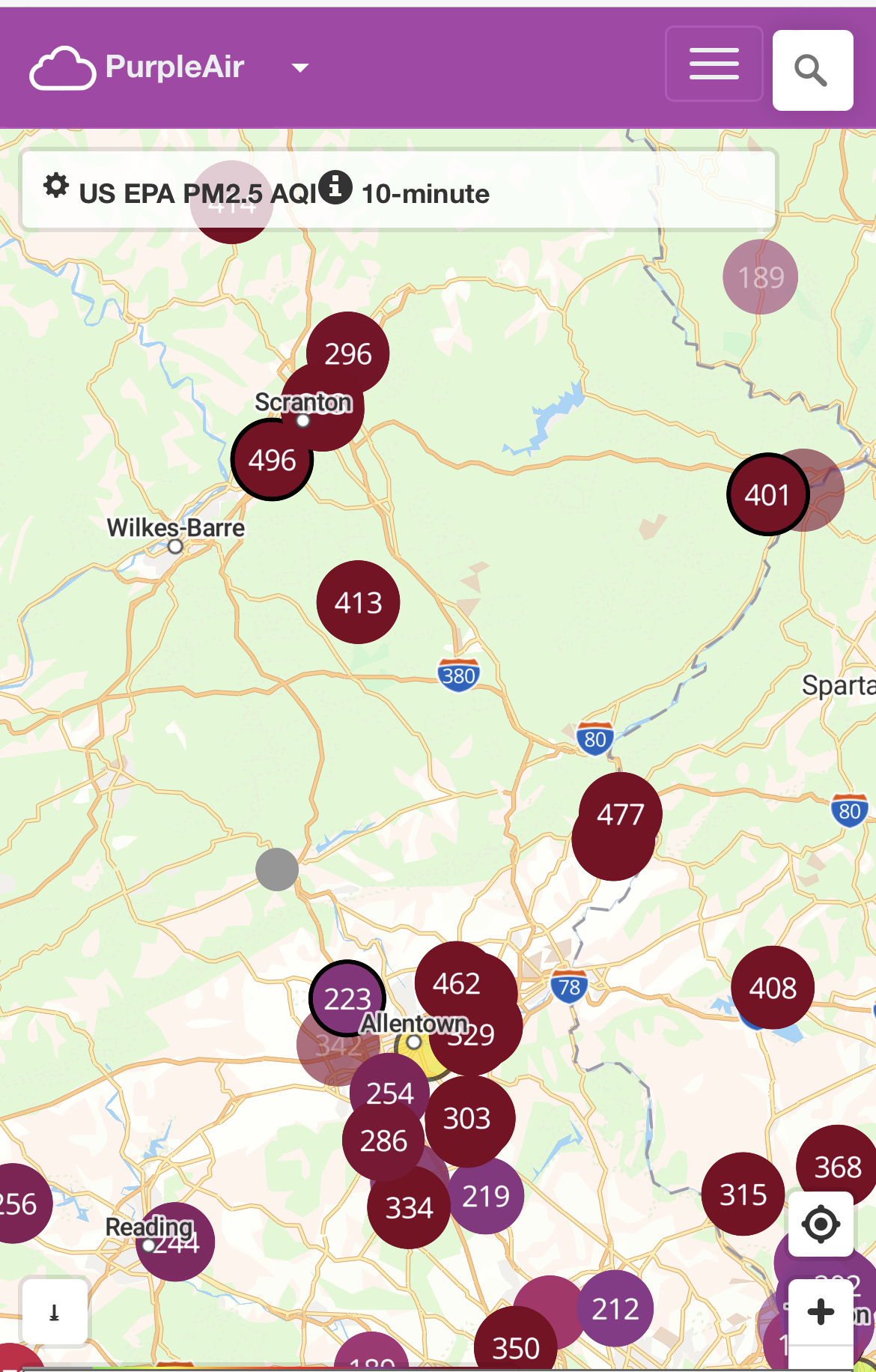
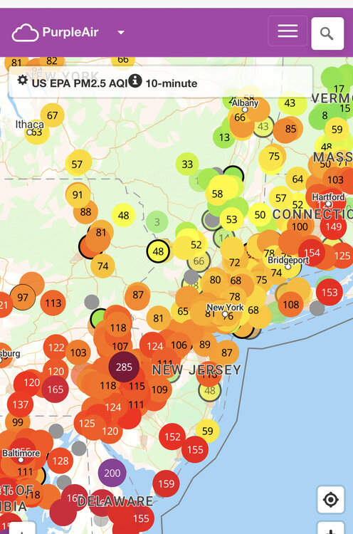
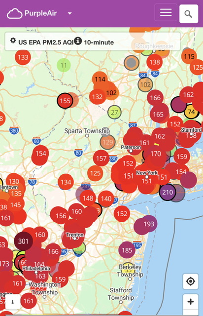
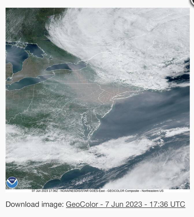
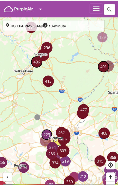
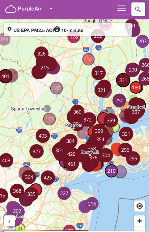
AQI’s look fairly good this morning across much of the area.
-
Big improvements continue as compared to yesterday.
-
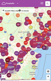
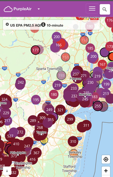
AQI is still quite nasty in many places but looks better than yesterday so far.
-
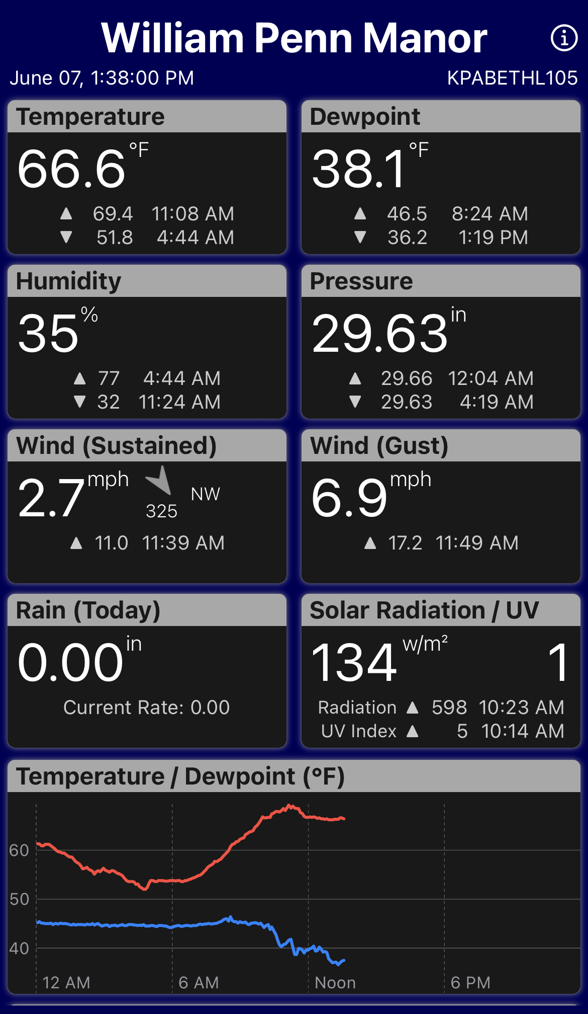
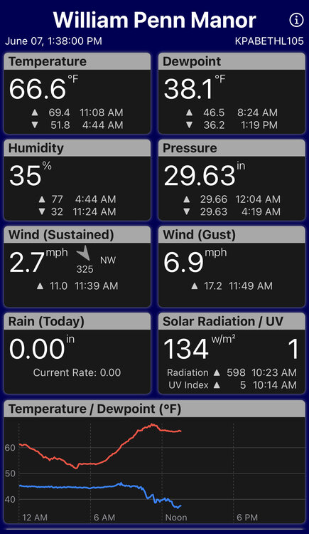
43 here with many other places near me down into the 30s.
-
Looks like the worst of it is down near the Philadelphia area
-
It really is.
-
-
Temps have dropped back to the 60s here.
-
It’s even worse to the west
-
Purple Air
-
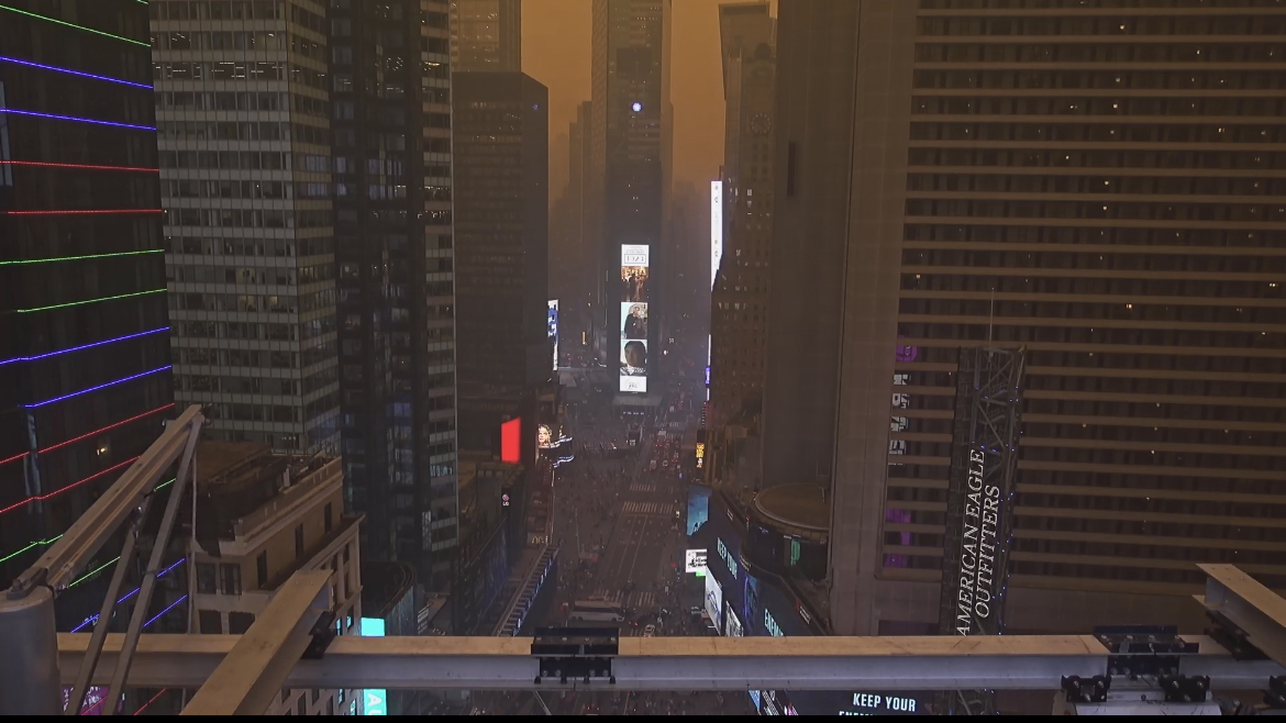
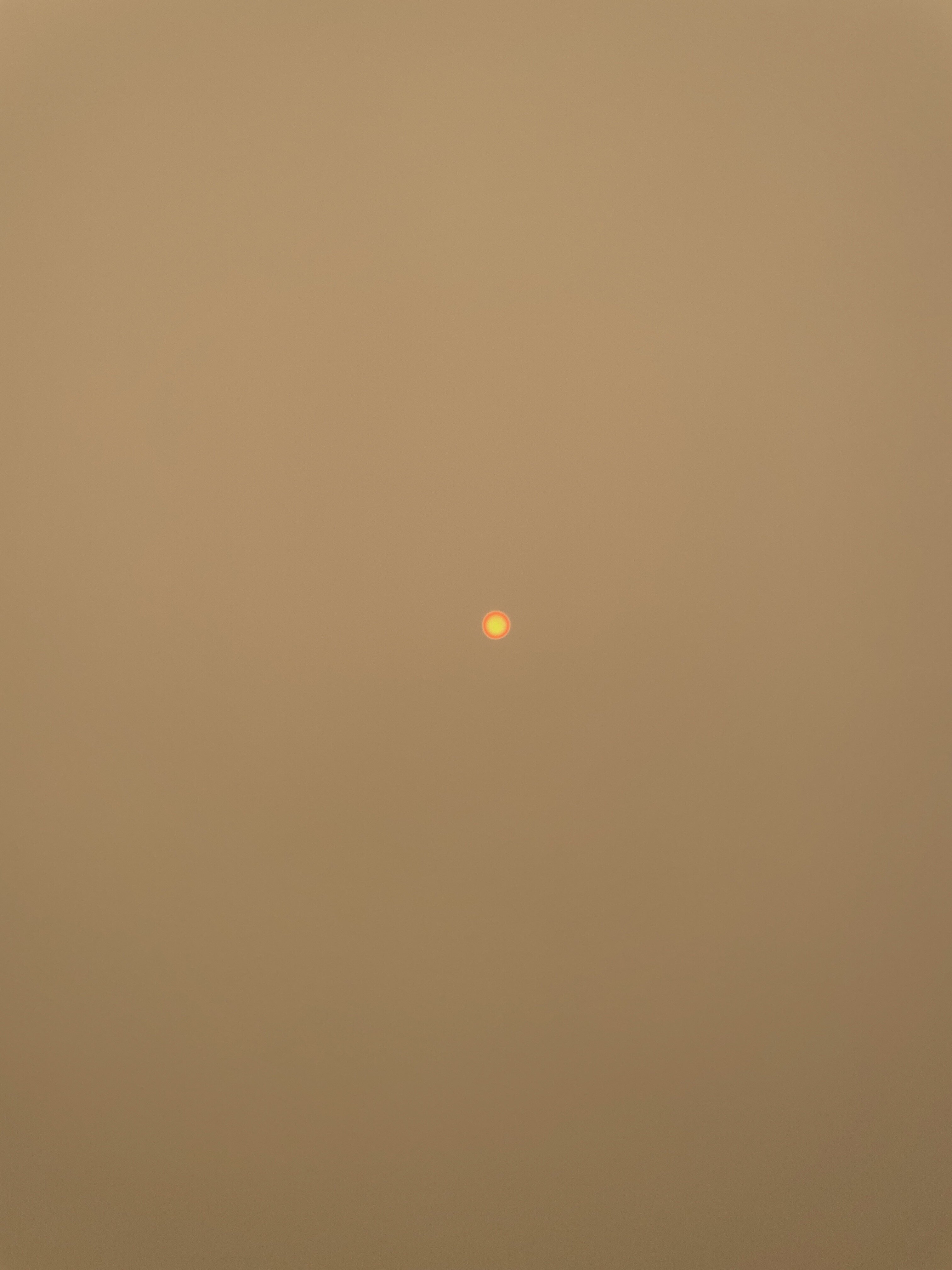
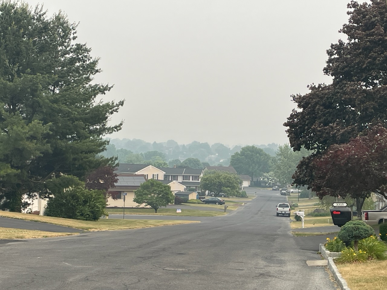
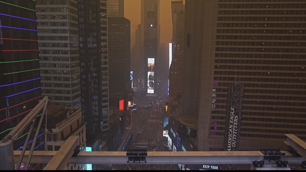
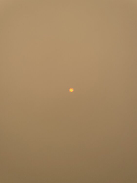
Kind of has a doomsday vibe to it.
-
It looks the same here- heavily overcast appearance.
-
Thick smoke condition here as well. The visibility has dropped noticeably here in the past hour.

-
That second cell over Oyster Bay has CTG strikes with it currently.