

Tatamy
-
Posts
2,037 -
Joined
-
Last visited
Content Type
Profiles
Blogs
Forums
American Weather
Media Demo
Store
Gallery
Posts posted by Tatamy
-
-
The deed is done here. We received 0.40” with a 15 minute downpour.
-
Second Tornado Warning just issued for a storm SE of Reading, PA.
-
Tornado warning issued for the cell moving into the Lehigh Valley in eastern Pennsylvania.
-
It’s back…
-
 2
2
-
 1
1
-
-
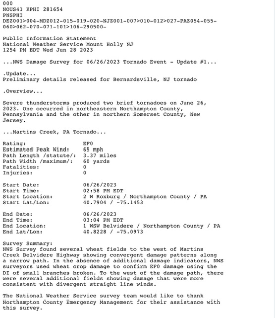
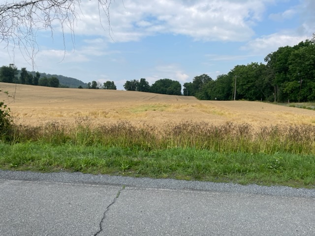
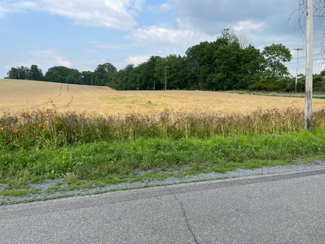
NWS Mt. Holly did damage surveys for Tornadoes that occurred on Monday in Northampton Cty, PA and Somerset Cty, NJ. I am attaching photos below of what I saw in the Northampton Cty. Survey area. The damage survey information is also shown. I saw two wheat fields with damage and took photos of the one with the more significant damage. As noted there was no other crop damage seen besides that in the wheat fields. The second one had a few small spots with the wheat knocked down. There are corn fields, soy fields, and stands of woods in the immediate vicinity. I did not see any evidence of broken branches, twigs, or leaves on those trees. Such is the fickleness of Mother Nature.
-
With another downpour this afternoon my two day event total is up to 3.48”
-
 1
1
-
-
13 minutes ago, Big Jims Videos said:
Not a drop at my place.
One of the features of this event was the gradients in precip amounts over short distances. The map from Mt. Holly posted above clearly shows that. In my situation a station a mile to my east received an inch more than I did.
-
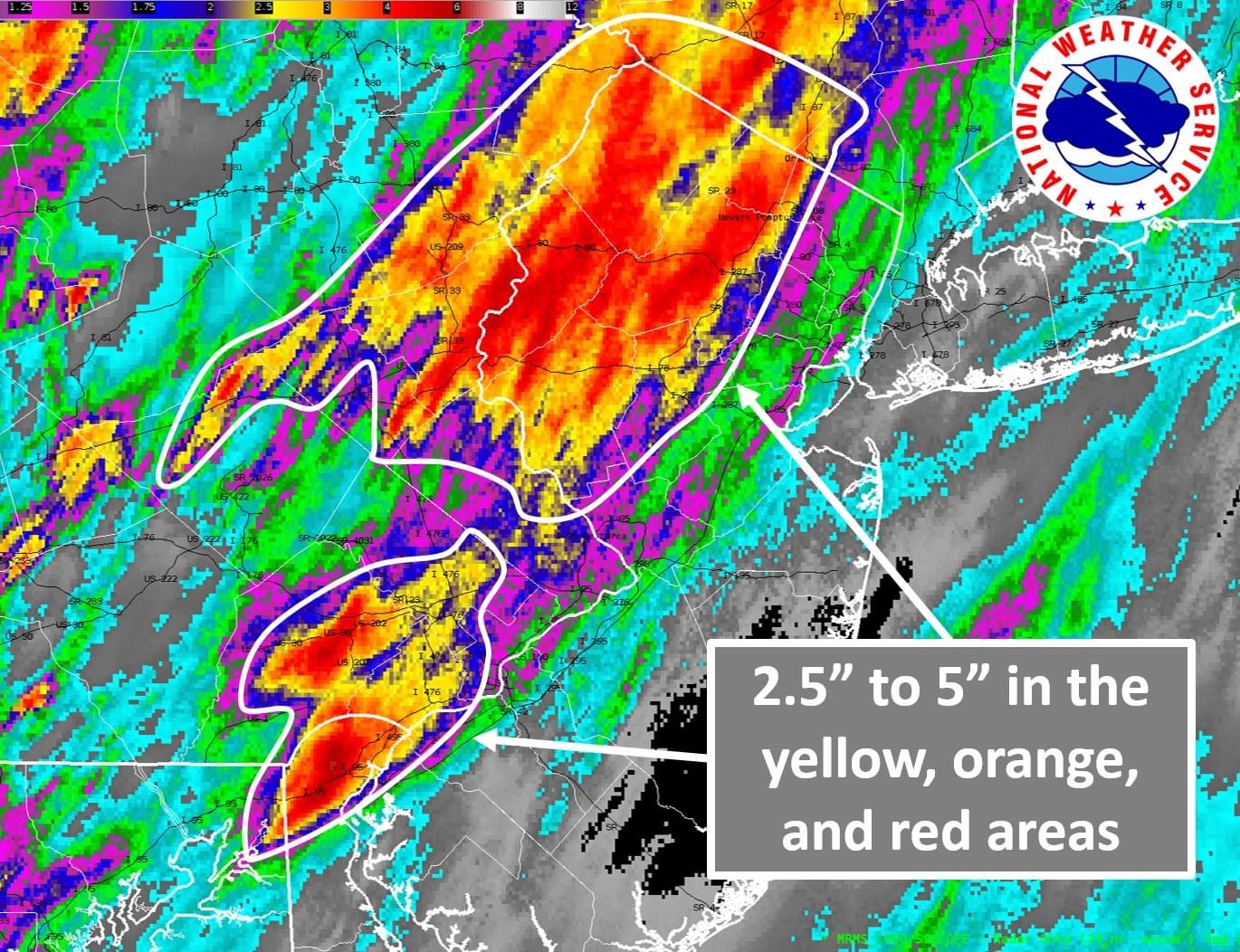
Mt. Holly radar estimates of rainfall totals in NJ and PA.

-
1
-
-
5 minutes ago, MANDA said:
Been watching the Easton and Allentown area and that area looks to be getting super soaked since late this morning. Still ongoing there now with a fresh wave of heavy rain.
It sure is.
-
12 minutes ago, MANDA said:
Pretty much same here. About 2” on the day. Same constant rumbling thunder. Heavy rain cones in waves. Based on radar looks to be taking a break for my area now. No real additional new development to my south now and skies brightening to the south.
Same here as well. Convection seems to be working up along preexisting boundaries left over from earlier storms. Have received over 2.5” here with large variations across the area in amounts due to the mesoscale processes taking place.
-
2
-
1
-
-
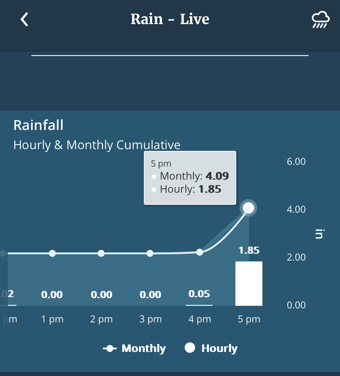
Still under those training echos. Have received almost one half of my monthly rain total in the 4:00 PM hour.
-
1
-
-
Under those training echoes in eastern PA. Up to 1.65”
-
1
-
-
7 minutes ago, weathermedic said:
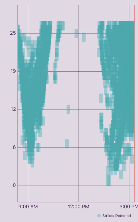
Craig Allen said 3700 lightning strikes from all the area storms within the last 30 minutes
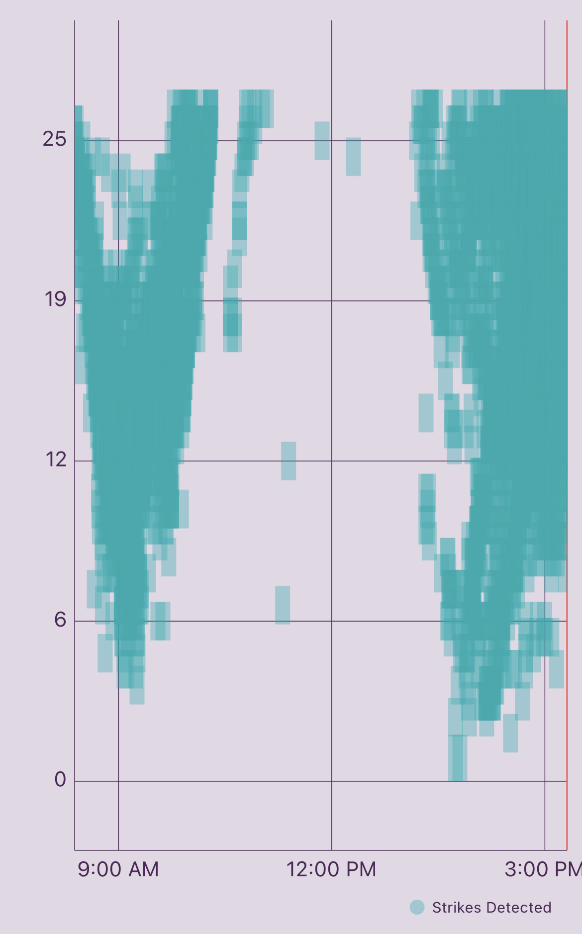
My Tempest has recorded over 5700 strikes in the past three hours here.
-
Things are really starting to pop at my location now with the storms generating overhead. Was just watching some weak rotation in the clouds above me.
-
For all this I have received 0.03” of rain… lol
-
My Tempest has recorded approximately 3600 lightning strikes in the past three hours so certainly no shortage of activity out here.
-
8 minutes ago, jm1220 said:
Definite rotation near Belvedere, NJ.
Mt. Holly just issued a TOR warning for that cell.
-
The frontal boundary near and along I78 is continuing to act as a focal point for convection this morning.
-
1
-
-
1 hour ago, winterwarlock said:
.07 yesterday...missed all the big stuff
.66 grand total on this week long summer train wreck
Its off the rails boys on the longest days of summer

Same here. Places 5 miles from me have had over 2.5” over the weekend. My total was .30”
-
5 hours ago, forkyfork said:
i have a good feeling about the west half of the metro today
Real interesting feature on the radar a little earlier showing a north to south oriented front moving from east to west across NJ towards eastern PA. This feature was firing up storms along the way as it intersected different outflow boundaries already in place. It looks to have washed out now.
-
5 hours ago, nj08822 said:
More rain in Nazareth PA to begin Sunday. We got slammed between 5 and 9pm last night. Just relentless rain and t-storms. Florida-type weather.
Hope y'all who need the rain get it
You guys did real well last night. Multiple reports of over 2.5” in that area. I am a little south of you and didn’t get much of anything.
-
Just about 1” here. It helps however we are still below normal.
-
Currently pouring here.
-
1
-
-
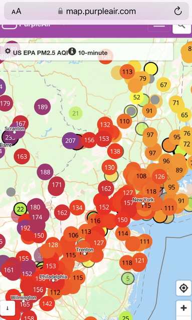
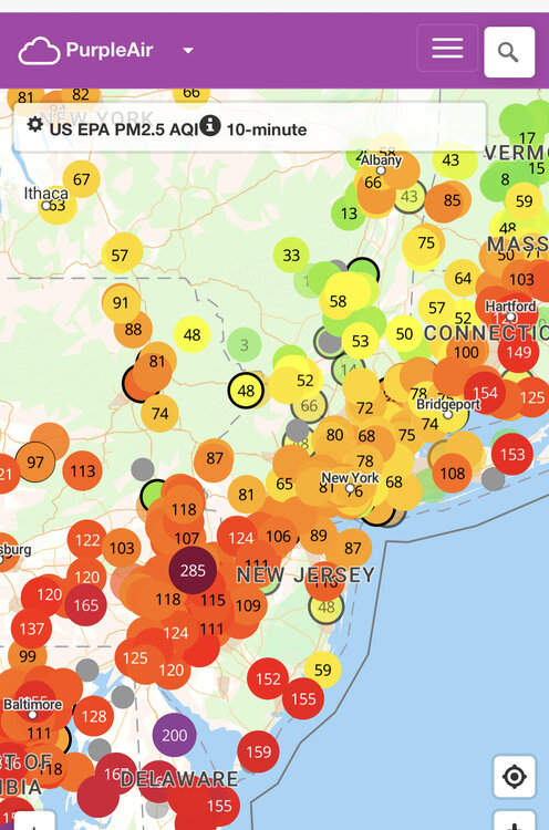
AQI’s look fairly good this morning across much of the area.
-
1
-


July 2023
in New York City Metro
Posted
I am under the front of it now. It’s rumbling and bumbling very slowly to the east.