HighTechEE
-
Posts
567 -
Joined
-
Last visited
Content Type
Profiles
Blogs
Forums
American Weather
Media Demo
Store
Gallery
Everything posted by HighTechEE
-
Welcome to the forum! You might be mistaking the range totals, ILN said 6-10 total accums.
-
Wow, Jan '96, Dec '04 and/or March 08'esk!!! and that's not including the next storm on Thursday!
-
LOL, I lived in Dallas from 1980-82, had an ice storm one winter where a solid 1" of ice happened and I was the only one to 'Make it to work" being an Ohio boy. It was 19 out and rained the whole day, driving back to my apartment that evening was so weird, I was the only one on the highway. SR75 to LBJ was fine, but on I-635 west caught me of guard, I wasn't traveling fast enough in my '78 Monte Carlo and was sliding towards the median in the banked curves! Had to speed up since I was the only one on the road!
-
Galveston has a Winter Storm Warning: https://forecast.weather.gov/MapClick.php?lon=-94.85194444656372&lat=29.293585232633333 Bet its been a while since they've had one of those.
-
Really, GFS 12z blasts the low for Thursday 300 miles NW from the 12z yesterday!
-
Last double digit snow IMBY was Jan 13 2019 when we got 10" in the south Dayton area in one of those elongated events just like the Monday/Tues one this past week.
-
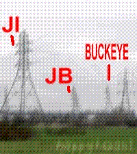
I always think of Buckeye with this GIF, LMAO!!
-
Last I heard, and this may have changed, but they used to not use steering currents in the 06z & 18z model runs to save money in the simulations.
-
Yes he will! and the big dog might be next Thursday, if the 850 OC cooperates!!!
-
That deserves a LOL!
-
I don't see 6-8 maps, do you see 6-8 maps? I don't see 6-8 maps...
-
-
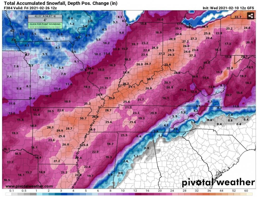
Not sure if anyone has posted this or not yet from the 12z GFS 16 day total snow, BUT I've never ever seen this much fantasy/eye candy snow modeled for SW Ohio before! This is in the HOLY SH*T category, 3ft for SW Ohio in the next 16days, hell if half that falls it would set records!!!
-
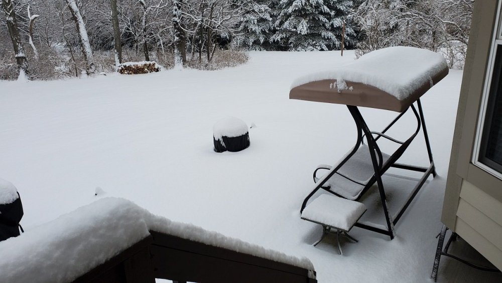
Ended with 5" on the dot IMBY, one report in Cincy 10.5" on the SE side! ILN was seriously Nowcasting last night...
-
2.5" and counting IMBY, 10 miles SW of me in Springboro an official 4.5" recorded and that was an hour ago, so they are over 5" by now. 10 miles to my NW is the back edge is near downtown Dayton. Going to be on that fine line all night looks like!
-
ILN has a WS Warning now in a skinny row of counties 5mi south of MBY, and I have the exact same snow totals of 4" or more in the forecast! Close to 1" of new snow here on the SE side of Dayton.
-
Visibility down to about 1/2 mile, everything white again (anything exposed to the sun melted the last snow over the past week or so), maybe 1/2" per hour rate. Its so rare in southern Ohio to get a snow system that every single flake sticks beginning to end (and we might get 3 or 4 in a row thru this time next week)!
-
First flakes are starting IMBY, ILN says 2-4" tonight, that might happen south of I-70.
-
Still amazing the GFS still has over a 1.5ft in southern Ohio thru next week over 2 1/2 days worth of runs up to 12z today!
-
Today's 12z GFS has 20 inches for KDAY the next 16 days, you can lock that in! Now more than 2ft on 06z GFS: https://www.pivotalweather.com/model.php?rh=2021020706&fh=378&dpdt=&mc=&r=us_ov&p=snku_acc&m=gfs
-
Last year 2019-20 I never touched my snow blower, but did some minor shoveling a couple times. This winter, haven't touched my shovel yet!
-
The mammoth artic blast Christmas December '83 is an excellent example, in SE Ohio in Athens Co we went below zero for 3 days down to -13F w/o a flake of snow, then 2 days later the very next spec of precip was..... ....wait for it, ....rain!
-
An area of stead light snow has formed tonight in the western & central parts of Ohio over the past couple hours, I've picked up about 1/3" since it started, my truck and the streets are covered up already. Looks like it may last the night stretching all the way to Lake Erie, ILN calling for up to 1" new snow, if this keeps up for like 8hrs they may have to adjust that.
-
After about 18 or 19 hrs its FINALLY switched back to snow IMBY, but very light.
-
Had 2" on when I went to bed, been raining fairly hard since, maybe a half inch of crap left on the ground full of bullet holes. Radar shows the northern half of Montgomery & Greene counties back to snow, but its not according to my buddies, still rain. chuckster you talking about the back side of the Friday system, looks like a wave forms and rides the cold wave into Sat, mood flakes for the weekend