HighTechEE
-
Posts
567 -
Joined
-
Last visited
Content Type
Profiles
Blogs
Forums
American Weather
Media Demo
Store
Gallery
Everything posted by HighTechEE
-
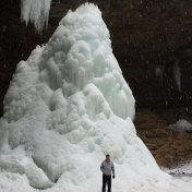
The 57th Hocking Hills Annual Winter Hike is in two weeks at the Old Man Cave State Park and no ice formations or snow so far. With the models showing near normal temps over the next two weeks, no hope for the real winter like scenes. The last real winter we've had here in Ohio was Jan. of 2014 and my avatar pic was at Ash Cave that year, it almost froze all the way to the top (85ft) and that only has happend once since I've been around and it happened in Jan/Feb of '78.
-
5.10" total so far IMBY for this system, this has only happened once in the 23 yrs I've been in this house (first time about 20yrs ago my 5 inch plastic rain gauge overflowed lol, didn't know the total back then): https://www.wunderground.com/dashboard/pws/KOHBELLB15
-
Actually it was Springvalley, 5 miles east of me!
-
I've got a horrible feeling about this set up for SW Ohio tonight, too eerily similar to the Memorial Day storms 2yrs ago. Extreme heat mid 90s in S. Indiana, 100 in St Louis to feed this system all night. I remember people back then talking about CCAPS (sp), anyone that knows what those are can comment on tonight's situation?
-
The same IMBY on the SE side of Dayton, about 4"!
-
4" IMBY as well, and a group of us is going camping today thru Sunday down in Highland Co
-
Heavy wet snow mixed with sleet just started on the SE side of Dayton. Update: and is sticking to elevated surfaces now at 32.4 degrees.
-
Was glancing thru ILN's wind reports from yesterdays wind storm and found an anomaly in my town: :3/25/2021,1155 PM, OH, Greene, 1 ESE Bowersville, , , 39.5706, -83.7047, PKGUST, 16, mph, OHDOT, Peak Wind Gust, :3/26/2021,1253 AM, OH, Greene, Fairborn, , , 39.8081, -83.9579, PKGUST, 32, mph, CWOP, Peak Wind Gust, :3/26/2021,0450 AM, OH, Greene, Beavercreek, , , 39.753, -84.074, PKGUST, 39, mph, CWOP, Peak Wind Gust, :3/26/2021,0430 AM, OH, Greene, Xenia, , , 39.7217, -83.9962, PKGUST, 41, mph, CWOP, Peak Wind Gust, :3/26/2021,0354 AM, OH, Greene, Spring Valley, , , 39.6002, -83.9733, PKGUST, 42, mph, CWOP, Peak Wind Gust, :3/26/2021,0340 AM, OH, Greene, Wright-Patterson AFB, , , 39.8167, -84.0333, PKGUST, 59, mph, AWOS, Peak Wind Gust, :3/26/2021,0335 AM, OH, Greene, Xenia Greene County Apt, , , 39.7, -83.9833, PKGUST, 60, mph, AWOS, Peak Wind Gust, :3/26/2021,0518 AM, OH, Greene, Bellbrook, , , 39.636, -84.0708, PKGUST, 112, mph, CWOP, Peak Wind Gust, pretty sure there was no 112MPH wind gusts anywhere near here!
-
Going to be a while before the Rocky River thaws and we can get back to Steelhead fishing!
-
Hit 64 IMBY today (forecast was 53) before the rain, only took 2.5 days to melt all the natural snow in the yards.
-
I'd say Jan 2014 would be the last time we had consecutive weeks with decent snow cover, that year it was for the whole month, not just 2 - 2 1/2 weeks.
-
The biggest problem with yesterday's storm is the jet stream wasn't right for us, draw a line from New Orleans to Cleveland it didn't matter what the ground temps were, if you were on or east of that line, that's where the WTOD road that line. When you see Gulf Coast states, like S Texas, Louisiana, and Mississippi get hammered with heavy snow and temps in the low teens to single digits, that's what burns our a$$eS!
-
I live about 1 mile from ilusnow and we had sleet to start, went over to fairly heavy snow but only lasted like 20mins, then 6 hrs of fairly heavy sleet, then about 9 last night went over to snow then it became heavy for a couple hours. So over 1" of sleet/crap, then 3-4" of fluff on top over that. Thurs system is a whiff to the south for a foot for the Ohio river folks, then NW trend this time will be directly over the I-71 crowd!
-
Picked up 1 new inch in the past 40 mins, definitely more than 1"/hr rates right now IMBY.
-
Just switched back to at least moderate snow here on the SE side of Dayton, lost almost 8 hrs of snow with this system.
-
The 8pm obs all Cincy stations is finally back to snow, but most of the Dayton area still sleet.
-
Over half the QPF has been pissed away already for this storm at 17.4 degrees, better switch over to snow pretty quick if I'm ever going to get 1" of new snow IMBY.
-
Come frick'n on, back to all sleet w/FR now IMBY!
-
Finally have gone over the moderate snow here on the SE side of Dayton, whitened up everything very quickly, so there is hope. OHweather is right!
-
Yep, this storm is officially ruined, sleeting very hard IMBY, losing significant snow accumulation.
-
The very first flakes for the 2nd session has begun here on the SE side of Dayton, I was worried that I might hear thunder virga, this mornings 1st wave IMBY was a bust only about 1/3".
-
Snow almost to Cincy now, 21.4 degrees IMBY. This isn't good: WESTERN AND SOUTH CENTRAL KENTUCKY CITY SKY/WX TMP DP RH WIND PRES REMARKS PADUCAH HVY SNOW 10 6 84 N12 30.10F VSB 1/4 WCI -5 HOPKINSVILLE HVYSLEET 16 15 98 NW3 30.02F VSB 5/8
-
Wow, 12z NAM & GFS shows if you're not NW of I-71 you're in big trouble
-
I like Ch12's out of Cincy: https://local12.com/weather/radar
-
I started on Rich Apuzzo's SkyeyeWeather forum early 2000s, then the EasternWX in which I think I was a member there longer there than the AmericanWX has been in existence (yea I'm old as my favorite weatherman was Joel Holbrook Ch10 WBNS back in the power winters of the late 70s)!