

CoastalWx
-
Posts
176,996 -
Joined
-
Last visited
Content Type
Profiles
Blogs
Forums
American Weather
Media Demo
Store
Gallery
Everything posted by CoastalWx
-
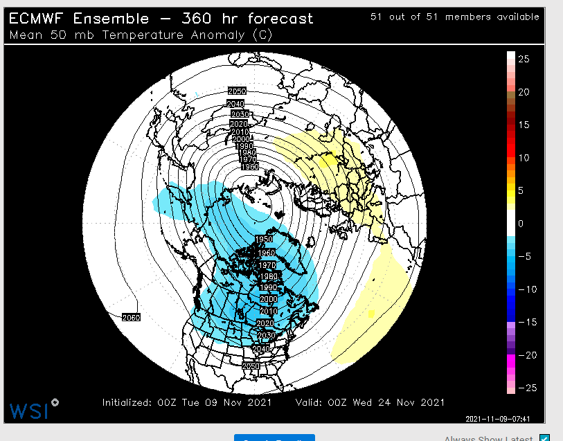
I typically look a 50mb since it's closer to the troposphere. I don't care too much if there will be a warming by the international space station.
-
No signs of warmings yet and it did take a few punches, but at least this isn't a concentric circle near Santa's fanny. That elongation to the south at least helps a bit.
-
Well I don't have mine on for a few reasons. Until I can get the anny on the roof and figure out my rain gauge we keep as is.
-
Ha, interesting.
-
I feel like I need to walk on egg shells when saying this stuff. Not directed at you.....just saying I am not cancelling anything. I'm not sure what to think right now given the look. I agree the AO/NAO right now is certainly not a black hole like 11-12 looked at this time. So that is good.
-
I mean it's the same person who thinks they live at KBDL in the summer and KORH in the winter, so it's not a surprised they seem geographically challenged.
-
55 here in Torchmouth.
-
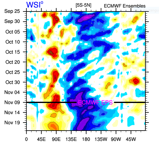
Also forcing looks strong on maritime continent. I think that will pull back the ridging to a more dateline look into December. Just my guess. Hopefully the AO/NAO aren't raging +. I know the sub surface is warming, but still strong easterlies at 850..moving a bit towards the west again. Not sure what to think.
-
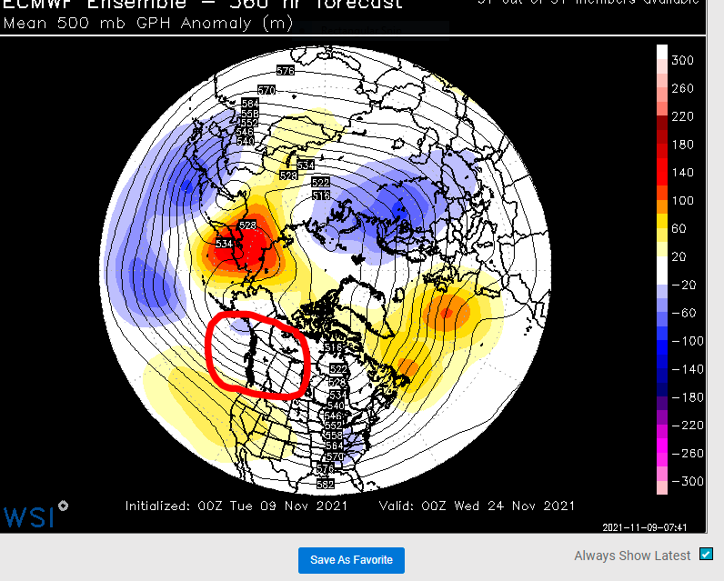
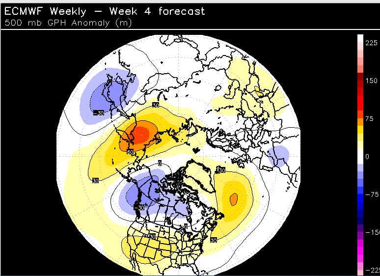
The end of the EPS try to show something. I could see lower heights progress from this image shown, to the weeklies. I'm not cancelling winter....just stating that concerns me a bit.
-
Just stating what they show.
-
The hours are brutal and it becomes a safety risk. I know accidents that have happened from plow drivers falling asleep. But dang that money though.
-
Wish I had a truck lol.
-
Wequassett resort in Harwich is real nice and probably half the price.
-
Chatham Bars Inn? Lol.
-
That’s kind of early for the Cape. It still can be chilly. Good news is that it is off season so you can stay at some spots that are typically ridiculous in the summer. Maybe DM me. I’ll give you ideas depending on budget.
-
That's some good cold in Canada so there is money in the bank anyways.
-
Just to elaborate: Positives: Maybe some higher heights in Greenland and perhaps some ridging out west and in the southwest. Negatives: Lower heights in a bad spot. I'd say a big negative. Caveats are week 4 etc...but given the end of the EPS where maybe things relax a bit...I'm not sure about a great look. JMHO.
-
Was 39 here. Semi fake.
-
It could be fine, but not a fan of lower heights as shown. Maybe the ridging out west helps, but I wouldn't expect that to build in a Nina.
-
I’m not so sure to start December. I wouldn’t say great.
-
6z laughs. People need to be patient I think. Maybe keep an eye around the 16th, especially NNE.....but still uncertainties heading through late month.
-
Yeah those lower heights near AK aren’t great, but ridging out west prevents a massive puke fest. Eh who knows this far out.
-
MVY coldest in SNE?
-
Huh?
-
That’s interesting. From an anomaly standpoint, the weeklies I can see looked ugly week 4-5.

