mob1
-
Posts
2,788 -
Joined
-
Last visited
About mob1

-
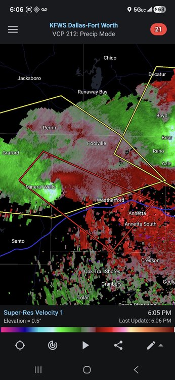
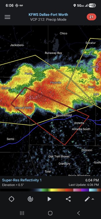
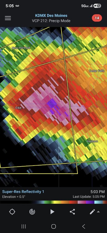
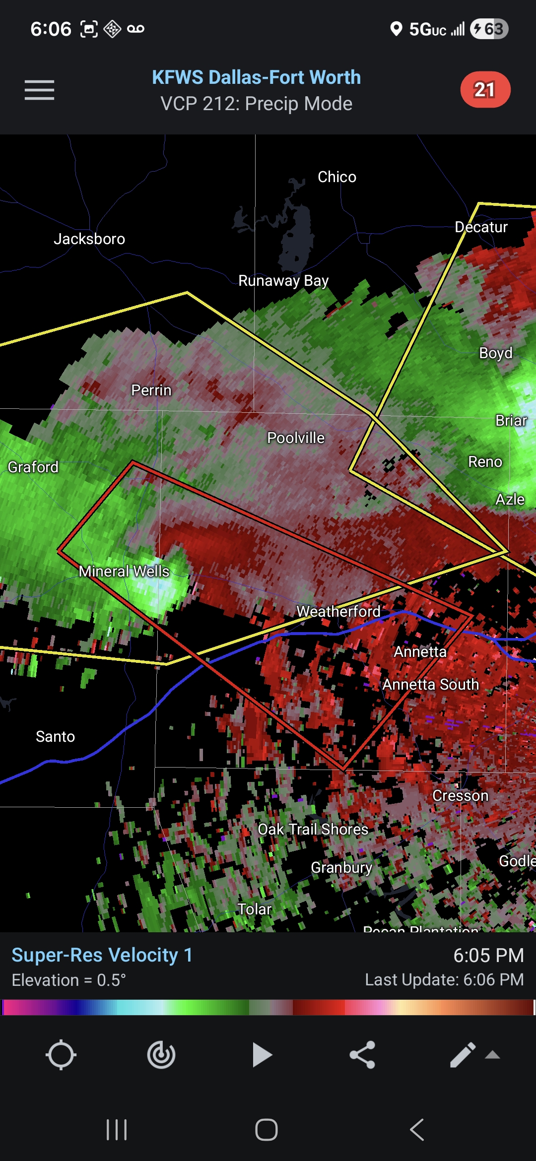
Decent couplet on the cell near Mineral Wells TX. Solid radar presentation as well.
-
Really underwhelming so far, we'll see if this'll turn into a nocturnal event.
-
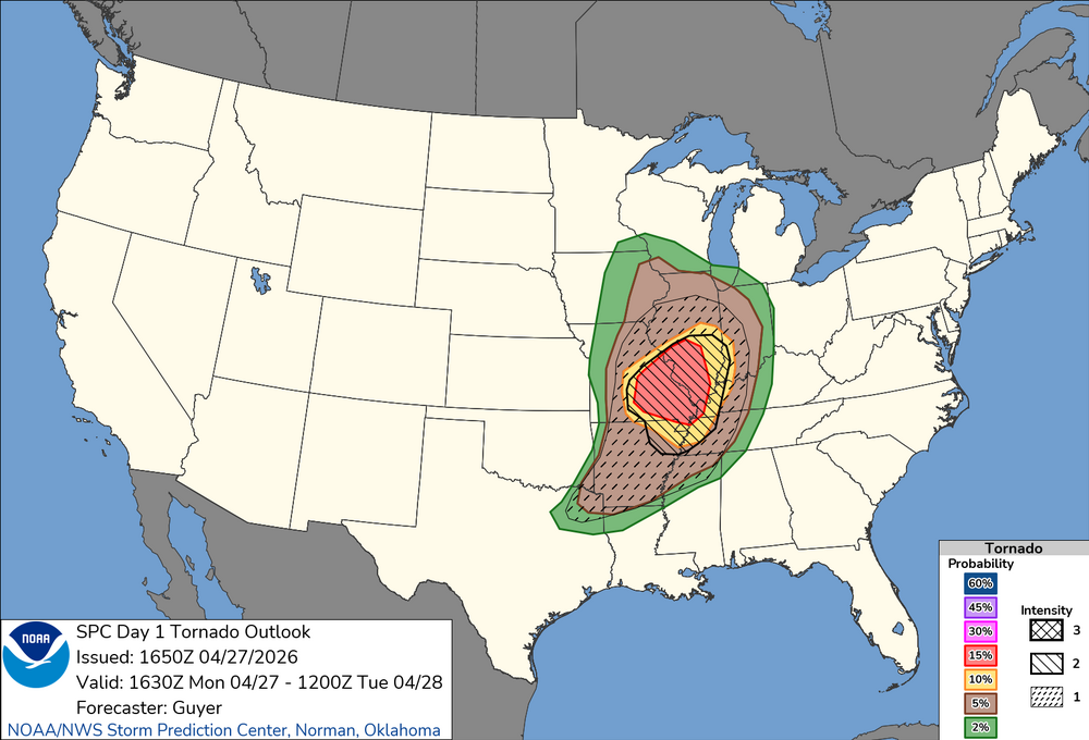
Based on current observations, the northern extent of true surfaced-based severe weather should extend roughly on a line from St Louis east/northeast ward. HRRR has the southern portion lit up with discrete cells before going linear.
.thumb.png.f5bf89887c3221f58715db5d63310b34.png)
-
New outlook nudged things a bit south
-
I wonder if the threat moves even further south based on where the current precipitation and outflow boundary is.
-
https://x.com/NickKrasz_Wx/status/2047770770005529075?s=20
-
Thanks for opening a thread for this, some of the soundings for Monday look pretty wild. Obviously every severe weather threat has many failure modes, but the potential is definitely there for a high-end event.
-
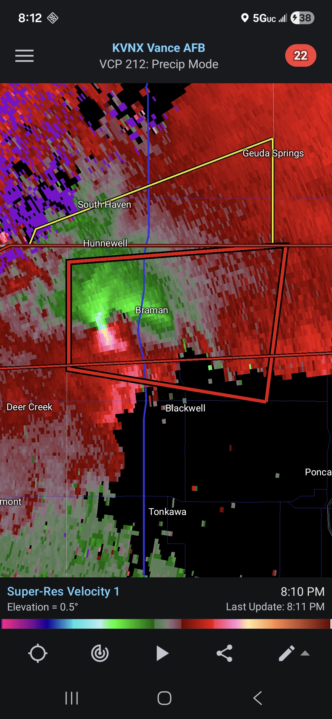
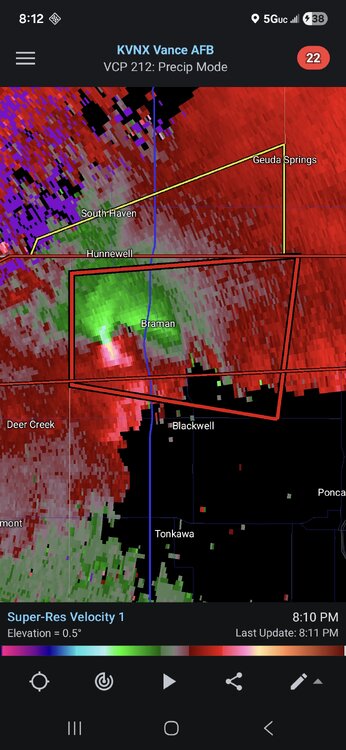
Since there's no active severe thread in the other subforum I'll just it here. PDS warned storm approaching Braman OK.
-
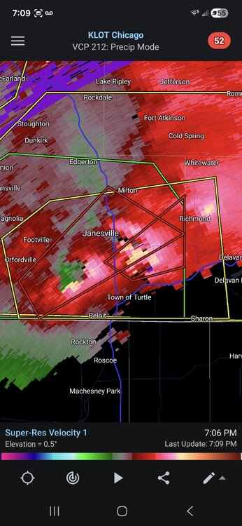
Confirmed tornado just south of Janesville. Possibly twin tornadoes.
-
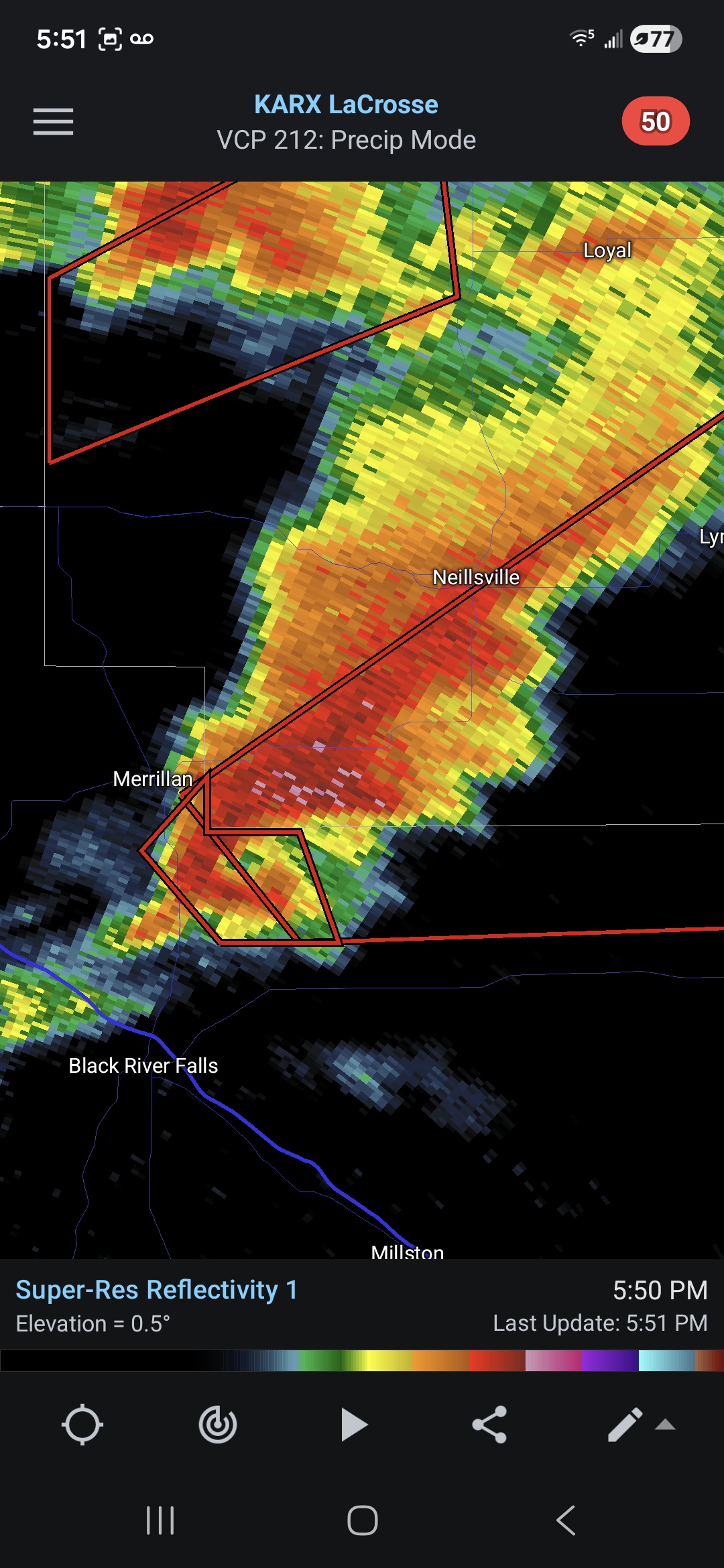
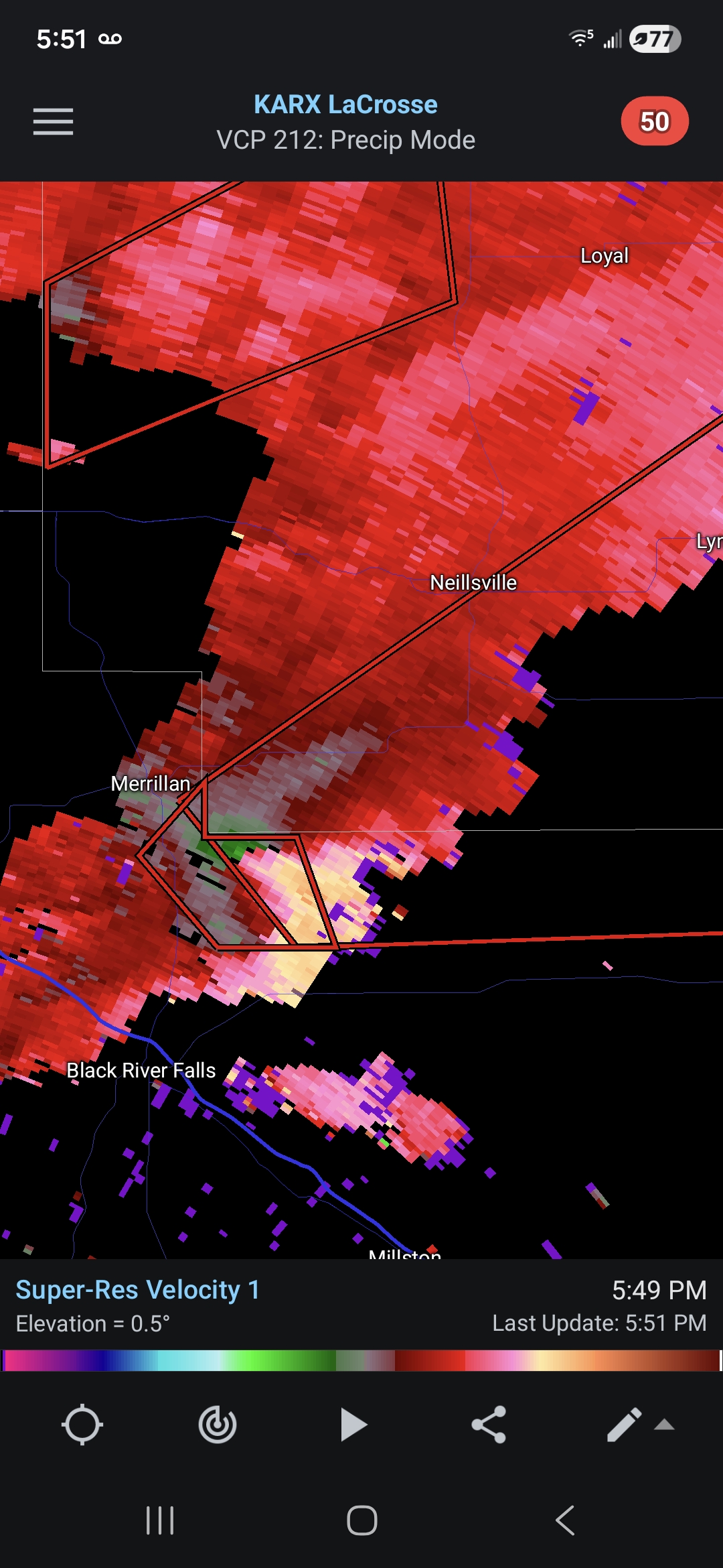
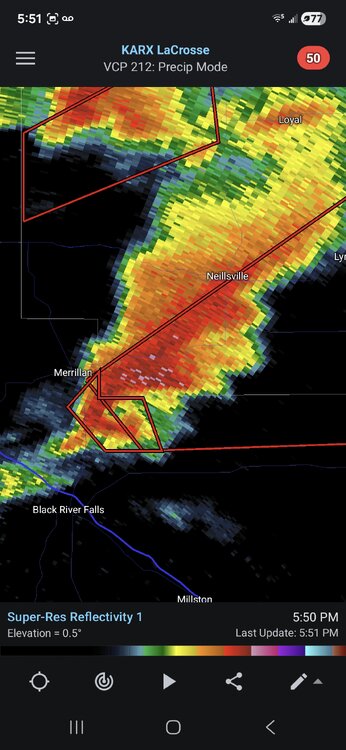
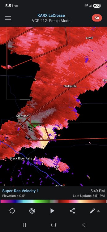
That cell just north of Black River Falls is likely about to drop something (if it hasn't already).
-
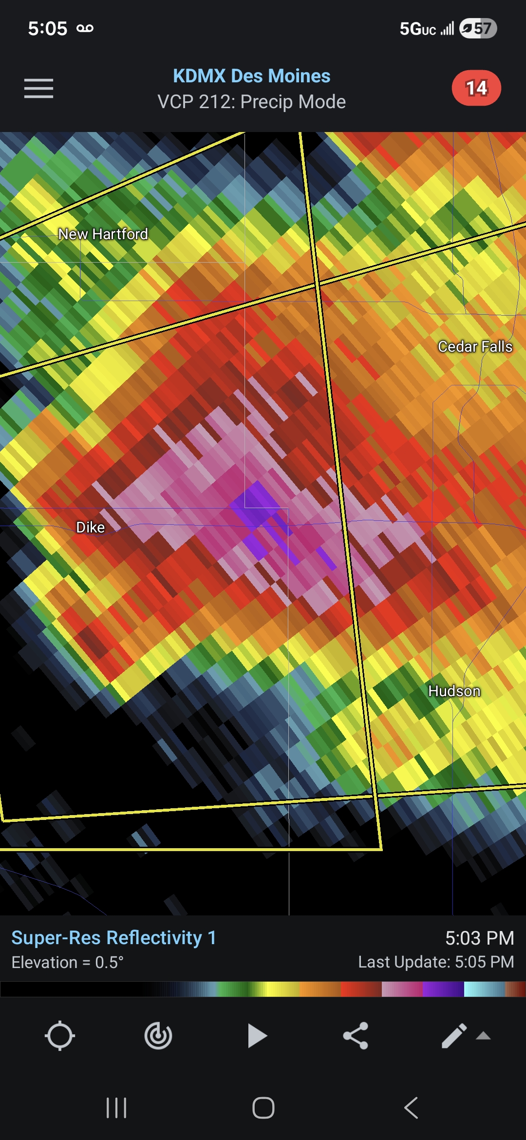
That's a pretty impressive hail core on this cell.
-
At this point pretty much everyone expect for the most dedicated snow weenies are fine with it.
-
2/24 - 2/25 Clipper Obs (1 - 2" for many on forum)
mob1 replied to Northof78's topic in New York City Metro
They still had great radar returns at 7 but we all know they'll only record what they got up to that point. -
The JFK one should be incomplete as well as they got more after 2 (the last band rotted over them for a a bit).
-
Thanks! Wonder if Boston can make it to 20, Logan was at 17 or so at 7 pm and they have a nice band over them (mostly east of the city proper now but I believe that's where the airport is).


.png.2120f695ed20f2c4174c4eb6d5de5ca7.png)