weathernut85
-
Posts
85 -
Joined
-
Last visited
Content Type
Profiles
Blogs
Forums
American Weather
Media Demo
Store
Gallery
Everything posted by weathernut85
-
Feb 24-25th Event -- Generators for some, pre-emerg for others
weathernut85 replied to JTA66's topic in Philadelphia Region
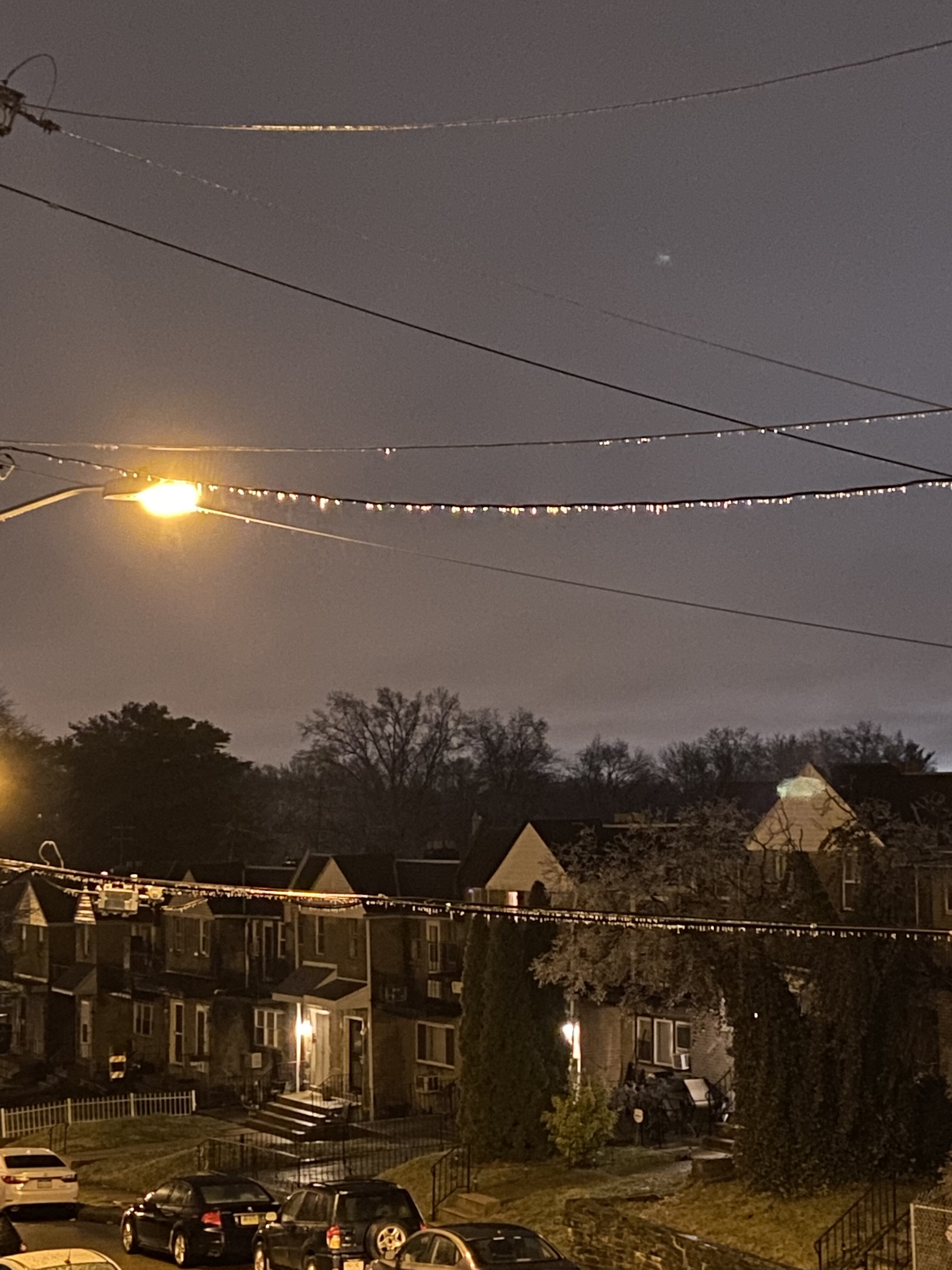
Just waking up to the bathroom at 4 am and along City ave in Overbrook Park powerlines and fences are still iced over for now (my patio is also elevated though, but I’m surprised to be hovering at freezing still
-
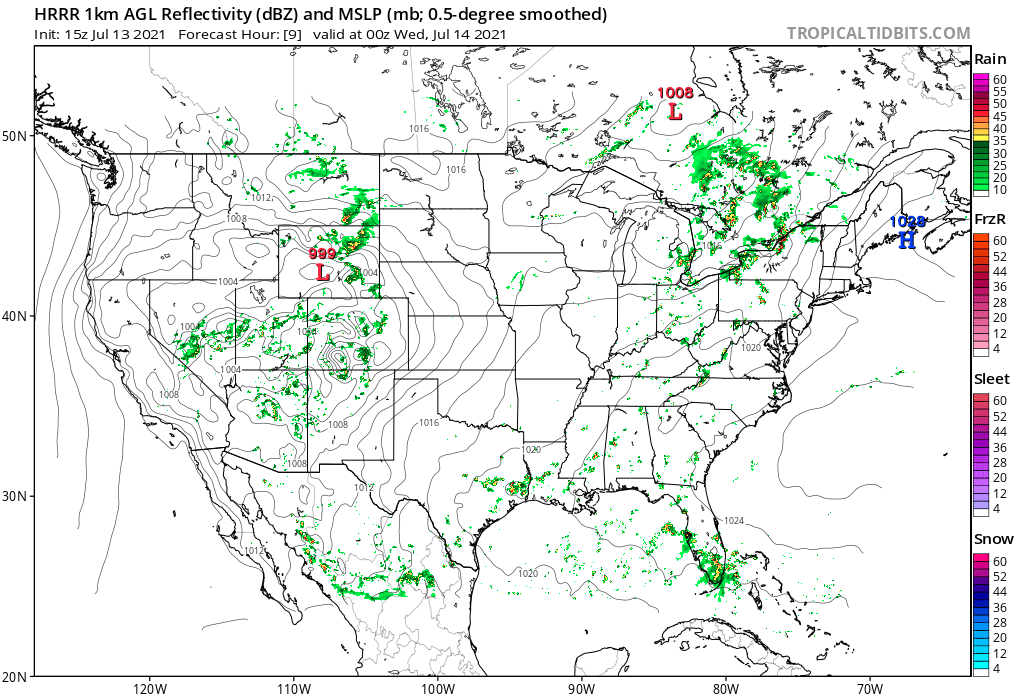
Finally getting the tiniest of flurries here on City Ave. Good sign I suppose that the column is moist enough for precip…radar echoes are creeping northward into Philly and Delco ever so… the HRRR still has SE PA in a small snowband through early afternoon so I’m crossing my weenie fingers lol
-
Wait is this forreal? The other footage was incredible but, (to quote Twister), “mother of God…”
-
Getting deluged here on City Ave…some of the heaviest rain I’ve seen all summer. My lights are flickering!
-
Was coming here to post the same. Prob 40-50 mph gusts here with that outflow boundary. I probably won’t see any thunderstorms now bc of it though lol
-
Wow that was probably some of the closest lightning strikes/ loudest thunder I’ve experienced in a long time. About a dozen or so extremely close CG bolts, all less than a half mile away or so. I live next to Morris Park so there’s a lot of trees/ open ground to catch lightning. Cars up and down the street had their alarms set off several times. Great show! Had me taking cover afar back from the windows haha!
-
Pouring rain with lots of lightning and thunder. my rain buckets are filling up! Thank ye rain gods
-
feeling like I’m at a casino playing roulette hoping for a good drenching today! I hear thunder from that popcorn storm in Delco near Drexel Hill… Do I feel lucky?
-
I’m gonna try to ignore that pop up storm by West Chester that fizzled out on its way to me here at the 3-way juncture of Philly, Delco, and Montco
-
So I’m not the only houseplant parent that spoils the kiddies! If only they knew how much angst I put myself through when we go stretches without heavy rain! Lol
-
Ok so here we go again…HRRR says there should be a thunderstorm sitting atop my head here on City Ave around 8 tonight. Don’t want flash floods but my rain cistern is almost empty! (I hate using tap water for my houseplants lol) I just need a good 10-15 min downpour!
-
Dissipated again! Just a quick spritz and distant thunder here to mock me lol. Never thought I’d turn into a summertime weenie lol
-
I guess I should be relieved to not have flash floods, but here in Overbrook Park we got maybe 5 raindrops total, same as it’s been all weekend as every thunderstorm complex has dissipated somewhere in central Delco or the mainline on its way here. my garden needed some of these storms today ugh
-
SN big fat lazy flakes on City Ave, these multiple-day, multiple waves of low pressure systems this winter have definitely come through in the clutch.
-
Yup another city proper lurker here, though I’m off city ave about 2 min from Wynnewood/Ardmore. still getting a SN/IP mix, + at times...though I’m envious of those with a fully cold column and pure snow ☃️
-
I think all of this can be true. There’s so much residual salt on walkways and roads. I’m in Overbrook Park on a 2nd floor duplex and my metal patio is completely iced over, as are the metal cars below, but the gravel cement asphalt surfaces aren’t as icy *yet* cus they can absorb some liquid first- even if it’s sub freezing air temp. Metal surfaces and elevated surfaces, even just by one story level, accrete ice so much quicker. but your rule of thumb is always air temp- if your at 27 and ANYTHING is falling from the sky, assume it’s either super frozen or will freeze on surfaces *eventually* - it’s literally impossible for H2O to remain liquid at 27 degrees if it isn’t already a solution of saline or some other chemical...
-
And this was when they made the fatal mistake lol
-
Mt. Holly’s WWA went into effect at 1 pm EST fwiw
-
cant believe we might pick up another coating or so today, this little enhanced area of snow showers over the Philly metro is really something now that we’re 72 hours after the first WAA
-
Same here in West Philly, snowing again sufficiently enough to re-coat the cars and sidewalks.
-
SN/ maybe SN+ on the Main Line/City Ave -- the band over Philly and sort of paralleling the Schuylkill is really starting to blossom, seeing some 30-35 dBZ returns on the NWS radar.
-
The jury is still out for me on the new NWS radar, but I do have to say the super hi resolution is...useful...on a day like today, or whatever...lol the banded look to the returns in NE MD coming into Chesco / Delco are starting to proliferate it’s nice to see this happening at noon already
-
light snow and blowing snow again, I'm quite pleased that the backend changeover really came through at the end here...not a bad storm to inaugurate the season!
-
Ripping sleet here, my skylights are ping ping pinging. I suppose it's nice to see the column getting colder again to support IP > ZR in WNW Philly.
-
Perhaps someone else can better describe this, but I think a main problem was some of the models were keeping the low fragmented at 700 mb and 500 mb and not quite closed off at all levels of the atmosphere, so that it was more just an 850 mb low level circulation with a progressive ripple trough higher up that would gently slide east off the coast. But the low closed off --I don't think it's fully stacked ? (someone better can say for sure)...but the trough tilted more negative, and this sort of yanked back on the surface low to hug into the coast close, taking the track over the Chesapeake and Delaware Bays we see tonight. Again, someone probably knows a better website (?) but you can see the different upper air maps here from Norman, OK -- all of them have a low plotted generally over the Delmarva (though I don't think the low is quite that far NW attm fwiw).