DomNH
-
Posts
7,811 -
Joined
-
Last visited
Content Type
Profiles
Blogs
Forums
American Weather
Media Demo
Store
Gallery
Everything posted by DomNH
-

Fall Banter, Observation and General Discussion 2018
DomNH replied to CapturedNature's topic in New England
-SN has begun. -
Yeah, GFS looks like a borderline warning event N of the Pike.
-
Could be kind of high impact if it sticks to pavement. Either way the ugly oak leaf infested pack persists.
-
18z NAM a hair less amped. Looks like a decent wet snow thump Rt. 2 north.
-
What a fooking mess this stuff ended up being. Flipping back to snow now...hopefully just mood snow and no more accumulating slop.
-
A very compacted 5.5'' on the ground this morning so I'm sure we were at like 6-7'' at some point. Pretty cool for 11/15-16 though the landscape is kind of ugly with all the leaves on top of the snow. Raining now.
-
This is a highly anomalously cold early season snow but October 2011 is a completely different beast. We may never see that again. My favorite weather event of all time.
-
Pounding dendrites...just under 2’’. Not staying up to see it through but would be surprised if we don’t reach warning criteria...very impressive for 11/15.
-
Coming down very nicely here. Hard to believe it's 11/15.
-
Flakes in ASH.
-
Pretty classic SWFE WAA omega bomb radar presentation.
-
I like 5-6'' here. Guessing we dry out and snizzle instead of a real scalping.
-
Looks a bit snizzly to me. Definitely dry.
-
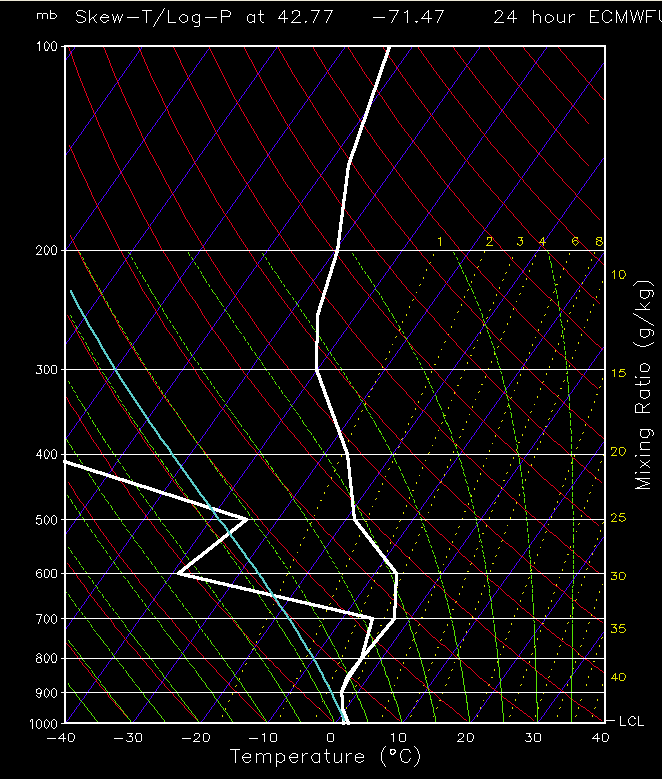
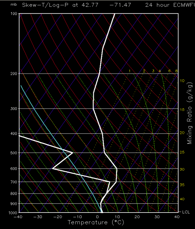
My meteorology is rusty as hell. This is 06z. Looks kind of ugly but I figured it'd be snow.
-
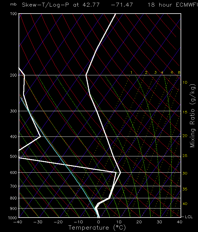
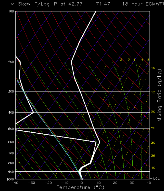
FWIW I'm looking at the 12z Euro soundings for ASH and I don't see any sleet at 06z. Maybe the in between hours between 06z and 12z but it's snow through 06z verbatim.
-
I'd take the under on that.
-
I can't imagine that roads will be good by 5:15 tomorrow morning with sleet following the thump. It's not like we're going to transition to 40F and rain.
-
I think this is fair. I haven't seen a model sounding that sleets srn NH until some time after 06z. If we can hold on to snow for the majority of the initial thump I can see widespread 4-6'' amounts Rt. 2 north. My biggest fear would be an earlier mix obviously along with mediocre snowgrowth producing like 2-3'' of sand and then pings.
-
GYX hoisted watches for most of their CWA...5-8''. Probably a tick higher than I'd go but it's hard to ignore how thumpy the Euro is.
-
When is the last time we had a November widespread advisory/warning event in the interior...Thanksgiving 2014? I haven't looked at modeling until just now but I like a solid 3-6'' before mess up this way.
-
Fall Banter, Observation and General Discussion 2018
DomNH replied to CapturedNature's topic in New England
Very meh here. Always take the under on MV winds. -
Fall Banter, Observation and General Discussion 2018
DomNH replied to CapturedNature's topic in New England
Nothing exciting here so far. Maybe some gusts to 30-35. -
Fall Banter, Observation and General Discussion 2018
DomNH replied to CapturedNature's topic in New England
Absolutely ripping raindrops. -
Summer Banter, Observation and General Discussion 2018
DomNH replied to CapturedNature's topic in New England
Just cracked a Green. Wow. Now I buy the hype. -
Summer Banter, Observation and General Discussion 2018
DomNH replied to CapturedNature's topic in New England
Tree House is very good but not life changing. So far I've had Julius, Bright, and Hurricane with Hurricane being my favorite of the three. Best NE IPA I've ever had was from Other Half in Brooklyn and these don't top it.