

Voyager
-
Posts
11,065 -
Joined
Content Type
Profiles
Blogs
Forums
American Weather
Media Demo
Store
Gallery
Posts posted by Voyager
-
-
Second warned storm of the night for Tamaqua. Missed the first one as I was on the road in the bus down by Duncannon, but home now. Wife told me a house nearby was struck by lightning in the first storm. She said the storm was pretty bad.
-
1 hour ago, Jns2183 said:
Next week looks to be quite insane in the nation. Georgia bakes like Phoenix and it snows and snows out west.
. ProAnd Monday's forecast high for Phoenix is only in the upper 70's which is nearly unheard of in May...
-
So where is this dry spell I thought we were getting? Looks like showers nearly every day in the forecast now through the weekend...
-
2 hours ago, Jns2183 said:
I see nothing but 70’s & 80’s for everyday in the extended forecast. Here’s to summer beginning until we eventually get that 4 day period in June with a cut-off low and east wind.
. ProThat usually happens on the 4th of July weekend...
-
Caught in a subsidence zone most of the day. Heavy rain along the Susquehanna and heavy rain along the Lehigh and Delaware. Here, not so much. Only 0.55" in the gauge today...
-
27 minutes ago, Superstorm said:
I think we warm up next week, but looks to get cool again after memorial weekend.
.I'm beginning to think this is the summer that we don't dare put away our winter clothes...
-
41 minutes ago, Itstrainingtime said:
2 torrential downpours today netted .65" in the gauge. On to Sunday...
I got 0.07" from some light rain early this morning, then nothing after that. From about 1:00pm on it was a rather nice day here.
-
1 hour ago, Itstrainingtime said:
It really truly doesn't look like we'll get much rain until later Thursday or probably Friday, so there's that...
")
I hope you're right. Personally I'd like to see a couple nice days in a row for a change.
-
Point and click forecast calls for showers every day through next Monday now. Thiis is beyond old.
-
My point and click forecast shows a chance of showers every day right through Sunday. Is this wet pattern EVER going to end???
-
This weather is disgusting...that is all.

-
Sitting under the Ben Franklin Bridge on the Camden side enjoying thunderstorm round two this morning. This one's bringing heavier rain with it.
-
 1
1
-
-
11 minutes ago, Itstrainingtime said:
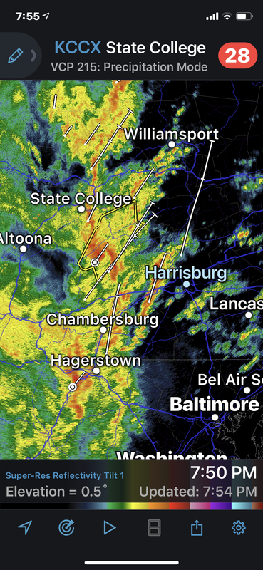
Thing is...there was an isolated cell that popped pretty much right over me yesterday around 1pm. I was on the board before just about everyone else in here. That was the heaviest ran I saw from the event. After 2:00pm I picked up about a quarter inch. Everything of significance ran up just west of the river.
And yet CTP's graphical qpf map had the heaviest rain east of the Susquehanna...lol
-
Looks like the guidance I mentioned last night (for my area anyway) appears to be correct. Sitting at 0.70" currently. I doubt I even make it to one inch. A far cry from the 2-3 that the NWS was forecasting.
-
1 hour ago, canderson said:
Storms might actually mostly miss HBG unless it backbuilds to the direct south. Everything is west and they are moving almost due north.
I was just about to post the same exact thing you did. Most of that line to the west misses to the west of the Susquehanna as well as my area per the HRRR. Not sure what to make of the less organized cluster to the south. Will that make it into the areas missed by the line and will there be any lightning with it?
-
8 minutes ago, Itstrainingtime said:
Hey at least in Jersey someone else pumps your gas for you.

And it used to be cheaper than here...
-
14 minutes ago, Jns2183 said:
Did any guidance have your 3”+ Sunday?
A few people here are going to get caught under embedded convection and watch a pond grow where grass once stood. Everyone else will have to settle for a mud fest.
Whatever larger cycle we are in, it’s one that loves raining more than guidance.
. ProYou do have a point. I certainly didn't expect that 3 inches. That was Saturday morning. We got two more on Sunday night. The Schuylkill River here is still running high.
I was just surprised at the lower qpf on the GFS, and especially the NAM, which usually has a wet bias.
-
Looks like most of the 18z guidance shows less than 2 inches of rain for most.
-
6 hours ago, Atomixwx said:
Not a met or a climatologist, but this seems to me that it would lead to a cooler, wetter environment for places most affected by the hole. Probably us.
That's not what I wanted to hear, but I suppose it could be a possibility.
5 hours ago, canderson said:I read it as being much more unpredictable and seasonal changes are different than historical. Which we have seen here with winter being pushed back and back it seems.
This was my initial thought. The last few years seem to feature a much warmer October and a much cooler April.
-
8 hours ago, anotherman said:
So does it mean colder or warmer overall for our region?
-
Not much seemed to happen in Lancaster, but...I was inside the Dutch Apple Dinner Theater, so I wouldn't have heard much over the music anyway.
-
1 hour ago, Flatheadsickness said:
The spc expanded the enhanced again to cover the whole state . western pa is probably under the gun the most because of timing. Us and a chunk of OH will be the states to see the worst of it today. Storms will begin rotating in the OH valley in the next hour as the new line develops .
It looks to me like it might be a night of interrupted sleep. If I'm seeing the models right, on my small phone screen, the second line (cold front) looks to roll through around or after midnight. Am I right?
-
Doing an overnighter in Lancaster today into tomorrow. Better chances down that way, or up here in Tamaqua?
-
@canderson, please let us know (when you can) that you are ok and safe...
Central PA Spring/Summer 2019
in Upstate New York/Pennsylvania
Posted
Ugh...wish I didn't have to go to NYC tomorrow. I'd have liked to have been closer to home, like the Sands Casino in Bethlehem...