Sey-Mour Snow
-
Posts
6,904 -
Joined
-
Last visited
Content Type
Profiles
Blogs
Forums
American Weather
Media Demo
Store
Gallery
Everything posted by Sey-Mour Snow
-
 Eps with a solid push east need another one. Still day 7-8 though.
-
Ya I know nice rain storm on the control next weekend for us.
-
Been a horrible bust down here for HRRR, can’t be trusted with its epic fails the last two storms, it’s steady with weenie solutions for several runs then trends towards globals last few runs before go time.
-
Snow sleet here since 7:30pm … 75% sleet all roads covered 34.5.
-
Damn old school maps haven’t seen those in awhile. congrats Dakotas on 18z gfs. Going to be a lot of waffling until Monday probably..
-
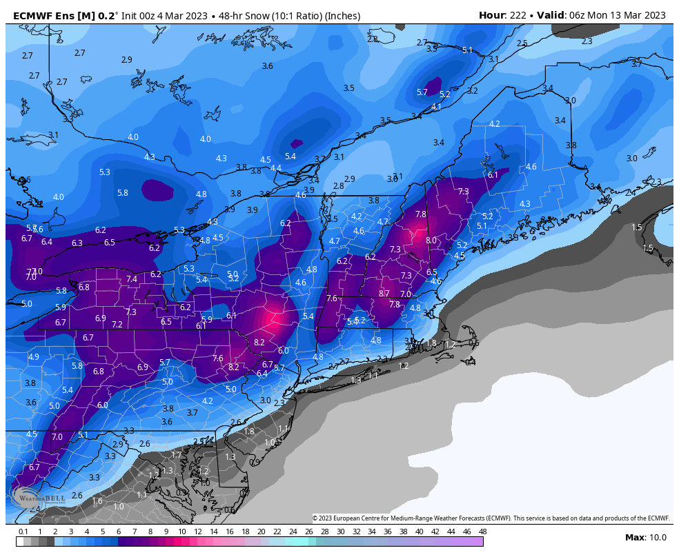
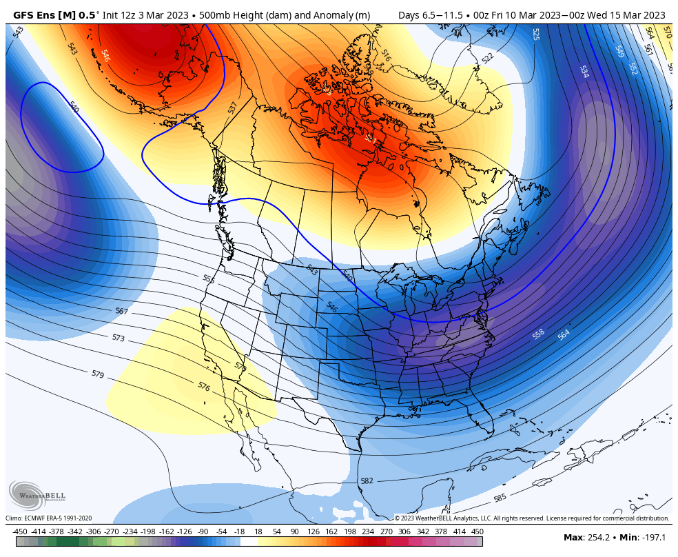
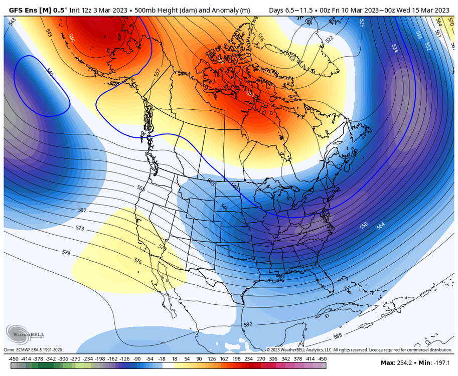
Here’s the GEFS 500mb anomaly 5 day mean from the 10th to 15th … pretty impressive.
-
Meh .. There's always one better.. We've had clown maps with 60-80" over the entire Northeast

-
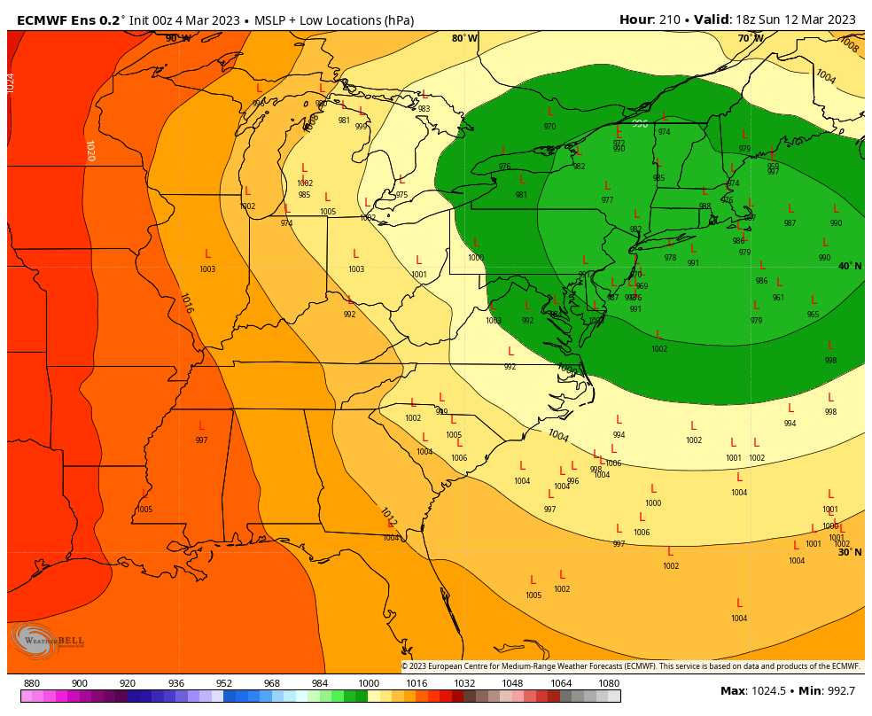
GEFS mean track and snow axis looks good at this range.. To me this means there is just as good a chance for a coastal as there is for an inland runner.

-
Need another 30-50” in some spots not happening james
-
Euro was late to the party with this. Gfs was first to catch on and have a cutter. However it was then too cold. Euro has been better the last few days.
-
Enjoy the rain CT. 99% of CT will be above freezing for the duration of this. Not much to be excited about. We wait til next weekend.
-
A lot of very snowy GEFS members

-
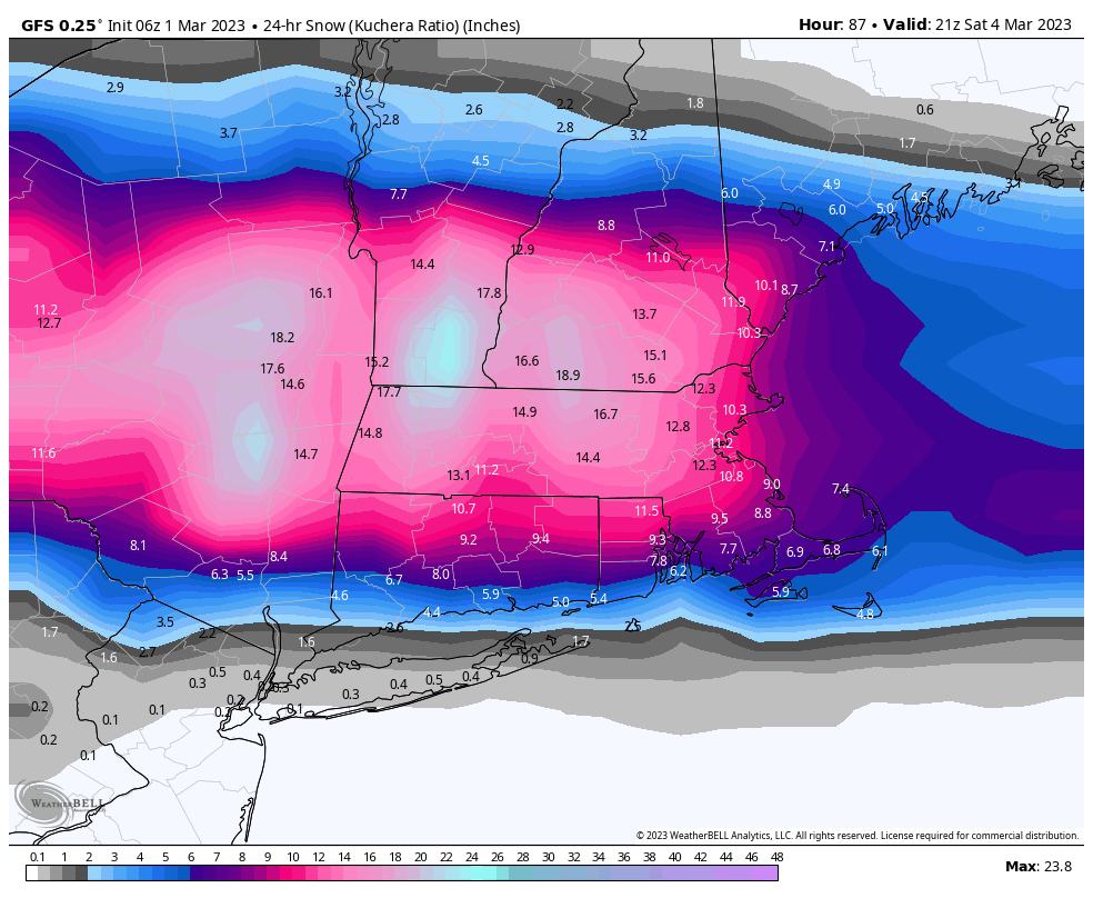
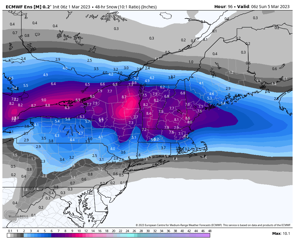
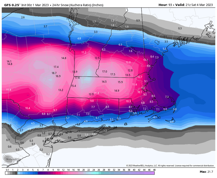
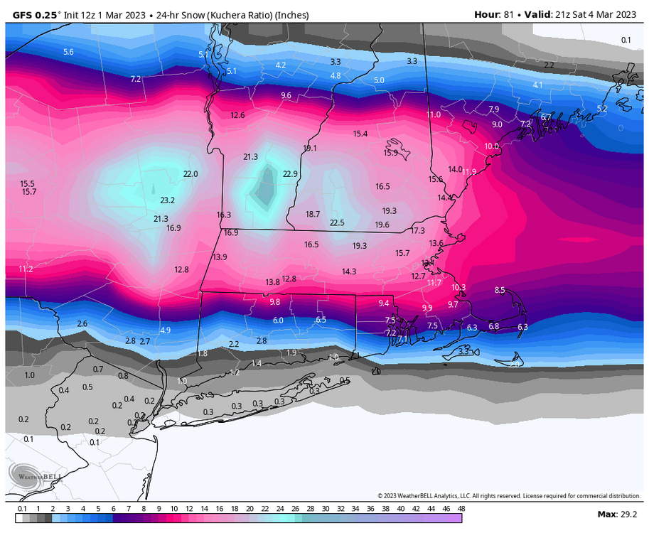
I like Kuchera for warm mid levels and an idea of how the southern edge of snow pans out. Warming trends last 3 runs for CT more than anything.

-
Mine is holding strong at Mount Seymour Snow.
- 509 replies
-
- 11
-

-
5.5” storm total and 10.0” on the season
-
Thats some major cold

-
4.8"
-
Feb 28th-March 1st long duration Miller B threat
Sey-Mour Snow replied to George001's topic in New England
Thunder snow in Manhattan -
Feb 28th-March 1st long duration Miller B threat
Sey-Mour Snow replied to George001's topic in New England
Good, it's much better when we have you guys out east in the party.. -
Feb 28th-March 1st long duration Miller B threat
Sey-Mour Snow replied to George001's topic in New England
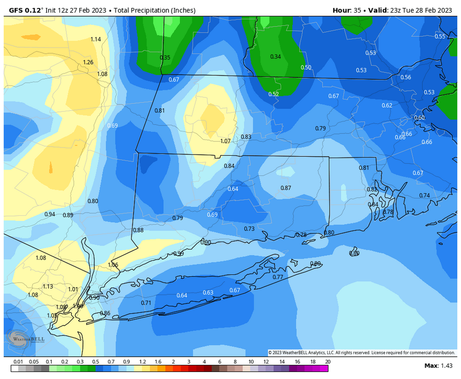
looks great widespread .7" qpf from the thump.. If we can get 12-13:1 ratios then its party on! -
Feb 28th-March 1st long duration Miller B threat
Sey-Mour Snow replied to George001's topic in New England
EURO really ramped up for CT , after it sniffed out the southward trend first, it's really been owned by the GFS in regards to precip output for this event , considering a cave 12-18 hours out.. Much better for the rest of SNE New England as well.. -
wrong thread
-
Feb 28th-March 1st long duration Miller B threat
Sey-Mour Snow replied to George001's topic in New England
Best run for all of SNE in a while.