Sey-Mour Snow
-
Posts
6,904 -
Joined
-
Last visited
Content Type
Profiles
Blogs
Forums
American Weather
Media Demo
Store
Gallery
Everything posted by Sey-Mour Snow
-
Yes, the answer is BEER. It’s run during happy hour, under the excessive consumption of BEER its calculations tend to be off.
-
.2” 4.2” on the season. The accumulating snow was 350’ and above. Not a sign of any snow now even up at 600’ as it all melted an hour after it stopped.
-
Heavy snow everything covered 34
-
And most of us in CT aren’t winning this one either lol. I think this is northern 3rd of CT up to the pike 1-3” as well as interior eastern mass, the rest just coatings. Oh well we move onto the next one.
-
Ya I’d like to see that heavier swath tick back south to encompass southern CT as well.
-
Hrrr went north and 3km. We will see..
-
You stole my snow lol
-
Unfortunately places along the shore and valleys in southern CT look too warm for any accumulations which would go along with seasonal trends. The 75 day accumulating snowless drought for @The 4 Seasons looks to continue.

-
 I made a thread.
 -
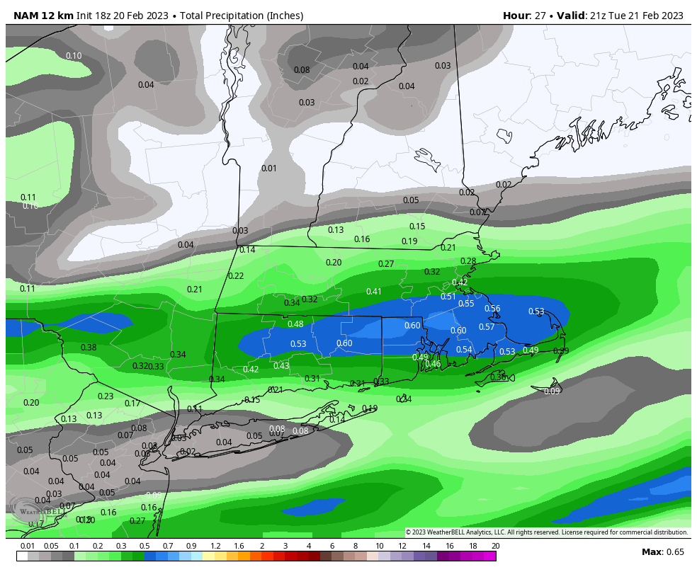
18z guidance is beefing up and moved north with the axis of snow for Tuesday. The HRRR nam and 3km all like rt 2 south through central CT and then out east to SE MASS for a swath of 2-4” snow where it is cold enough .. down here in southern CT, we look to be a bit too warm and maybe the southern edge of heavier rates. However, the exact axis of the band has been waffling and this is a nowcast event so we track.
-
Sey-mour snow land. Idk it’s going to be close here with temps but elevation will help. I’ll believe it tonight if more guidance confirms that narrow band of heavier precip. Looks like this could be a Prospect special about 10 miles NE of here has 1000’ elevation.
-
Doesn’t mean much but 18z gfs is nice to look at for 2/28
-
Yes we’ve had many solid years of 60-80” around here in the past 20 years. 2010-11 stands out the most.
-
What was 2015 in Hamden? Just a basic above average winter with no memorable snowstorms in the western half of the state. I know it was MUCH different in the eastern half.
-
Nice. Better than backing down on the 00z trend.
-
I’m only loaded to 240. Can we back up off the ledge from 00z?
-
Might be a warm front in there. 50 degree spread across 150 miles.
-
SE ridge hooking up with NAO on all ensembles after day 12.
-
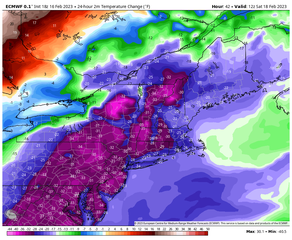
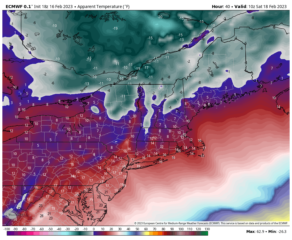
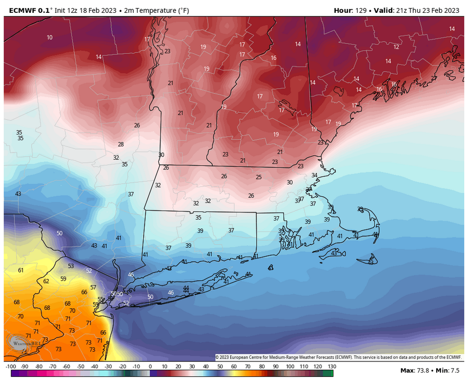
Pretty solid 24 hour temperature change. From feeling like 60 Friday morning to more like 10-15 just 12-24 hours later will be a shock even though it’s not much below average.


-
Imagine the melts.

-
That was Wills call. CT shoreline torching widespread 67-71. 66 here.
-
Sorry that was just for those calling for 100% sunny skies.. it was more for down here with possible rain moving on after midday but that has been delayed. it’s def cloudy but high clouds for now, temps having no problem rising. your call was spot on kudos. I’ll enjoy the 70ish temperatures.
-
Ya more clouds than I was hoping for but the rain should hold off til after 4-5pm. Already some spots in nyc metro in the upper 60s. Mid 60s Fairfield county and central Rhode Island.
-
PVD 64 and BOS 60 record highs already
-
ISP JFK and BDR all broke their record highs by 9:30am lol