


Roger Smith
-
Posts
5,927 -
Joined
-
Last visited
Content Type
Profiles
Blogs
Forums
American Weather
Media Demo
Store
Gallery
Everything posted by Roger Smith
-
Incoming Megi approaching Taiwan for probable direct hit north-central late today into tonight local time (which is 8h ahead of GMT so around 12-15z Tuesday). At time of posting, 1940z = 0340h Tuesday 27th in Taiwan Standard Time. This is the time stamp on radar link below. http://www.cwb.gov.tw/V7e/observe/radar/ Current forecast intensity appears to be high end cat 2 or low cat 3 in NATL terms, dropping to 1/2 by time the eye leaves western Taiwan (on current forecasts that would be 20z Tuesday).
-
Hengchun near south tip of Taiwan has 15-min updates of all parameters ... currently 966 mb and 8 inches of rain in 9.5 hours with wind gusts to 180 km/hr (about 112 mph). http://www.cwb.gov.tw/V7e/observe/real/46759.htm There was a buoy off the south coast reporting but it went down around 00z. Radar shows eye about 50 nm south of this location.
-
Lanyu (Orchid Island) offshore to east of south tip of Taiwan recently reporting gusts to near 60 m/sec which translates to about 135 mph. Track prediction is off the southwest coast of Taiwan, at least cat-2 if not cat-3 conditions could spread across that region today, and if track is any closer, cat-4 is possible. Penghu Island off west coast of Taiwan will eventually take almost a direct hit, their hope lies in eventual weakening by that time (about 18z), storm still looks very strong on satellite (which can be accessed from same website as the radar above).
-
Eye now visible on Taiwan radar. Local time is 8 hours ahead of GMT, in other words, 23z or 7 pm EDT (4 pm PDT) is 0700h Wednesday 14th in Taiwan. http://www.cwb.gov.tw/V7e/observe/radar/
-
as long as it's your own, just sayin ...
-
Okay, had a look at my Toronto data (1841 to 2013) which should run fairly similar in trends. The same things can be seen in this data as what you've reported. But as I looked at 1984 to 2013, I have the advantage of having columns of daily data and could easily see that four years (1995, 2005, 2006, 2013) had massive spikes on the 12th and 13th. Take those years out of the data and the other 26 years show almost no anomalous warmth on 12th-13th. The two curves (30-year and 26-selected-years) are almost identical except that there is a 3.5 F drop for the 12th and 13th (and 1.5 on the 30th). So the large spike in the data for 1984-2013 are almost entirely due to the anomalous warmth of four of the thirty years. As to any other explanations, nothing comes to mind. Just seems that the recent 30 years were dominated by these four very warm episodes as well as the super cold episode of Jan 1994 which leaves an imprint a few days later (15th in my Toronto data is a full 9 deg colder than 13th in all years 1984-2013, and 5 deg colder in the 26 years not counting the four warm ones). 1984 also had a very cold interval around the mid-month dates. Longer term, what I noticed by dividing the data into large time segments and fiddling with boundaries was that from about 1841 to 1872 (before your data set starts) the data are much colder in the first half of January than since 1872, whereas the data in second half have not warmed that much if any. Also, the so-called January thaw can be seen drifting later through the data sets from 17th-19th in the middle of the 19th century, to 21st-22nd in the 20th century, but more like 23rd-24th in more recent times, also that signal has weakened somewhat relative to all data and shows signs of a split, as though one component of it wants to stay fixed on 21st but other components are drifting forward in time. Does this help in any way?
-
Is a sports analogy valid here? The weather data in question are sets that are very close together. Large variations in frequency could be anticipated when looking at higher and lower data points among such sets. The only real test would be random variability as in coin toss frequencies and while the change looks rather large, it probably falls within about a 2-s.d. range of random expectation. So I don't know if we can really deduce much of a "reason" for these results, it certainly isn't as indicative of a background explanation as that much of a change in a sports team's performance. I am going to look into it further since I am always intrigued by singularities that move gradually in a time series from my research perspective. One example would be the January thaw. If there were such an animal and it was expected around Jan 21, then if it had an external forcing cause, you could expect that to occur 1.5 days earlier every century, on average, in a constant Gregorian time frame. That is due to precession of the earth's axis in space. Let's say there are weak but significant resonances between the Sun and the mass of the galactic equator or various other fixed sources. Then these would occur 1.5 days later every century, or .015 days earlier every year. Nothing there that we could apply to changes in a 30-year normal set, but it's the kind of shift that I look for in weather data sets when assessing signal strength. Some other background factors move a lot faster, so I'll have a look at what actual differences you're noting and see if I can see anything. The other factor to consider is that micro-climates have quite large signals in data, if you re-site an airport weather station it can lead to "normal" shifts of up to 3 F deg (!) and not every type of weather makes the same shift when you re-site. Just the very local radiation budget is quite significant. I did an experiment as part of my own education on boundaries of urban heat islands and found that the "normal" monthly temperature at a normally situated weather station would vary by that 3 F deg amount if you just moved the instruments as little as 30 feet and changed the surrounding environment by as little as having a couple of small trees nearer to the thermometer, or an unused unheated building closer. It was the equivalent of driving thirty miles north or south to a similar site at similar elevation to your control site.
-
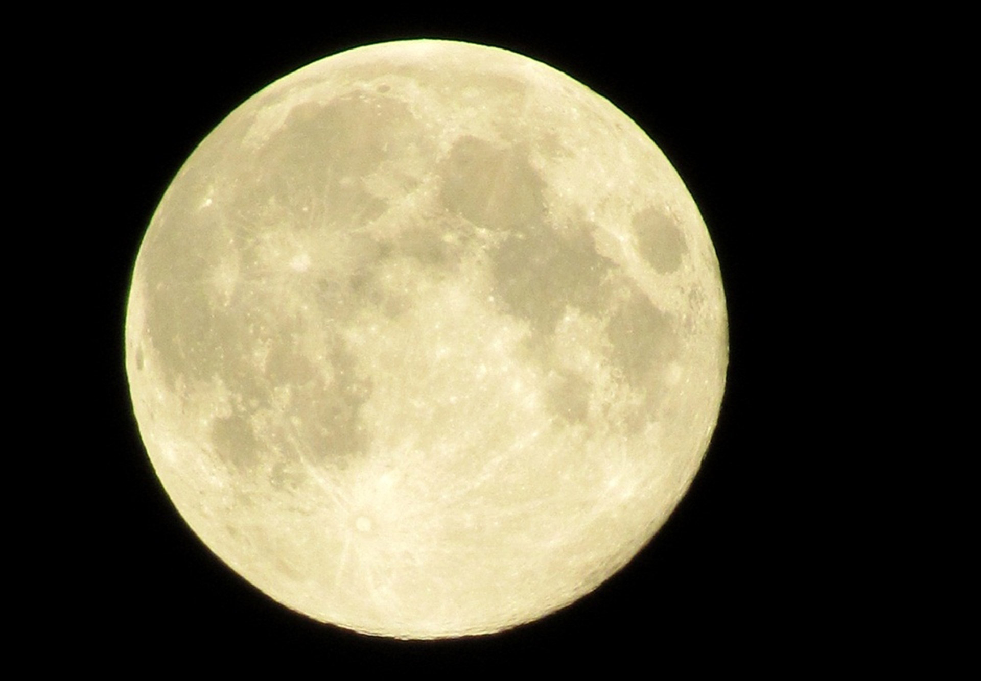 This theory is embedded in a larger and more comprehensive theory that has already been discussed here, that the Moon creates interference patterns in the atmosphere most likely as a result of interactions with the geomagnetic field, and that these patterns create travelling cyclonic storm systems that can be timed for certain lunar events in a system of timing lines (which run generally NW-SE radiating out from the magnetic poles) and meteo-latitude contours that are similar to terrestrial latitude except displaced somewhat to fit the geomagnetic grid. These lines of meteo-latitude tend to follow the shape of the mean 500-mb contours and there is a trough over east-central North America that at its deepest point tends to add 10 deg of "meteo-latitude" to terrestrial latitude. The correction over the central Atlantic is more like zero and over Europe closer to minus five deg although the grid also diverges somewhat further away from its more intense North American region. The situation for tropical storms and hurricanes in the developing theory is (somewhat simplified) that these storms likely form through processes largely unrelated to the lunar energy that dominates in the mid-latitudes, but that there may be a growing interaction between these storms and distant conventional lows moving east in the higher latitudes after about the point where storms begin to recurve, approximately 25-30 deg north, with the final extratropical transition stages becoming increasingly part of the more conventional system. Now in the frequency and intensity of the more ordinary lows, the energy peaks most likely to produce intense low pressure have been identified as declination maxima, full and new moon (these are simultaneous sets in December and June) and certain other lunar positions. The northern maxima of declination or N Max events are statistically the strongest and also show a peak in severe storm activity. A secondary peak occurs at S Max. Just briefly, the declination cycle of the Moon occurs because the Moon orbits in the ecliptic plane and not around the earth's equator. If you were looking at the earth from the inner solar system (from in front of the Sun) in northern hemisphere autumn, the north pole would be tilted slightly away from the sunward side of the planet but less obviously the planet would also be tilted to the left, the equator would not be oriented left-right but more lower left to upper right in your field of view. The planet would be moving to the left and that orbital plane is the ecliptic. The equatorial plane would thus be at a diagonal (the maximum occurs around end of September) and the Moon, if you happened to look seven days or so after full moon, would be off to the left of the earth near its orbital path but about 23 degrees above the equatorial plane. This maximum northward displacement varies in an 18.6 year cycle and can be as much as 29 degrees or as little as 18 degrees. We are currently approaching a minimum, the last maximum was in 2006. With that in mind, during the heart of the North Atlantic (and other n.h.) tropical season, the Moon routinely crosses the equator around full moon and reaches a northern max several days later, that being about seven days by the 21st of September, five days in mid-October, three days in mid-November. Although it's later than the tropical season, the northern max and full moon are simultaneous for full moons that fall around Dec 21. The same is true of new moons around June 21. Now my research into hurricane dates shows a strong correlation between this period between full moon and N Max, and hurricane recurvature. I expressed this as landfall not because there's any particular reason for landfall to occur then, but because landfall opportunities happen to overlap this northward turn, especially given the curved nature of meteo-latitude which reduces the difference in terrestrial latitude between the Gulf coast and the southeastern U.S., I am not aware of any formal studies but common sense would tell us that the mean forward direction of landfalling hurricanes in the United States is probably NNW and likely varies from NW in south Florida to N or even NNE in New England. This is because with higher latitude, longer portions of recurvature have likely taken place. So my original statement about the N Max event being correlated with landfall is really a close consequence of the real physical phenomenon which is that recuravture is correlated with N Max. My study of all hurricane recurvature between the western Atlantic (including offshore tracks that have no U.S. landfalls) and Gulf of Mexico, using data from the NHC such as their lists of all significant storms since 1850, annual track maps starting 1871, etc, show the following broad results: To simplify the task of assessing correlation, I used the meteo-latitude 40N which runs close to the northern Gulf coast from about Galveston to Panama City then begins to pull away north to run close to the Carolina coasts although out to sea near Wilmington NC then north of Bermuda and well south of Cape Race, Newfoundland. Hurricanes crossing this meteo-latitude are generally moving close to either NNW or due north and beginning to recurve in most cases. Their landfalls are generally within half a day of being simultaneous except more like 1.5 days later for New England landfalls and 2.5 days later for Nova Scotia first landfalls. The overall frequency of lunar declinations (the cycle being 27.32 days) has a strong peak of about 3 times random in the 5 days that run from 3 days before N Max to 1 day after that event. A secondary peak of 1.3 times random occurs at the same point around S Max. Otherwise, frequencies are generally slightly below random expectation in the other 17 or 18 days of the cycle, but if I break down the data by half-months, then the full and new moon dates between N Max and S Max show up as other secondary peaks and in October the full moon to N Max peak begins to look like a double-peak of two equal components. This was of course the period when Sandy was approaching the northeast last October and as stated, the full moon (Oct 29, 2012) at that late stage of autumn is only 4 days or so before the N Max. __________________ GRAPH of 40N Meteo-latitude shows recent and historic (19th century) postulated positions. The data set was produced with five positions in this rather narrow band, timing differences would generally amount to less than half a day over the range and a few hours for each increment north, but this was to account for northward shift of the grid over time. The map also shows timing line one, a feature in the model for travelling cyclonic lows (these can be expected to cross nine different timing lines at lunar event times) and also some typical hurricane tracks in red that end at the timing point of 40N meteo-latitude. The few cases that were further east than the map grid were timed from the extension of the meteo-latitude towards the Azores and eventually south-central France. Storms that did not maintain an identity to the required latitude were not included, but hurricanes that weakened before crossing the 40N meteo-latitude were timed from remnant lows crossing. It would be a general principle from research that the closer to N Max a hurricane approaches 40N, the stronger it will likely be and the longer it will remain a hurricane afterwards. A secondary peak applies at S Max for these principles. View attachment: 40N.jpg GRAPH of 27.32-day declination cycle frequency of hurricane transit of meteo-latitude 40N from hurricane data 1851 to 2012 ... graph places each data point relative to defined N Max (6h r.a.) and S Max (18h r.a.) lunar positions using 06z to 06z climate days. Example, Hazel 1954 crossed 40N meteo-lat at 34N on Oct 14 1954 or N Max - 2, data point is in column two to left of highlighted N Max column. This procedure followed for all storms. View attachment: hurr.jpg Frequencies as follows from an arbitrary starting point in the lunar cycle, S-4 days, S Max and N Max in bold: 15 16 17 24 29 26 25 19 17 16 16 21 30 32 32 34 41 55 58 45 39 34 24 20 17 21 18 16 (TOT 757) (mean 27.0) Note that in mid to late September, full moon would fall at N Max -7 d and new moon at S Max -7 d, more like -4d in each case by mid-October. The sliding nature of these dates by comparison to the solar year frequency of hurricanes would account for the slight second-order peaks near those dates. ______________________ My conclusion from this study is that hurricane formation in low latitudes may be unrelated to lunar energy interactions with the atmosphere, but if a storm has formed in a suitable time window it is more likely to intensify and move further north if the timing brings it northwest early in the seven day period before N Max which from early September to mid-October means around full moon. A storm moving NW near the tropic of Cancer around an autumn full moon is therefore more likely to become a dangerous storm with landfall or long-track potential (depending on longitude). A weak secondary effect applies to the opposite period, around new moon in mid-autumn to become more intense around the following S Max. The dynamics of this cycle are timed much differently in June which would see N Max hurricane intensification simultaneous with the new moon. This was in fact the case with Audrey in 1957. Something that could have a minor research potential would be the apparent lull in statistical terms in early July, perhaps that set of lunar potentials is lower than June or August and that counteracts what must be more favourable sea surface temperatures. The original discussion in the main thread listed many of the more powerful hurricanes associated with a N Max landfall. A smaller subset can be drawn up for the S Max landfallers and with those two sets completed, there are only a few storms left over among major hurricanes, with landfalls in the larger time windows not specified by N-3 to N+1 and S-3 to S+1 (10 days out of 27.3). What I hope to do with this data is to illustrate with charts and maps breaking down the results into perhaps third-monthly intervals which might further define the details of the process. On the whole, I believe what we are seeing from this strong peak at N Max is that lunar energy takes over the destiny of tropical storms after their origins for whatever other set of reasons, and guides them into the larger system of travelling lows. This is why we quite often see a strong hurricane making a regular recurvature which seems to move very similar amounts of lat and long in different cases and always glides into the warm sector of some distant but increasingly linked mid-latitude system until merger near the Great Lakes. It is remarkable (to me at any rate) how many major hurricanes have seen remnants pass within 150 miles of Toronto, and when I was living in that region, I saw the remnants of Andrew, Hugo, Gilbert, and many lesser storms come through the region, as Hazel and Audrey which were somewhat before my time. A secondary note on research findings: the N Max peak is stronger with "major" hurricanes where it reaches about 4:1 against random expectation, and weaker with cat-1 storms at about 2.5:1 ... I have not had time to study tropical storms but the problem with those is that relatively more of them do not move far enough north to recurve anyway. Another note is that intensity cycles during westward motion at low latitudes are probably unrelated to lunar energy also, my hypothesis at present is that lunar interaction begins to ramp up about when the storms pass 22 or 23 N and begin the early portions of recurvature in most cases. Of course the situation is more complex than some very simple description can handle, and I like to study these complexities to understand more of the process. But the fact of the matter is that the statistics over about two centuries illustrate that N Max is statistically three times as likely to see major hurricane development near 30-40 north than any other point in the lunar declination cycle. If this is not due to some phyiscal process, then one would have to explain it either as random chance (seemingly unlikely given that we are talking about over 600 hurricanes) or evidence of a process with similar timing but unrelated to the Moon. That could implicate the Sun's rotation which, when adjusted for earth's forward motion in orbit, is also about 27.3 days (it is given as 25.6 days against a fixed background but the rotation requires added time to catch up to the moving earth). That actually introduces the rather interesting possibility that solar rotation (which after all is only measurable by magnetic disturbances on the Sun) could be linked to the earth-Moon system in some unknown way. I don't know when astronomers or physicists will uncover the linkages (they are beyond my capacity since theoretical reasoning alone would be insufficient, space-weather type measurements would be required), but if they do, I suspect that one day, a jaw-dropping and unsuspected cause and effect might be obtained, namely, that the earth-Moon system being closer to the Sun than the outer planets, has some ability to focus and enhance interference waves or other forms of energy from the outer solar system (like a lens process) and that the "solar rotation" is actually a projection of this earth-Moon energy onto the Sun's magnetic field. The Sun may not be rotating at that speed at all, but the energy rotates. After all, if you tracked earth's atmospheric disturbances, a lot of them also move east at about 12-13 deg longitude per day or they have periods of about the lunation periods between 27 and 30 days. But the earth rotates in 24 hours, not 30 days. The N Max event probably holds the key to understanding atmospheric processes of many kinds. It falls close to peaks of temperature, storminess, hurricane recurvature and other parameters especially when these are measured near timing lines. But my hunch is that in the earth's southern hemisphere, the stronger energy peak there is S Max as a mirror image, with the secondary peak being N Max. This even has implications for climate change of a cyclical nature, because it is not always the case that the early winter full moon is at N Max. That cycle processes over 26,000 years and with other second-order variations, and this could have implications for the atmospheric wave formations of other points in the long cycles. Similarly, if another component of terrestrial climate is rotating field sectors in the solar system, these also have different latitude cycles over the precession cycles and this could imply much different blocking potentials at different times of year. The highly variable and largely unknown wandering positions of the magnetic poles might turn out to be related also, but if these are random, then what we would be left with is a blend of predictable variability against a random background of grid locations. The bottom line is that a 3 or 4 to 1 increase on random expectation over such a long period of time (showing equal propensity in the 19th, early-mid 20th, and late 20th early 21st century sub-sets) is very unlikely to be random or unrelated to the Moon. The question then is, what is the process at work? Is it tidal, geomagnetic, gravitational, some blend of all of these, or forced through solar-earth-Moon interactions modulated by field sectors? This research is at a relatively early stage. The hit rate of hurricanes at suitable N Max dates is something like 35%. What prevents hurricanes from forming the other 65% of cases? Can we find the same general results in the eastern Pacific, central Pacific, western Pacific, Indian-Arabian theatres? Are there comparable results in the southern hemisphere? I have not had time to even start those investigations.
 -
Alaska/Western Canada obs and discussion
Roger Smith replied to patrick7032's topic in Central/Western States
Here it comes, severe cold and then snowstorms for the south coast (of B.C.) across the border into western WA and all the way east to Montana. I think Vancouver Island is going to get buried mid-week once the severe cold starts flowing out of the local fjords. Would expect about 15-30 cms snow in total around Vancouver and 25-50 cms possibly more locally in southeast Vancouver Island. This will play out as sleet or rain at first in Puget Sound but could turn to heavy snow by mid-week there as well. Definitely a heavy snow situation for the local lower elevation slopes (Whistler is already nicely covered). Severe cold into the BC interior and across western Canada, could reach -45 C or lower in places. Might reach -8 to -12 C here as well, after no real winter of any kind so far.
