

dendrite
-
Posts
74,765 -
Joined
Content Type
Profiles
Blogs
Forums
American Weather
Media Demo
Store
Gallery
Everything posted by dendrite
-
The only thing that looks like 90 is his scalp.
-
Looks like deep winter out there. Pack is back up to 17”.
-
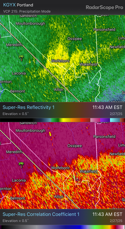
Bright banding
-
Over to rain at home per Lisa. 2.5”
-
Dumping in CON
-
Kinda got sleety/zr’ish on the ride in approaching CON. Some snow pellets and pingers right now with meh lift.
-
27.8° -SN Couple tenths so far
-
HRRR still has a few inches here but there’s a sharp cutoff…borderline sleety around CON/MHT for a bit. But yeah, 3k is like 1-2”.
-
Pack is currently 15”. 35.9°/26°
-
Looking good for 2-4”.
-
Pretty colors at H5. 2012 was torched well into QB. Both models have HP and cold lurking just over the border. But it’s d14 so whatev.
-
Don’t do it.
-

-
Which probably traces back to the pack. Albedo and latent cooling limiting mixing.
-
Did Will move all of his snow piles around the ORH ASOS?
-
Congrats everyone
-
44.0° Drip drip
-
Min 29.0° All iced back up for now.
-
d15…good luck But we still pray
-
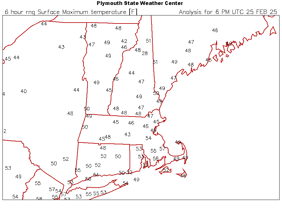
40.1° First 40s of the year
-
-
I was expecting mid 10s this morning and got upper 20s.
-

New England Winter 2024-25 Bantering, Whining, and Sobbing Thread
dendrite replied to klw's topic in New England
Appreciate the effort. It was light enough to not bust through the snow. I still lean skunk. -
It keeps getting better for you
-
High 30.6° Feb high is still only 36.7° from the 3rd.


