NorthShoreWx
-
Posts
5,434 -
Joined
-
Last visited
Content Type
Profiles
Blogs
Forums
American Weather
Media Demo
Store
Gallery
Everything posted by NorthShoreWx
-
Been a bit nippy on top of the Greenland ice cap: https://www.weather.gov/wrh/timeseries?site=GEUSNAE&hours=72 Thousands of feet below, its between 0 and +10 on the beaches.
-
Those 3 charts illustrate the "January thaw" in the early years.
-
30 or 40 years ago it was probably 36ish for the North Shore. I'm old enough to be unwilling to let that go. When I see a high of 33 vs 36, I think a chilly day, but not outside of a range of normal ( +/- 2⁰C). We all perceive things different, but I think that range is reasonable.
-
This might be a function of the high winds. The urban heat island really shows itself when the winds drop.
-
Average high for this date is probably about 37 in his area, maybe 36. It isn't that far off.
-
I saw a decent amount Sunday on the east side of the river near Newburgh.
-
16.4" IMBY from that one. 2.4" fell before midnight on the 28th, 14" on the 29th. 36.2" that winter. Of the past 5 winters, two have been near or a little above average and 3 have been well below. The 5-year average has been 22.1", which kinda sucks, but it is only our second worst 5 year period in the past 30. The worst was 97-98 through 01-02 at 20.7". On the brighter side, the best 5 consecutive winters from 2013-2014 through 2017-2018 averaged 56.0" I still think the guys who were saying "don't get used to it" were wrong.
-
The 12z GFS remains quite cold through the end of the run. One thing that I find interesting is that the surface temperature maps imply that the remaining open water in the eastern and northeastern parts of Hudson Bay will remain unfrozen for the next 384 hours. That seems unlikely since the open waters are shallower than much larger frozen area to their west and the surrounding temperatures are forecasted (in this run of the GFS) to be below normal much of the time beginning this weekend. I imagine the temperatures in that area are overdone late in the model run.
-
Congratulations Gulf of Mexico (or whatever they're calling it these days)
-
Saw some kids playing hockey on a pond in my neighborhood on Sunday. Hasn't been much of that the past couple of years. I think the last time might have been a short window around Christmas 2022.
-
It's also highly unlikely there would have been any patch of ground named after Charles Lindbergh 20 years before he was born.
-
San Diego had an airport in 1882?
-
This is sadder than I thought. I have more than that. Edit: PS I wish I was lying.
-
We don't brag about that until May
-
Exactly...that's seasonal, not frigid.
-
You missed a good January.
-
Average snowfall at CP for the period 1959-1960 through 1968-1969 was 32.0". KU's accounted for 115" of snowfall over the decade. The average snowfall excluding from KU storms was 20.5" during the 60's. If we get closer to normal by the end of the decade, KUs will need to play a role, but that isn't new.
-
From those charts, we have the following sets of 5 year averages: 19-20 to 23-24: 14.2" 69-70 to 73-74: 15.5" 84-85 to 88-89: 15.5" The most recent 5-year period is 8% less snowfall than similar 5-year periods in the 70s and 80s. Another way to put it is that the total 5-year relative deficit is about 6.5", or one marginally warning-level snowstorm. It shouldn't be that much more difficult to get to a 10-year 20" average than it was in the other two decades. It should be noted that both of those decades had KUs.
-
Jan 11th-12th Super Bomb or Super Bummed?
NorthShoreWx replied to Rjay's topic in New York City Metro
Remind me not to nominate you for Director of Happiness.- 993 replies
-
- 8
-

-

-
- metsfan vs snowman
- bomb
- (and 2 more)
-
Jan 11th-12th Super Bomb or Super Bummed?
NorthShoreWx replied to Rjay's topic in New York City Metro
Nickels and dimes would be good, but these have been pennies.- 993 replies
-
- 6
-
-
- metsfan vs snowman
- bomb
- (and 2 more)
-
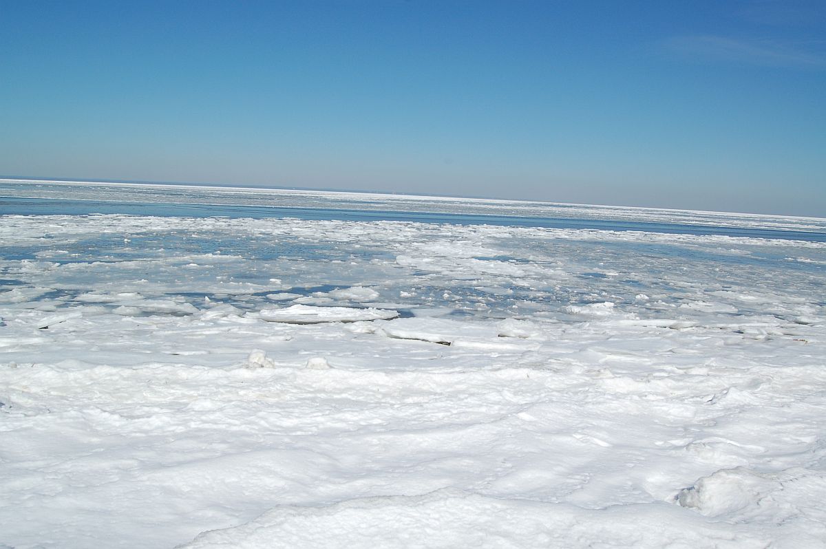
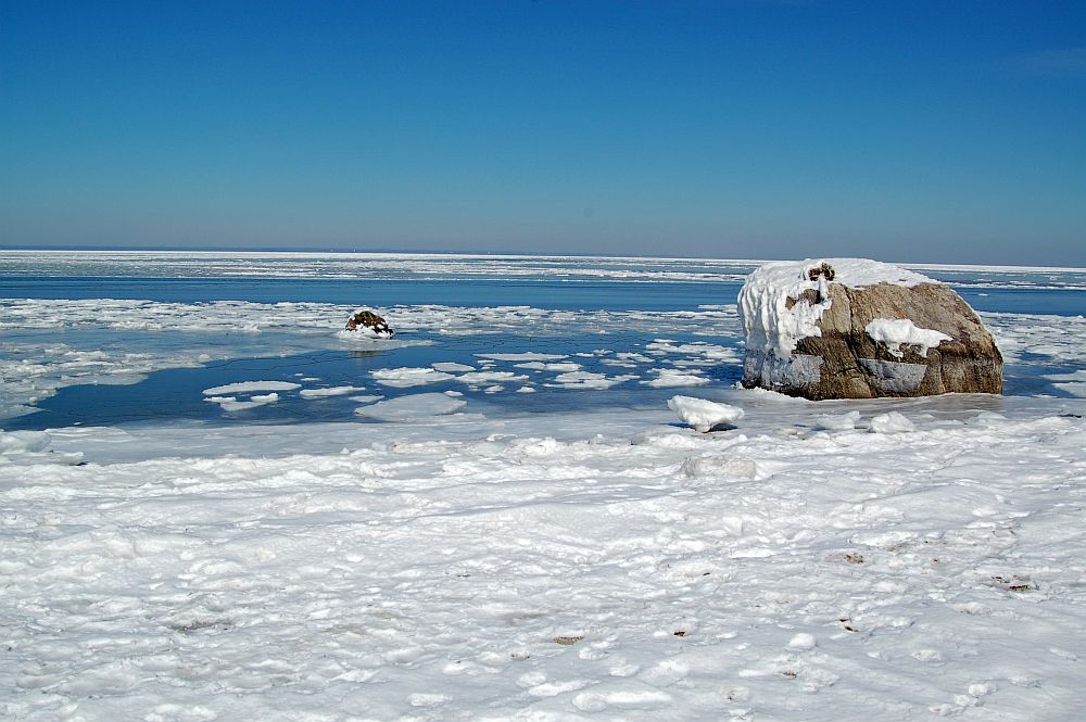
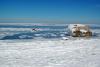
Long Island Sound / Smithtown Bay, February 2015
-
I guarantee it would have a lot more sound-effect rain. Maybe an extra 10 or 20 miles would boost some snowfalls, but I'm not sure it would offset all of the negatives.
-
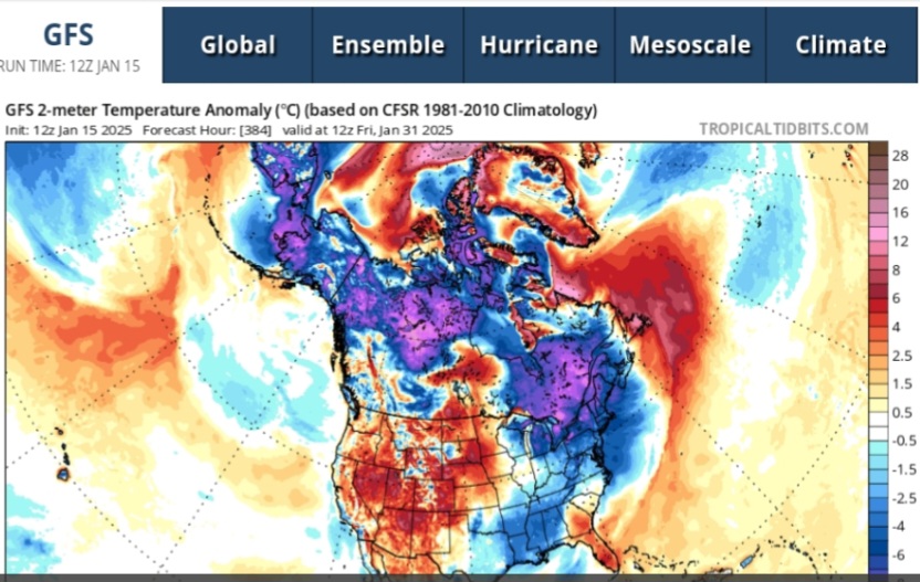
Thanks. It's a cool graphic that I hadn't seen before. That's a good scenario that you mentioned with the DC example. It would probably be interesting this month with the greatest departures to the SW.
-
Is there any useful visualization from overlaying the tracks of multiple endpoints?
-
It was raining on the beach and snowing on top of the bluff.