buckeyefan1
-
Posts
13,470 -
Joined
Content Type
Profiles
Blogs
Forums
American Weather
Media Demo
Store
Gallery
Everything posted by buckeyefan1
-
Indeed
-
-
-
The end of the month has had my interest and I noticed that too
-
Indeed! Bless their hearts
-
Ya'll are gonna need to make sure your meds are filled for the chaos filled model madness coming this week
-
True and a lot if them also come as a pattern is breaking down, as crazy as that sounds
-
Happy New Year to you guys!! That, my friend, is beautiful and hopefully we will cash in at some point I'm not Larry, but will chime in to say IMO it doesn't matter as much here in the south. We've scored during warm and cold winters. IMO the only thing that really matters is blocking. Don't get me wrong, having a cold winter sure does help if you are in the upper se or the mts, but without blocking you are putting your chips all in on passing clippers, sliders and the hope that the cold air will be established. PS....I deleted your thread as requested, but fyi there is not a limit on how many threads are made
-
Agreed my friend Just keep in mind that with blocking, anything is possible
-
Nobody has you confused. Take your trolling somewhere else. This is the only warning you get
-
Happy day of your birth JB I miss you a shit ton and I’m waiting on the special winter madness that you said you’d be sending. I raise my glass today to celebrate your awesomeness
-
Glad you are safely back and isn't that every weather nerds dream?
-
You should really read more and post less
-
no they are not
-
Yes there is and nobody is really taking about it because the models didn't even get the current system that is moving through the state now halfway correct until basically gametime. Fun times
-
Goooooooood morning winter weather nerds It's easy to see that after this last system, nobody got their meds refilled. I do realize this was probably due to taking more than required at the time Anywho, I'm going to repeat for the gazillionth time that there is a ton of energy flying around and until the models start getting a grasp (hopefully by Sunday) of what to expect, the windshield wiping will continue. Patience grasshoppers. In the meantime, please don't forget to get those meds filled and take them as needed, get plenty of rest between model runs, practice your yoga skills to regulate your breathing, drink plenty of fluids and keep some chocolate handy to stop yourself from becoming hangry. Drop your shoulders, sit up straight, take a deep breath, relax your facial muscles, and feel the tension subside. All good now? Yay! Buckle up everyone and good luck! I can't wait to see the pictures of your backyard frozen paradise
-

2024-2025 Fall/Winter Mountain Thread
buckeyefan1 replied to Buckethead's topic in Southeastern States
My gawd the cliff diving in the long range thread is off the charts. I have spent the last 30 minutes deleting stuff and there's still a ton left -
2024-2025 Fall/Winter Mountain Thread
buckeyefan1 replied to Buckethead's topic in Southeastern States
I just mentioned earlier today that I rode it to glory It was the only time I knew from 2 weeks out that it would snow. It was just a question of how much moisture. I ended up with 9" of beautiful powder that was completely melted before 10am the next morning. -
I got mine today Not looking forward to next month either lol
-
Patience grasshoppers I thoroughly believe that we will continue to see shifts until Sunday at some point. Hell, it could take until Monday. Living in CAE all those years have taught me that it’s not over until it’s over. Yes, I’m the eternal optimist p.s. I rode the cmc/dgex to frozen glory back in 2010. Stranger things have happened before
-
-
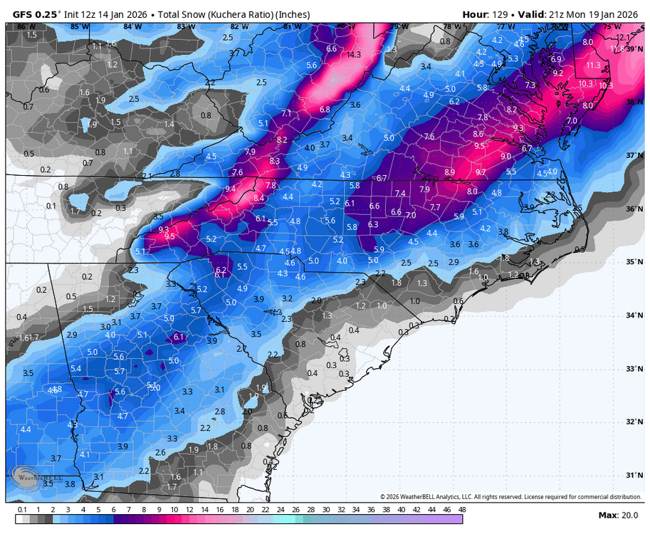
The 18z euro from yesterday is what we are looking for This is todays 18z. It's soooo close I do have to say that it has been fun trying to figure out how each different run unfolded with all of the energy flying around, and what it takes to get what we are all looking for. I've missed this
-
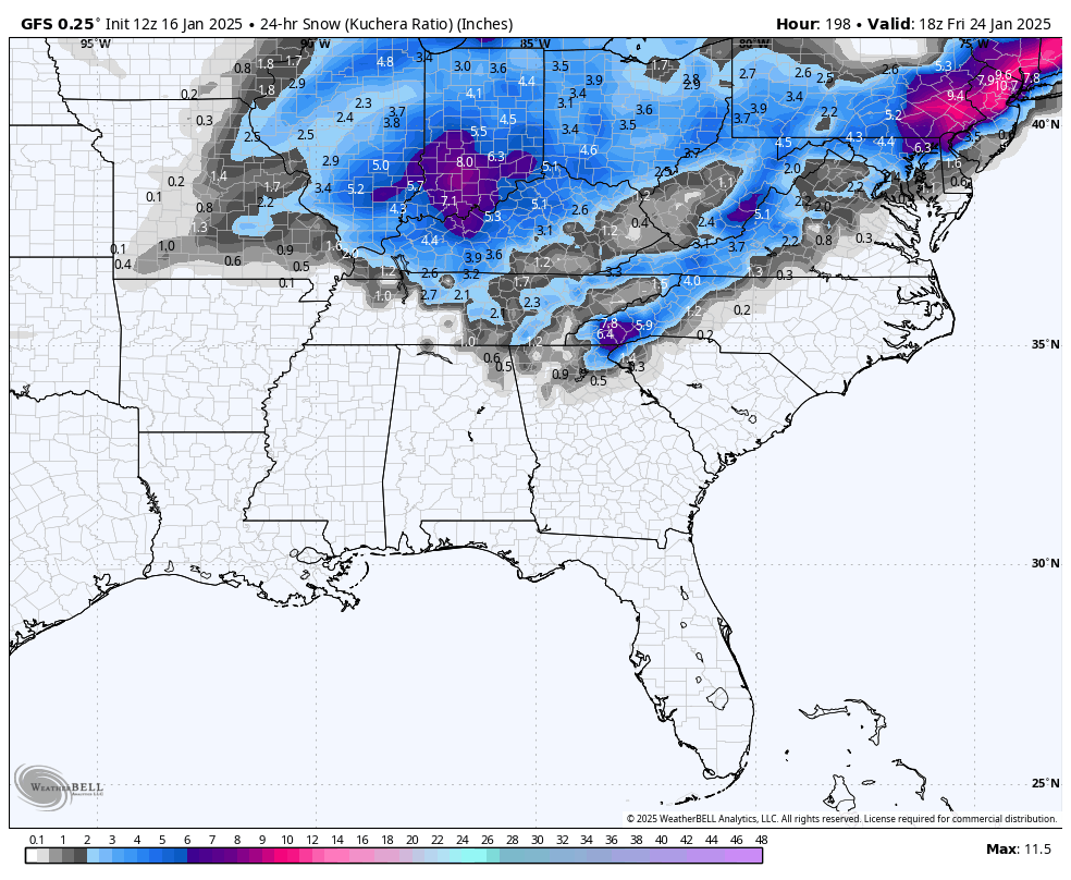
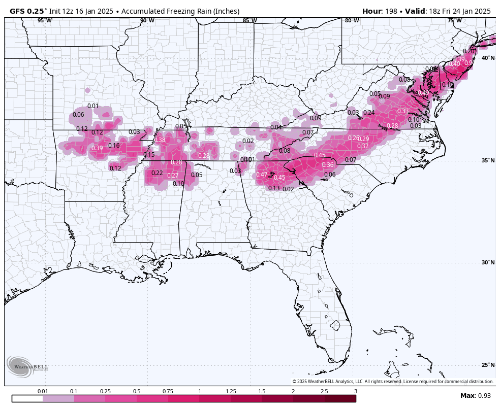
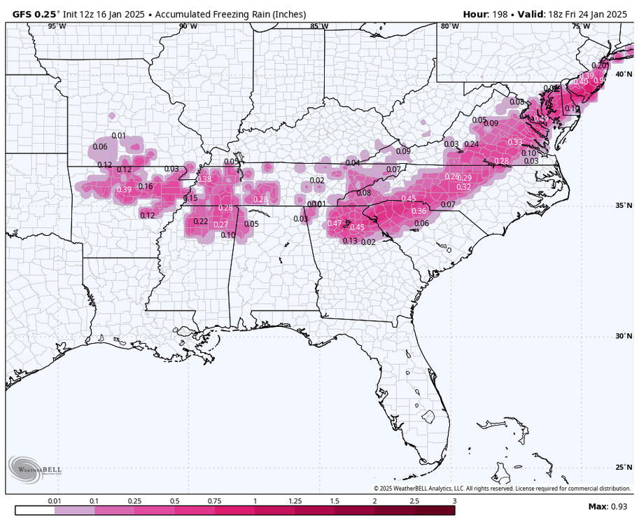
gfs 1st system has no ice gfs second system clown
-
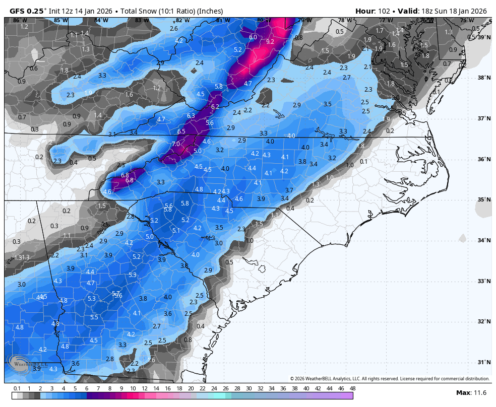
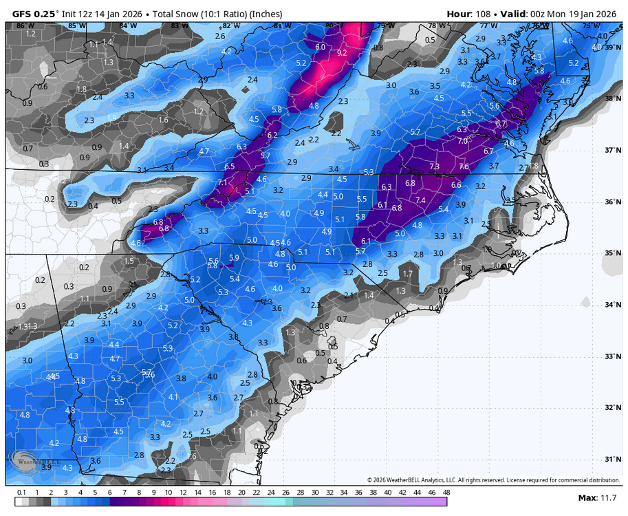
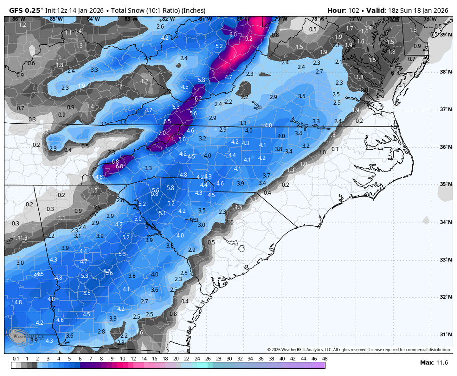
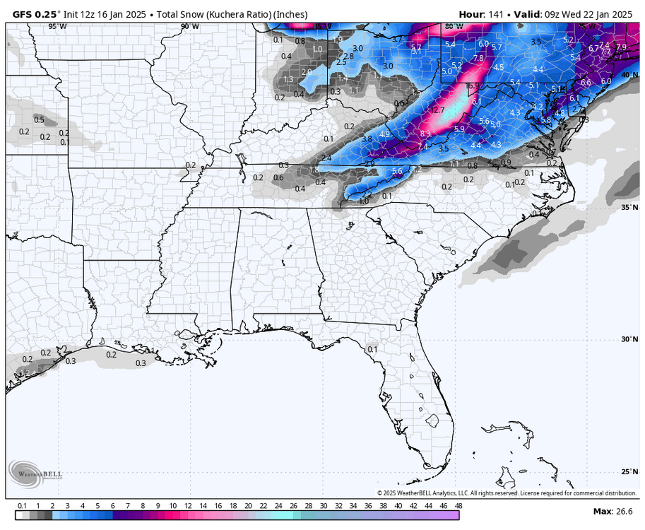
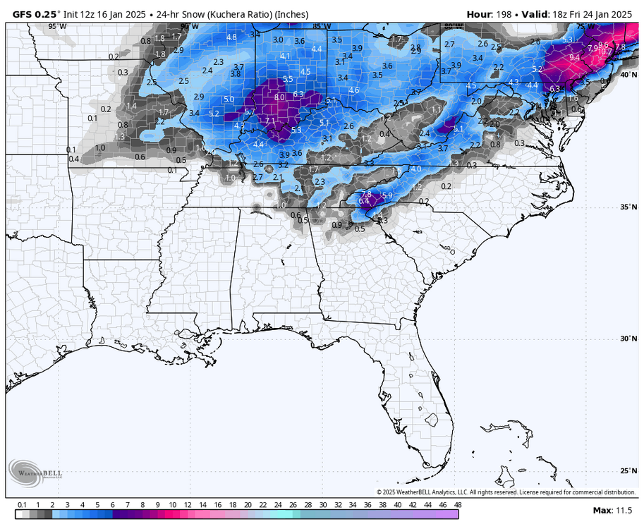
Cold air = higher ratios
-
Ya’ll, I’m going to repeat this again. There’s so much energy flying around and nothing has made it onshore yet. Just like this last storm, we are not going to know until all of the players are on the field. Yes, I know it’s a week (or under) away, but it wasn’t until it was actually unfolding in TX that we even had a clue what to expect with this last system. Higher resolution models are needed here and until it’s all within range, we will continue with this madness