buckeyefan1
-
Posts
13,470 -
Joined
Content Type
Profiles
Blogs
Forums
American Weather
Media Demo
Store
Gallery
Everything posted by buckeyefan1
-
It’s beautiful
-

2025-2026 Fall/Winter Mountain Thread
buckeyefan1 replied to Buckethead's topic in Southeastern States
I absolutely love ya’ll! It’s why I’m still here after 20+ years -
2025-2026 Fall/Winter Mountain Thread
buckeyefan1 replied to Buckethead's topic in Southeastern States
Thank you Steve, I appreciate you I’ll admit it’s really tough without him. We made the best team -
2025-2026 Fall/Winter Mountain Thread
buckeyefan1 replied to Buckethead's topic in Southeastern States
bx and rjay will drive by when they can, but there’s not many of us left who can or will -
2025-2026 Fall/Winter Mountain Thread
buckeyefan1 replied to Buckethead's topic in Southeastern States
Indeed I just don’t have the time to babysit someone who knows better. I work 50 hrs a week and drive to Columbia a lot to take care of my Mom who just started hospice. Not to mention that I’m the only green tagger here now I only want to enjoy this with everyone -
2025-2026 Fall/Winter Mountain Thread
buckeyefan1 replied to Buckethead's topic in Southeastern States
Yasssssssssss! -
Take it to banter before I lose my patience because WE ALL KNOW THIS
-
2025-2026 Fall/Winter Mountain Thread
buckeyefan1 replied to Buckethead's topic in Southeastern States
Can I hide here with the normal people without wild mood swings -
For the last time, not one single person has even said this. EVERYONE knows precip types are not even close to being set. Read more and post less if this is the best you can do.
-
Players still on the table….check euro bias of holding back the energy some…check high pressure in a good spot…check blocking established…..check moisture feed….check 3 days to go before we have a clue on specific types and/or guesstimate amounts….check Winter chaos incoming
-
Ya’ll, this is beautiful
-
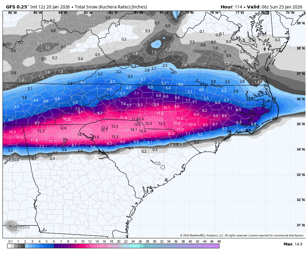
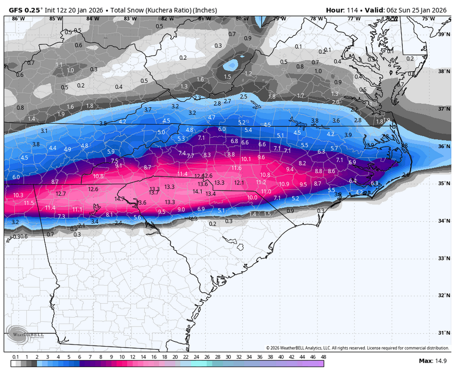
As we wait for 12z, here’s 6z for mby
-
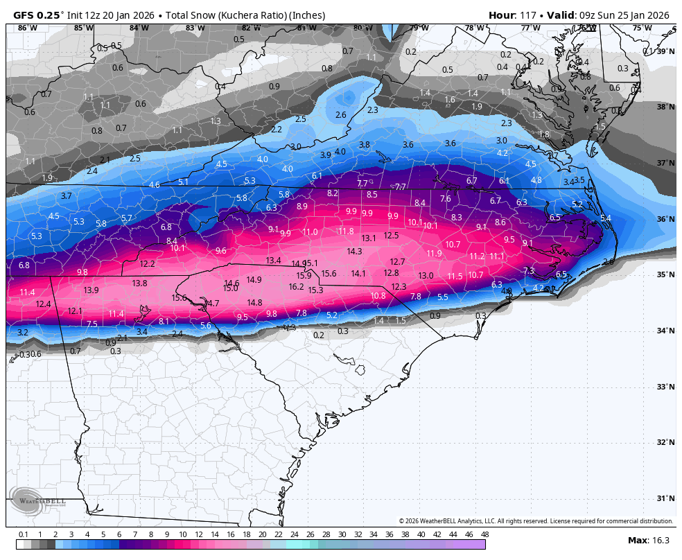
12z gfs

-
-
No. Please stop
-
It’s not going north. Nobody said anything about a slam dunk. Nobody will know anything about precip types until go time.
-
miss hearing your signature BOOM
-
2025-2026 Fall/Winter Mountain Thread
buckeyefan1 replied to Buckethead's topic in Southeastern States
You might wanna look for yourself -
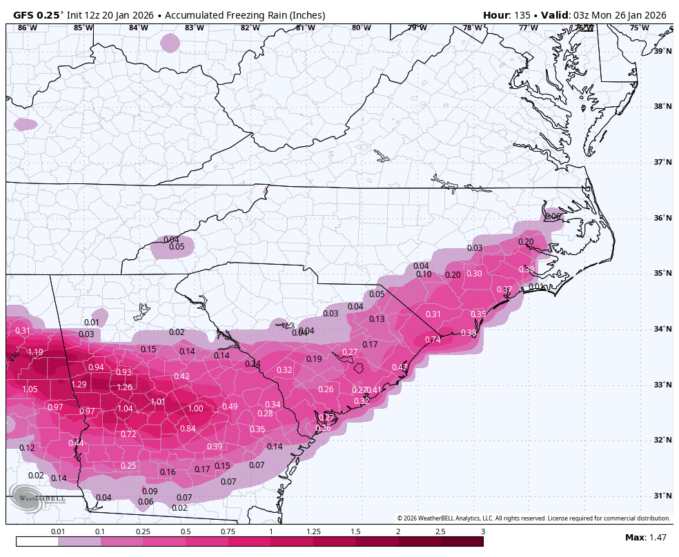
Nothing is going to melt with temperatures in the upper teens and low 20’s. That’s instafreeze and isn’t going anywhere once it hits
-
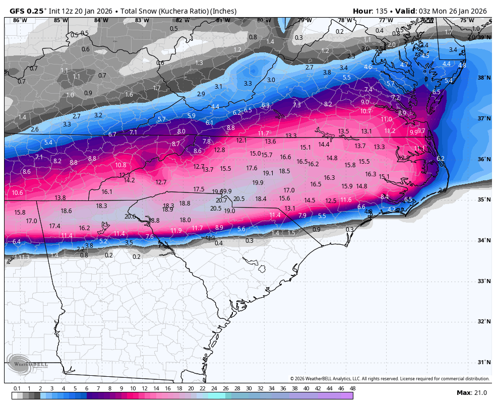
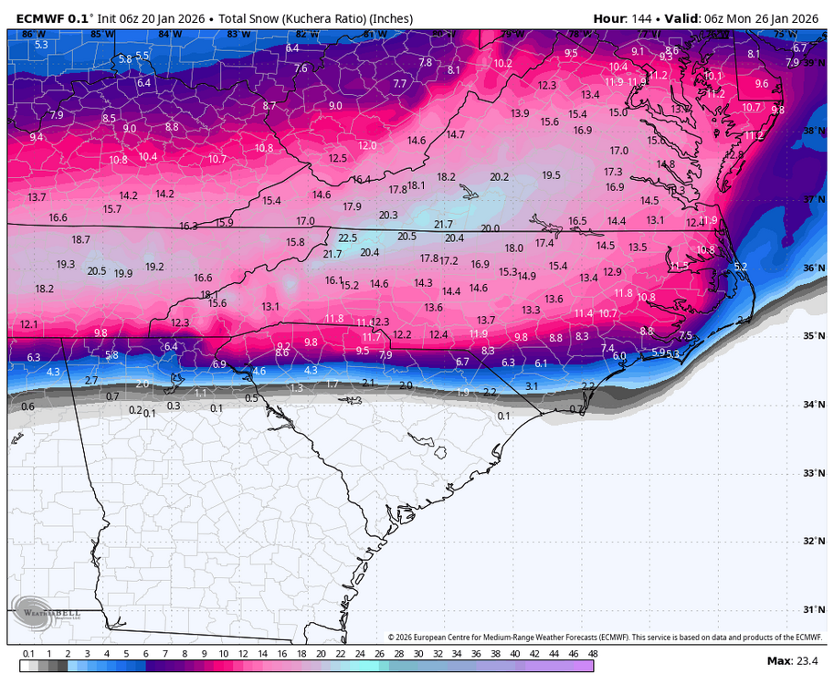
Absolutely insane 6z Euro
-
Goooooooood morning weather nerds! Here’s your reminder to please keep the memes/gif’s/one liners and whatever random thoughts you have, contained to the appropriate thread. Please add discussion to your posts and maps. Not everyone will know where your backyard is and this will be a very high impact event for a lot of peeps who deserve accurate information. We are the best AMWX has to offer after all Most importantly ya’ll take your meds, practice your breathing skills, use a different finger or thumb for consistent refresh rates of model runs, drink plenty of water, sleep when you can and enjoy the madness we’ve all missed for too long now
-
2025-2026 Fall/Winter Mountain Thread
buckeyefan1 replied to Buckethead's topic in Southeastern States
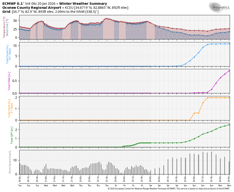
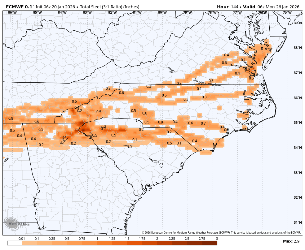
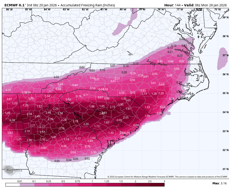
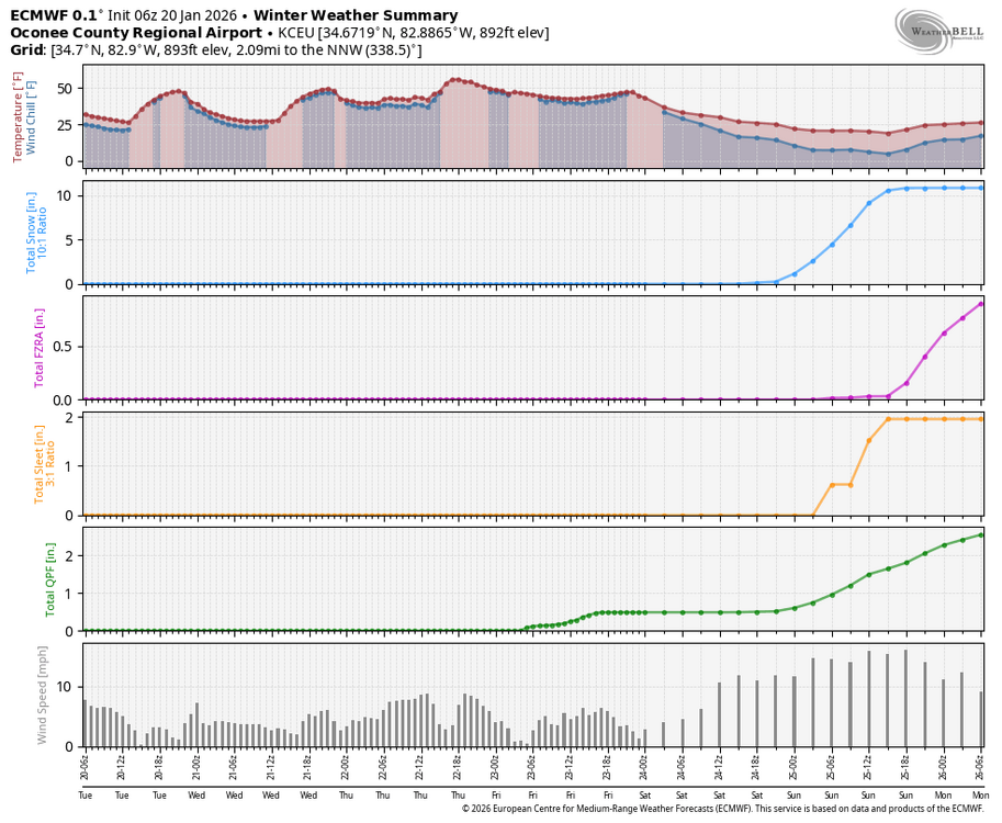
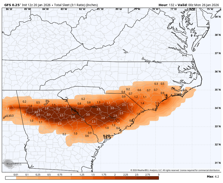
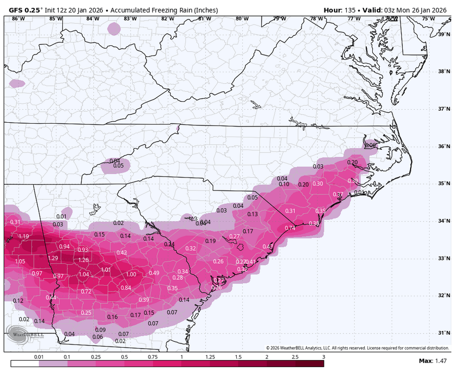
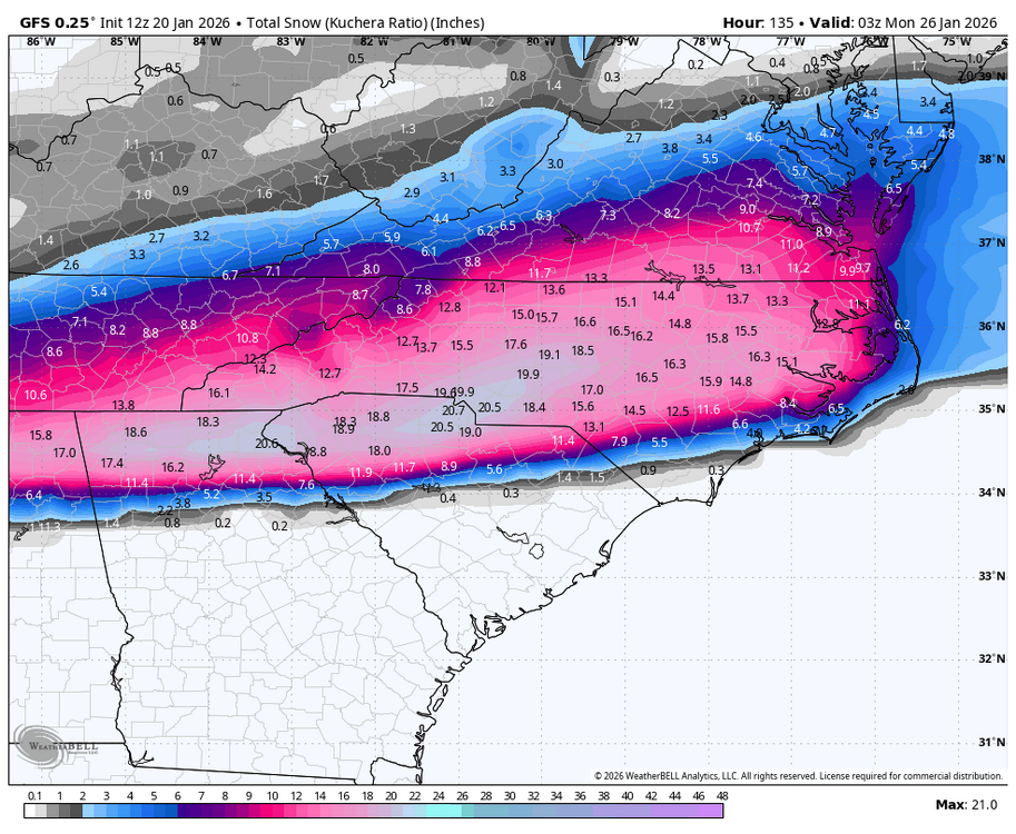
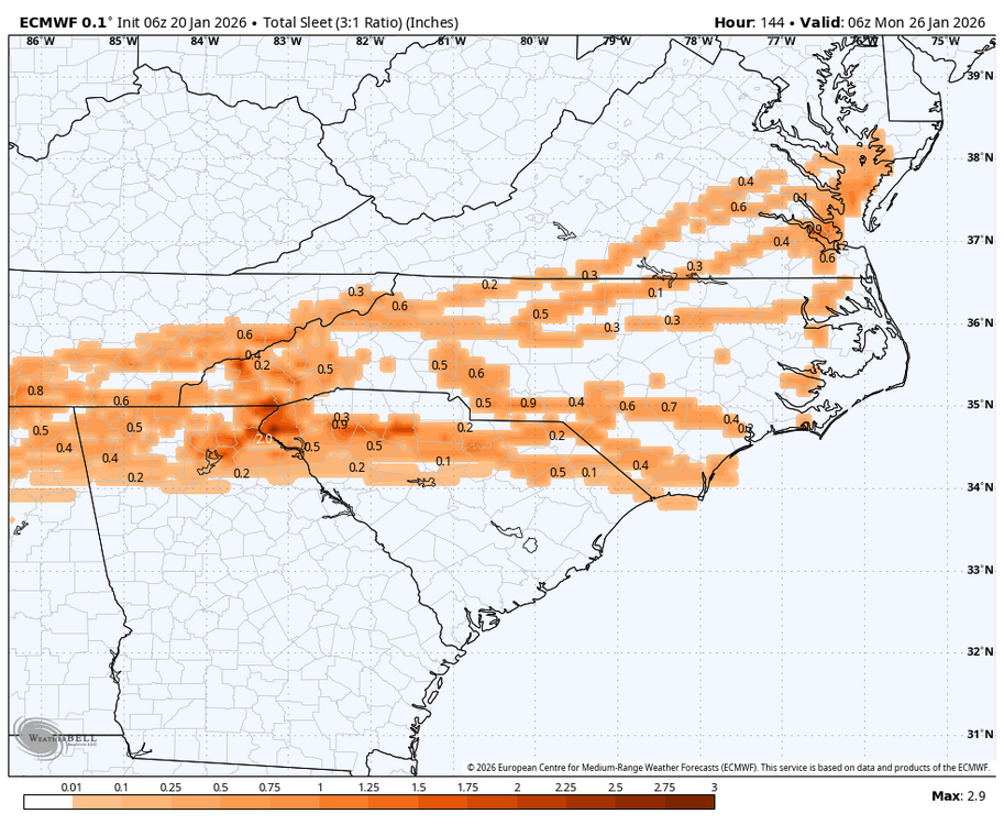
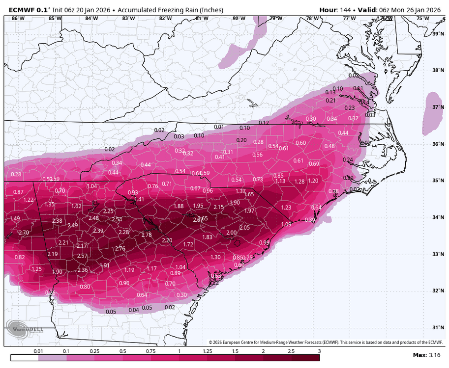
The 6z gfs says mby will have 3.5” of snow, 6” of sleet and a little glaze to really lock it in. Good thing I have plenty of pto -
18z Euro
-
2025-2026 Fall/Winter Mountain Thread
buckeyefan1 replied to Buckethead's topic in Southeastern States
I would love nothing more than to bless its heart in the best way possible, instead of the usual -
It's every euro model that is run, including the op, that creates the ensemble. Each colored segment is a 24 hr period of the winter goodness that specific model is showing. 50 total