

michsnowfreak
-
Posts
17,980 -
Joined
-
Last visited
Content Type
Profiles
Blogs
Forums
American Weather
Media Demo
Store
Gallery
Everything posted by michsnowfreak
-
Once the Christmas season has passed I would love to do a lake effect snow chase. I plan to take lots of walks in the snow throughout winter as well as a trip north in Feb. But chasing some Lake effect would really be fun and something I've never done. Between working from home and not being able to do much with this damn pandemic, great year to do it.
-
The decade was filled with blockbuster Febs. Detroit is slightly above avg this season to date at 9.2". But literally each of the 3 main snowfalls (Nov 22, Nov 30/Dec 1, Dec 16/17), esp the first two, jackpotted the far southeast corner of the state. An observer in Monroe (between Detroit and Toledo) is at 11.1". This is misleading for anyone outside the immediate metro as Flint and Saginaw have had very low snowfall (2-3" total). Im at 9.3" and have only had 7 days with 1"+ snow on the ground. Should this theme keep up the winter is definitely a dumpster fire from a sustainable perspective but as I always said, temps mean little wrt actual snowfall. It will be funny if Chicago pulls an above avg season by April lol.
-
very snowy winter...id allow a Jan tornado lol
-
only 4-5 months to go
-
I remember that too! I remember they were talking about it all week.
-
February is where it is at. Our average since 2000 has been 14.7" and since 2010 has been 18.0". Despite the pattern of the past few years there is no question that increasing snowfall in January and February, especially February, is what has been responsible for the 2010s being our snowiest decade on record. Lean snow years from the 1930s-60s really brought the avg down. 2010s vs 20th century Nov- 2.9 vs 2.8 Dec- 8.5 vs 8.6 Jan- 14.3 vs 10.4 Feb- 18.3 vs 9.0 Mar- 5.0 vs 6.7 Apr- 0.9 vs 1.5 ssn- 49.9 vs 39.1 Is Toronto above avg to date?
-
What kind of color is expected? W, NW, N, NNW lol?
-
We had great December's in 16 and 17 But the 2 decembers on each side of it were terrible. This December at least we've had snow here but its not been the best. We are in a very odd pattern lately of early and late season cold and snow, with one of the Winter months being not so wintry. It's frustrating. But also snowlovers in much of the midwest were very spoiled 2007-2015. Thats why they say karma is a bitch. Its very cool to see these out of season snowfalls but id gladly give them up if we could get back on track lol. We had a March storm in 2017 and 2018, and of course March 15 had deep snow. So id say over the past decade Dec has been the least wintry month of DJFM. Going a step farther, and this requires subjective thinking, id say that relative to normal, from NDJFMA December has been the worst. Obviously Dec has been colder and snowier at face value that November and April, im talking relative to normal. If anything the winter seems to be getting longer with a remission at some point during what should be the heart of winter.
-
I know it has been a frustrating start in Chicago and I like that you looked it both views. There are plenty of examples where there was good Winter after the New Year despite hardly any before the New Year. Today is only the 1st official day of Winter.
-
Happy first official day of Winter all. May the rest of the season bring us all lots of snow lol
-
Im at 9.3" but that doesnt mean I want to miss the next snow either. I want all my snow friends to cash in from IL to OH, but if tracking something thats a more narrow band of snow, of course I will always root for mby, and I dont expect anyone else to do any differently for their by.
-
Euro lost its king status a few years ago I believe
-
Getting a top 10 harder than most years, but here we go... 1.) May 10th accumulating snow (0.7") amidst a record 5 consecutive days with May snow and record cold 2.) Jan 11th rainstorm (2.81" over 36 hrs) 3.) Jan 18th heart attack 7" snowstorm thump 4.) November Indian Summer with record amount of 70s 5.) Local downpour July 10 (2.62" in less than hour) 6.) July 2-9 heat (no extremes but 8 consecutive days over 90). 7.) Postcard spring snowfalls Apr 15 (1.5") & Apr 17 (3.4") 8.) Feb 26 snowstorm (5.7") 9.) unusually long lasting and vivid Fall color show 10.) being in/near local "jackpot" for early season snows (Nov 22, Dec 1, Dec 16)
-
Wow this storm looks to bring tropical rains and a Christmas torch to the East Coast. Sounds like flood potential.
-
murky and damp out. The snow melted except for a few piles. Gross out on this last day of Autumn.
-

Winter 2020-21 Medium/Long Range Discussion
michsnowfreak replied to Hoosier's topic in Lakes/Ohio Valley
I have weatherbell and I don't get which version of cfs this is. it changes daily but hasn't looked nearly that warm recently. -
Thanks. Hoping the north builds up the pack, its time!
-
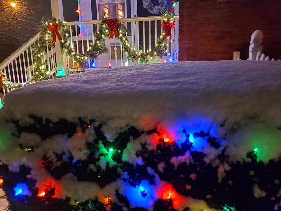
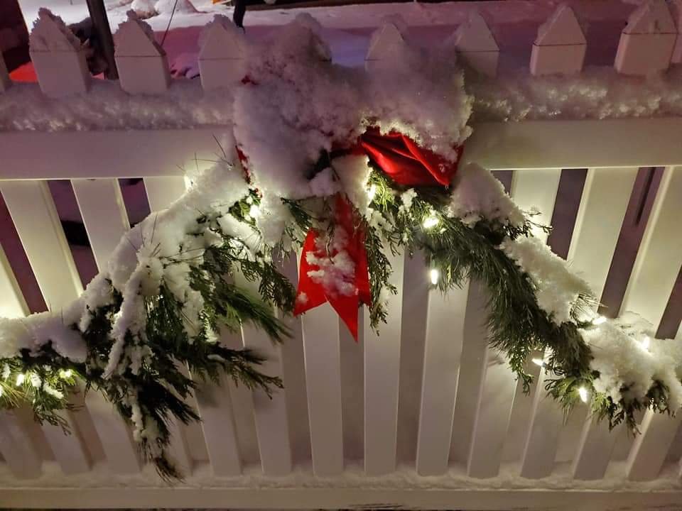
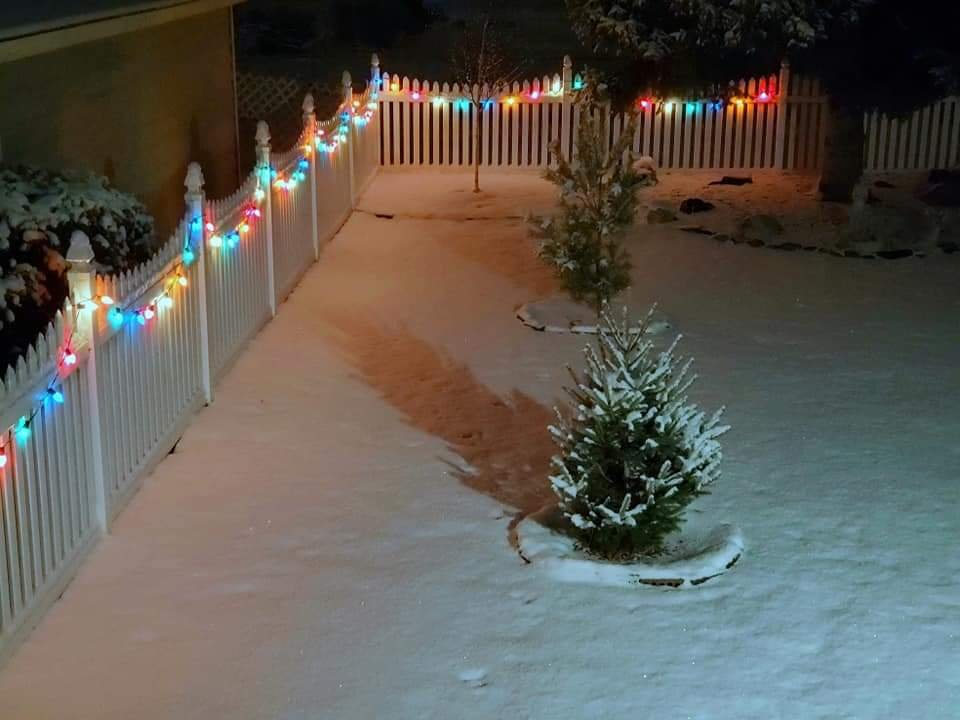
Continued snowing beautifully all day today. I think it's finally ending. Over the last 2 days we have grinded and I mean grinded out 3.1" of snow total. Seaaon at 9.3" to date. Nevertheless it has been a snow globe and it was beautiful and I just love looking at the Christmas decorations in fresh snow.
-
I just meant a death band sets up anyone outside of it will be jealous.
-
if a storm of that type happened in this subforum, even a watered down version, you'd have some mighty unhappy posters and some ecstatic ones lol. A death band of 35-40" with a pedestrian foot just a short distance away.
-
Winter 2020-21 Medium/Long Range Discussion
michsnowfreak replied to Hoosier's topic in Lakes/Ohio Valley
95-96 was terrible for snow. it was by far and away the most screwzone winter I've ever witnessed. the screwzone was Chicago to Detroit corridor. DTW only saw 27.6" of snow despite a cold winter and record snow in the upper Midwest and east coast. Only good think was an unexpected March 20 blizzard (or else we could have had a 20" season). I was only 12 at the time, and we've more than made up for it since then (the joke about the SE MI Snowmagnet)...but if I ever see a repeat i won't be all positivity like everyone thinks I am lol. Sounds good to me going into a new year. I'll take my chances with average temps in a nina! -
Winter 2020-21 Medium/Long Range Discussion
michsnowfreak replied to Hoosier's topic in Lakes/Ohio Valley
do you have a list of modoki ninas? I'm unfamiliar with which years. its mid December rogue, its not staying quiet for the entire winter. -
Winter 2020-21 Medium/Long Range Discussion
michsnowfreak replied to Hoosier's topic in Lakes/Ohio Valley
I agree. We have sort of lucked out in SE MI with 3 snowfalls so far, and there was a nice snow in a narrow band in Madison this week...but its largely been a crappy start for the midwest. not to say there won't be screwzones, but this quiet will not continue in a nina in the Midwest all winter. -
Damn I wish I was in Binghamton. Here light snow has now been falling for 29 hours and counting lol. Just over 2" in total though it is the classic Christmas "mood snow" like they show on every movie ever invented that takes place during Christmas.
-
picked up 1.5" of sugar snow. Still snowing so may grind out more. Its the kind of snow that literally has the look and consistency of sugar. no fluff factor. Regardless it made for a beautiful evening last night for Holiday nights at Greenfield village. Driving sugar snow plus breathing thru a mask, not a great time to wear glasses

