

pasnownut
-
Posts
10,322 -
Joined
-
Last visited
Content Type
Profiles
Blogs
Forums
American Weather
Media Demo
Store
Gallery
Everything posted by pasnownut
-

Central PA Autumn 2024
pasnownut replied to Itstrainingtime's topic in Upstate New York/Pennsylvania
This is why I was poo poohin Mitchy poos post yesterday about not much to see. In the end he may well be spot on....but its not gonna be because the pattern sucks.... just our luck does. -
Central PA Autumn 2024
pasnownut replied to Itstrainingtime's topic in Upstate New York/Pennsylvania
you forgot to add moister. the GFS. It got moister too....check qpf panels for the doubters among us. Am I sayin its happenin....no, but I'm not seeing a shutout at all. Small ball can win games too. -
Central PA Autumn 2024
pasnownut replied to Itstrainingtime's topic in Upstate New York/Pennsylvania
aleet aleet.... 13th.... 13 will be the forums new lucky number and will dismantle 12/5 and associated stigmas of the past. -
Central PA Autumn 2024
pasnownut replied to Itstrainingtime's topic in Upstate New York/Pennsylvania
384 hr gfs rolled forward is an out and out blizzard on the 13th. -
Central PA Autumn 2024
pasnownut replied to Itstrainingtime's topic in Upstate New York/Pennsylvania
Well I'm in the all guidance camp as one has not been proven to be empirical in verification vs others, and IF one looks at ALL model guidance (OP/ENS) and couples that with tellies, once again the word workable comes to mind. Based on current Enso and influence of MJO possibly being a bit muted, I'll take a - AO/ + PNA and roll w/ it as long as we can. Deep winter it may not be, but workable IMO. -
Central PA Autumn 2024
pasnownut replied to Itstrainingtime's topic in Upstate New York/Pennsylvania
I'm not sure what you are looking for, but most guidance (both Op and ENS), have predominant troughing here in the east w/ cold close enough to get it done with the right timing (as always). Personally i dont need northern FL under freeze warnings. Just need it cold enough to snow....and I see heights largely supportive of a workable regime. Of course there can be a relaxation here and there, and the only one that I saw was followed by deep blues returning or rather constant at 850mb and this oozes something we havent had for a while....clippers as its largely norther stream driven. -
Central PA Autumn 2024
pasnownut replied to Itstrainingtime's topic in Upstate New York/Pennsylvania
I'm not at all bothered by nooner trends. GFS/CMC/ICON/GEM not too far off, and ticked in the right direction. Wouldnt be too surprised if we back into a little sumthin for turk day for true CTP'rs. Regardless I'm headed to cabin Friday morning and looks like it'll be just in time for first notable LES event of the season. Happy short week to all, and to those already on PTO....enjoy. -
Central PA Autumn 2024
pasnownut replied to Itstrainingtime's topic in Upstate New York/Pennsylvania
Tis the season..... Getting closer though. -
Central PA Autumn 2024
pasnownut replied to Itstrainingtime's topic in Upstate New York/Pennsylvania
Plenty enough of a signal to keep our interest. 6z GFS again shows the dual wave solution so those who want turk day snow get it, and those who want to wait till black friday....get their chance too . Overnights def show the event, but diverge which one and when as icon is thurs and CMC is Friday. To me its them trying to figure out which wave to focus on, as you can see 2 areas of energy on maps. plenty of time to sort out, but fun to watch. -
Central PA Autumn 2024
pasnownut replied to Itstrainingtime's topic in Upstate New York/Pennsylvania
As Mitch pointed out earlier, early looks are already being revisited due to ENSO (or lack thereof), so yeah, like you, I'ma gonna take it as it comes and hope for surprises, or futher tweaking of long lead forecasts (Weather World was quite the Debbie....) -
Central PA Autumn 2024
pasnownut replied to Itstrainingtime's topic in Upstate New York/Pennsylvania
511 cam east of mansfield due east is lookin rather snowy. Steady light snow continues and sets my mood just right. Thanks Mo Nature. -
Central PA Autumn 2024
pasnownut replied to Itstrainingtime's topic in Upstate New York/Pennsylvania
I like how you think. You should be a lawyer in your next life. Yeah, as there seems to be some correcting going on wrt ENSO, slight nina can be workable. Just need AO to frequently peturb polar regions and keep that cold conveyor belt working. BTW win down here. frosted roofs noted on way into office. Perty. Happy Friday all -
Central PA Autumn 2024
pasnownut replied to Itstrainingtime's topic in Upstate New York/Pennsylvania
Yep. Where the boundary sets up follow Tuesday event will be what to watch. Historically we seem to underperform in that regard, so that's the first fly in the ointment that we'll need to work through. Fortunately some runs have it notably south, so nothing set in stone by any means. edit, looks like this was just stated by Bub -
Central PA Autumn 2024
pasnownut replied to Itstrainingtime's topic in Upstate New York/Pennsylvania
Hi res NAM, still has 2 qpf max's first one is poconos w/ SLP placement just puking snow on them, but as SLP goes retro on us, wraparound surely favors somerset/laurels. My pal just bought a place in Terra Alta WV, and they think 12+ as he sits right up top. He's not going to be down for this one, but i told him that i'd be inviting myself sometime when a good ol upslope event looms. getting snowed in is fun stuff, and sorely missed. -
Central PA Autumn 2024
pasnownut replied to Itstrainingtime's topic in Upstate New York/Pennsylvania
Nope. Never did it. yep, cabin in for a good shellacking as we sit at 2275'. I go up next Friday. Didnt put the plow on the UTV, and wondering if I may regret that. -
Central PA Autumn 2024
pasnownut replied to Itstrainingtime's topic in Upstate New York/Pennsylvania
yeah poconos have been where i've always thought the best accums may come from. Of course somerset (seven springs) will try to 1 up em. Will be fun to see how it evolves, but base on LP sitting over eastern pa, chips pushed to NE for me. Awesome to see other opps lining up for next week n beyond. Cant ask for more as we are just getting started. Happy pre friday all. -
Central PA Autumn 2024
pasnownut replied to Itstrainingtime's topic in Upstate New York/Pennsylvania
at this range, plenty of waffling expected. As suggested by a few, Op/Ens are seeing the storm, and the pattern is close enough to get it done, so that's good enough for now. Lets just enjoy the chase, and hope for the best (well that's what I'm doin anyway). -
Central PA Autumn 2024
pasnownut replied to Itstrainingtime's topic in Upstate New York/Pennsylvania
No matter how it plays out down here, I'm with ya, to be considering the prospects of snow....is a big win. Good luck to all and if this one isnt yours, maybe the next one will be as a couple shots of fun may be looming in next 2 weeks. Good enough for me. -
Central PA Autumn 2024
pasnownut replied to Itstrainingtime's topic in Upstate New York/Pennsylvania
Cant believe not a chirp about next friday's shop till ya drop...or get buried in a snow drift special. many this place IS rusty.... LFG -
Central PA Autumn 2024
pasnownut replied to Itstrainingtime's topic in Upstate New York/Pennsylvania
lol. I fully know, and chuckled, but dont want others to think less of me than they already do.... so in fear of being cancelled...."I responded appropriately" -
Central PA Autumn 2024
pasnownut replied to Itstrainingtime's topic in Upstate New York/Pennsylvania
Oh stop....I'm not that guy..... Snowmap for period in question is fun to look at. -
Central PA Autumn 2024
pasnownut replied to Itstrainingtime's topic in Upstate New York/Pennsylvania
In the spirit of thanksgiving, feels somewhat appropriate.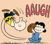
-
Central PA Autumn 2024
pasnownut replied to Itstrainingtime's topic in Upstate New York/Pennsylvania
posted link above. Go look at the 222 thru 240 panels on GooFuS. that should get the chatter up....for the next 6 hrs. anyway. -
Central PA Autumn 2024
pasnownut replied to Itstrainingtime's topic in Upstate New York/Pennsylvania
Happy White Friday. https://www.tropicaltidbits.com/analysis/models/?model=gfs®ion=eus&pkg=mslp_pcpn_frzn&runtime=2024112012&fh=222 -
Central PA Autumn 2024
pasnownut replied to Itstrainingtime's topic in Upstate New York/Pennsylvania
Loonngggg duration advisory as its a 2 pronged event. thinking better chances of accums on part 2 as column would be better cooled. Just my hunch.



