colonel717
-
Posts
2,928 -
Joined
Content Type
Profiles
Blogs
Forums
American Weather
Media Demo
Store
Gallery
Everything posted by colonel717
-
He goes by Western Pennsylvania Weather Forecaster on facebook
-
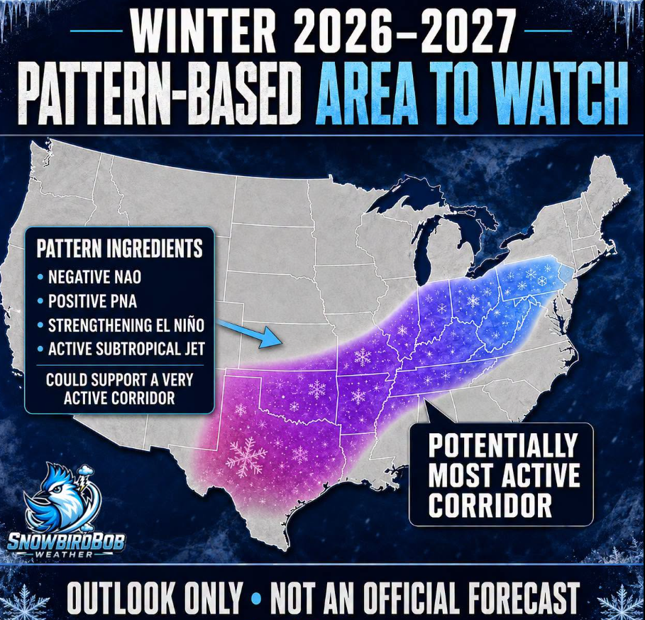
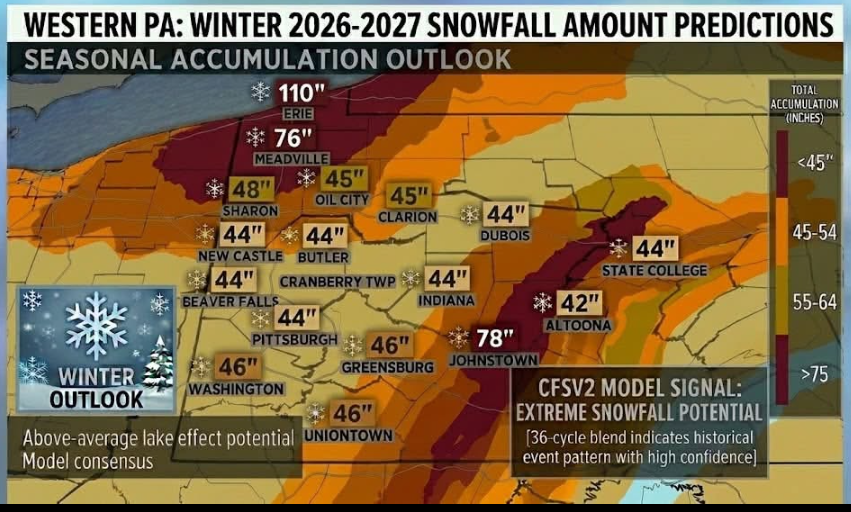
FINAL OUTLOOK FOR WINTER 2026-2027 (Western Pennsylvania Weather Forecaster) UPDATED!!!!! The threat of a polar vortex setting up in later November through mid December is looking a bit more likely. [OVERALL OUTLOOK] -December could start with early season arctic blasts and a potential early winter storm with Milder periods possible . It will began to get cold with frequent winter storms in mid January-March with polar vortex disruptions. Winter storms could include messy mixtures of sleet, freezing rain, and snow. The atmosphere will be well loaded with moister due to the super El Niño. With polar vortex disruptions, this will increase the chances for bigger snowstorms (8-12 Inches+). Above average snow likely with 45-55 inches of snow expected for the season. 140% of average snow. [MOTHLY OUTLOOK] {DECEMBER} - Potential for colder and snowier start due to the Polar Vortex then normal across much of the area. Temps could get very cold at times. Potential for Milder periods. Some winter storms possible mainly mixing or ice/snow. {JANUARY} -Colder with the threat of several winter storms. These could include mixtures of rain/freezing rain/sleet/snow especially in northwestern Pa. Southwestern Pa would have the higher chance of seeing all snow events or rain transitioning to snow events. {FEBRUARY} -Coldest air of winter will arrive in strong arctic blasts. Most Winter storms will more likely be all snow. Northwestern Pa could see storms mixing with ice. Potential for a few significant winter storms bringing as much as 12 inches + of snow in some areas. {MARCH} -Off and on arctic blasts with swings of warm and cold likely. Winter storms possible early month. Temperatures warm near the end of the month.
-
Judah Cohen blog https://published.aer.com/aoblog/aoblog.html Plain Language Summary The widespread warmth across the Northern Hemisphere (NH) this past summer and now the fall has continued into October (see Figure). However, a series of stretched polar vortex (PV) this month has led to some, albeit modest cooling in Siberia, East Asia and to an even lesser extent far Eastern Canada and New England (see Figure). However, one last stretched PV will bring more intense cooling to Siberia and East Asia and yet again more modest cooling to far eastern Canada and New England (see Figures 3 and 6). Some blocking in the North Atlantic and near Scandinavia will also bring colder temperatures to Europe (see Figure 9). But all eyes then turn to a much larger disruption of the PV that is likely to have an important influence on NH weather late November into December.
-
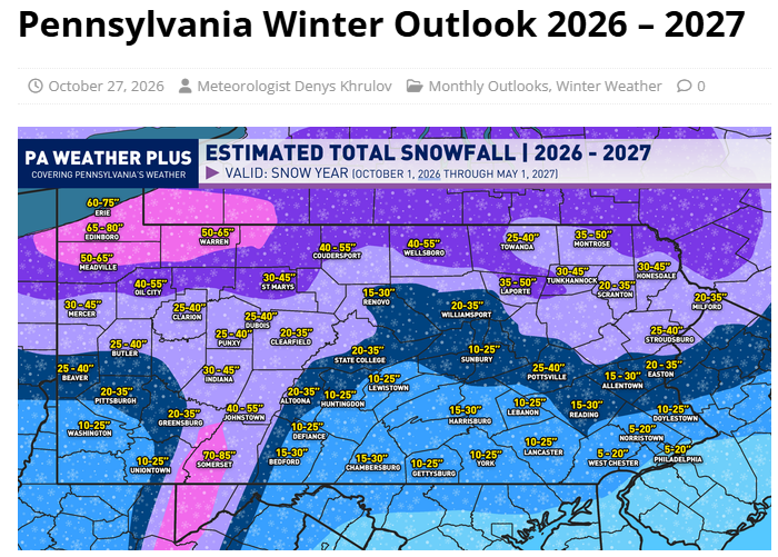
https://paweatherplus.com/pennsylvania-winter-outlook-2026-2027/
-
Weather Sentinel "Big developments are beginning to emerge in the northern hemisphere. It appears as if we may be looking at a weakening of the polar vortex. This is a very anomalous situation as most El Niño winters do not feature this kind of event. This would literally throw a monkey wrench into the seasonal forecasts . This anticipated stretching and weakening of the polar vortex is exactly what happened last winter . Combining a weak vortex or an out right splitting of the vortex with this El Niño could trigger catastrophic winter storms over the Northeast . Personally I’m not super surprised this is occurring or may occur. One of my analog seasons was the 2009/10 one . This was because of a El Niño coupled with a negative phased Atlantic oriented ocean . I also believe the negative Pacific Decadal Oscillation is playing into this and maybe the actual cause of this vortex stretching out and weakening. No two El Ninos are ever alike . Even the 82/83 and 97/98 were different from each other . So how will this change the winter ? Number one is the anticipated moisture flow could be affected and be colder despite the warm Pacific air getting sucked into the US . More likely than not this could be a very volatile situation and may spawn some nasty severe weather over the south east not to mention snow in the north. Another developing situation is the Siberian snow pack . It is progressing at a pace not seen since 2015 and is more on par with 2009 by all accounts. This snow pack is also anticipated to grow exponentially in the next few weeks. This matters as this region is the source of most of the cold air that eventually makes its way into the US in winter . More snow cover equals more cold . If you like snow then the stars may be aligning for a big season this year. This could very well range from west to east . More than anything it looks volatile. I think this may lead to more snow getting into the I-95 corridor and possibly further south . At this stage I believe the Mid Atlantic will be the bullseye. I will be updating this information as it becomes available."
-
Chad Merrill senior meteorologist and long-range expert at AccuWeather says “we’re looking at a very warm winter ahead.” https://www.audacy.com/kdkaradio/news/local/pittsburgh-winter-forecast Merrill breaks it down month by month: End of October: Expect a cold snap around Halloween that lasts into early November before warming up again. November: “November will bring a couple of cold days and probably the first snow of the season, sometimes in the middle-to-later part of November.” December: Merrill expects temperatures to be three-to-four degree above average. “It will be one of the warmest months of the winter season.” January: Two-to-three degrees above average February: A degree or two above average. That doesn’t mean it won’t be cold, or even freezing at times, but Merrill doesn’t expect a long, sustained deep freeze this winter. Snow forecast: 20 to 35 inches of snow is expected, which is well below the average of around 44 inches. “We are looking at three to five days with two inches of snow, last year, over seven,” said Merrill. He adds there will be 20 to 30 days of getting a tenth of an inch. That’s lower compared to the 39 we had last year. Merrill says the reason for the above average temperatures is “very strong” El Nino. With that El Nino will mean more moisture in our area, and with above average temperatures, that means rain, with Merrill saying there could even be some thunderstorms in the winter. With above average temperatures expected, that doesn’t mean there won’t be cold streaks. Merrill expects colder air to come though in time for Christmas heading into 2027.
-
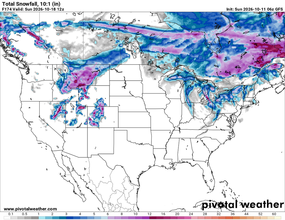
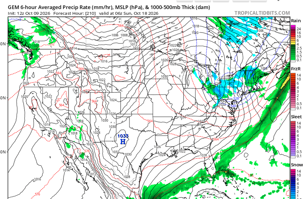
First lake effect next Saturday? Not buying any accumulation but could be some heavier bands.
-
Lets hope that happens with the snow this winter.
-
Maybe some flakes next weekend.
-
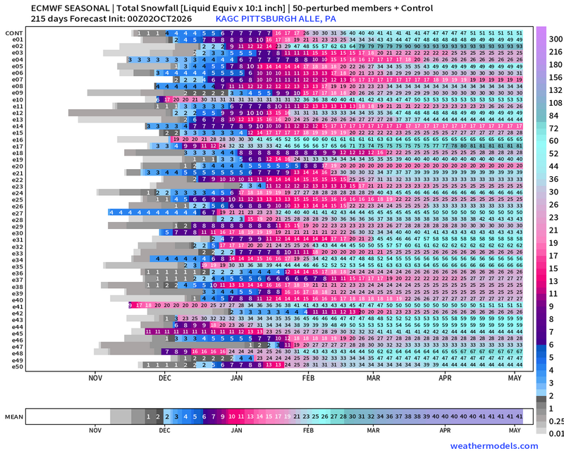
The mean improved by 2 inches from September one.
-
-

Pittsburgh PA Summer 2026 Thread
colonel717 replied to TheClimateChanger's topic in Upstate New York/Pennsylvania
Some big potential in some of these.
-
Pittsburgh PA Summer 2026 Thread
colonel717 replied to TheClimateChanger's topic in Upstate New York/Pennsylvania
https://www.severe-weather.eu/long-range-2/winter-2026-2027-first-forecast-super-el-nino-polar-vortex-snow-cold-united-states-canada-europe-fa/ Winter 2026/2027 First Forecast: Super El Niño Drives a Major Weather Divide -
Pittsburgh PA Summer 2026 Thread
colonel717 replied to TheClimateChanger's topic in Upstate New York/Pennsylvania
https://x.com/WeatherCast3/status/2089934351911858402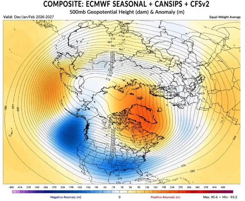
-
Pittsburgh PA Summer 2026 Thread
colonel717 replied to TheClimateChanger's topic in Upstate New York/Pennsylvania
I'm not used to all of the snow positivity this far in advance for winter. Being set-up for the ole rug pull...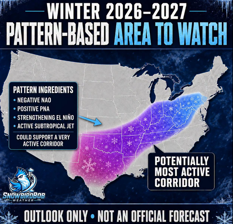
-
Pittsburgh PA Summer 2026 Thread
colonel717 replied to TheClimateChanger's topic in Upstate New York/Pennsylvania
Looks like CPa and west could have snowy Dec -
Pittsburgh PA Summer 2026 Thread
colonel717 replied to TheClimateChanger's topic in Upstate New York/Pennsylvania
The clickbait sites hype begins,,, -
Pittsburgh PA Summer 2026 Thread
colonel717 replied to TheClimateChanger's topic in Upstate New York/Pennsylvania
Surprised we are seeing some positives in the long range models at this point for winter. We will see if we get surprised. https://www.farmersalmanac.com/farmers-almanac-2026-2027-winter-weather-forecast Winter 2026–2027 is shaping up to be a season of sharp contrasts, with an active southern storm track, quick bursts of snow and bitter cold across the North, and a tricky mix of rain, sleet, ice, and heavy wet snow in the Northeast. Keep the shovel, rain boots, and ice scraper close—this winter may bring plenty of surprises. A Tricky Winter for the Northeast The Northeast may face one of the season’s most complicated winter patterns. Coastal communities could receive more rain or mixed precipitation, while inland areas may be hit by several rounds of heavy, wet snow—particularly during January and February. Small shifts in storm tracks and temperatures could make the difference between rain, sleet, freezing rain, and accumulating snow. Residents should be prepared for forecasts to change quickly as storms approach.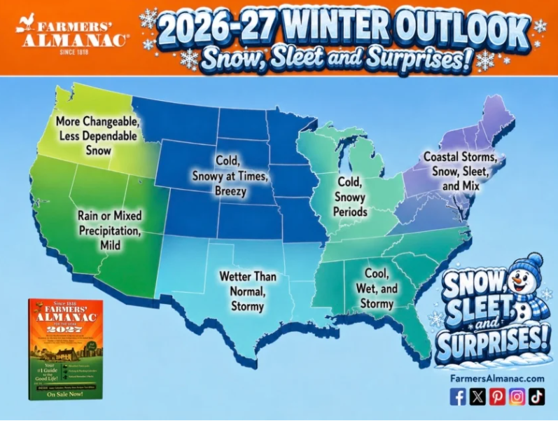
-
I think there will be additional chances especially for your area around 4/28-5/3
-
Looking at some initial signs for next winter JAMSTEC April update includes first DEC-FEB forecast.
-
Snow in May...? May see some flakes early next week. I have no desire for A/C weather. Have not turned it on yet, but may need to this week. The polar vortex split attempt (wave-2) that occurred back in early Feb will significantly impact our large-scale wx pattern in late Apr & May as the circulation & temperature anomalies from it propagate into the troposphere, leading to increased high-latitude blocking (-NAO/-AO) https://x.com/webberweather/status/2042246921671336290?
-
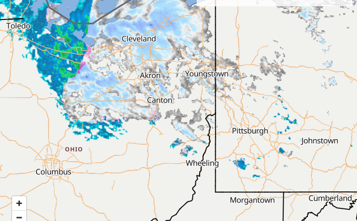
Looks like we could see some decent squalls if they hold together
-
I am not ready yet...I have been getting some sleet and some heavier snow squalls. I'm good with not getting fully into spring for a few more weeks.
-
Pittsburgh/Western PA WINTER ‘25/‘26
colonel717 replied to Burghblizz's topic in Upstate New York/Pennsylvania
Love these squalls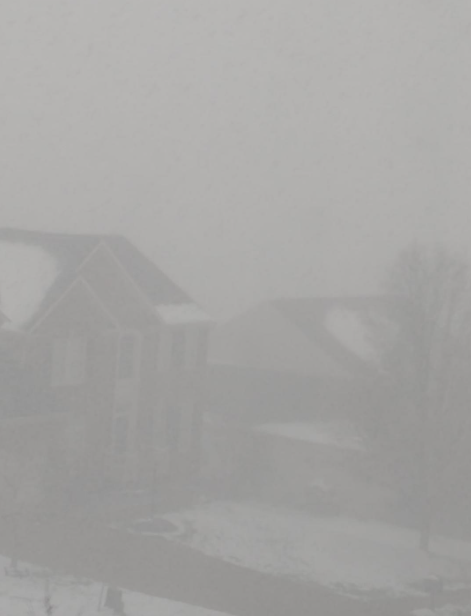
-
Pittsburgh/Western PA WINTER ‘25/‘26
colonel717 replied to Burghblizz's topic in Upstate New York/Pennsylvania
Heavy snow here, Wow. Almost whiteout.