

CentralNC
-
Posts
763 -
Joined
-
Last visited
Content Type
Profiles
Blogs
Forums
American Weather
Media Demo
Store
Gallery
Everything posted by CentralNC
-

The “I bring the mojo” Jan 30-Feb 1 potential winter storm
CentralNC replied to lilj4425's topic in Southeastern States
Sorry about that...1993 -
The “I bring the mojo” Jan 30-Feb 1 potential winter storm
CentralNC replied to lilj4425's topic in Southeastern States
3/13/1993 had a blizzard warning in Guilford and Forsyth counties -
2025-2026 Fall/Winter Mountain Thread
CentralNC replied to Buckethead's topic in Southeastern States
Dang Jefferson with SN+ at 6pm CITY SKY/WX TMP DP RH WIND PRES REMARKS ASHEVILLE CLEAR 17 8 67 N9G25 30.13R WCI 6 JEFFERSON HVY SNOW 10 6 83 W12G23 30.01R VSB 1/4 WCI -5 MORGANTON PTCLDY 23 8 51 W5 30.22R WCI 17 HICKORY CLEAR 22 5 48 NW17G29 30.17R WCI 8 WILKESBORO CLOUDY 21 10 63 MISG 30.20R RUTHERFORDTON CLEAR 23 10 58 W8G16 30.21R WCI 14 BOONE N/A N/A N/A N/A MISG N/A -
I don't envy you, but I ain't no rookie. Turned 66 today and have been screwed by these storms more often than I can count. Why don't I move to where it actually snows....I have no idea.
-
Same here. Have post storm blues as it is...
-
Southern Crippler - Get well soon Jimbo Storm Obs
CentralNC replied to BooneWX's topic in Southeastern States
31 here. NW winds have picked up significantly in the last hour -
The “I bring the mojo” Jan 30-Feb 1 potential winter storm
CentralNC replied to lilj4425's topic in Southeastern States
Mods, can we pin this? -
If only...
-
Southern Crippler - Get well soon Jimbo Storm Obs
CentralNC replied to BooneWX's topic in Southeastern States
Ripping sleet in Lewisville. Temp went up 3 degrees as heavy sleet brings down some of the warmer air above. -
Southern Crippler - Get well soon Jimbo Storm Obs
CentralNC replied to BooneWX's topic in Southeastern States
This bad boy putting down some serious sleet at my house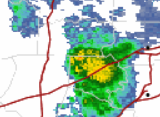
-
Southern Crippler - Get well soon Jimbo Storm Obs
CentralNC replied to BooneWX's topic in Southeastern States
17 degrees with a mix of sleet, pillars, needles, and snowdust here in Lewisville. -
Southern Crippler - Get well soon Jimbo Storm Obs
CentralNC replied to BooneWX's topic in Southeastern States
Nada in Lewisville. 24 degrees -
Southern Crippler - Get well soon Jimbo Storm Obs
CentralNC replied to BooneWX's topic in Southeastern States
Anyone know what app to use to display Mping reports? -
Yeah just looked at Pidgeon Forge Webcam and ain't nothing happening there yet
-
Southern Crippler - Get well soon Jimbo Storm Obs
CentralNC replied to BooneWX's topic in Southeastern States
Dalton, GA reporting Mixed precip at 6am. Earlier than expected I think. -
Love this blurb from RAH disco. I have said all along that sleet is going to save my area from crushing ZR. Of course not too far from me it's going to be lights out. Area Forecast Discussion National Weather Service Raleigh NC 457 AM EST Sat Jan 24 2026 .WHAT HAS CHANGED... As of 400 AM Saturday... * There will probably be a corridor of more sleet accumulation at the expense of freezing rain accrual than currently forecast, probably over a portion of the nw Piedmont. This probability is not explicitly forecast at this time; and it may not be until the nowcasting phase, when observational trends indicate when and where it may occur. * No notable changes have otherwise been made to the ongoing forecast.
-
Southern Crippler - Get well soon Jimbo Storm Obs
CentralNC replied to BooneWX's topic in Southeastern States
Looks at these 4am obs though. Cold air is screaming down the lee side. And those DPs! CITY SKY/WX TMP DP RH WIND PRES REMARKS WASHINGTON NAT PTCLDY 14 -9 35 N24G30 30.60R WCI -5 DULLES PTCLDY 11 -10 38 N15G23 30.60R WCI -5 ANDREWS AFB PTCLDY 14 -13 30 N17 30.55R WCI -3 QUANTICO CLEAR 16 -10 31 N20G33 30.59R WCI -1 COLLEGE PARK* PTCLDY 13 -12 32 N16 30.61R WCI -3 LEESBURG* PTCLDY 10 -6 48 MISG 30.61R MANASSAS* CLEAR 13 -8 39 N17 30.61R WCI -4 GAITHERSBURG* PTCLDY 9 -10 42 VRB6 30.57R WCI -1 -
Southern Crippler - Get well soon Jimbo Storm Obs
CentralNC replied to BooneWX's topic in Southeastern States
41, noticed Raleigh is already colder than me -
Raleigh disco out https://forecast.weather.gov/product.php?site=NWS&issuedby=RAH&product=AFD&format=CI&version=1&glossary=0&highlight=off
-
Brick keep bringing the hopium for us. I never get tired of it.
-
2025-2026 Fall/Winter Mountain Thread
CentralNC replied to Buckethead's topic in Southeastern States
Yeah and very low dew points not too far away. -
Im a Bills fan! You want to talk about disappointment? We apparently live for it
-
GSP disco is out. Man, they are really struggling with this one https://forecast.weather.gov/product.php?site=NWS&issuedby=GSP&product=AFD&format=CI&version=1&glossary=0&highlight=off
-
Maybe this will be the Miller A we have been wishing for. I bet it gets suppressed.
-
Yeah I think in general this is not being emphasized by the NWS, but in time they will.


