

CarlislePaWx
-
Posts
2,417 -
Joined
-
Last visited
Content Type
Profiles
Blogs
Forums
American Weather
Media Demo
Store
Gallery
Posts posted by CarlislePaWx
-
-
24 minutes ago, canderson said:
WTF I’m at 90 now
I'm right there with you with my temp at 88.9. Interestingly the dew point has been dropping slowly and is now down to 64. So, heat index virtually the same as the temp.
-

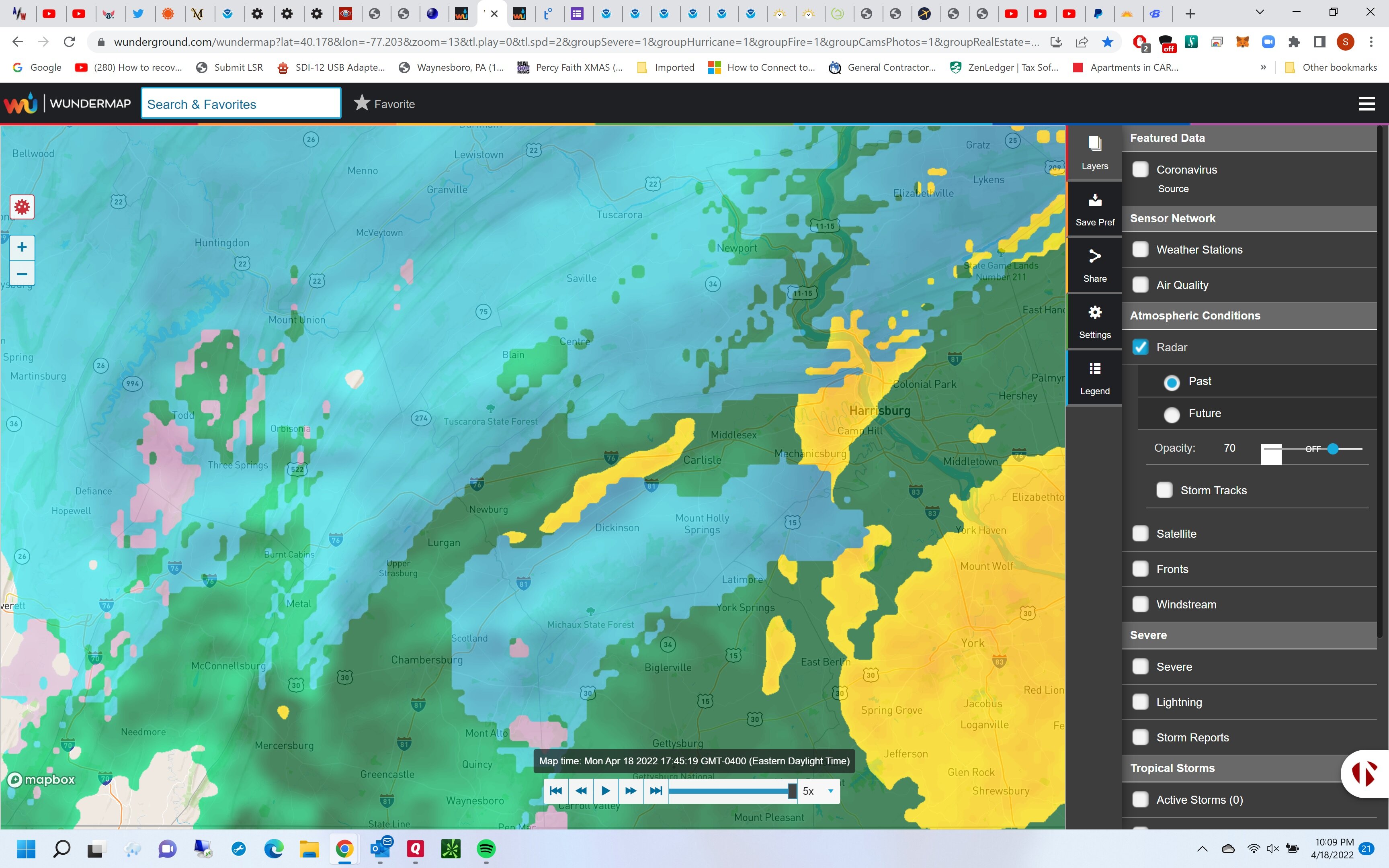
Here's a good example of the flood watch. Pretty much the central third from NY border to M/D line (and beyond into northern Virginia).
-
Temp up to 75.6 as the sun emerged from the overcast about 30 minutes ago. I have a Flood Watch out for me until 11:00pm. Haven't looked at anything yet. It's been a pretty dry June so far with only 1.24" for the first 3/4ths. That's the polar opposite of last month with 6.78". Grass is still green here and growing.
-
90.9 for my high. Temp down to 80 on the way down to 60 by morning. Dew point in the last 12 hours has dropped from a morning high of 73, now down to a wonderful 53! Love it. Might have a shot at upper 40's either Sunday or Monday morning. Very refreshing indeed.
Meanwhile...18z GFS develops a hurricane north of Cuba and runs it northwest through the east-central gulf coming ashore around the western panhandle of Florida with a pressure of 971 millibars, 2 weeks from today. I have to go find how what that pressure is on the saffir simpson scale. It has to be a major hurricane. Guessing between a 3 and 4.
Edit>>Whoops. 971 is a Cat 2, so not even a major.
-
1 minute ago, Bubbler86 said:
84 in the Ville. I think we may make it but it may only be for an hour or two until the dryer/cooler air starts filtering in.
I don't know about cooler, but the drier air has begun to filter in here. A few hours ago the dew point was 73. Now it's down to 66 and going down fairly fast. Temp holding at 87.3.
-
 1
1
-
-
14 minutes ago, Anduril said:
Sorry yea I meant severe based on winds not sure how they rate on hail alone
I believe it's hail of 0.75" or greater to be a severe thunderstorm (with or without the wind gusts).
-
Literally the western edge of the storm passed over me, but while my lightning detector has been going off like crazy...3500+ strikes in the past hour, it didn't stay over me long enough to even produce a sprinkle.
This morning I had my warmest overnight low for the season-to-date at 72.1 degrees. High temp this afternoon of 84.2. Looks like some fantastic weather on tap for this weekend. Low 70's with dew points in the 40s, sunshine, with a bit of wind. But it doesn't get much better than this for early summer.
-
Another tornado watch until 11:00pm. This is like the third one this season. Mostly cloudy and 82 here at the moment.
-
1 hour ago, Mount Joy Snowman said:
Yeah it must have, but you wouldn't have known that with how it blossomed on the radar right over us. A bit of fool's gold, but still pleased to get some beneficial rains. I'm running pretty much right at average for the year, with 18.24" YTD.
Wow! I had 0.30" since midnight with 0.10" yesterday. For the month I'm only at 1.24" and for the YEAR I am 18.23".!!

-
 1
1
-
-
I don't think I've ever seen a low pressure (in June!) that looks like a clipper come down from the northwest and slice through PA while central pressures drop to the low 990's. It looks so weird.
Another thing I haven't seen (though I'm sure it's happened before) are such widespread temps over 100 in so many states. It looks like all of Georgia is over 100 degrees at 2:00pm Tuesday. Absolutely crazy...lol.
BTW, I've had a trace of rain here since midnight. Over the last 3 days I've only had just under 0.25". Low this morning was 56, currently 65 with the sun trying hard to make an appearance, yet still overcast.
-
@Bubbler86, @canderson, @TheDreamTraveler...
Thank you for your comments & well-wishes. I can definitely attest to the bitter taste the Paxlovid leaves in your mouth when you aren't eating or drinking something. Very yuck. After 3 days on it, it does seem to have stopped the progression of the virus. Did I mention that my wife became positive yesterday? She's on the med now also and confirms the bitter taste. She's doing quite a bit better than me...enough that she was able to work today. I'm pretty sure I have bronchitis now. I get it whenever I have a bad cold. I have to be careful because it can progress to pneumonia. So far things seem to have stabilized. Perhaps I'm nearing the peak.
As far as weather, today was my warmest day of the year so far with a high of 93.6 degrees. At least dew points remained in the mid 60's which kept the heat index down close to the air temp. Looks like relief is just a few days away. Only 90 days to the start of met fall !!
-
4
-
-
90.9 degrees for my high today. Yesterday's high was 82.0. Low this morning was 53.4.
May has easily been the wettest month of 2022 so far, with 6.78". More than half of that fell in that 2-day deluge earlier in the month. My annual precip to date is 16.99", which is pretty close to average for the first 5 months of the year.
Hope everyone is enjoying the beautiful weather. Unfortunately, I am not. Yesterday I tested positive for Covid and today my wife did as well. My doctor gave me a new Pfizer med called Paxlovid. It's a 5-day course that is supposed to stop the progression of the virus in those who are at risk. I meet the criteria for age, plus I have asthma and chronic bronchitis. Has anyone else here been treated with Paxlovid? I'm curious as to how effective it seemed to be.
-
7 minutes ago, TheDreamTraveler said:
I thought I was hearing things...hearing some good thunder. A storm popped out of nowhere to my west. I thought that line wasn't going to hit me
Yes, it literally formed right over me. Picked up 0.15". Almost no wind. It's done now and the sun is out. lol
-
1
-
-
Hi guys. Just checking in with my storm stats...
Rainfall yesterday was 2.48"
Rainfall since midnight was 1.09"
Storm total so far = 3.57"
Will this event be another 4"+? We had one such event last year.
-
1
-
-
Just went outside to let the dog out. I thought it was just raining until I glanced at my car windshield and it was covered in sleet. At the same time I heard crackling beneath my feet as I walked along my driveway. This much sleet will easily qualify for an official frozen measurement of 0.1". Temp holding steady at 34.3. Total liquid so far today has measured 0.61". Could there be a white surprise come tomorrow morning?
-

Look at this wild radar with the donut hole of snow surrounded by heavy rain.
-
Moderate to occasionally heavy rain, mixed with sleet continues to fall here in Carlisle just before 10:00pm. The temperature has been slowly falling back down from the earlier 36 degrees back around 5:00 now down to 34.3. BTW my low here this morning before the clouds rolled in was 26.4 making today really feel like February. No accumulation here today though it did snow for quite a few hours early to mid afternoon. That deformation band really does look nice affecting parts of our area during the night. I just forgot the model Bliz just showed where my area is still forecast to receive 4" of accumulation by morning. I'll be happy to wake up to a coating to maybe a half-inch.
Then it's off to Lake Wales / Winterhaven Florida later tomorrow morning. This intensifying coastal is sending a strong cold front down through most of the peninsula which will lead to glorious weather with highs in the low 80's and lows around 60 with lots of sunshine through the rest of this week. Very excited to visit a close childhood friend I haven't seen in over 20 years. He's my NWS friend who just retired last year from the Blacksburg, VA forecast office after nearly 20 years as the meteorologist-in-charge there.
-
1
-
-
URGENT - WINTER WEATHER MESSAGE
National Weather Service State College PA
239 PM EDT Mon Apr 18 2022

PAZ026>028-035-036-050-056-063-064-190000-
/O.EXB.KCTP.WW.Y.0019.000000T0000Z-220419T0000Z/
Huntingdon-Mifflin-Juniata-Fulton-Franklin-Snyder-Perry-
Cumberland-Adams-
Including the cities of Huntingdon, Mount Union, Lewistown,
Mifflintown, McConnellsburg, Chambersburg, Selinsgrove, Newport,
Carlisle, and Gettysburg
239 PM EDT Mon Apr 18 2022

...WINTER WEATHER ADVISORY IN EFFECT UNTIL 8 PM EDT THIS
EVENING...

* WHAT...Wet snow. Additional snow accumulations of up to one
  inch. Total snow accumulation 1 to 3 inches.

* WHERE...Portions of central Pennsylvania. Heaviest snowfall at
  higher elevations.

* WHEN...Until 8 PM EDT this evening.

* IMPACTS...Plan on slippery road conditions. The hazardous
  conditions could impact the evening commute.

PRECAUTIONARY/PREPAREDNESS ACTIONS...

The Pennsylvania Department of Transportation and Pennsylvania
Turnpike Commission remind motorists to adjust speeds based on
driving conditions as winter weather impacts will include snow
covered roads and limited visibility.
-
1
-
-
Hey...I just got a text that Cumberland county is now under a winter weather advisory until 8:00pm this evening! I'm sure someone else will post the particulars soon.
-
There's an amazing difference between relatively warmer temps to my east while everyone to my west and southwest is between 32 and 33 degrees.
It's been 100% snowing here for over an hour. However, the temp has only dropped to 34.3 and it's not heavy enough to accumulate yet. It's fascinating seeing places south of me along the I-81 corridor colder. I just need heavier rates to drop the temp further and to get any accumulation going. Mulch still bare.
This morning's HRRR was forecasting 1.00" of all rain for me earlier. That inch of rain falls between 2pm and midnight. Will be interesting to see what happens as the sun begins to sink further. Will have to wait until probably 4 or 5pm for that.
-
1
-
-
An almost frosty (and unexpected) low of 35.6 this morning. But, at 10:30 it has rapidly rebounded up to 61.5. Yesterday was my first official day with a high of 80 or more with 80.1 degrees. 2 days ago (Wednesday) my high was 79.2, which was the warmest day of the year so far, then eclipsed yesterday.
-
3 minutes ago, Blizzard of 93 said:
Meanwhile in North Dakota currently….
Blizzard Warning
URGENT - WINTER WEATHER MESSAGE
National Weather Service Bismarck ND
241 PM CDT Tue Apr 12 2022

NDZ017>023-025-035>037-046-047-050-130345-
/O.CON.KBIS.BZ.W.0005.000000T0000Z-220415T0000Z/
McKenzie-Dunn-Mercer-Oliver-McLean-Sheridan-Wells-Foster-Burleigh-
Kidder-Stutsman-Emmons-Logan-McIntosh-
Including the cities of Fessenden, Harvey, Linton, Killdeer,
Tappen, Mcclusky, Jamestown, Watford City, Hazen, Wishek,
Underwood, Bismarck, Beulah, Carrington, Napoleon, Ashley,
Center, Wilton, Garrison, Halliday, Goodrich, Gackle, Steele,
Strasburg, Washburn, and Turtle Lake
241 PM CDT Tue Apr 12 2022 /141 PM MDT Tue Apr 12 2022/

...BLIZZARD WARNING REMAINS IN EFFECT UNTIL 7 PM CDT/6 PM MDT/
THURSDAY...

* WHAT...Heavy snow and blizzard conditions expected. Total snow
  accumulations between 12 and 24 inches, with locally higher
  amounts up to 30 inches possible. Winds gusting as high as 50 mph.

* WHERE...Portions of west central and south central North Dakota.
Wow. A Blizzard warning that lasts for more than 48 hours until Thursday evening! This must be a cut-off low or something. I haven't looked. Amazing, though.
-
1
-
-
A very chilly 27.3 degrees for my low this morning. Heavy frost everywhere. I'm willing to bet that today is the last day seeing 20's until next fall.
-
@sauss06 Just saw your earlier post about my weather yesterday. The western 1/3 of the county I believe got hit fairly hard. The line weakened a bit as it progressed through. By the time it reached me it was in no way near severe. The winds were piddly throughout the storm. They were nearly calm in the 15 minutes before the thunderstorms arrived and only were maybe 10-15 during them. The winds seem to have returned as I just heard the roar from outside. Gusts at least to 20 for a bit. I think the grids had winds gusting to 30+ the early part of the night, then dropping off during the night. If they don't drop off by 3 or 4am my current 41 will not make it down to the forecast low of 31. Current dew point is 23 so that will help with the drop if the winds go calm.
-
1
-
Central PA Summer 2022
in Upstate New York/Pennsylvania
Posted
0.93" for today. Rained heavily for a while, but not as quickly as others have reported. High made it up to 88.