

IUsedToHateCold
-
Posts
629 -
Joined
-
Last visited
Content Type
Profiles
Blogs
Forums
American Weather
Media Demo
Store
Gallery
Posts posted by IUsedToHateCold
-
-
In the yellows and it continues to pile on. Eyeballing around 6 inches? Probably second best storm I’ve seen since moving here in 2011
-
Just piling up at an incredible rate. Stuck with the toddler and can’t get out to measure but it’s got to be at least 4-5 inches now
-
 2
2
-
-
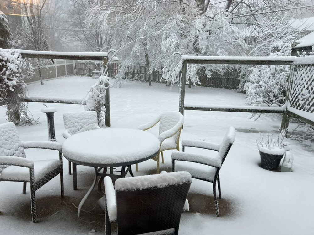
Obligatory deck pic. Eyeballing 3 or so inches. Official measurement soon.
-
4
-
-
On 1/2/2022 at 7:05 AM, NorthArlington101 said:
I'll DM you my handle

Go ahead because I’m already eyeballing 3 inches. Enjoy a drink on me!
-
Roads have caved, snow coming down good. Haven’t been this excited in a long time.
-
2
-
-
4 minutes ago, WxMan1 said:
You're not kidding with the 06Z NAM. We're gonna be right on the edge of that jackpot here in the Crofton-Bowie area.

Yup, talk about living on the edge for now. Looks to be drifting north on the last frame though.
-
Woke up to a decently heavy snow! Eyeballing about an inch or so on the grass and rooftop. Paved surfaces still wet. 32 degrees.
-
2
-
-
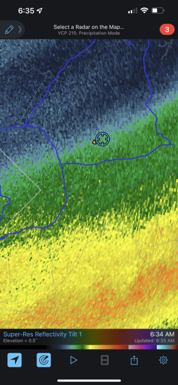
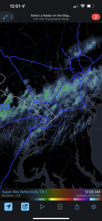
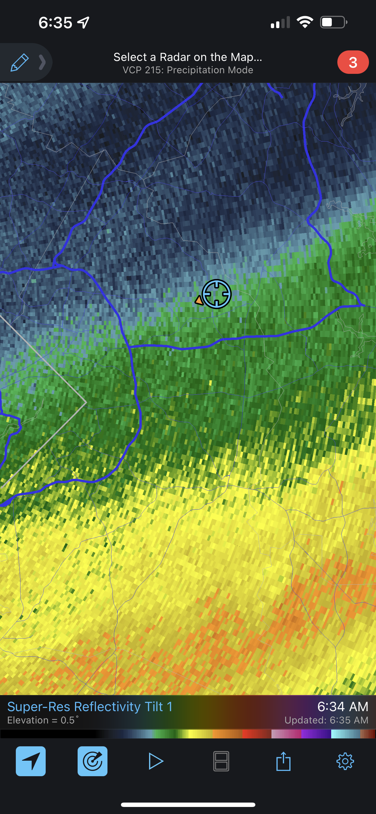
Radar made a fool of my last post. Rain already moving in.
-
I’m at least 4-5 hours away from precip judging by radar. Could begin as all snow depending on how fast the cold can get here. Probably not
-
-
5 minutes ago, rjvanals said:
NAM will be the favored model for many in DC after this run
NAM still had this thing running off the coast of SC last night IIRC.
GFS has nailed it from the beginning. I want to see the 19 inches it has repeatedly shown me I am going to get, so I am hugging it.
-
2
-
-
Model runs today have given my yard nothing to be scared about, I look to be in prime position (for once). Good luck everyone!
-
Just now, caviman2201 said:
GFS is aligning with all other guidance. The end. This was inevitable.
It is indeed. Looks more like the 12z Euro
-
Local weatherbug has 63/60. About to go for my last walk of this abnormally warm winter period.
-
9 minutes ago, baltosquid said:
I think I get a handful of images to share per year or something as a goody two shoes with a subscription? One can't hurt... anyway I would echo Chill's comments, the jack looks suspicious between DC and Baltimore, but that's a lot of pink regardless.
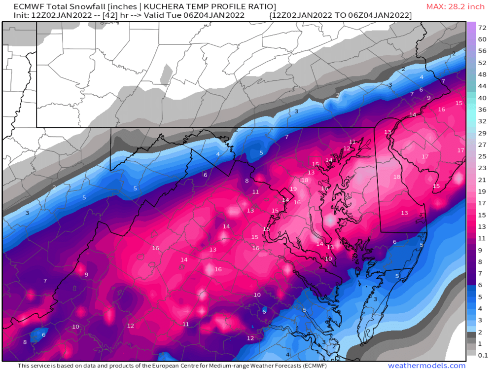
Jackpot is over my yard. I'll take.
-
2
-
 1
1
-
-
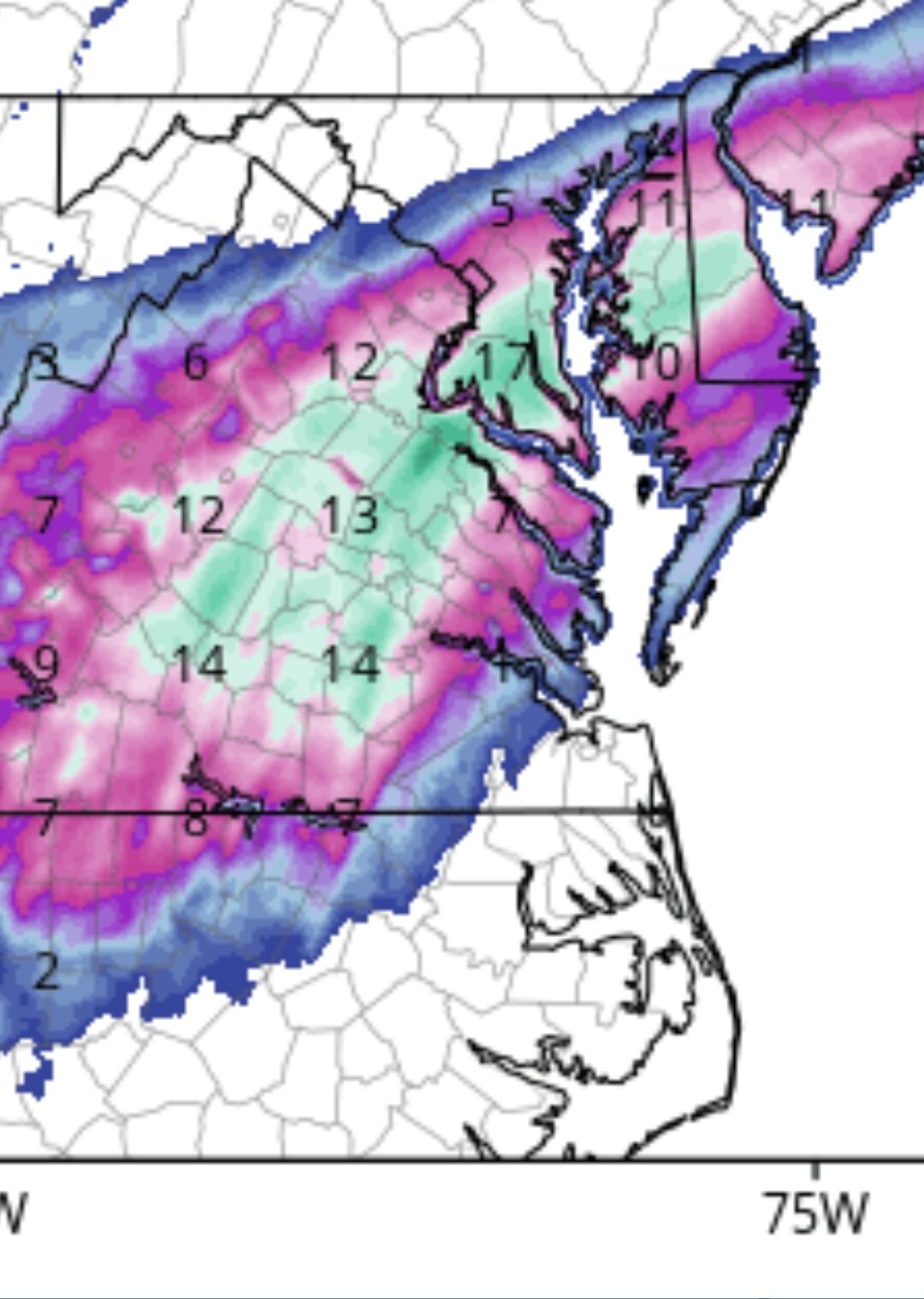
If the 12z GFS verifies LWX ain't going to look good.
-
1
-
1
-
-
I’m hugging the GFS. It was the first to detect this storm and it has led the entire way. Bring it on.
-
1
-
 1
1
-
-
The banding on the FV3 makes sense. I’ll buy it.
-
7 minutes ago, H2O said:
And all I’ll say about the death band is this:
It will snow the best where it usually does. Without fail. Call it ortho lift, call it frontgen, call it same ol shit
what will matter most is the cold push. Where that sets and sits will make this a boom or bust. That’ cold push is what will wring out the juice. What screws the SE areas is always the cold bleed. Cold air loves to sit above 300ft and take it’s sweet time to filter down to the coastal plain.
I have been watching Mid Atlantic snowstorms for only 10 years (way less than some other posters) and I have never seen it not happen this way.
NW areas won’t get as much QPF, but will be colder and thus get more snow out of the QPF they do get.
-
1
-
-
Euro doesn't quite have what the GFS did, but these totals seem more sensical to me. GFS really does score a coup it seems.
-
1
-
-
On 12/31/2021 at 8:26 PM, IUsedToHateCold said:
If I get more than 3 inches then I will.
This is looking more and more likely
-
6 minutes ago, nj2va said:
It does seem GFS has been leading the way in terms of other models catching up to a more NW solution. I’m not saying the GFS (especially the crazy 00z depiction) is right, but the “oh lets 100% discount the GFS because its the GFS” mantra may not hold with this storm.
The GFS was the only model that even had this idea 5 days ago. It is absolutely leading the way.
-
1 minute ago, Weather Will said:
There is some sleet mixed in…

That is a weird map. Hard to believe areas in southern Maryland don’t mix while places north of Baltimore do.
-
GFS gets everyone in on the action.
-
1
-


January 3, 2022 CAPE Storm Obs/Nowcast
in Mid Atlantic
Posted
Ugh. I imagine they aren’t going anywhere too soon. That sucks