

Terpeast
-
Posts
3,490 -
Joined
-
Last visited
Content Type
Profiles
Blogs
Forums
American Weather
Media Demo
Store
Gallery
Posts posted by Terpeast
-
-
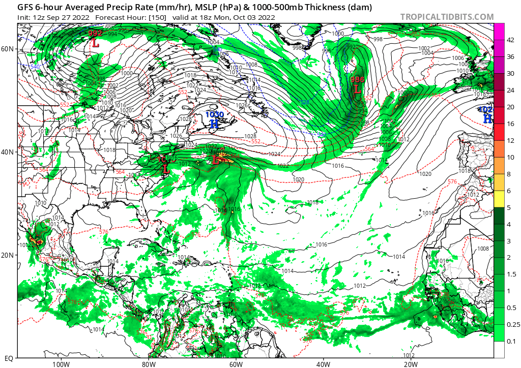
First wisps of Ian up overhead
-
 1
1
-
-
1 hour ago, IUsedToHateCold said:
I'm not sure about snowfall, but this is what I'm currently thinking for temperature departures:
November: torch (maybe warmest ever?)
December: -1 to -2
January: 0 to +1
February: +4
March: -2
The thinking is an eastern trough in the first half of meteorological winter with a ridge in the second half, with the trough returning in March.
Leaning towards this kind of thinking/temp departures, too.
-
4
-
-
Having lived through Ike in Houston in 2008, Ian’s radar imagery gives me goosebumps.
-
3
-
-
15 minutes ago, mattie g said:
lol
We set the AC to 67 at night in the summer. Heat is at 62 in winter. I turned off the unit last night and it was a comfy 66 overnight!
That’s not gonna fly with my Vietnamese wife. She’d be shivering in her thick wool coat at those temps haha
-
 2
2
-
-
Low 46. Forgot to turn on the heating before bed, and it was 69 in the house this morning.
-
1
-
-
38 minutes ago, poolz1 said:
A pretty extended easterly fetch coming into the MA beaches on the GFS.

Been a while since I’ve seen an easterly fetch like that. One could dream of this being in January and the high centered over Toronto…
Ok, back to the present. Carry on, people.
-
2
-
1
-
-
1 hour ago, MillvilleWx said:
Well, it finally happened. My parents moved into their new home near Sarasota (15 miles inland) and will be evacuating tomorrow to Ft Lauderdale. Looks like they will take a hit head on for their area. Their house is a fortress, so not too concerned about its integrity, but it'll certainly be an unwelcomed present.
Hope it all stays intact for them. Looks like serious flooding if wind isn’t the main issue.
-
1
-
-
9 minutes ago, yoda said:
Looks like guidance is split in 2 schools of thought, one having Ian fizzle in the carolinas and the other driving it up the EC. Must depend on the interaction with the trough
-
3
-
-
I liked this writeup about Hunga Tonga and potential effects on this winter.
-
5
-
-
39 minutes ago, 40/70 Benchmark said:
Too many folks are approaching this like its a slam dunk, PV on roids season.
I'm not, but I'm not all enthusiastic about it either.
We're about to witness a global experiment on what happens when we inject a butt ton of vapor (a strong greenhouse gas) directly into the polar stratosphere.
-
4
-
-
17 minutes ago, 40/70 Benchmark said:
I'm not sure Hunga Tonga doesn't trend the polar strat warmer in the N HEM.
I’m not sure that it does. There are a lot of “if”s to make that happen.
-
1
-
-
Already seeing blue skies behind the line. Barely a trace. Think I got screwed again
-
Low of 44, ashburn
-
35 minutes ago, SomeguyfromTakomaPark said:
I don’t think I’ve ever seen an nhc cone include Greenland!!!
Yeah I saw that! Is that going to be a first if it actually pans out?
-
1
-
-
1 hour ago, WxUSAF said:
Good luck if you think winters from a century ago are good analogs
Yeah, if we’re going BN, it’ll be more like -1 or -2. The good news is we don’t even have to get that cold to get good snows as 2009-10 showed.
-
2
-
-
7 minutes ago, snowman19 said:
Worth noting that the 4 corners in the west are warmer than normal in all four cases… and on the flip side, interier NE (especially Maine) are colder than normal in all cases.
-
4
-
-
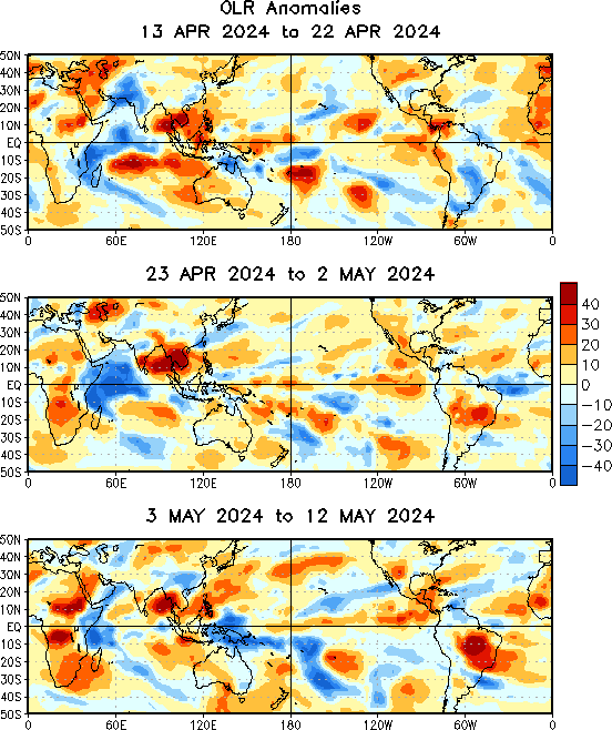
Terrible look in August. Now? Not great, but not game over yet. Hoping the trend holds.
source: https://www.cpc.ncep.noaa.gov/products/precip/CWlink/MJO/olra_last30days-3plots.gif
-
 2
2
-
-
4 hours ago, North Balti Zen said:
that is LITERALLY what he wishes for. he wants carnage and destruction.
As long as he’s not in a flood zone, all good.
-
18 minutes ago, snowman19 said:
The updated NWS CPC winter forecast FWIW: https://wjon.com/winter-weather-outlook-from-the-climate-prediction-center/
Looks like a copy paste nina winter outlook
-
1
-
-
5 hours ago, psuhoffman said:
Since 2000 these are all the DC snowfall totals in -enso years and neutral years following a nina year (which tend to mimic nina results)
3.2", 13.6", 4.9", 7.5", 10.1", 2.0", 3.1", 3.4", 7.8", 0.6", 5.4", 13.2".
The avg is 6" and the range is 0.6" to 13.6".
Every single season was below avg.
For IAD, the range is between 2.6" and 15.8", average is 9".
Source https://www.weather.gov/media/lwx/climate/iadsnow.pdf-
1
-
 1
1
-
-
1 hour ago, psuhoffman said:
I don't think its luck...there is a repetitive trend during Nina's that when it does get cold there are progressive waves that seem to have a better chance the further east you are in our region. On top of that there tend to be a lot of miller b storms due to the lack of a strong STJ and those, while not usually prolific, do sometimes clip our eastern regions a bit as well. Signs of this repetitive pattern have shown up at times in 2009, 2011, 2017, 2018, and 2022. I think there is enough evidence, and Nina snowfall anomaly maps show this as well, that the immediate 95 corridor (where most live!) is the absolute snowfall minimum in a nina. Further west tends to get a bit more snow from temperature dependent systems and further east has a better chance of getting clipped by the progressive waves and miller b's. DC and Baltimore are in the exact worst location and most likely to get screwed. I think that's climo not bad luck.
ETA: simply put...the further west you can go before getting any elevation advantages...the worse off you are in a progressive pattern.
I agree with you that it's standard nina climo that we usually get stuck between suppressed cold/dry and warm/wet cutter tracks.
With a moderate but weakening nina, -PDO, and the NAO being projected to avg weakly positive, I still lean towards a below normal snowfall this winter.
But there are a couple of X factors that didn't exist on previous analogs - one being that the ATL hurricane season has been uncharacteristically quiet, and two being the H2O vapor eruption with undetermined effects on the stratosphere (i.e. there is a long chain of "ifs" that must come true to get -AO from a NH strat warming as a result).
Again, leaning BN snowfall, but leaving the door open to a couple of surprises.
-
6
-
-
31 minutes ago, Eskimo Joe said:
We haven't had a big 8" - 12" rain event in some time.
Careful what you wish for..
-
2
-
-
35 minutes ago, snowman19 said:
2 are -nao
1 (dwdd) is extreme +nao/+ao
And 5 showing a neutral to weak +nao. (that’s where I see consensus)
-
3
-
-
1 hour ago, Great Snow 1717 said:
Personally, I would never consider using analog years from 100+ years ago.
Or even 50. I wouldn’t use analogs earlier than 1980, even though the 70s are interesting ones to look at.
September Discobs 2022
in Mid Atlantic
Posted