tavwtby
-
Posts
2,814 -
Joined
-
Last visited
Content Type
Profiles
Blogs
Forums
American Weather
Media Demo
Store
Gallery
Everything posted by tavwtby
-
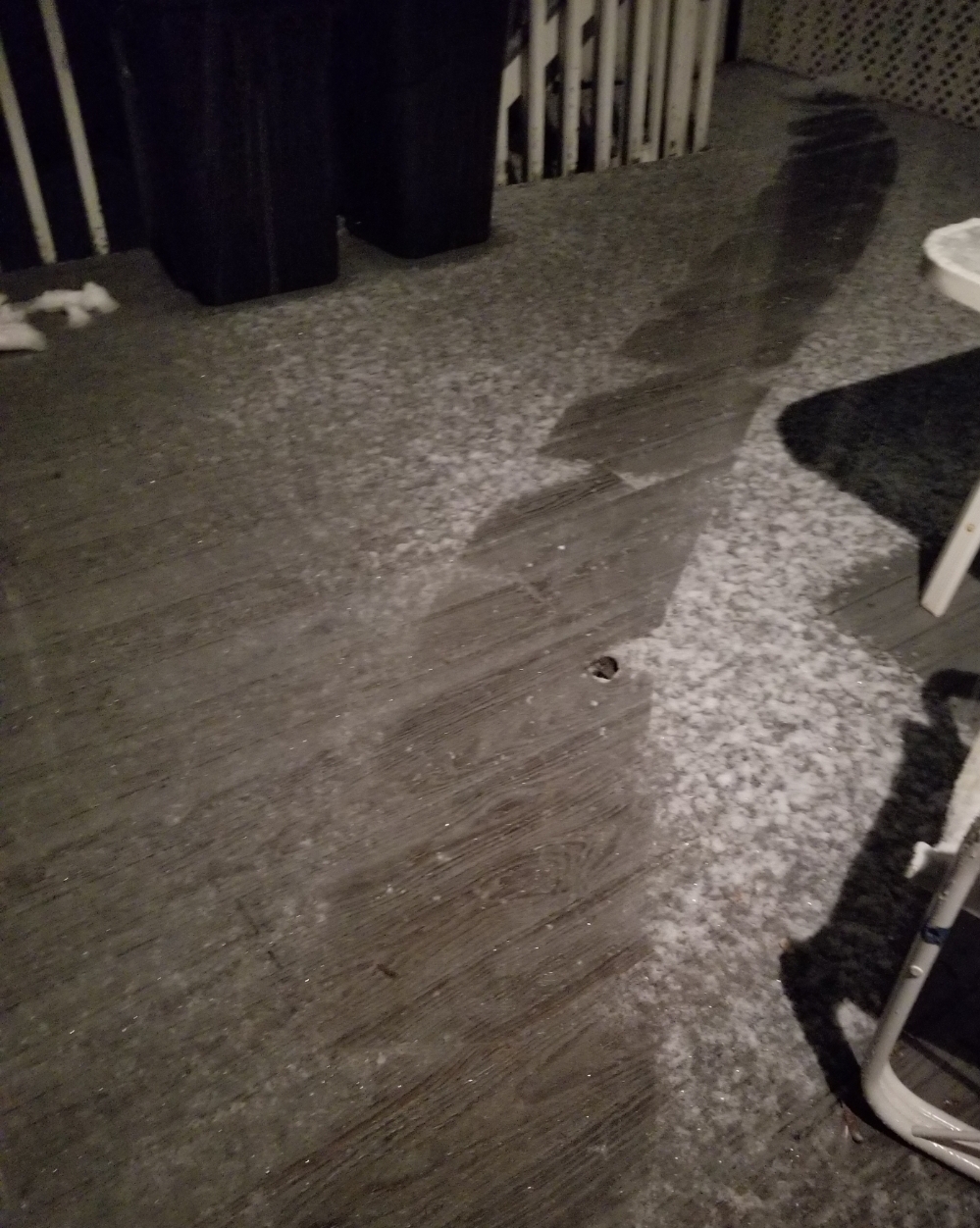
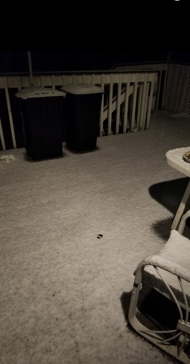
woke to 6 of absolute mashed potatoes, covered everything, I would not be shocked if power goes, still ripping too
-
closing in on an inch now, I just hope we stay frozen, then we'll verify here.. bed soon up early to see what fell, good luck all!
-

The last hurrah? Putting all the eggs in the Tuesday 3/14 basket
tavwtby replied to Ginx snewx's topic in New England
yeah completely coated here, roads too, those paws really slushed things up now it's accumulating nicely -
paws have gotten smaller, but still snowing good, about 1/2mi vis, I can barely make out my 1/4mi marker so maybe a little less than 1/2
-
you flip or still raining? I think you're good for 4-6, tricky the valley forecast, as always in these marginal events
-
.5" slush in the last half hour

-
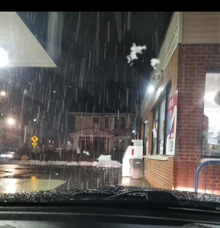
everything coated, that didn't take long with these massive paws, good God, it's like red dawn with parachutes out there, ha
-
pounding chutes right now, wow
-
I'll try I usually have trouble posting pics here but I found if I take a picture and then a screenshot of that picture I can post them
-
believe it or not it's actually starting to slush up the wet spots when it rained before, looks like 100% snow now
-
yeah me too, I've been pretty steadfast with my 8-12 since go, but all these numbers I keep seeing got me second guessing, I'm still not sold though on them big amounts, although we are pounding paws atm.
-
beginning to flip here, some wet flakes mixed with the rain, down to 34, I went from here to work near BDL and was 41 drizzle, down to Meriden and was 45 light rain, Waterbury was 43 when rain got heavier, temp dropped as I drove up 8 by nearly 10 degrees, if we flip here now and stay all snow, we're in the money... ALY still has my area on the edge of 12-18, just south 8-12, and that's what I'm sticking with here
-
The last hurrah? Putting all the eggs in the Tuesday 3/14 basket
tavwtby replied to Ginx snewx's topic in New England
looks like a IVT into CT there -
The last hurrah? Putting all the eggs in the Tuesday 3/14 basket
tavwtby replied to Ginx snewx's topic in New England
yeah you too, hoping for the best, prepared for the worst -
The last hurrah? Putting all the eggs in the Tuesday 3/14 basket
tavwtby replied to Ginx snewx's topic in New England
radar looking pretty stout upstream for weenie flakes and filling in south, hope so because I got a lot of running around today before things really kick -
The last hurrah? Putting all the eggs in the Tuesday 3/14 basket
tavwtby replied to Ginx snewx's topic in New England
sitting at 33.5/30 with flakes flying, should we fire up an obs thread? this is wayyy earlier than I expected to see any flakage -
The last hurrah? Putting all the eggs in the Tuesday 3/14 basket
tavwtby replied to Ginx snewx's topic in New England
there's actually flakes flying right now in Winsted -
The last hurrah? Putting all the eggs in the Tuesday 3/14 basket
tavwtby replied to Ginx snewx's topic in New England
that looks like one of those spin paint plates you get at the big e -
The last hurrah? Putting all the eggs in the Tuesday 3/14 basket
tavwtby replied to Ginx snewx's topic in New England
still sticking with my 8-12... trending in the wrong direction, maybe they should put the algorithm in the models from 10 years ago, it seems like the last few years more often than not there have been major struggles with them even latching onto a solution more than a day out... maybe it's me but it's like we used to have goalposts set a week out with fine tuning as we close in, now it's almost a now cast event all the time, other than sniffing out a sig, of course many other things to look at, such as upper level mechanics, etc. but they just seem awful with handle on systems lately
-
The last hurrah? Putting all the eggs in the Tuesday 3/14 basket
tavwtby replied to Ginx snewx's topic in New England
yeah, believe it was Burnsville, and yeah they closed I think it's I35, was insane a couple days later it was like 50 -
The last hurrah? Putting all the eggs in the Tuesday 3/14 basket
tavwtby replied to Ginx snewx's topic in New England
you see my post a little bit up, described exactly that, was outside Minneapolis and literally 2" otg and completely white out, like 50-60mph winds and cold as I ever felt. -
The last hurrah? Putting all the eggs in the Tuesday 3/14 basket
tavwtby replied to Ginx snewx's topic in New England
I thought I remembered 96 still having a temp requirement, am I mistaken, when exactly did they nix that? if you recall. -
The last hurrah? Putting all the eggs in the Tuesday 3/14 basket
tavwtby replied to Ginx snewx's topic in New England
yeah them ground blizzard deals are crazy, I went through one with only a couple dry inches otg, crazy whiteout -
The last hurrah? Putting all the eggs in the Tuesday 3/14 basket
tavwtby replied to Ginx snewx's topic in New England
oh that's nice, sit down and clean! no fighting the new snowblower -
The last hurrah? Putting all the eggs in the Tuesday 3/14 basket
tavwtby replied to Ginx snewx's topic in New England
I would love to see it verified, I believe I've only seen it verified a couple times inland in my life, that's usually relegated to the coast where those sustained winds are common, but near the coast with this one may not get three hours of 1/4mi vis snow, hopefully for there I'm wrong... my area doesn't see winds sustained above 35 during storms often, it's usually after when the NW screaming winds come