tamarack
-
Posts
16,409 -
Joined
-
Last visited
Content Type
Profiles
Blogs
Forums
American Weather
Media Demo
Store
Gallery
Everything posted by tamarack
-
The number of power outages in the state of Maine surpassed the Ice Storm of 1998.[1] True, but with caveats: --2017 caused far less infrastructure damage than 1998 - poles/transformers/wire, etc. --Comparing outages 2 days (or 2 weeks) after the events show there was little comparison by then. --The power companies, especially CMP, were doing a poorer job in 2017 than 19 years earlier. Lots of tree damage in each one, though mostly breakage in 1998 and a much greater proportion of uprooting in 2017.
-
That March '56 dump was about 3x bigger than any snow I'd seen (except 12/47 when I was 21 months old). Then 2 more big storms in '58, 2 in '60 and 2 in '61. Even Fort Kent couldn't approach that cluster of big storms. I thought that with 10" depth in early December this year, we were good to go. Alas . .
-
I first got interested in snow during the early 1950s. Not the best time for the NYC region. Average snowfall: 1943-44 thru 48-49: 39.2" The 12/26-27/47 storm might still be NYC's #1 had measurements been done the way 2006 & 2016 were measured. (Check depth changes.) 1949-50 thru 54-55: 14.2" Our NNJ home site had no storms of 10"+. 1955-56 thru 60-61: 34.5" Home site had 7 storms of 18-24" during this period.
-
Ancient history, but in our 13 winters (85-86 thru 97-98) in Gardiner, the worst for pre-Jan 1 snowfall was 1992. However, Feb-Mar were kinda nice, and the 92-93 total trailed only 95-96 over those 13. The exception that proves the rule? (If there's any such thing.)
-
It's been done, at least in a 1962 short story, "The Weather Man" by Theodore L. Thomas. (I have the story in a book, "Time Probe: The Sciences in Science Fiction", assembled by Arthur C. Clarke.) It describes technicians riding into the sun's atmosphere on "sessile boats" that are protected by "a thin film of gaseous carbon", with weather modification made by carefully aimed water drops. A fun read. I'm hoping that, like the last one did in the 48-hour run-up, the Monday storm will start edging east so that only BHB and point east will get the strong winds. I'd also like, if it has to rain, that temps would stay in the 30s here, also like last Monday.
-
True - we had 3.25" though about 0.4" was in SN/IP at the start. Thanks to the 22" with 2.41" LE on Dec 16-18, that 12/23 deluge only pounded the pack down to 12". The big difference from the Christmas Day Grinch of 2020 is that most of the 2022 rain came with temps in the low-mid 30s while in 2020 the heaviest rain came at low-mid 50s. There was only 4" OG going into 12/25/20 but even if it was 14", all would've gone down the Sandy River.
-
That 12/29-30/76 storm dumped 12" at our Fort Kent home, atop the ~2' from 26-27. We drove home thru the night from NNJ, hitting snowy roads in Mass and falling snow shortly after crossing the Piscataqua. Reaching BGR in S+ about 4 AM, we stopped at HoJo's for a big coffee and headed north. That coffee went right thru me and blessedly, the outhouse at the Medway rest stop had TP. With the temp in the low teens, using powder snow would not have been fun. Got to FK about 9 AM, and our blue Beetle was merely a white lump. Less than 5 minutes after parking the pickup, the NW backsides were blasting at 40-50 and visibility dropped to 50 feet in the gusts - could not see Pelletier Florist across the street. Very fortunate that those winds didn't come while we were between PQI and CAR. CON was 18° at midnight but the afternoon high was -8° at nearly 20kt sustained. Yeah, no thanks. KCON 251900Z 31018KT 20SM CLR M22/M33 A3015 RMK SLP220 T12211332 Had 9° at my 9 PM obs time and -23 the next morning with winds gusting 40+. Afternoon max was -16 and the 3" from the evening before was blowing a blizzard. !st CT Lake, with its 7 AM obs time, reported -24/-32 for 12/26. Outside of MWN, it's tied with Jan 15, 2004 on Mansfield for the lowest max I've seen in New England.
-
That type of sequence is very very rare in this region. I can't recall experiencing a system with even 1/3 of the respective P-types, and the only one other than 1992 that I can think of was the NYC "snowicane" in Feb 2010.
-
Been there in 1953 and 1998, the 2 storms 45 years apart, to the day. As a forester, I'd be fine if the next one didn't come until 2043. Nice flurry 7:15-7:30 this morning, briefly S+. Of course, while the Greens get 3-4", Our 0.1" coating has to suffice here.
-
5th greatest peak flow on the Sandy, 95 years POR. In NNJ we had about 8" capped by a bit of ZR as temp never got up to 32.
-
Farmington co-op had 10" come down on December 26-27/1969 (though it's a bit suspicious as no one else in the region had more than about 7"). Started with 15" SN then poured as temp rose to 50°. Was also BTV's top snowfall until 2010 topped it. Nice to see a sunny day, with modest temps.
-
Exactly the same as here.
-
Still 4" here, which will be white pavement when the temps fall. And still enough frozen on the driveway to bring out the wood-ash bucket tomorrow. Looks like the serious RA is done for us, some light stuff for another hour or 2.
-
Had 2.02" thru 7 this morning with some moderate RA since, and temp never got past mid-30s. Nearly all the snow washed off the trees after nearly a week of winter wonderland, but the 2' icicle is still hanging from the end of the gutter. Saw some 50+ gusts reported from BHB and a 53kt gust out on Mt. Desert Rock.
-
Some Maine sites I've tracked show about 3-3.5° rise during that time, most of it in the current century. However, picking 1970 as the start may overstate the longer-period rise, as those Maine sites were the same or milder in the 1940s than in the 70s. Still, 3°+ in 80 years is dramatic.
-
Light rain arrived about 3:30, somewhat thinning the fog, which was about 1/16 mile most of the day. Temp 33-34 as the inversion holds for the moment.
-
$0s to 50+ in S, Maine/NH and still hanging in the 20s here. Cloudy and raw feeling despite little/no wind. Trees have lost some snow to gravity but none to wind/temp.
-
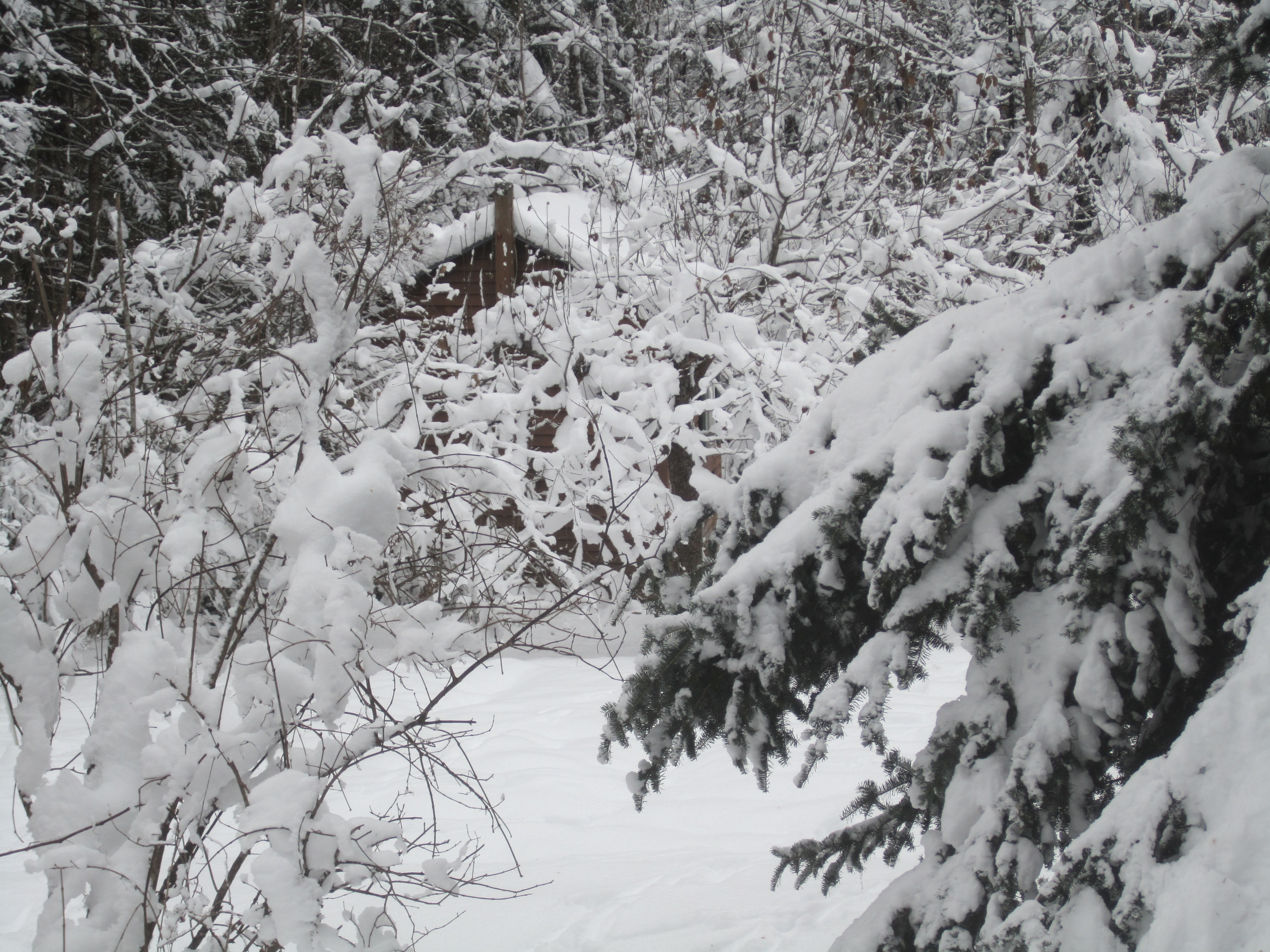
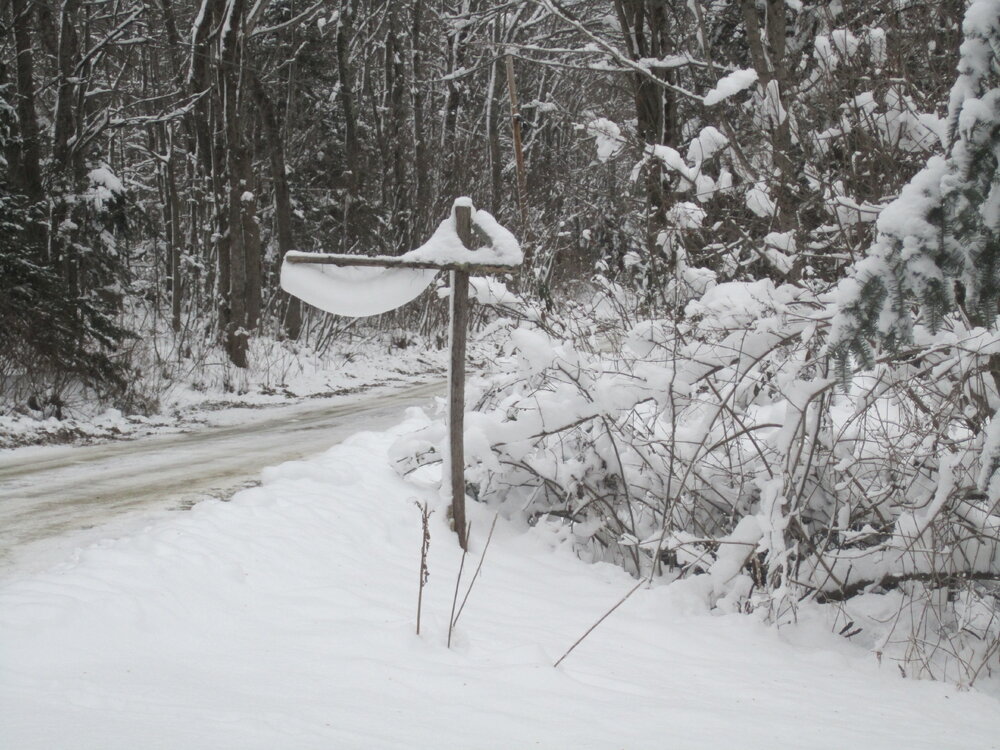
First pic - elastic snow? Second - Toolshed hiding behind snow-loaded apple trees.

-
12/17/73 redux? Early evening conditions: BGR 56°, 3" RA NYC 25°, ZR NNJ 15°, IP
-
Here November and April are much the same, except for biggest storms. December averages more than March but March has more big storms, even though Dec's top 3 are above anything in March. November April Avg: 4.6" Avg: 4.8" 1. 13.0", 26-27/2014 1. 18.5", 4-5/2007 2. 9.7", 23/2011 2. 15.1", 1-2/2011 3. 7.1", 27-28/2018 3. 11.2", 12-13/2007 4. 7.0", 17-18/2002 4. 8.5", 9-10/2020 5. 6.0", 13/2018 5. 5.2", 15-17/2007 (with ~5" RA as well) December March Avg: 18.9" Avg: 16.9" 1. 24.0", 6-7/2003 1. 19.9", 7-9/2018 2. 22.0", 16-18/2022 2. 19.0", 30-31/2001 3. 21.0", 29-30/2016 3. 16.5", 13-14/2018 4. 15.5", 21-22/2008 4. 16.0", 22-23/2001 5. 13.2", 14-15/2003 5. 15.5", 14-15/2017 Next: 12.4" this week Next: 14.5",14.0", 13.5", 13.3" 10 events 10"+ 14 events 10"+ (in one less year)
-
Always dries up before reaching here. Latest info means maybe mid-30s gusts here. We've had only one event that brought gusts stronger than 40-45 since May 1998, a near-severe TS in June 2005 that had a 30-second spell of (probably) mid-50s - rain-mist filled with twigs and numerous large aspen broken down.
-
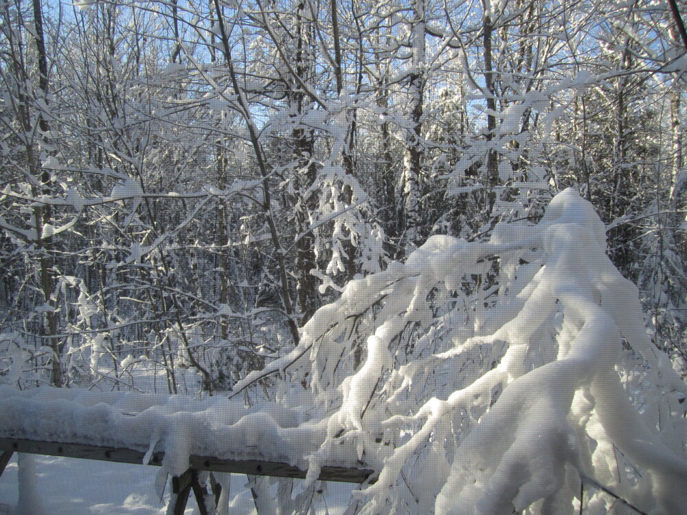
Taken thru our SW-facing window (screen and all) this morning. Not as pristine as on Tuesday and Wednesday, but still amazing for the 4th day after snowfall ended.
-
Canon's battery is flat, now on the charger. It did well to allow yesterday's pics.
-
Well-seasoned oak, hard to beat, but that species is uncommon here thanks to preferential harvests in the distant past. Whoever owns our woodlot after we're no longer around will have greater amounts of oak, as I've had fun releasing the numerous saplings from the popple and red maple. When you sit back and think about it, the amount of days and weeks and months we waste of possible snow waiting for that elusive pattern change to kick in really is amazing. All the tracking, all the 10 days that keep getting pushed back.. just happens so often.. and before you know it Tip is posting about warm car seats and sun angle on Feb 10.. and then Morch hits Bring it on - Morch is a winter month here. This past winter the month was 3.5° AN but had 27.9" snow, and that with being only grazed by the mid-month paste bomb.
-
I wish. Only camera I might've had back then would be a Polaroid Swinger - nearly the size of a breadbox and took 2"x3" pics that tended to curl severely. (And probably if saved would be so yellow-brown after 60 years that nothing could be seen.)