hazwoper
-
Posts
3,489 -
Joined
-
Last visited
Content Type
Profiles
Blogs
Forums
American Weather
Media Demo
Store
Gallery
Everything posted by hazwoper
-

E PA/NJ/DE Winter 2023-2024 OBS/Discussion
hazwoper replied to The Iceman's topic in Philadelphia Region
Kind of already over winter TBH. LR models show some below average temps, but really the overall pattern doesn't favor many decent shots at storms through 2/17. I mean, I'd take a late month storm, but not holding my breath and honestly after all this cloud cover, I am ready for spring and summer. -
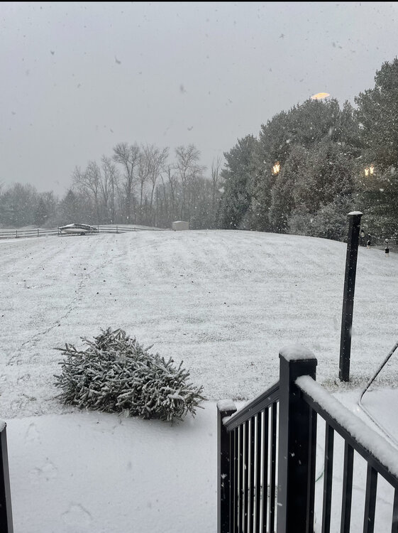
Shame it’s not a full moon tonight. This is the kind of snow that looks like diamonds under a full moon.
-
Models struggle with ratios in these set ups. I’ve seen many times over the years where Mt Holly picks up on this fact. Vey low moisture can pile up when the conditions are perfect.
-
Trust the professionals
-
E PA/NJ/DE Winter 2023-2024 OBS/Discussion
hazwoper replied to The Iceman's topic in Philadelphia Region
Hoping for 4”. Wouldn’t be at all surprised to only see 2-3”, but feeling good for some reason. Meh -
E PA/NJ/DE Winter 2023-2024 OBS/Discussion
hazwoper replied to The Iceman's topic in Philadelphia Region
It’s currently 32 at my house with a DP of 18. Ho read up on wet bulbing in storms like this one. You might learn something -
E PA/NJ/DE Winter 2023-2024 OBS/Discussion
hazwoper replied to The Iceman's topic in Philadelphia Region
Again, post less, read more. Thanks -

-
E PA/NJ/DE Winter 2023-2024 OBS/Discussion
hazwoper replied to The Iceman's topic in Philadelphia Region
Ah, so you know more than professional meteorologists. Got it. Thanks. -
E PA/NJ/DE Winter 2023-2024 OBS/Discussion
hazwoper replied to The Iceman's topic in Philadelphia Region
Not based on the mesos, which should be used at this point for small features such as inverted troughs -
Pretty remarkablly anomolous severe event Jan. 8/9 over panhandle
hazwoper replied to beanskip's topic in Southeastern States
How rare is it to have super cells with large imbedded tornadoes forming off the cost of the Carolinas and making landfall in mid January. Serious question. -
How rare is it to have super cells with large imbedded tornadoes forming off the cost of the Carolinas and making landfall in mid January. Serious question.
-
Flip back to mainly snow here in Hatfield pretty crazy and unexpected
-
No, I think I’m gonna be wrong
-
Keep an eye out for this slug of moisture heading NE. I have a feeling that will flip you and ABE back to mix. Curious to see if I am right.
-
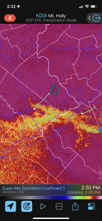
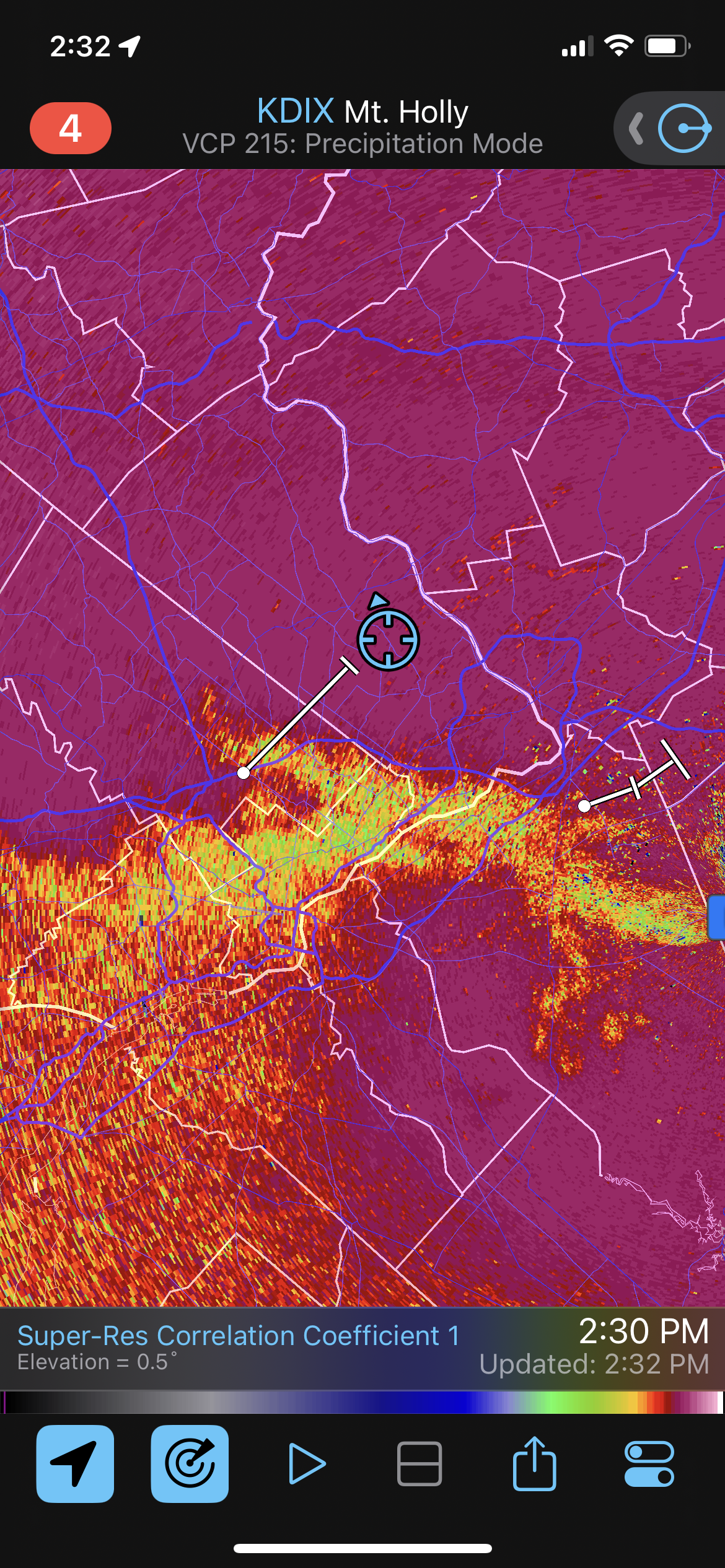
I am in Lansadale. Surprised to see a lot of flakes still mixed in. CC seems to be moving SE a tad near here.
-
It’s not accurate. Way off. Use CC
-
If you’ve changed over don’t expect to flip back later. The problem is warm 850s. They won’t drop again until the low is NE of us.
-
And the mix has started just as the CC showed it . Still mostly snow though
-
Just about 2” now and heavy snow.
-
It Radar Scope. The correlation coefficient radar
-
Mix line actually dropped a bit south for the time being by me so we still have moderate snow
-
Still coming down but mix line at doorstep.
-
Yeah should have said mix line. Rain just beyond that transition line
-
CC radar accurate for r/s line