hazwoper
-
Posts
3,489 -
Joined
-
Last visited
Content Type
Profiles
Blogs
Forums
American Weather
Media Demo
Store
Gallery
Everything posted by hazwoper
-

E PA/NJ/DE Winter 2025-26 Obs/Discussion
hazwoper replied to LVblizzard's topic in Philadelphia Region
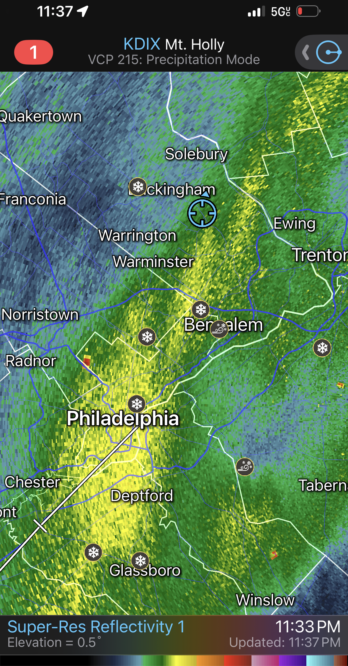
Anyone know why the huge amount of ground clutter at Ft Dix/McGuire the past few days? Looks like what you see around a wind farm.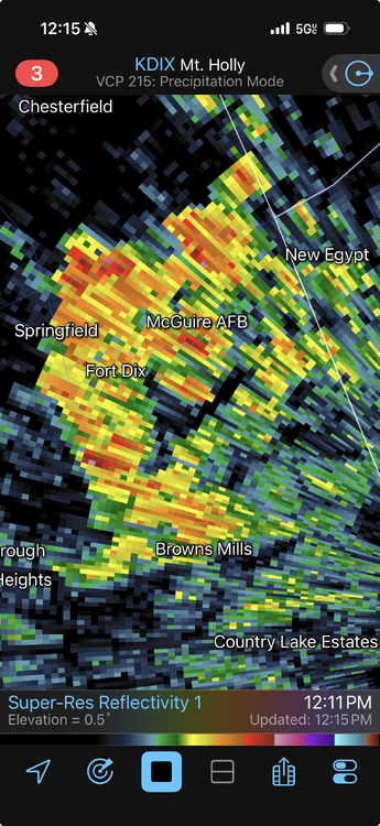
-
Radio towers by Conshy and buildings downtown
-
RadarScope. It’s an app
-
One of the largest deform bands I can possibly remember
-
8” here. 29 and mod/heavy snow
-
Damn! The radar is blowing up!!!
-
That’s what I have in Wrightstown
-
-
Yeah. Ralph I think your measurement is off. I am just over 7”
-
Where r u located now?
-
It’s expanding over Philly
-
May run the ATV plow before calling it a night later. Too wet I think to wait till tomorrow
-
Where did you “see” this?
-
33 Lawn already covered and driveway caving here in Wrightstown PA
-
The Jan 31 Potential: Stormtracker Failure or 'Tracker Trouncing
hazwoper replied to stormtracker's topic in Mid Atlantic
-
Sorry meant the vorticity map. Those maxes are far better at predicting where the energy is going.
-
The 500mb shows the vort maxes farrrrrr better.
-
OBX blizzard
-
E PA/NJ/DE Winter 2025-26 Obs/Discussion
hazwoper replied to LVblizzard's topic in Philadelphia Region
Read more. Post less. -
E PA/NJ/DE Winter 2025-26 Obs/Discussion
hazwoper replied to LVblizzard's topic in Philadelphia Region
Yeah, but it is a pretty massive spread. Plenty of time. EDIT - in fact the spread is actually wider earlier on at 138hr as opposed to 144 which tells me they are having a hard time handling the upper level steering that has been showing it tuck back into the coast at that timeframe. -
E PA/NJ/DE Winter 2025-26 Obs/Discussion
hazwoper replied to LVblizzard's topic in Philadelphia Region
5 days out from yesterday's storm we were all thinking either suppressed south or low impact all snow...... -
E PA/NJ/DE Winter 2025-26 Obs/Discussion
hazwoper replied to LVblizzard's topic in Philadelphia Region
I've doing this for years. Believe me, there is plenty of time. GFS had this storm as a bomb of Friday, lost it till early runs today. There is plenty of time. -
E PA/NJ/DE Winter 2025-26 Obs/Discussion
hazwoper replied to LVblizzard's topic in Philadelphia Region
relax. plenty of time. -
E PA/NJ/DE Winter 2025-26 Obs/Discussion
hazwoper replied to LVblizzard's topic in Philadelphia Region
right where we want it at this point. -
E PA/NJ/DE Winter 2025-26 Obs/Discussion
hazwoper replied to LVblizzard's topic in Philadelphia Region
Same, although we were planning to stay Saturday night. Going to hockey game at stadium.....