
MANDA
-
Posts
1,286 -
Joined
-
Last visited
Content Type
Profiles
Blogs
Forums
American Weather
Media Demo
Store
Gallery
Posts posted by MANDA
-
-
29 minutes ago, snowman19 said:
Larry Cosgrove has finally given up in his new blog. He was going for a big cold/snowy winter in the east. Said he thinks it’s over
Ya think! Some real diehards this season. Some are STILL hanging on for dear life thinking their forecasts will be vindicated with a cold and snowy March.
-
 1
1
-
-
10 minutes ago, Brian5671 said:
.96 of an inch of rain at BDR this month-first dry month since last May/June.
Yeah, the hose finally got turned off. We'll see where we go from here.
-
4 minutes ago, Allsnow said:
Kasper was so far ahead of his time. His updates on the mixing line and radar during storm on the radio were a great source of information
If you watch the video you will hear how he had to fight management at WCBS to a degree to educate people and not dumb things down. You'll never see anything like that today. Most of the time he had to do it in under 90 seconds.
He was also great at NJ101.5. I suspected at the time he was shown the door but he confirmed that last night on the podcast. Wake up at mid-night, drive an hour to work to start at 2am then leave for home at 10am. For 25 YEARS! He loved what he did.
-
2
-
-
Here is a link I had sent to NJ101.5 that I had come across years ago.
Still have great audio clips of Alan from his TV days, Hurricane Belle, Blizzard of 78 and some other events.
https://nj1015.com/vintage-footage-of-weatherman-alan-kasper-video/
Only a few good on air Meteorologists around today, but Alan was one of a kind in his delivery.
-
Off topic for this thread but I'll post it here since the weather is quiet.
For those of you who were fans of Alan Kasper back in the day you will like this.
A friend of mine sent me this link so I am passing it along. Lots of great memories.
I worked weekends at WCBS late 1983 to late 85 and Alan had left by then. Wish I had gotten to meet him. A Legend.
What came after him not so much.
Here is link:
-
2
-
-
34 minutes ago, Brian5671 said:
Yes I have noticed a few more birds here of late. The end is coming and probably quickly.
Same here....lots more bird activity than usual for this early in the season. I think most I've seen at this time of year.
-
1
-
-
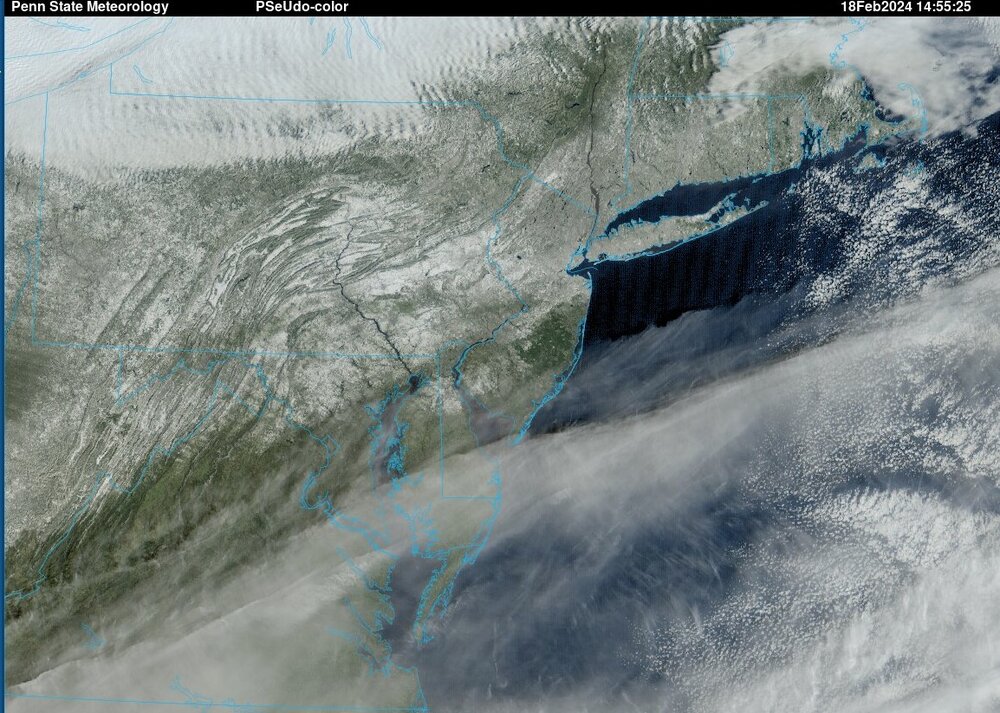
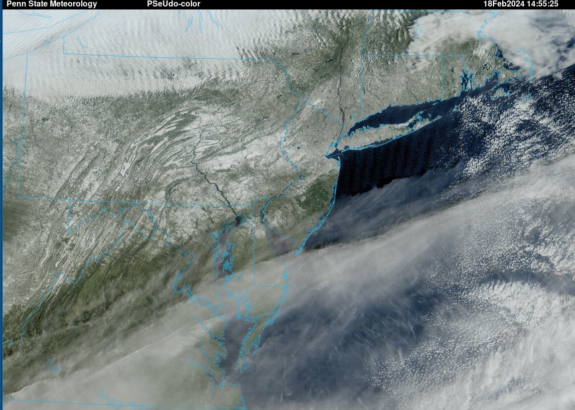
Wintry looking visible satellite image this morning.
-
5
-
-
All done here. Just flurries now. Finished with an even 9”.
-
3
-
-
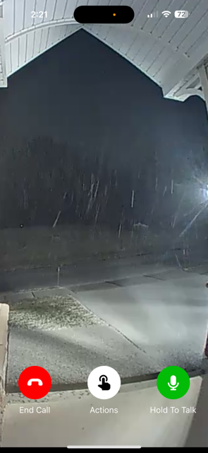
Last band coming through. Moderate snow now.
-
4
-
-
Looks nice out there. Still light snow.
-
2
-
-
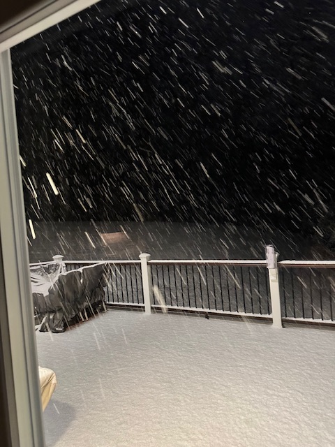
Snowing lightly. 8.6” otg. Light snow for a bit longer but it is wrapping up soon.
-
2
-
-
28 and 5” otg. Heaving snow attm.

-
5
-
-
29.5 and moderate snow now
-
 1
1
-
-
33 here. Light to moderate snow. Everything including road covered since it began about 30 min ago.
-
Just now, Brian5671 said:
whole state is closed here tomorrow-town/city offices schools you name it--north of 84 may have close to nothing.
Absolutely nuts. Stuff like this never used to happen.
-
2 minutes ago, jm1220 said:
Wow. Schools in Boston are for maybe 2-3" there.
 2 minutes ago, jm1220 said:
Wow. Schools in Boston are closed for maybe 2-3" there.
Laughable if true.
-
2 minutes ago, Allsnow said:
They had to bump the numbers down along and north of I80. There was nothing left to support what they had going. Looks like much more reasonable map overall. I would tend to lean to the lower end of the range for 78 north.
-
2
-
-
2 minutes ago, Allsnow said:

Not impressed with this map. Knock some off for not pure 10:1 event and you are notably less than NWS amounts. Especially up my way. Going to be interesting from around daybreak through noon. Some will be disappointed IMO.
-
Wow, we moved up to first place! Last time you posted we were #4, I think at the end of January.
Interesting to see where we drop to after the event tomorrow.
Thanks for posting.
-
1
-
-
Don-
Thanks for all your great stats. Do you have an updated winter ratter chart as of today? Just wondering if NYC bumped up a position from the last time you posted? Just wondering what it will be before and after the coming event.
Thanks.
-
1
-
-
Has got to be some cutting of the totals by NWS at some point for along and north of Rt. 80. I don't see their current forecast of 8-10, 10-14 verifying along and north of 80 and west of 287. I'm thinking 4 to maybe as much as 6 for my area and the 6" is a MAYBE. Not liking the current trends for more than 6" up this way.
-
1
-
-
I was in Manhattan for the April 1982 storm. It stuck on the roads and temperatures the day before was I believe were in the low 50's. Granted during the event temperatures fell into the m/u 20's, that is a big difference compared to 32-34 tomorrow. Late morning into early afternoon would have done late January or early February proud. Heavy snow with thunder and lightning and intense rates of fall got the job done. Also, that storm was not that different than this. Bombing low off Del-Mar-Va moving NE to near BM. If I recall correctly CNJ had much less than CP and SNJ had little to none.
Guess my point is that if temperature can fall to 32 and you get 1-2" rates for a while it will stick to the roads but it has to snow HARD.
-
6 minutes ago, SnowGoose69 said:
3K is bad though, even for places like BDL for a time...that said the 3K does suck until inside 30, the 12K can usually begin to be reliable to a degree inside 48...I still doubt we'd see this dip south enough as far ML low track to see anything more than 1 inch near NYC...if this was moving slower its likely we'd actually be able to see something as everything crashed behind the departing low but its moving so darn fast that is not really realistic
Would also have been much better if decent cold air was in place and more was readily available to be tapped. We're really relying on dynamic cooling especially more eastern parts of the forum. Still going with 2-4" for my location with 6" or 6"+ for NW Sussex county on north and east.
We'll see soon enough.
-
My thinking best chances for 2-4" starts along I80 and west of 287 for the NJ crew. First call for my area 2 to perhaps as much as 4". Thinking 1/2" to 1" of slop NYC/LI and immediate NJ burbs EWR area. 1-2" interior NE NJ.
Subject to some adjustment but not envisioning 6" or more outside of NW Sussex on north and east from there.
-
2
-

February 2024
in New York City Metro
Posted
A reading from the book of Revelations.
The end of days are near. Repent.