
MANDA
-
Posts
1,309 -
Joined
-
Last visited
Content Type
Profiles
Blogs
Forums
American Weather
Media Demo
Store
Gallery
Posts posted by MANDA
-
-
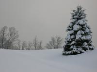
Late week warmth is coming but still nice to see this.

-
 2
2
-
-
Snooze fest right now. Temperatures are pleasant with chilly nights but overall the pattern at least for now is boring.

-
1
-
-
2 hours ago, bluewave said:
The Northeast is on track for another warmer October. Some parts of Maine are close to +10. Next few weeks look like more of the same.


Been a common theme for a while. Above normal around here with the warmest departures to our north...and is some cases a lot warmer relative to averages to our north over Maine and southeast Canada.
-
11 hours ago, Stormlover74 said:
Nam vs rgem
.thumb.png.1e7e8635f1460d8142480b73363dc20b.png)
.thumb.png.a5191a23532c25770cd8f040cb81419c.png)
Prozac in an IV drip for winter !
-
List of stations in the NJ Weather Network (Rutgers) that dipped into the30's this morning.
First 32 of the season I believe.

-
4
-
-
2 hours ago, Volcanic Winter said:
First 30’s of the season! Hit 38 this morning.
Same here had a low of 39 degrees.
-
2
-
-
58 minutes ago, bluewave said:
NYC is on track for another 50”+ year with numerous sites around the area already over 50”.
Data for January 1, 2023 through October 6, 2023
Click column heading to sort ascending, click again to sort descending.StateNameStation TypeTotal PrecipitationCT SEYMOUR 1.2 WSW CoCoRaHS 57.56 NY WEST POINT COOP 56.70 CT ANSONIA 1 NE COOP 53.38 CT PROSPECT 1.9 ENE CoCoRaHS 53.11 NY PEEKSKILL 0.4 N CoCoRaHS 52.92 NY STONY POINT 0.7 NW CoCoRaHS 52.56 CT NORWICH 2.5 NNE CoCoRaHS 52.48 NY THORNWOOD 0.7 NW CoCoRaHS 51.99 CT NORTHFORD 0.8 SW CoCoRaHS 51.99 CT EAST LYME 0.5 SW CoCoRaHS 51.82 CT WATERBURY 1.3 WNW CoCoRaHS 51.72 NY NEW HEMPSTEAD 0.6 SE CoCoRaHS 51.51 CT BROOKFIELD 3.3 SSE CoCoRaHS 50.76 CT GRISWOLD 0.9 N CoCoRaHS 50.61 NY SHRUB OAK COOP 50.59 NY BEACON 4.2 ESE CoCoRaHS 50.37 CT MIDDLEFIELD 0.6 SE CoCoRaHS 50.14 CT PROSPECT 0.5 SW CoCoRaHS 50.00 CT NAUGATUCK 1.7 NNE CoCoRaHS 49.50 NY CARMEL 4N COOP 49.46 CT MERIDEN 2.8 WSW CoCoRaHS 49.39 NY SOUTH SALEM 2.1 NW CoCoRaHS 49.26 CT BETHANY 1.3 SW CoCoRaHS 49.26 NY PORT JERVIS 2.9 ESE CoCoRaHS 49.22 NY SOUTH SALEM 0.8 N CoCoRaHS 49.10 CT COLCHESTER 0.6 ENE CoCoRaHS 48.99 CT NEWTOWN 4.6 SE CoCoRaHS 48.98 CT HIGGANUM 0.8 NE CoCoRaHS 48.68 CT DURHAM 1.2 W CoCoRaHS 48.64 CT WALLINGFORD CENTER 1.9 WNW CoCoRaHS 48.62 CT RIDGEFIELD 2.4 NNE CoCoRaHS 48.35 CT NEW CANAAN 1.9 ENE CoCoRaHS 48.17 NY BROOKLYN 3.1 NW CoCoRaHS 48.10 NY ELMSFORD 0.8 SSW CoCoRaHS 48.09 NY ARMONK 0.3 SE CoCoRaHS 48.05 CT OAKDALE 2.6 WNW CoCoRaHS 47.88 NJ RINGWOOD 3.0 SSE CoCoRaHS 47.73 CT HIGGANUM 0.7 N CoCoRaHS 47.50 NY PINE BUSH 3.4 WSW CoCoRaHS 47.34 NJ WAYNE TWP 2.3 ESE CoCoRaHS 47.31 CT SOUTHBURY 2.3 W CoCoRaHS 47.25 NY LITTLE NECK 0.3 SE CoCoRaHS 47.15 CT JEWETT CITY 3.0 ESE CoCoRaHS 47.10 CT WALLINGFORD CENTER 3.3 NNW CoCoRaHS 46.92 CT SHELTON 1.3 W CoCoRaHS 46.62 CT NORWALK 1.4 ENE CoCoRaHS 46.48 CT OLD LYME 3.4 ESE CoCoRaHS 46.42 CT BETHEL 0.5 E CoCoRaHS 46.33 CT RIDGEFIELD 3.6 N CoCoRaHS 46.13 NJ GLEN ROCK 0.7 SSE CoCoRaHS 46.12 NY LAGUARDIA AIRPORT WBAN 46.00 CT OXFORD WATERBURY WBAN 45.98 CT MONROE 0.8 W CoCoRaHS 45.98 CT NEW CANAAN 3.8 N CoCoRaHS 45.97 CT NORWALK 2.9 NNW CoCoRaHS 45.90 CT SALEM 3.6 SE CoCoRaHS 45.78 NY NY CITY CENTRAL PARK WBAN 45.73 47.68" here as of 9-30-23.
-
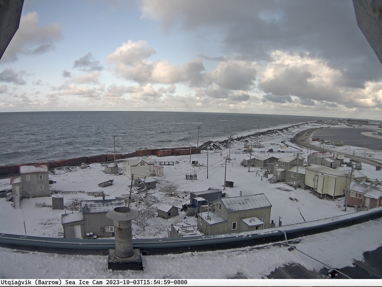
Signs of the coming season.
Wintry in Barrow today and currently 0F in Eureka, Nunavut, Canada.

-
4
-
-
Rainfall at my location for September: 7.50". That pales in comparison to other locations in the sub forum.
Y.T.D.: 47.68"
-
32 minutes ago, Rmine1 said:
I just saw the sun!
Same here....a break or two. Per satellite the solid cloud deck is finally beginning to collapse southeast !
-
1 hour ago, winterwx21 said:
I'm looking forward to next week. A much needed warm drying out period. We might get up to 82 degrees Tuesday and Wednesday. Looks like our last taste of summer. The following week looks very cool with first frost threats to the north and west.
Looking forward to both...the warm dry period and then the cooler first frost threat N&W.
-
3
-
-
Two day event total here = .99". Glad my area missed out on the excessive totals. Just don't need any additional rainfall for a while. Nice to go into Fall / Winter with wet ground but I've kind of had enough.
-
2
-
-
Two day event total here = .99". Glad my area missed out on the excessive totals. Just don't need any additional rainfall for a while. Nice to go into Fall / Winter with wet ground but I've kind of had enough.
-
Just .46" so far here as of 8am. Couldn't be happier. We just don't need any additional rain.
Stay safe and use caution if you are in the "jackpot" zone NENJ, NYC, SW CT and western LI. Looks Ida-esque there. Stay off the roads in those areas. I would!
-
21 minutes ago, ForestHillWx said:
Sneaky cool morning…45
Same here. Overnight low of 45. Turned the heat on.
-
1
-
-
Not exactly ....... weather with that depicted pattern.

-
2
-
-
Getting closer little by little and day by day.

-
3
-
-
Three day rainfall total here = 3.16". Still ongoing mist and drizzle.
-
1
-
-
7 minutes ago, NJwx85 said:
This should be fun


PRE going on right there. Taken verbatim could be a notable flooding event for parts of the forum. Still a ways to go before final solution comes into better focus and this is the NAM after all.
-
1
-
-
Received 1.48" rainfall over the last two days. Euro did best, at least for my location. Was more rainfall that I was expecting.
Was thinking on the order of .50.
-
1
-
-
FWIW HPC is going with the wetter solutions for the weekend.....subject to change of course.

-
1
-
 1
1
-
-
So much for the AI modeling. Looks like they have more "learning" to do. Was interesting to watch though.
-
3
-
-
Low this morning of 49. Very pleasant albeit a rather boring weather pattern in progress.
-
4
-
-
Another nickle and dime rainfall day here last 24 hours. Total = .15".
Total since last Wednesday = 1.31".
Nothing noteworthy in terms of wind, thunder / lightning, heavy rainfall rates. Just off and on passing moderate to briefly heavy showers / T-showers for the last 6 days.


.png.a441b72ad07ab8cb7c56153d81b78634.png)
.png.413244b87ff83c0ad10344b66f2ab1fc.png)

October 2023
in New York City Metro
Posted
Received .58" rainfall last two days. Kind of needed it to moisten the soil, been on the dry side last two weeks. Enjoying the cooler weather after the warm days.