

winter_warlock
-
Posts
1,110 -
Joined
-
Last visited
Content Type
Profiles
Blogs
Forums
American Weather
Media Demo
Store
Gallery
Posts posted by winter_warlock
-
-
29 minutes ago, psuhoffman said:
@Ji Case in point there have been 11 snowstorms of greater than 15” here since 1980. Every one of them was also a big storm for you. We share the same big storms.
Jan 96: 36”
Feb 11 2010: 30”
Jan 2016: 28”
Feb 2003: 28”
Feb 83: 28”
Feb 5 2010: 27”
Feb 2014: 23”
Dec 2009: 18”
Feb 1987: 18”
March 93: 17”
Feb 2006: 16”
Yup and every one of those was big for me too!!
")
-
24 minutes ago, MDScienceTeacher said:
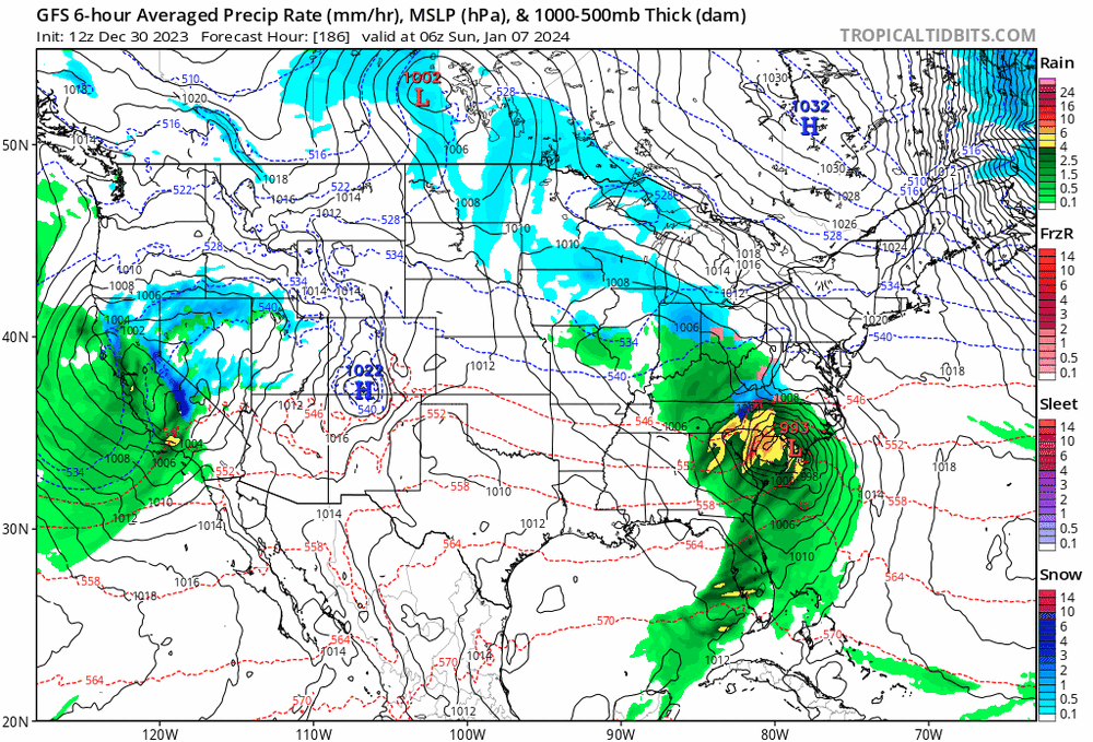
Per the op, sub 990 low going over Central VA under an air mass that has been historically means temp issues. Not saying it couldnt happen, we have the 50-50 low so that should help to fight the warm air, I am just saying dont invest too much in to this storm until we get closer.
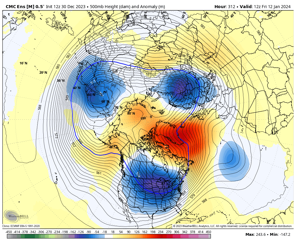
One silver lining is that the GEFS shows a much different track, with the low pressure bombing out after it exits the coast: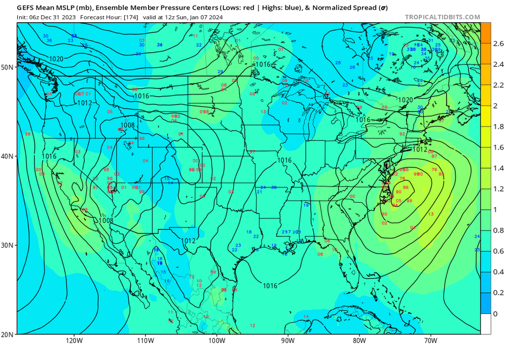
The 06z gfs control was too far inland for my taste im glad to see the ensembles farther east
-
Sterling has now started to mention the storm for the 7th
They are in a wait and see mode lol
......
From sterling.....
low pressure system in which the track of the low could be to our south and intensify as it approaches the mid-Atlantic Coast. The consensus low pressure system track has the low moving from central North Carolina, across the Tidewater of southeastern Virginia and just offshore of the Delmarva. It is too early to tell how much rainfall, how much snowfall, locations of these types of weather, and the timing of impact. We will need to monitor next weekend`s low pressure system over the early part of this week.
-
I can see myself haveing alot of sleepless nights waiting for the late model runs this coming week
")
-
 3
3
-
-
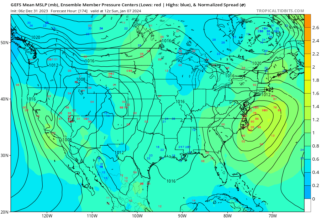
5 minutes ago, Heisy said:
Hard to know for sure if that’s coming up the coast. At 144 on the map MJO posted it had some decent confluence out ahead. Still, more support for the 7th so we take
.Nice to see some aggreement in models 7 days out
-
1
-
-
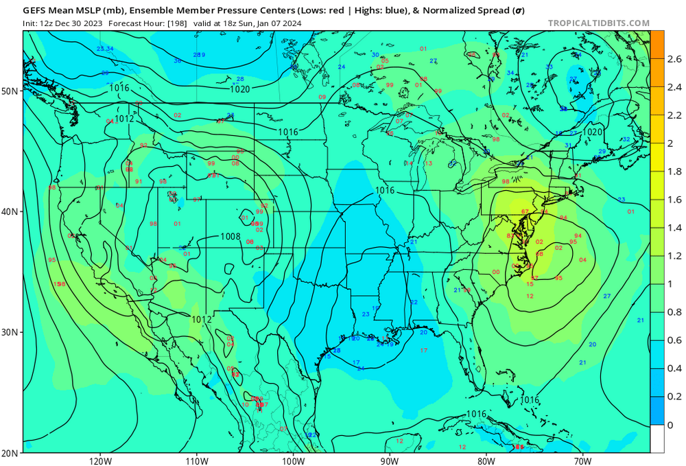
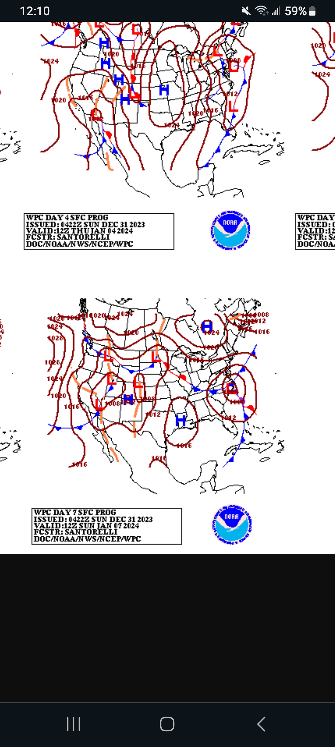
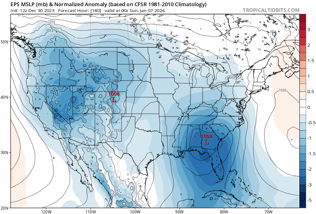
WPC seems to agree with latest modeling on their day 7 prog..

-
 1
1
-
-
Just now, MJO812 said:
Yes
Big hit

Very nice!!!!
-
3
-
-
Just now, NorthArlington101 said:
we got the second shade of blue!
ill take that!!!
-
47 minutes ago, nj2va said:
Looks great!! Need it to be just a lil more east! But ill take it considering its still 7 days out!
-
2
-
-
1 hour ago, Chris78 said:
It's dicey but the low track is as close to perfect as you can get.
7 days out or not, that is a thing of beauty!!
-
3
-
-
1 minute ago, Weather Will said:
Yesterday the runs looked horrible, today good, although the latest GEFS brings the SER back again at the end of the run. Lot of volatility/ chaos. Honestly, will be disappointed if we don't see some snow in the next 2 weeks but only God knows what is going to happen....will say I was really relieved to see a model show a coastal low with snow in the comma. Been a long time...
Amen brother !! It had been a long time!!
-
 1
1
-
-
11 minutes ago, Scraff said:
Have not read any previous posts above as I just clicked in here after looking at the 18z GooFuS. Safe to assume people started getting slightly encouraged for 1/7? I went straight to the bourbon 3 mins ago when I saw it. Let’s fuckin go!!

Ahhh. I love me some bourbon!!!
-
1
-
-
1 hour ago, IronTy said:
Udderly the most severe looking period I've seen on the models in decades.
Kinda funny, but actually true lol
-
23 minutes ago, clskinsfan said:
The HP showing up on recent runs changes a lot. While it isnt very robust it will help with the overall flow heading into the event. Been a while since we have had some excitement in here.
Its a 1022 high so not very strong but still a good thing to see a week out!!!
-
12 minutes ago, stormtracker said:
That’s my favorite IG meme. I’m going to run it into the ground. On da beach in Mexico and looking at fucking models and this thread.
What a time to be alive.
Ahh love the beach bro!!!!!
-
1
-
-
2 hours ago, JenkinsJinkies said:
And since we're not in a Nina it won't get the Mid Atlantic staple walk back with precip reduced by 75%.
Lol true!!
-
1
-
-
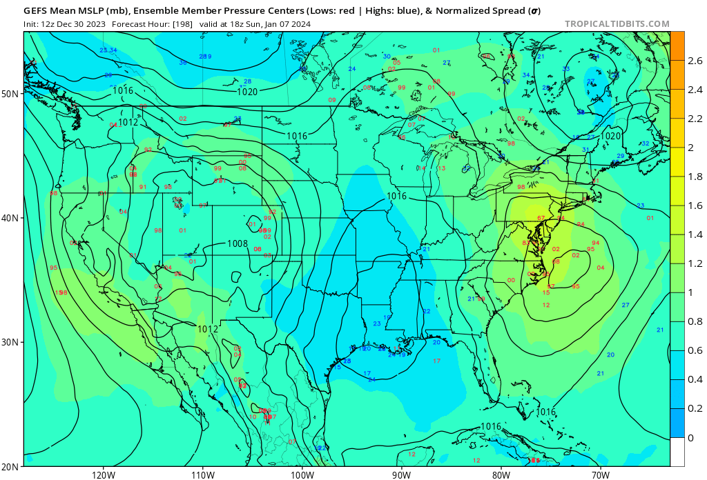
2 hours ago, MDScienceTeacher said:
Here are the individual Ensemble Members for the 7th. This is noticeably north of the previous three runs. Good Cluster of lows. Not sure if it will be cold enough.
Not a bad look at all for a week out!
-
Just now, Allsnow said:
This would work

Id still like to see that trough a touch more east.
-
1 hour ago, SnowenOutThere said:
Well I’m old enough to get my license (I’m too scared to drive though) but not an adult yet. Putting me at the fun spot where the past 7 years of nothing winters makes up my memory of winters! That’s why I like PSU so much because he doesn’t sugarcoat the shit winters I’ve seen my whole life, you need to see our new climo for what it is not what it was.
I’m not anywhere close to 30 so what happened in 2002 doesnt matter much to me personally
Damn u a youngin bro! lol hell im 56!! I remember blizzards in the 70s lol
-
2
-
-
2 minutes ago, Ji said:
@psuhoffmanthis would work right?

I personally would like to see that trough a lil more east.. but thats me
-
This is definitely something to watch. Been on for a couple model runs bow. Still a week out but definitely something to track . Hopeing it makes the turn a lil more north in future runs..
-
4 minutes ago, snowfan said:
Damn. How young are you? BWIs current 10 year average is 16.7”, which is certainly not the lowest 10 yr avg in its reporting history. 10 year stretches in the 40/50s, 70s, 80s/90s all had lower averages.
Every decade is different, i dont really go by any 10 year averages. I go by the typical 30 year
-
1 hour ago, Heisy said:
Even look at last nights 00z euro control for another example. It has this block and not an inch of snow anywhere near us. It goes from this….
To this…
Yet no snow anywhere because of same reasons you mentioned. Not that I care what the model shows verbatim, just another example
.I personally dont put alot of stock or faith into what any model shows 2 weeks out. Hell models cant even get things right 72 hours out half the time lol. Just gotta wait to see how it evolves.. but any "winters cancelled" claims are just ridiculous in last week of December especially with 3 months left lol... historically In elnino years its usually mid to late january before winter storms really start affecting the east coast and mid Atlantic in earnest anyway!
-
1
-
-
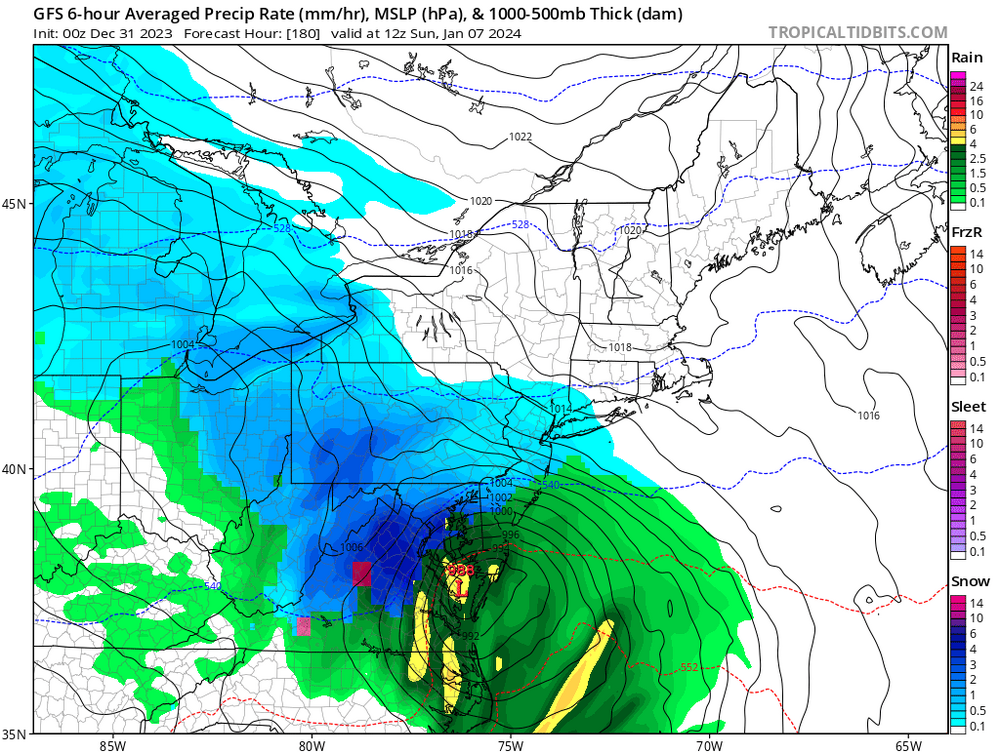
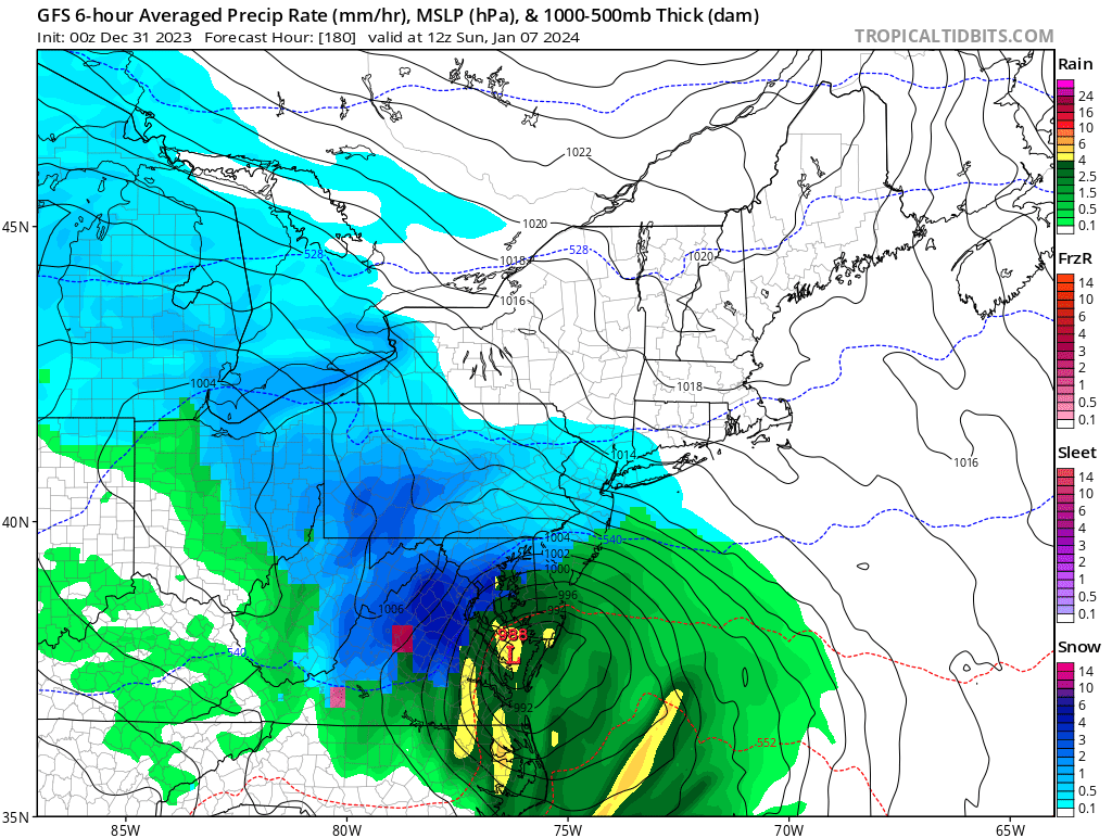
I got 2.15 inches of rain in my guage from this storm! Shame it wasnt snow!! Woulda been a nice 2 footer

Jan Medium/Long Range Disco: Winter is coming
in Mid Atlantic
Posted
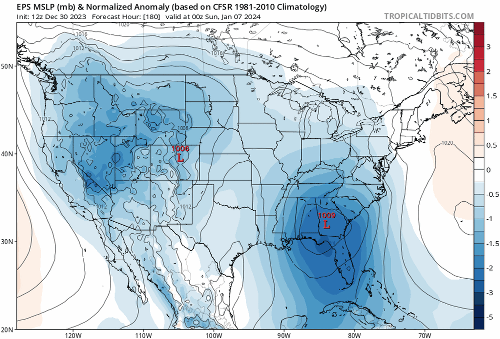
Latest WPC places the low almost perfect for mid Atlantic and i like the triple highs to the north!