

winter_warlock
-
Posts
2,265 -
Joined
-
Last visited
Content Type
Profiles
Blogs
Forums
American Weather
Media Demo
Store
Gallery
Posts posted by winter_warlock
-
-
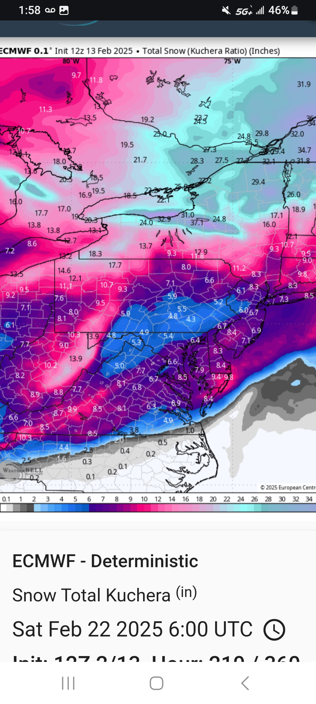
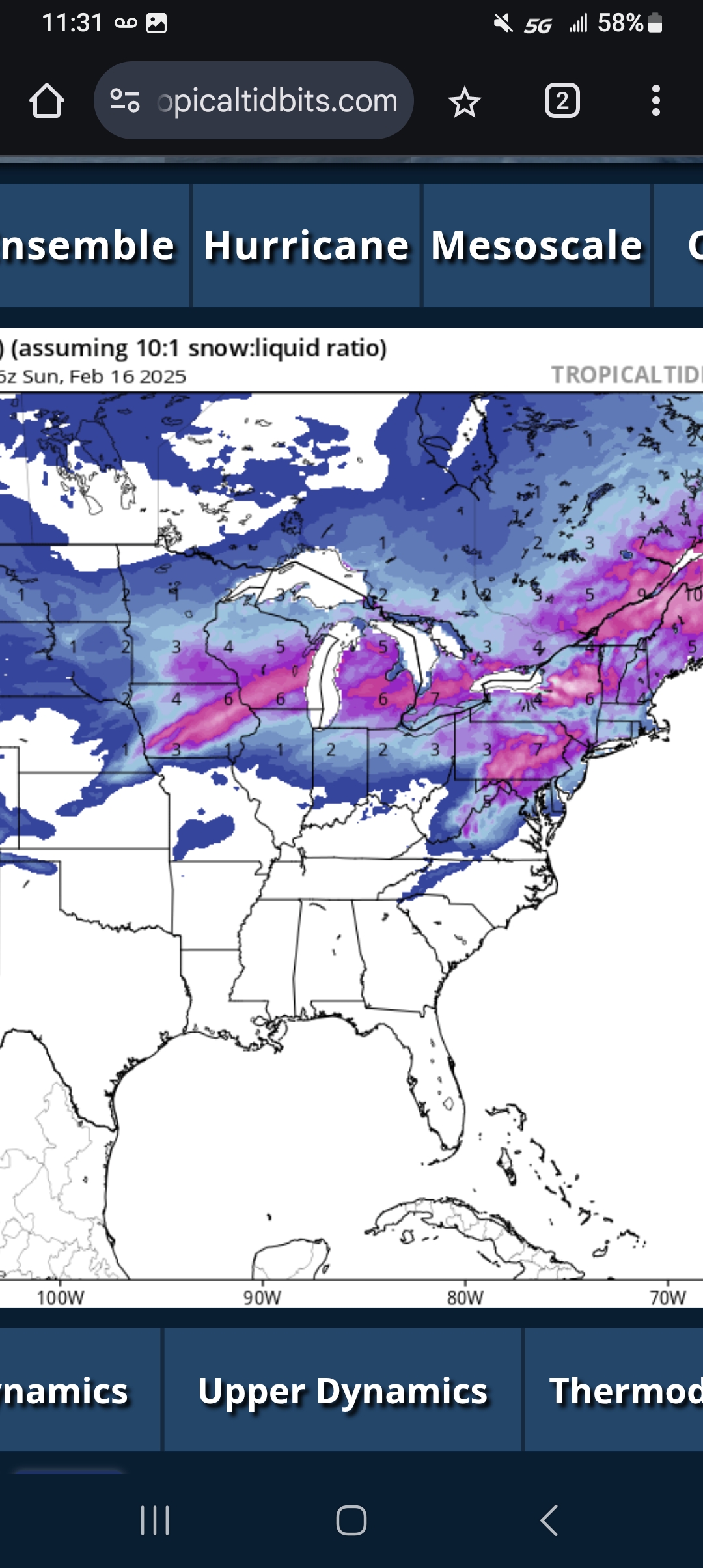
12z euro snowfall kuchera

-
5 minutes ago, NorthArlington101 said:
not sure anyone ever posted a GFS map without Saturday's "event"?

Not bad at all
-
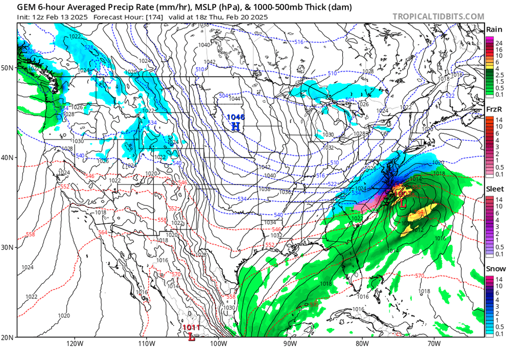
Considering it's 6 days out the cmc/gem don't look bad at all!!!
-
 3
3
-
-
Just now, WxUSAF said:
I don’t believe that Saturday morning stuff on the GFS and NAM at all. Hope I’m wrong.
I don't beleive ut either but it does add to the total snowfall maps
-
1
-
-
2 minutes ago, Maestrobjwa said:
How's that? It's gonna be mostly rain isn't it?
This is gfs thru sunday....

-
4 minutes ago, mitchnick said:
.thumb.png.a537c0507e961809a7cdbbe3cefd314c.png)
Some of that is this Saturday
-
1
-
-
If GFS and EURO shows what icon showed this forum will explode lol
-
3 hours ago, kristia said:
More like
Oh hey there’s a glass. I should put that in the sink. Look at this mail over here. I should open that first. Christmas tree is still up. I should go get the storage bins, take some of the decorations off and then just walk away.
Sounds like my sister she's the same way lol
-
1 hour ago, Ji said:
No it’s on purpose. We should have way more snow than we should. It’s basically been a wall to wall winter. It’s like having 7 great drives and scoring 6 fields goalsWe've had the cold. Just need the storms to be in the right spot. Still. Lots of time left. Alot of us have had more snow this winter then we've gotten in a few years
-
 1
1
-
-
2 hours ago, kristia said:
Leaving a trail of weather sadness and misery wherever I go

Well. Sounds like your a " glass half empty " kinda girl
-
2 hours ago, kristia said:
Moved here from Baltimore County in 2020 and I think I killed the snow vibe
hasn’t been much to write home about these last few years.
Well the lanina years don't help lol but I think ull probably get back to more traditional winters up there in years to come
") ..ull probably get more then I do in baltimore county lol
..ull probably get more then I do in baltimore county lol
-
Just now, Fozz said:
A winter with weeks of January snowpack and multiple light to moderate events (and major events if you’re in southern MD) is sure as hell much better than some other recent seasons.
Very true
-
1 minute ago, Ji said:
You guys act like you’re from the Carolinas just taking any snow that shows up on the models
Can only take what we're given bro
-
2 minutes ago, Heisy said:
I’ll take the euro at this range, eps isn’t bad. There is def a shot at a decent event here. Just wish the pac would slow down to allow the wave to dig and turn the corner better that’s all
.I agree. A week out I wouldn't wanna be in the bullseye anyhow. It never works out that way lol
-
14 minutes ago, mitchnick said:
Euro 12z
.thumb.png.d4cec48cb79dfc9eddebf69db2f3744f.png)
Thatss not bad for a week out relax people!+
-
1
-
-
22 minutes ago, kristia said:
Catoctins
Ahhh ok yeah. U guys got less up there.... This time. Usually u cash in up there
-
28 minutes ago, kristia said:
30.5 here currently. I would say about 2 inches total.
Only 2 inches wow . Must be north ? Where r u at?
-
7 minutes ago, NorthArlington101 said:
Are we rich already? This is alright?

Thats not bad for 7 days out!!
-
1
-
-
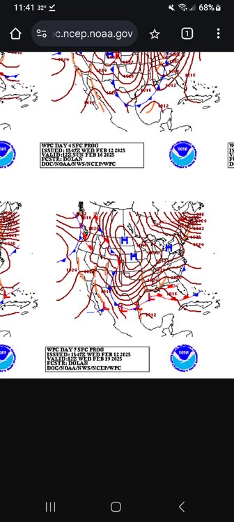
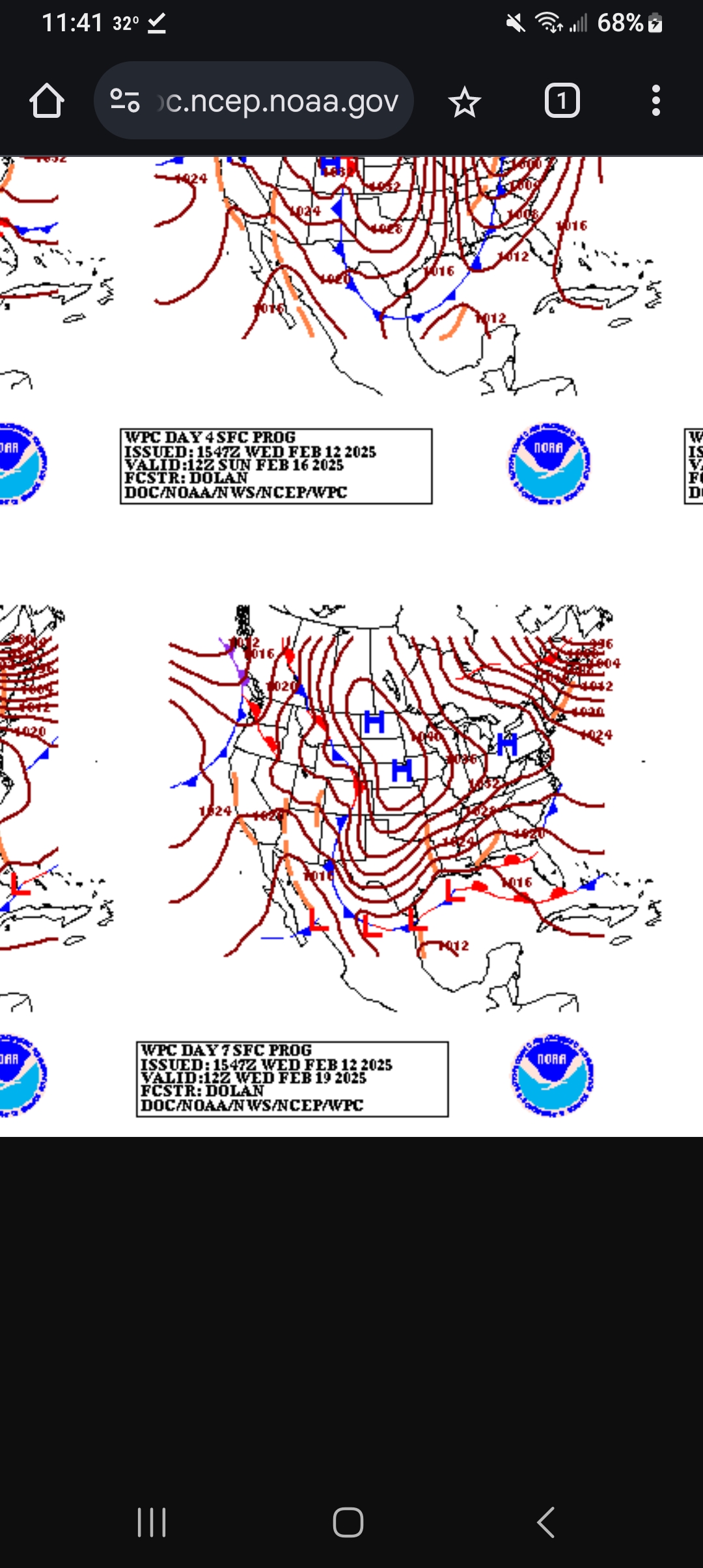
Wpc. Has storm in the gulf. Next Wednesday!
-
6
-
-
2 minutes ago, mitchnick said:
Got time for a north trend. Storm is there. Thats all we can ask a week out
-
7 minutes ago, mitchnick said:
Close up
.thumb.png.abdab18041e5a1a8153c4196d256d414.png)
Looks fantastic.. iod love to see euro come on board
-
1
-
-
From sparrows point MD
12/24.. Tr
1/6 .. 6.03 inches
1/11 .. 1.0 inches
1/19 .. 1.0 inches
2/8.. 0.10 Inches ( zr)
2/11-12 ...4.9 inches
--------------------
Total so far winter 24-25.. 13.03 inches
-
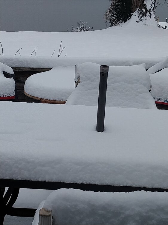
Snow has stopped
It's 31 degrees. I have 4.9 inches here. Almost 5! Not a bad storm at all
-
2
-
-
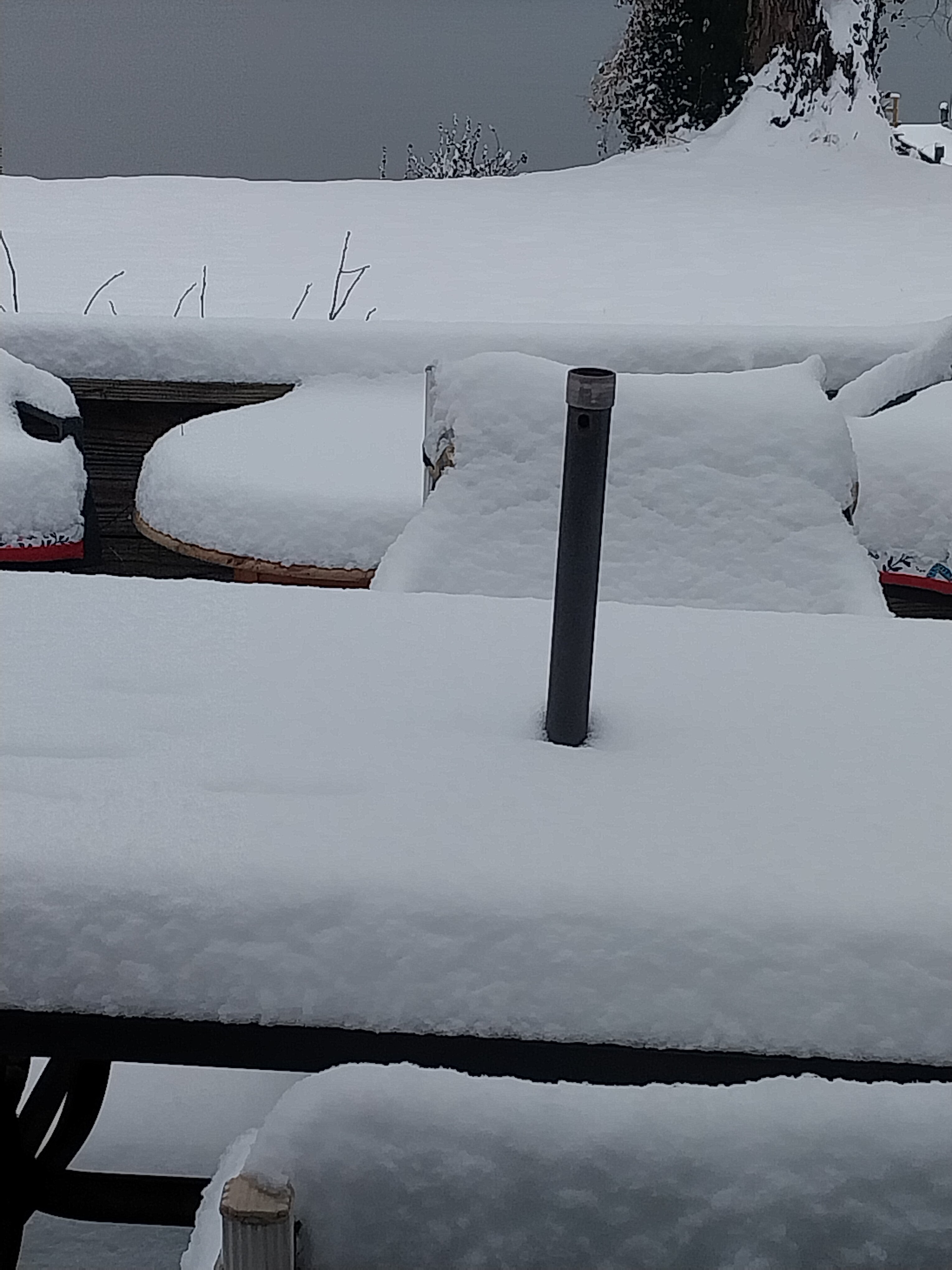
At 12:30 am ...in sparrows point MD.... 30 degrees F. 4.25 inches of snow. Light snow falling currently

.png.1371bd4782fc1bb5f9fc42bacc3c99f1.png)
.png.59bb5c0b0d381b50f34f4b057feaeaed.png)

.png.cdace5d79c88d6f7a7cc349861d5eef5.png)
February Medium/Long Range Thread
in Mid Atlantic
Posted
Sterling has snow forecasted for. Central md.....
Kinda Ballsy for 6 days out