

winter_warlock
-
Posts
2,265 -
Joined
-
Last visited
Content Type
Profiles
Blogs
Forums
American Weather
Media Demo
Store
Gallery
Posts posted by winter_warlock
-
-
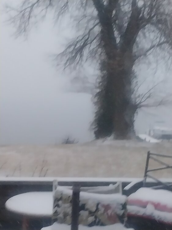
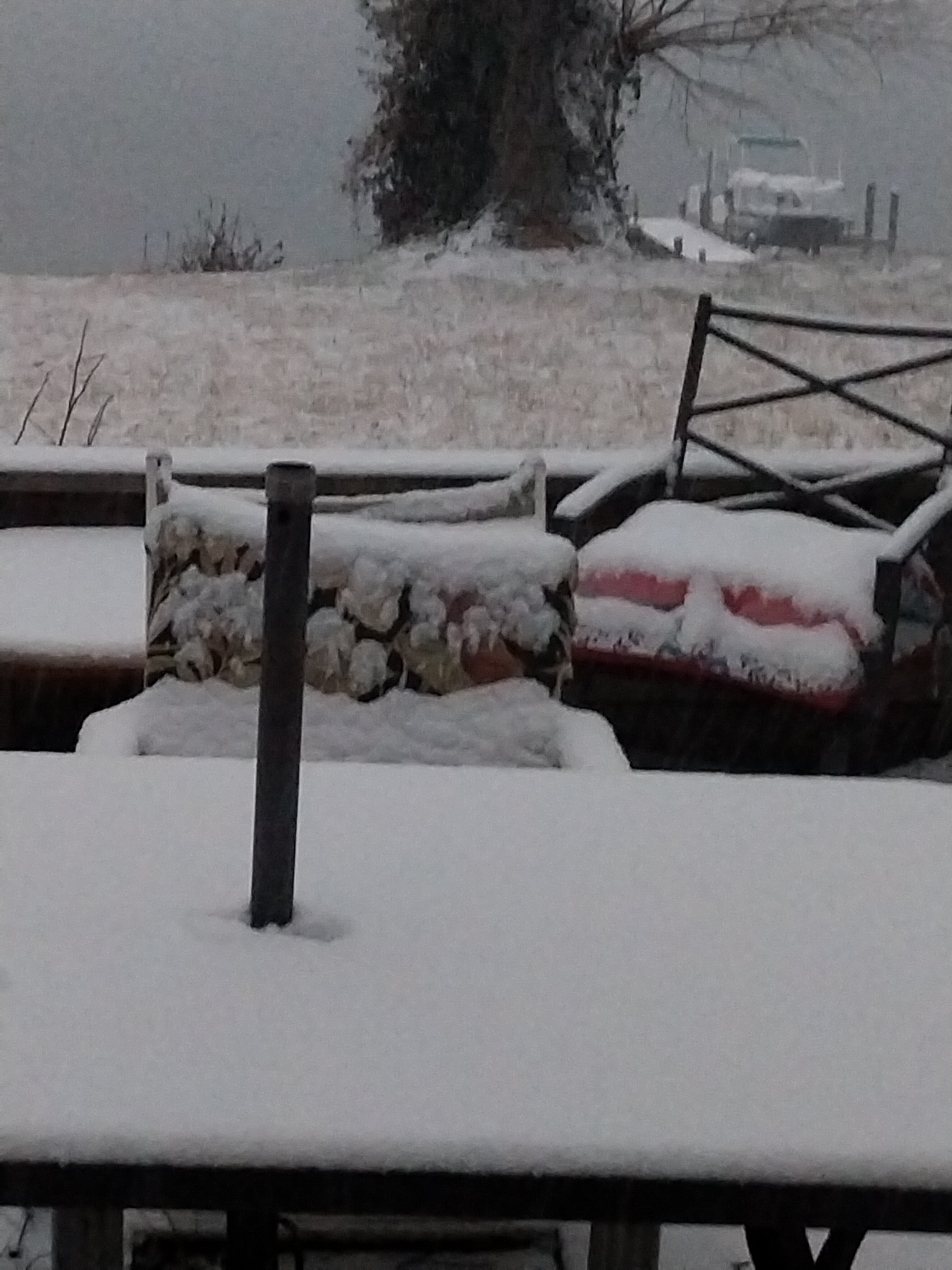
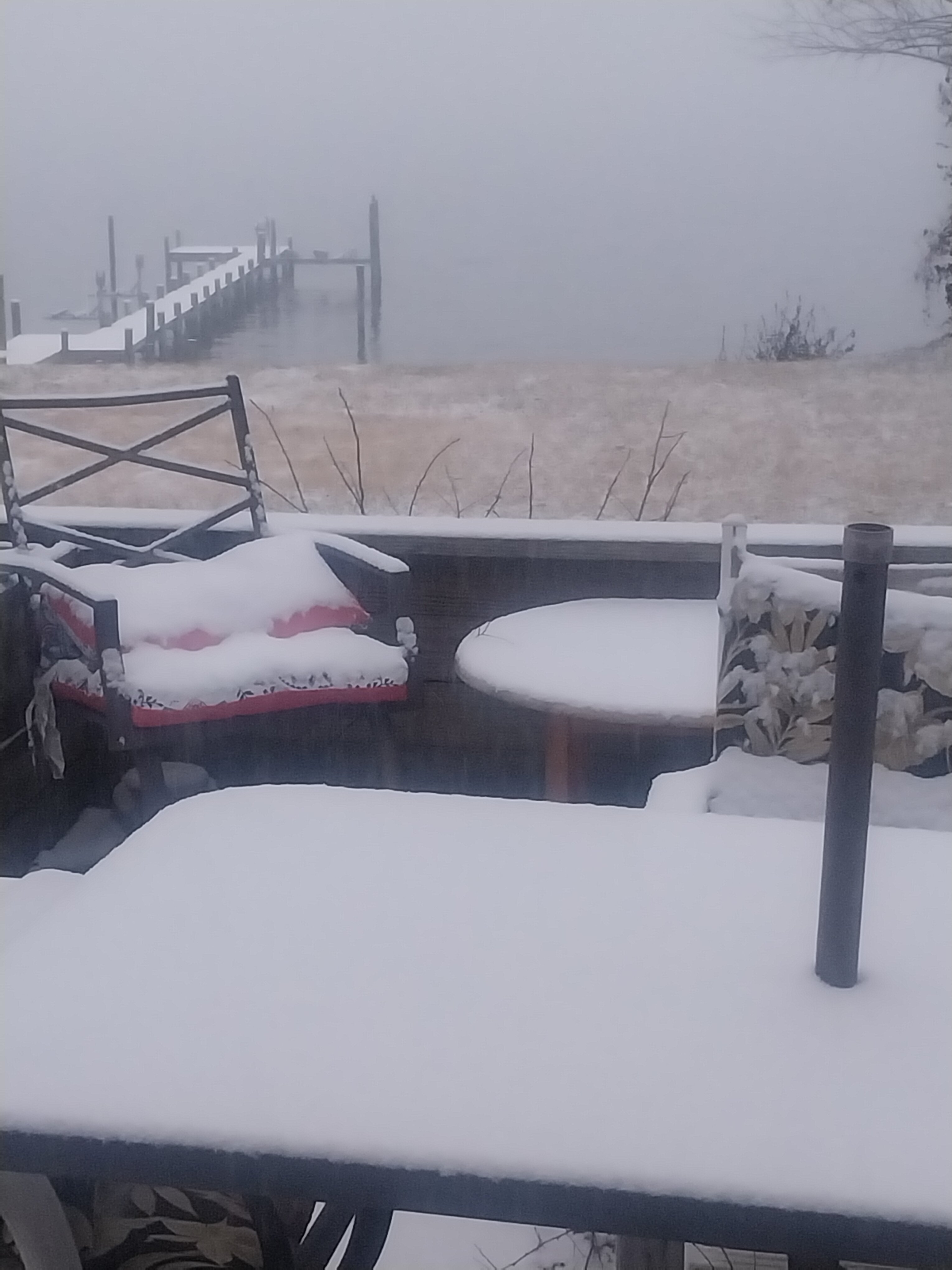
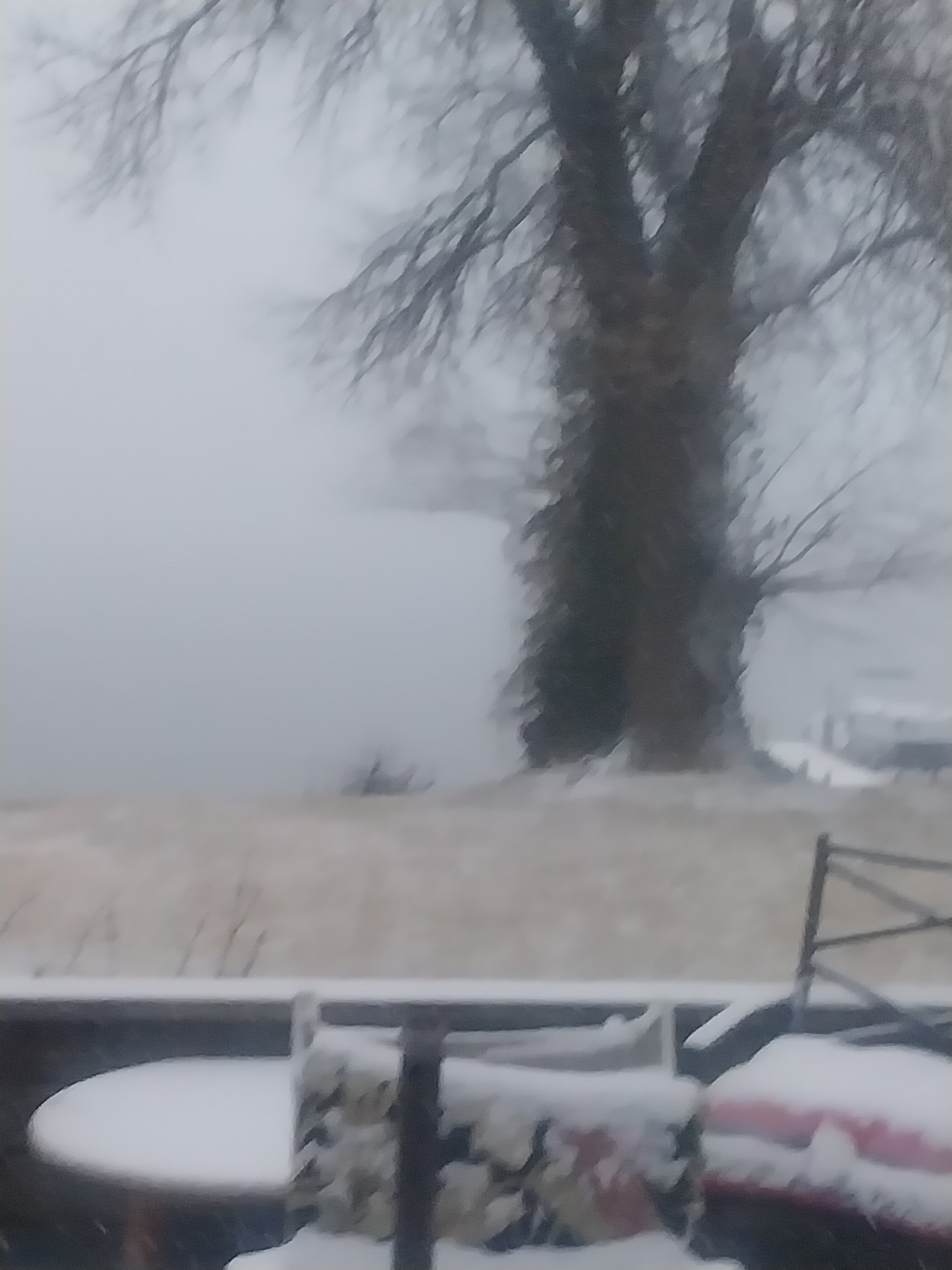
29 degrees at 8:55 pm. 3.0625" inches so far moderate snow falling in sparrows point MD
-
 1
1
-
-
37 minutes ago, Ji said:
Amazing how fast this fell apart lolFell apart?? Still 7-8 days out lol
-
1
-
 1
1
-
-
Just now, stormtracker said:
"Kids, do your homework"
That was his way of saying.." hahaha ull have school tomorrow!!" Lol
-
1
-
-
Just now, BristowWx said:
Never did win the golden snow shovel. Oh I tried.
I wanted to hit him with that damn shovel lol
-
1
-
-
Just now, stormtracker said:
Indeed. When I was a wee lad, I used to get so mad at him
He used to piss me off too. I always thought he just hated snow with a passion
-
2
-
-
Been 1 hour. And I now have 2 inches. So I'm getting snowfall of 1 inch an hour here!! Temp down to 29 degrees
-
2 minutes ago, Scraff said:
LOL. Should I? Never of thought of that. What if the weight of the beers finally snap my shelves!? Meh I’ll figure it out should it happen.
")
Just stick the beers in the snow lol
-
 1
1
-
-
I now have heavy snow and just measured a full 1 inch here in sparrows point MD

-
5
-
-
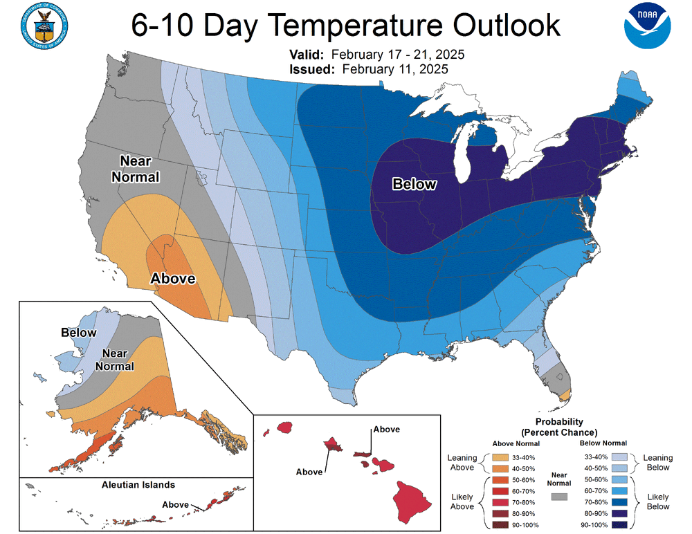
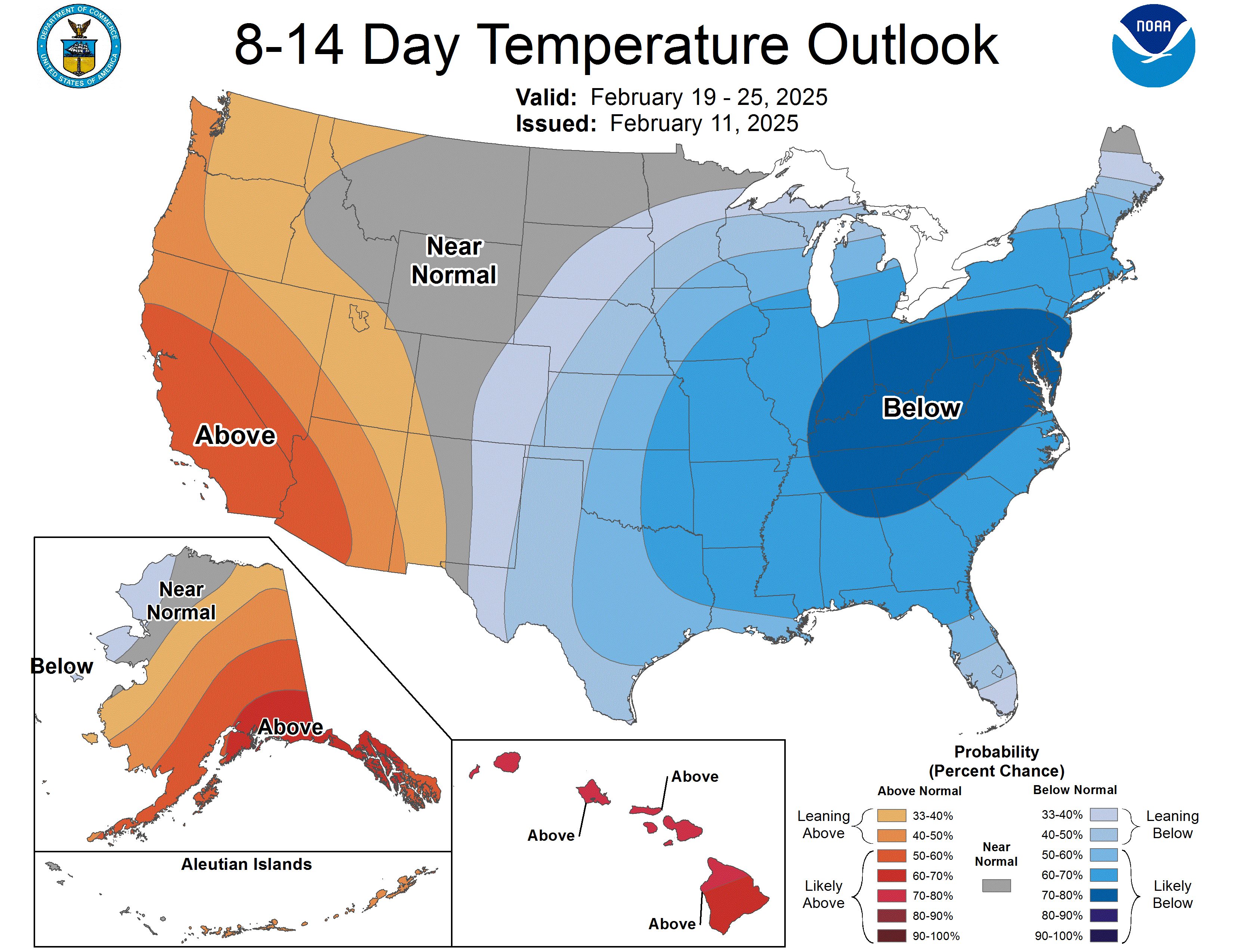
Regardless of storm track. Cold is coming back for a while!

-
2
-
-
1 minute ago, stormtracker said:
It's funny how we were worried about too amp'd and now it's south of us. Happened all in 12 hours. Honestly, that's where I'd want it right now.
I agree 8 days out id rather it be off shore instead of a cutter!
-
1 minute ago, stormtracker said:
Damn, nice to see a flip phone pic. What's that, 0.5 MP?
It's not a flip phone Pic. It's just a crappy Pic lol
-
 1
1
-
-
-
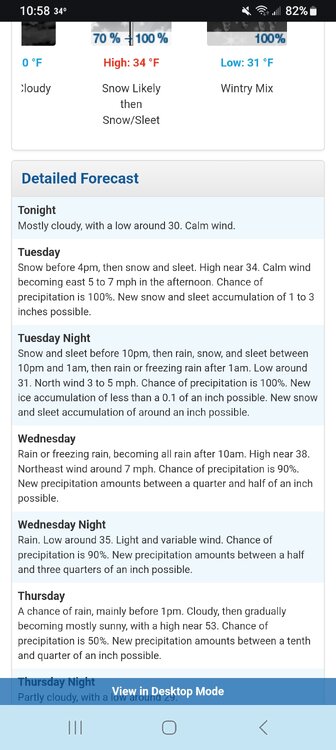
30 degrees moderate snow here. And about .5 of and inch
-
1
-
-
33 minutes ago, NorthHillsWx said:
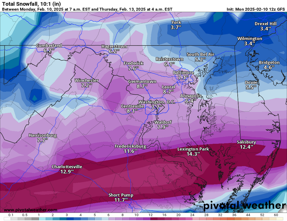
Someone between DC and Richmond is going to get a foot+ from this. That moisture feed goes all the way back to Arkansas.
Richmond not getting a foot lol
-
10 days to go. Gonna be a wild ride lol
-
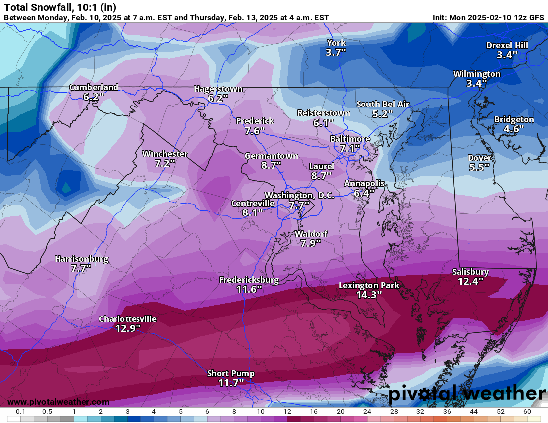
Cmc has different look. More south and east. Snow to 95
-
Gfs takes it too far west. I95 is slow to rain but 10 days out. It won't look like that in days to come lol
-
6 minutes ago, Terpeast said:
Gfs adamant on double digit totals south of dc close to RIC but the wakefield wfo isn’t having any of it.
Ur right wakefield barely saying much more then 1 -3 for Richmond. They. Aren't putting alot of stock in the Snowmaps...
From Wakefield .....
-
Just now, psuhoffman said:
But why is your bar a HECS? Those are super rare. If we get a 6-12” snowstorm across the area that’s a win.
Agreed I'd take a 6 -12 inch storm any day !! They are kinda rare in central md!!
-
6 minutes ago, psuhoffman said:
On the day of those storms yes numerically the NAO was neutral to positive. But there had been blocking and I consider the loading pattern days before more important. Second most don’t consider the nao by the numerical metric. If they see ridging near Greenland over a vortex under it near 50/50 they call it a -NAO, but numerically it’s actually a -AO. But I’m not interested in a semantics argument about terms.
My point is that’s a good pattern for a snowstorm. I don’t care what we call it.
Amen brother!!
-
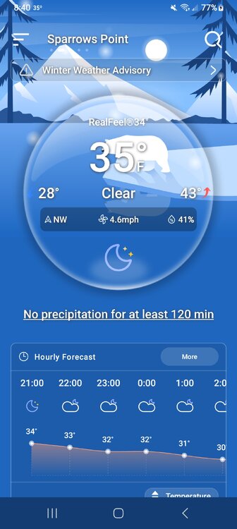
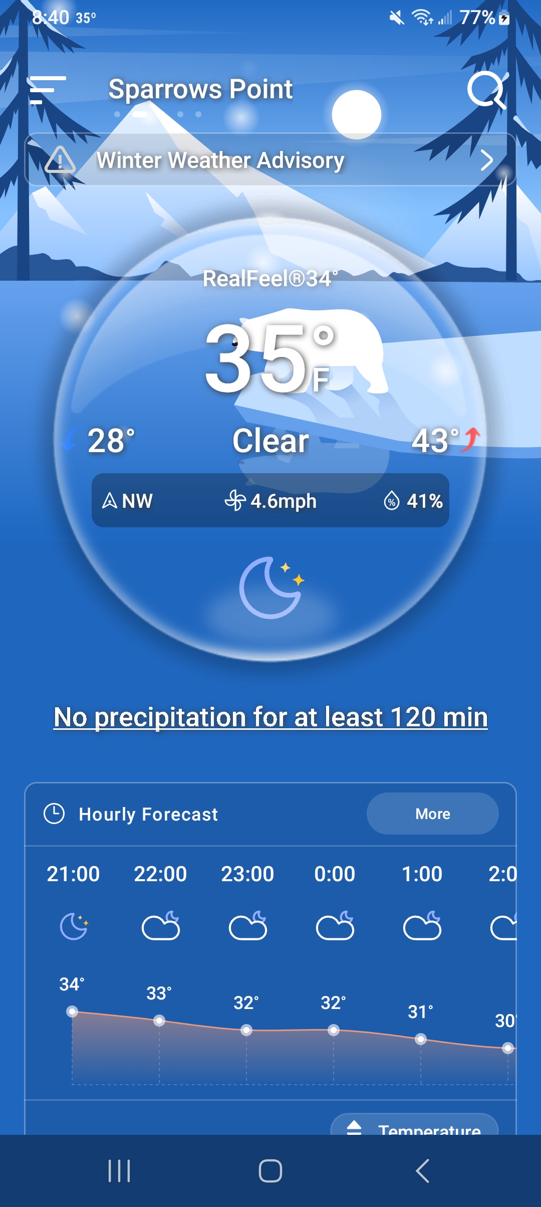
At 8 40 pm. Sparrows point MD...
-
18 minutes ago, wasnow215 said:
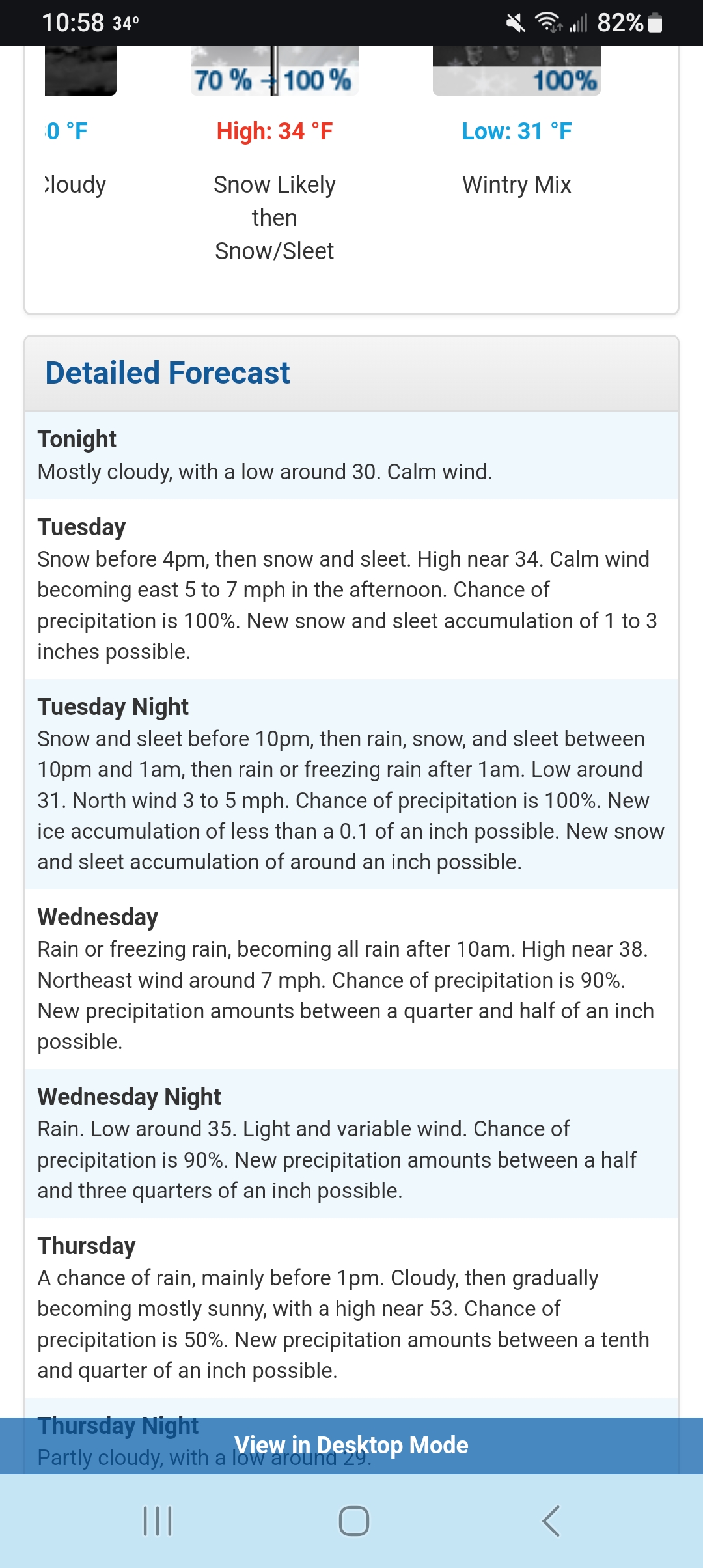
In order to be accurate you have to show or look at the simulated radar throughout Tuesday til the changeover.
Ok
-
 1
1
-
-
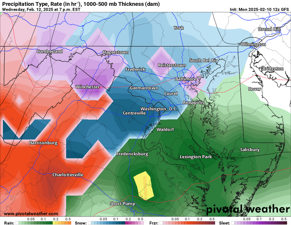
Ok if u look at the model. It shows rain in short pump and Salisbury yet it Shows outrageous snow totals. They are wayy over done down there lol
-
1
-
 1
1
-
-
1 minute ago, mdhokie said:
Not when short pump is jacking with 11"!
Yeah but if u look at the model it shows rain down there also so I think that 11 inches is wayy overdone


Feb 11-13: Nowcast/Obs
in Mid Atlantic
Posted
10:51 ppm. 30 degrees F. Now I have 4.0 inches of snow. moderate snow falling