

winter_warlock
-
Posts
1,108 -
Joined
-
Last visited
Content Type
Profiles
Blogs
Forums
American Weather
Media Demo
Store
Gallery
Posts posted by winter_warlock
-
-
Well i shit my drawers when i saw the gfs. If the euro shows what the gfs just showed, were all gonna have to wear fucking pampers when we look at the 00z modeling lol
-
8 hours ago, Terpeast said:
Always a chance we get a lucky shift south like we did with the second Jan storm, but I don’t think this is it. We don’t have a PV or any arctic front pressing things south as the wave approaches to begin with. I’m more interested in the feb 18-20 window
Feb 18-20 looks like a much better shot for alot of us!!
-
17 hours ago, stormtracker said:
True...im not saying bail...i'm just not feeling this one for us
Agreed!!! I feel better for the feb 18-19 possibility
-
35 minutes ago, J.Mike said:
I say: BRING IT
Im ready!!!
-
2 minutes ago, stormtracker said:
Yeah, this ain't it yall. I'm sorry
No sorries bro. Still 140 hours away lol. I wouldnt wanna be in the bullseye 140+ hours out anyway lol
-
Sterling mentions wintry precip possibilities....
Some of the ensembles have wintry precipitation funneling into the area late Monday night into early Tuesday. Given the synoptic pattern, it will take a strengthening cold air blast to be settled into the area ahead or along the precipitation shield. We will continue to monitor this system over the next several days. A cooling pattern will likely take place shortly after this event.-
 1
1
-
-
3 minutes ago, anotherman said:
Oh crap henry just jinxed us lol
-
 1
1
-
-
Well since the Ravens shit themselves today, Im hoping we get a nice mega snowstorm to track!
-
1
-
 1
1
-
 1
1
-
-
15 hours ago, Fozz said:
@ravensrule just imagine if the Ravens win the Super Bowl and then the following day we get a 12-18" storm
That would be like winning the lottery!!!!!
-
1
-
-
2 minutes ago, clskinsfan said:
All guidance is pretty consistent about a clipper affecting the area for the 31st. Meso models look eerily similar. With an inch or two for us. We are due again.
Bring it on!!!
-
1
-
-
2 minutes ago, CAPE said:

Ill take that!!
-
1
-
-
4 hours ago, midatlanticweather said:
@Ji - What is happening in Loudoun! LOL! Anyways, this was a wild run.

Ill get. More excited If other models jump on board
-
1
-
-
21 minutes ago, brooklynwx99 said:
and to think people are punting the rest of the winter. fucking insane
gotta suck to be that jaded
Punting the rest of winter on January 24th is just plain stupid. Still 2 full months to go
-
5 minutes ago, Terpeast said:
True, but we had the cold air. This time we don't.
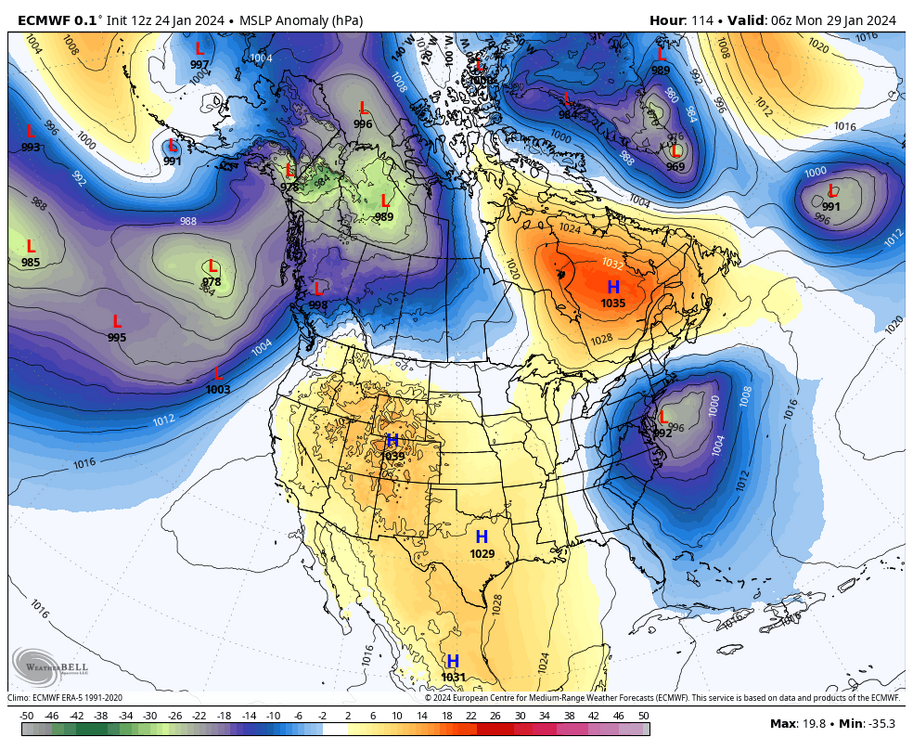
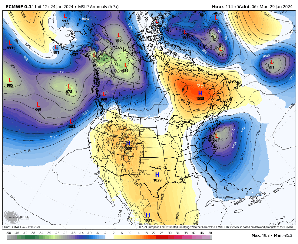
Well if u look at this pic. And see that high to the north we should have cold air coming down..
-
Still 5 to 6 days out. Last 2 storms werent nailed down till within 24 hours lol and even then it had to ve tweaked the last minute.. it will change a few more times
-
1 minute ago, stormtracker said:
So, we're not keeping one eye half open about the Sunday thing? It's the longest of long shots, but I mean..there's a high right there. All we need is to thread the needle, and an eclipse or something
Amen brother!!
-
25 minutes ago, Stormchaserchuck1 said:
So the +PNA/+NAO is going to lead to a -PNA that is going to lead to a -NAO, that is going to lead back to a +PNA?
Sounds legit lol
-
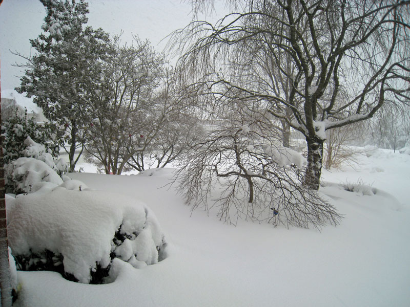
I got 3.9 inches today! So for the week i got 8.8 inches. Not bad!! Definitely a much better winter so far compared to last few winters!!
-
3
-
-
30 minutes ago, WVclimo said:
No one would think less of you if you rounded that up to 2.188”
")
Lmaooo
-
i have 2.1875 inches here in sparrows point MD. 26 degrees moderate snow falling
-
Just now, Stormchaserchuck1 said:
It's new snow coming
Oh ok nice!
-
Just now, stormtracker said:
So far, the most noticeable change is the sfc is colder leading in.
Could mean higher ratios!
-
Just now, Stormchaserchuck1 said:
0z Hrr has a good strip of 4"+ through central MD on snow depth! I wonder if they are narrowing in that it was the same area that got hit hardest by the last storm..
You think the snowdepth includes snow already on the ground or just the new snow coming?
-
1
-
-
My official forecast!! I feel pretty confident in it !! Lol


2024 Valentines Day Rain/Snow/Who The Hell Knows Thread
in Mid Atlantic
Posted
Hmm how accurate is DT? Lol