psuhoffman
-
Posts
27,419 -
Joined
-
Last visited
Content Type
Profiles
Blogs
Forums
American Weather
Media Demo
Store
Gallery
Everything posted by psuhoffman
-
Just need the Cmc to capture slightly further south and amp up a little more and it’s the euro.
-
@stormtracker


-
Cmc not a full cave to the euro but definitely moved most of the way that direction.
-
Y’all gonna like the Cmc
-
Patience grasshopper
-
Read my post to high risk. Imo it’s in how they handle the h5 as it enters the Midwest and starts to feel the effects of the flow to the northeast. My money is on the euro. Not just because it’s has superior physics but it makes more sense Imo.
-
It got a little better this run but yea. The gfs and euro seriously diverge when the upper low gets to MO and starts to feel the effects of the blocked flow to the northeast. The gfs continues to lift the wave right into the suppressive flow and so it then opens up and it becomes a diffuse mess before eventually being forced southeast. Euro turns SE from MO and amplified the h5 right to the coast. The other globals are somewhere in between with that.
-
Secondary track is perfect. The reason it’s not the euro is the primary gains too much latitude before the transfer and the h5 instead of digging and amplifying in phase with the secondary opens up as it approaches. In other words it’s a messy transfer. Fix that and it’s a euro like solution.
-
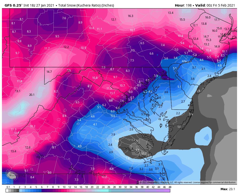
Not just me specifically those are the biggest storms to affect our region as a whole the last 30 years. However...the Delmarva and southeast VA are a different climo zone when it comes to snow. They can do “ok” when DC and Balt and places west get a HECS but honestly for you to “Jack” required a different type of storm usually. For Baltimore and IAD and me to be getting 20”+ usually means your mixed or dry slotting because to get that kind of moisture feed here the low is too close for you. There are some rare exceptions like (ironically) PD1 and PD2 (for different reasons) but those are rare exceptions.
-
Anytime just drop of the check to cover the very reasonable 50 cent daily storage fee. That comes to $730.
-
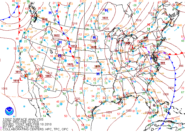
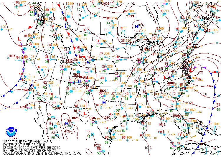
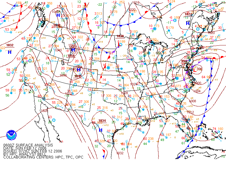
1996 tucked 1/25/2000 tucked 2/12/2006 tucked Feb 6 2010 Tucked Feb 11 2010 tucked Feb 13 2014 Tucked 2016 Tucked Almost every one of our best snowstorms of the last 30 years was tucked in right against the Delmarva coast. The only exceptions were Dec 2009 and Feb 2003. 2009 managed that because it was a very amplified stj wave out of the gulf with an amazing moisture fetch that was 985mb over eastern NC It also had an inverted trough into WV so that combo meant an incredibly expansive heavy precip shield to the northwest of the track. It tracked NE from the outer banks. Frankly a less intense and less juiced up STJ system with that track likely doesn’t provide big totals in the NW 1/3 of our region normally. That track would usually fringe places like Winchester or Hagerstown or Frederick. PD2 was a west to east STJ wave overrunning an Arctic high. The coastal was weak sauce here and had very little contribution to that event. But the rule on an HECS here is we want the low tucked into the Delmarva coast.
-
Man I’m an idiot. My cache was loading yesterday’s eps. 18z looked amazing. Sorry. Still think suppression is more a risk but it’s becoming less of one. Frankly it’s hard to see how we don’t get at least a decent snow from this. Carry on.
-
It’s possible you dry slotted before the mid level warm intrusion in 96. But sleet did make it as far NW as IAD. The dryslot is caused by the same function as the mixing. The mid level warm intrusion also often times up with the dry slot because it signals the rapid WAA has ended (the cold has been displaced) and so you get light or no precip. Whether it’s sleet or just dry doesn’t make a difference to snow totals lol.
-
96 I changed to sleet all the way in Herndon. Wasn’t a big deal mostly light in the dry slot. 2016 the extreme dry slot prevented mixing since there was no precip during the mid level warm intrusion but the effect was the same, places southeast of 95 didn’t get the 30”+ totals NW did. I think your misunderstanding me. I’m not saying places like DC and Annapolis and EZF can’t get a lot of snow from a HECS where Winchester and I do. They can. But if the western end northern parts are getting big hits they are probably flirting with a dry slot and some sleet. For the deform to set up along the coastal plain (where there is no oragraphic aid also) it likely means a rapid drop off in totals NW of 95. Those are very rare but happen. The knickerbocker storm is an example. That gave DC 28” of pure snow but it wasn’t that big up here or in Winchester. Totals dropped off rapidly NW of 95. If we want a true forum wide 1 foot plus places southeast of 95 probably can’t Jack and will flirt with dry slot or mix. Otherwise the NW 1/2 of the forum will get left out. That’s simply climo on these type storms. Of course everyone should root for the most snow in their yard. If you Jack and I get 3” so be it. I won’t hate on ya. I’m just pointing out what the typical outcome is.
-
Yea
-
Before I get flooded with “don’t worry” I don’t think this misses. We’re now inside the range the euro went way south with previous storms. And even if it adjusts south some it might come back north a little at the very end. It’s doing that now with tonight’s snow down in NC and south VA. I think we’re pretty close to the final solution on the euro. It’s pretty locked in with only some wobbles on the EPS the last 36 hours. But the bigger threat to a total fail is still suppressed imo if your north of DC. Doesn’t mean I expect that fail.
-
I liked 6z and 12z better. More tucked slp. An escape southeast and late capture is by far the biggest threat to missing a big snow if your north of DC. Places southeast of DC would wave that but honestly if your more then 20 miles east of 95 you have to mix for places west of the fall line to get a huge snowstorm. I hate to be brutally honest but in almost every HECS for places like Winchester or IAD or me and mappy southeast of 95 has to mix. That doesn’t mean the can’t get a lot of snow. But sorry the eastern shore and the blue ridge aren’t both getting 20” snowstorms. If lower MD is getting a 20” pure snow I am probably smoking cirrus.
-
DC is in the dryslot from 96 hours to 116 which is when temps support rain. There is virtually no precip. Temps do warm to the mid 30s but I doubt that melts all the ~5” that fell in the general DC area. Probably compressed it down to 2-3” but that would happen frankly after ANY storm ends in a storm we don’t have Arctic air behind it. Think of it as 2 storms. A 5” snow followed by a 2-4” storm 15 hours later, yes with some melting in between. It’s probably 2-3” of frozen slush with 2-4” of powder on top (even with mediocre surface temps snow under that upper low would be high ratio fluff) in the end. That’s like the 3rd best snowstorm in DC the last 6 years!!! And that’s the “disaster”.
-
I dunno what the TT depth uses but about .4-.55 qpf falls before there is mixing across the general area low to high from EZF to Baltimore. I know WAA won’t have high ratios but I don’t see why they would be that low either. So that looks like a general 4-5” thump followed by dry slot then 2-4” with the upper low. Even if we toss the back end stuff that’s still by far the biggest snow for the area in a long time and I don’t see why we toss the upper low when something like that is showing on all guidance. Besides speculation that the run will be worse then it really is could happen with ANYTHING...it’s still kinda lol to see people calling a warning level snowfall a “disaster”.
-
Late February the NAO went through one last cycle and setup a last window the first few days of March. I was excited from a week out. We had some good tease runs. But in the end the trough split the energy between two waves and neither amplified. We got light rain with one and I had some mid 30s light snow and a slushy coating up here but it was a wasted opportunity. Cant complain though. Well Ji did lol.
-
@WxUSAF I noticed 3/3/2010 in that analog package. It was in there before 2016 also. It confirms what I thought back then that we were so close to a 4th HECS that year. But the trailing sw acted as a kicker instead of phasing and the trough remained diffuse so nothing organized until off the coast and the pathetic cold we had pretty much that whole year wasn’t going to work with light precip in March. But it was close Imo. Imagine if we had closed that season with another 10”+ storm!
-
Lol at ppl tossing this like it’s garbage. Yea it’s not the euro hecs but a 5-10” area wide snowstorm is not something you label a fail unless you have no concept of our climo.

-
Boxing Day was a miller A it simply screwed us. You could make a (weak) argument it was hybrid because of the phase interaction with a NS wave but the real issue Imo was a weak wave that came across right in front that originally shunted the gulf wave to the south then the flow relaxed and it bombed due north but too late for us. WRT miller Bs you will always see some screw jobs in any analog list because frankly the difference between a big hit and a close miss is really minor on a pattern scale. If you go through some of the near misses and just look at h5 you can’t tell the difference from some of our HECS storms. I played that game once to prove a point. It’s hard to tell apart the screw jobs from the hecs at h5. That’s what makes them screw jobs. They had huge potential but didn’t perform. We will always be at risk of that from range. Especially given our southwest most locations of the northeast hecs zone. We need everything to come together the fastest. A late phase. A suppressed STJ so the storm has to develop a precip shield late. A messy transfer. A west primary that holds too long. They all can get their act together in time the further northeast you go but any of those factors kills us. We are always playing with fire here in ANY big coastal setup no matter how good it looks at range. Jan 2005 looked like a 2 foot DC hecs from 5 days then the stj got shunted southeast and it became all NS. Just this December every global was saying 12”+ for a while then the mid level issues appeared. The only totally safe setup here is a WAA wave with a cold high in front. And we kinda have that here except the wave is actually shearing out again as it moves east so we become dependent on the coastal for a lot of the snow. That’s a boom but also bust scenario. Right now I favor boom but bust is always lurking to set @Ji off!
-
That list looked like that 5 days before 2016 also. Obviously minus 2016 lol. Only other time they looked close to that good.