uofmiami
-
Posts
2,349 -
Joined
-
Last visited
Content Type
Profiles
Blogs
Forums
American Weather
Media Demo
Store
Gallery
Everything posted by uofmiami
-
10 here in Syosset & 13 in Muttontown.
-
See if the smoke messes up the temps for Tuesday.
-
Just had two mornings of 58 for the low in Muttontown on Friday & Saturday. I’ll take these cooler summer mornings as they come, a welcomed break.
-
They have any hail today? Doesn’t that get recorded as a T of snow? Thought I remember that happening at some other station one summer in the area, maybe my memory is wrong though.
-
SVR-PRE (ELSA) potential NYC subforum Tue-Fri morning July 6-9, 2021
uofmiami replied to wdrag's topic in New York City Metro
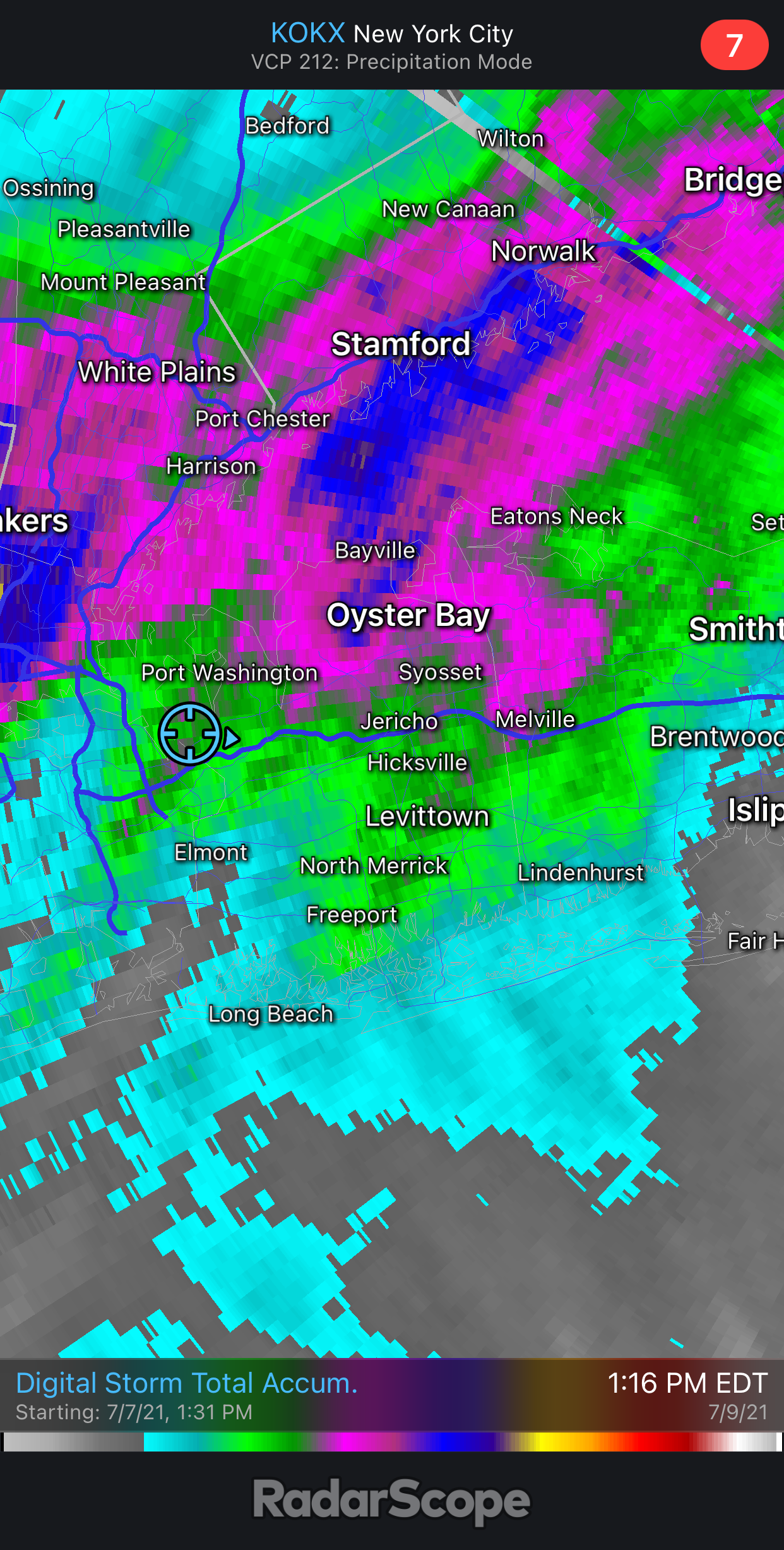
Yep radar estimate shows it well and matches up with my two stations in NE Nassau. Muttontown with 4.93” and Syosset with 3.86”
-
SVR-PRE (ELSA) potential NYC subforum Tue-Fri morning July 6-9, 2021
uofmiami replied to wdrag's topic in New York City Metro
-
SVR-PRE (ELSA) potential NYC subforum Tue-Fri morning July 6-9, 2021
uofmiami replied to wdrag's topic in New York City Metro
Looks like I’ll end up with around 4” in Syosset and 5” in Muttontown when this is done shortly. Had stronger winds in Tuesday’s storms but I expected that. -
SVR-PRE (ELSA) potential NYC subforum Tue-Fri morning July 6-9, 2021
uofmiami replied to wdrag's topic in New York City Metro
4.74” in Muttontown & 3.72” in Syosset. Highest gusts at both is 29mph. -
SVR-PRE (ELSA) potential NYC subforum Tue-Fri morning July 6-9, 2021
uofmiami replied to wdrag's topic in New York City Metro
4.07” in Muttontown now, 3.21” in Syosset. -
SVR-PRE (ELSA) potential NYC subforum Tue-Fri morning July 6-9, 2021
uofmiami replied to wdrag's topic in New York City Metro
3.58” in Muttontown & 2.98” in Syosset now. -
SVR-PRE (ELSA) potential NYC subforum Tue-Fri morning July 6-9, 2021
uofmiami replied to wdrag's topic in New York City Metro
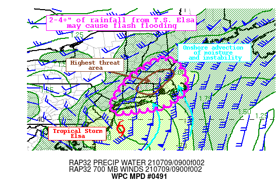
-
SVR-PRE (ELSA) potential NYC subforum Tue-Fri morning July 6-9, 2021
uofmiami replied to wdrag's topic in New York City Metro
Looks like a deformation band is just setup over E Nassau/W Suffolk as Elsa starts to move away from us. Too bad this isn’t a winter storm, haha. 2.97” in Muttontown & 2.49” in Syosset so far from t-storms and Elsa. -
SVR-PRE (ELSA) potential NYC subforum Tue-Fri morning July 6-9, 2021
uofmiami replied to wdrag's topic in New York City Metro
OKX should put radar to VCP 121 but they haven’t. -
SVR-PRE (ELSA) potential NYC subforum Tue-Fri morning July 6-9, 2021
uofmiami replied to wdrag's topic in New York City Metro
-
Seems to have the warmest 850 temps N of us too, as has been the pattern it seems.
-
Elsa looks like a TS from recon, NHC jumped the gun based on wind report from Barbados.
-
Looks like 95 for the high in Muttontown & Syosset today.
-
Tmagan says nearly six years since it last happened!
-
Did anyone read the article? I haven't followed this model, but it allegedly gave lead times of a month on the Texas outbreak etc. They also stated the model at times is wrong, case in point. So it's a work in progress. If anyone wants to follow it, as it's in development with RSMAS & funding from NOAA, they can.
-
Obviously a work in progress. I wouldn’t be making critical decisions based off it that’s for sure.
-
Came across this article in the Miami Magazine, on the SubX long range model (1-4 weeks out). Ben Kirtman, who helped with NMME model is in charge of this new model. https://magazine.miami.edu/features/2021-spring/subseasonal-experiment-subx.html Here’s one link to the model: http://wxmaps.org/subx_custom.php
-
95 for Muttontown & 94 for Syosset, so far. Currently 93/77 w/108 HI in Syosset & 93/70 w/101 HI in Muttontown.
-
92 for the high today in Muttontown & Syosset!
-
48.7 in Muttontown & 50 in Syosset for lows. Low of 72 here in Orlando, looking forward to landing in the crisp weather later today.