Nomz
-
Posts
743 -
Joined
-
Last visited
Content Type
Profiles
Blogs
Forums
American Weather
Media Demo
Store
Gallery
Everything posted by Nomz
-
Nothing yet in Georgetown
-
Looks like game time. This is why we do what we do.
-
Radar showing virga over south DC
-
Decent reflectivity up over Warrenton, closing on Manassas, at about 60mph e-w. Looks to be the first band that'll hit DC in 30 minutes.
-
One of these days we'll hit the jackpot and it'll be worth it. Or maybe the snow is the friends we made along the way.
-
Don't do this to me man
-
If LWX reflectivity is to be believed, DC is about 15 miles from snow.
-
January 24-26: Miracle or Mirage JV/Banter Thread!
Nomz replied to SnowenOutThere's topic in Mid Atlantic
Spent too much time arguing with people about this. I have 10 bucks coming if we stay under a foot. -
Reflectivity region-wide has definitely increased in the last 15 minutes or so. Tiny little band moving w-e into Woodbridge right now.
-
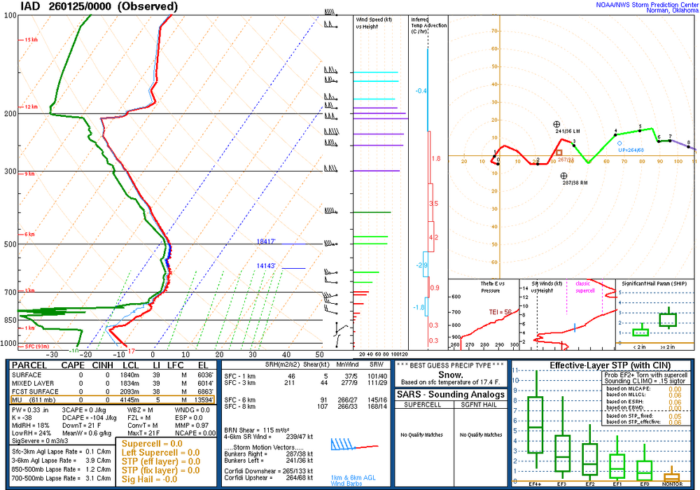
Here was the IAD sounding from 00z. Moisture starting to build in.
-
At this point, I'll take it. 9 inches combined for DC. With a little compression, maybe it's 8.
-
Final call pre precip in DC, sticking with the 6-10" (including sleet) forecast that I've had since Thursday AM. Unfortunately, staying conservative was the right move.
-
January 24-26: Miracle or Mirage JV/Banter Thread!
Nomz replied to SnowenOutThere's topic in Mid Atlantic
-
January 24-26: Miracle or Mirage JV/Banter Thread!
Nomz replied to SnowenOutThere's topic in Mid Atlantic
How’s it looking? Haven’t had time to weather nerd today and last night. -
January 24-26: Miracle or Mirage JV/Banter Thread!
Nomz replied to SnowenOutThere's topic in Mid Atlantic
I’m unfortunately going to be doing some I Told You So -
Seeing clouds with the arctic blast overspreading the blue ridge from 81
-
AIFS has been deadly this winter so I'll take it in our corner
-
January 24-26: Miracle or Mirage JV/Banter Thread!
Nomz replied to SnowenOutThere's topic in Mid Atlantic
If we get a sequel event next week, I'm not staying up to see the 00z euro till we're at least within 72 hours. -
January 24-26: Miracle or Mirage JV/Banter Thread!
Nomz replied to SnowenOutThere's topic in Mid Atlantic
I think you already screwed us lol -
January 24-26: Miracle or Mirage JV/Banter Thread!
Nomz replied to SnowenOutThere's topic in Mid Atlantic
Winter storm warnings from Mexico to Boston. Anyways Georgetown just cancelled for the poor saps that have classes Sunday.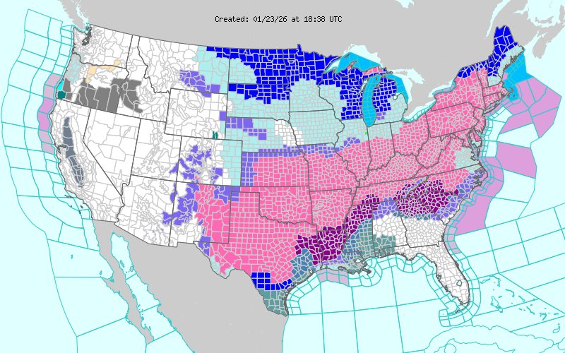
-
January 24-26: Miracle or Mirage JV/Banter Thread!
Nomz replied to SnowenOutThere's topic in Mid Atlantic
I was just looking at the 10:1 snow map and it looked off up north and figured it would have upstream effects. -
Jan 24-26 Weekend Snow and Sleetfest Model Thread Part Tres
Nomz replied to H2O's topic in Mid Atlantic
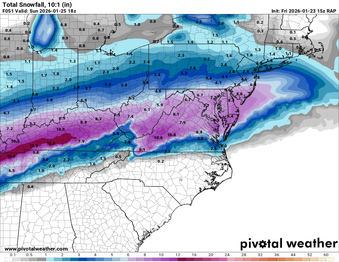
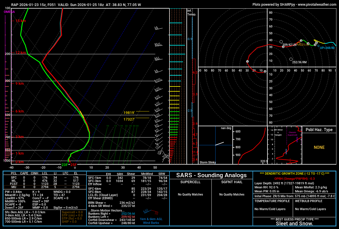
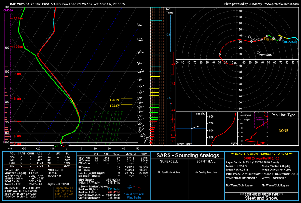
No clue how good the RAP is with winter wx, but I like it more than the NAM for severe wx. Gives us 7.7 inches on 10:1 at the end of the model run and coincidentally right before the changeover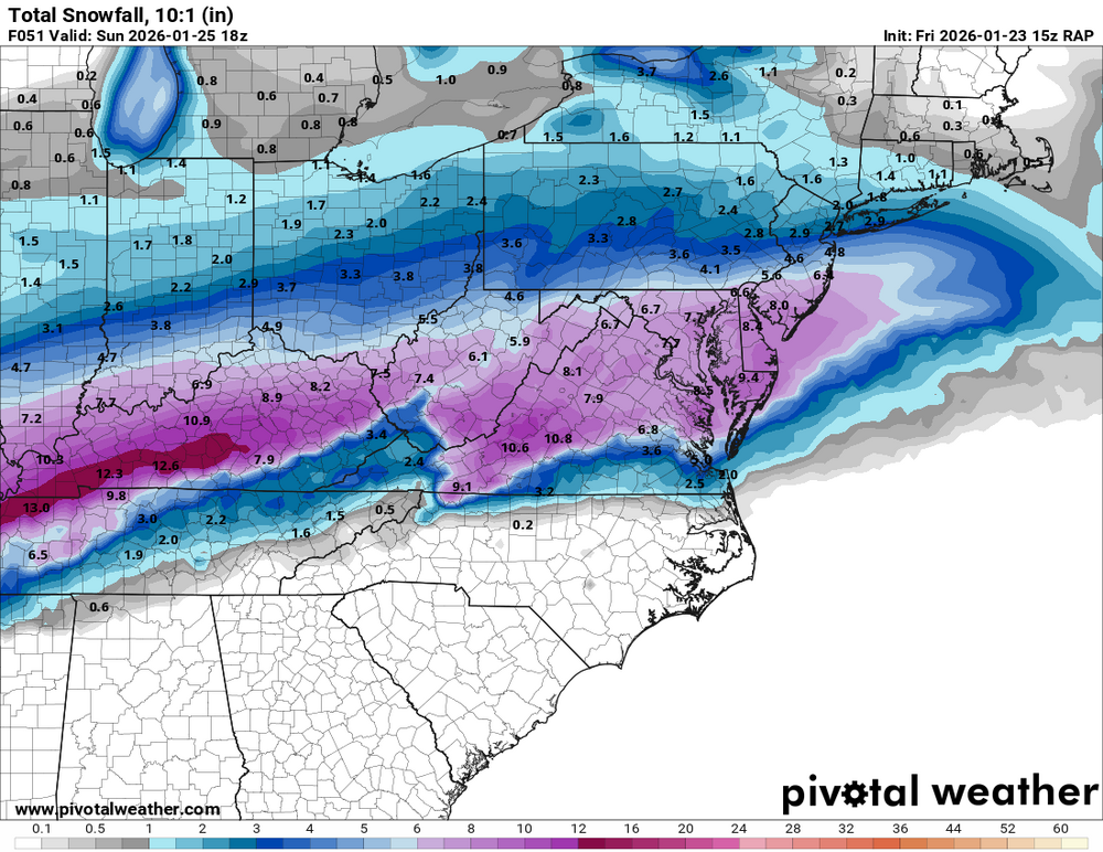
-
January 24-26: Miracle or Mirage JV/Banter Thread!
Nomz replied to SnowenOutThere's topic in Mid Atlantic
when green line go past blue line bad -
Jan 24-26 Weekend Snow and Sleetfest Model Thread Part Tres
Nomz replied to H2O's topic in Mid Atlantic
Probably a ratio thing then... lucky fucks up north probably getting 15+:1 -
AIFS has something at like h300 but its a miller b